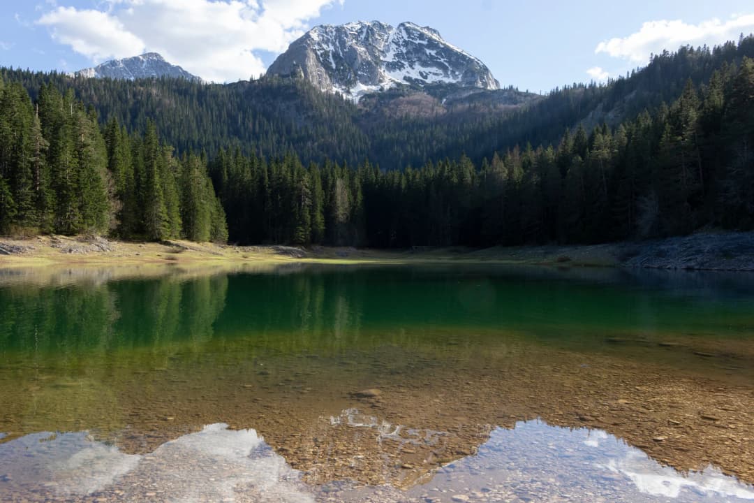
Pošćensko Lake is a small glacial lake in Durmitor National Park, not a conventional staffed attraction. Montenegro's 2024 register of significant waters places it in Pašina Voda, Žabljak municipality, about 150–200 metres east of the Nikšić–Žabljak road. The register gives an elevation of 1,488 metres, an area of 0.025 square kilometres and a shoreline of roughly 0.70 kilometres.
Those facts identify the lake; they do not establish a current public parking place, signed footpath, opening hours, fee, accessible route, bathing permission or right to cross nearby land. No current official lake-specific visitor page answering those questions was found during this review. Treat Pošćensko as a protected-landscape stop that requires confirmation with National Parks of Montenegro, not as a drive-up resort or guaranteed recreation site.
| Category | What it covers |
|---|---|
| Potentially a good fit | quiet highland landscape |
| Potentially a good fit | short stop after route confirmation |
| Potentially a good fit | photography from lawful ground |
| Potentially a good fit | flexible weather plan |
| Do not assume | resort or visitor-centre services |
| Do not assume | authorised roadside parking |
| Do not assume | swimming or fishing permission |
| Do not assume | step-free lake access |
| Working note | A map pin locates water; it does not grant access or describe conditions. |
Source: media.gov.me, nparkovi.me
Pošćensko Lake at a glance
| Question | Best evidence | Practical reading | Confirm before travel |
|---|---|---|---|
| Where is it? | Pašina Voda, Žabljak municipality; inside NP Durmitor | Highland protected landscape | Authorised approach and parking |
| How large? | 0.025 km²; 0.70 km shore | A small lake, not a major waterfront circuit | Whether a lawful shore path exists |
| How deep? | 1.0 m average; 3.6 m maximum | Shallow does not mean safe | Edge, ice and water conditions |
| When to go? | High-massif hiking broadly June–October | Planning range, not a safety guarantee | Same-day weather and park notice |
| What facilities? | No current lake-specific official facility page found | Plan to be self-sufficient | Toilets, tickets, access and restrictions |
The official identity: small, shallow and easy to confuse
The strongest lake-specific record is the Water Administration's 2024 register of waters of significance. It records Pošćensko Lake at 43°05′27.9″N, 19°06′33.6″E and 1,488 metres above sea level. The entry locates it below Pošćenski katun and notes that the katun belongs to residents of Pošćen, a village approximately 3.5 kilometres northwest of Šavnik.
The same entry warns, indirectly, against overconfidence in a search result: two much smaller water bodies nearby are also known as Pošćensko. A shared local name can make map pins, captions and third-party descriptions look more precise than they are. Use the official coordinates only to identify the principal lake, then follow current park directions and visible lawful access. Do not turn a coordinate into permission to cross a field, open a gate or park on a verge.
Why official numbers conflict
The Water Administration's gallery calls Pošćensko a glacial lake and one of Durmitor's 18 “mountain eyes,” but it gives an area of 0.092 square kilometres and elevation of 1,495 metres. Those values conflict with the newer register's 0.025 square kilometres and 1,488 metres. Both records give a maximum depth of 3.6 metres and volume of 15,000 cubic metres.
This guide prioritises the dated 2024 register for dimensions and elevation because it is newer and expressly compiled as a register. It uses the gallery only for the glacial classification and general hydrology. Possible reasons for the difference include older source material, a changed measurement convention, a typographical error or different treatment of the small neighbouring waters. Without a published reconciliation, choosing one explanation would be speculation.
How a shallow seasonal lake behaves
The gallery describes three springs around the lake and the Striježevica outflow, which can dry during summer. That is consistent with a small water body whose appearance responds to snowmelt, rain, groundwater and seasonal loss. It does not predict whether an outflow will be running, how wet the margin will be or how far water will extend on a particular day.
Average depth is not a safety rating. Soft ground, submerged vegetation, cold water, an abrupt deeper pocket and a fragile wet margin can all exist around a shallow lake. No current official bathing classification, water-quality result, lifeguard service or drinking-water statement for Pošćensko was found. Do not drink untreated lake water; do not infer swimming permission or safety from clarity, temperature, depth or another visitor's behaviour.
| Stage | Condition |
|---|---|
| Inputs | springs + weather |
| Lake | shallow + variable |
| Outflow | may dry in summer |
| Implication | never treat an old photo or fixed shoreline as a live conditions report |
Source: gov.me, media.gov.me
A lake inside a protected living landscape
UNESCO describes Durmitor as a glacier-shaped limestone massif with numerous lakes, high plateaus, forests, canyons and underground waters. It says the 32,100-hectare World Heritage property was extended in 2005 to coincide fully with the national-park boundaries. The park is not empty wilderness: farmers and shepherds continue traditional use of high meadows. A respectful visit therefore protects both natural features and legitimate local livelihoods.
UNESCO's site record describes three management zones: a strictly protected zone, a protection zone and a sustainable-use zone. It also identifies control of development as an overarching need. That does not tell a visitor which exact zone covers a road shoulder or lakeside patch. A broad map, property listing or old development concept is not a substitute for current official zoning and on-site signs.
The World Heritage Committee's 2025 Durmitor decision welcomed work to realign park and World Heritage boundaries, recommended a future buffer-zone proposal after park expansion, and requested an updated conservation report by 1 December 2026. This is landscape-level context, not notice that Pošćensko Lake is closed. It does show why visitors should use current park information rather than assume that historical access remains unchanged.
| Level | What applies |
|---|---|
| Landscape | World Heritage property + national park |
| Site | Current zone + management rules |
| Ground | Signs + authorised route |
| Footprint | The decision at the visitor's footprint |
| Working note | Never infer local permission from the protected-area name alone. |
Source: whc.unesco.org, data.gov.me
Access: what is known and what must be checked
The 2024 register's “150–200 metres east of the road” description is geographic, not an access instruction. It does not identify where a vehicle may leave the carriageway, whether the intervening land is public, whether the ground is firm, or whether a marked path reaches the shore. Older online descriptions of motor access are not repeated here as current advice.
Before making a dedicated trip, use the current Durmitor National Park information and ask for a lake-specific answer. Give the name Pošćensko jezero and the official coordinates to avoid confusion with the smaller waters. Ask whether there is an authorised approach, where parking is permitted, how far and on what surface one must walk, whether a ticket or seasonal restriction applies, and whether pastoral or private boundaries affect the route.
Also ask about the intended activity. Photography from a lawful route, bringing a dog, flying a drone, fishing, picnicking, entering the water and visiting in snow are different questions. Silence on a webpage is not permission. If staff cannot confirm the approach, choose a signed alternative in the Žabljak and Durmitor guide instead of improvising across a verge or meadow.
| # | Check | Question |
|---|---|---|
| 1 | Approach | authorised route? |
| 2 | Parking | exact lawful place? |
| 3 | Surface | distance + terrain? |
| 4 | Season | open and safe now? |
| 5 | Ticket | fee or checkpoint? |
| 6 | Boundary | pasture or private land? |
| 7 | Activity | what is permitted? |
| 8 | Access | mobility constraints? |
| — | Record the date | mountain conditions and restrictions change |
Source: nparkovi.me, media.gov.me
Season, weather and dynamic closures
Montenegro's National Tourism Organisation gives June through October as a broad hiking period for high massifs. Use that only as a trip-planning window. Durmitor can retain snow, receive sudden storms and become cold or wet outside the conditions suggested by a valley forecast. Spring thaw can soften edges and tracks; autumn daylight shortens; winter can obscure both water and boundaries.
National Parks' notices show why same-day checks matter. In 2026 the park appealed to visitors not to use Durmitor hiking trails during unsafe conditions. In August 2026 it announced protection measures and prohibited entry to the Ice Cave. Neither notice says Pošćensko Lake is closed. Together they demonstrate that route safety and conservation restrictions are dynamic and place-specific, and that a general summer plan never overrides a current warning or sign.
Carry weatherproof layers, water, sun protection and footwear suitable for uneven wet ground even if the intended stop looks short. Tell someone the plan, keep enough daylight to retreat, and do not rely on mobile reception. Montenegro's integrated emergency number is 112; having the number does not replace conservative decisions or guarantee coverage and rapid response.
Practical go/no-go test
Go only when the park confirms the approach, weather and surface match the group, a lawful parking option is clear, and everyone accepts a quiet landscape stop without facilities. Modify the plan when conditions are uncertain but a signed public alternative is available. Do not go when the route depends on crossing an unsigned boundary, leaving a vehicle unsafely, ignoring a closure, walking onto ice, or assuming permission for an activity the park has not confirmed.
| Decision | Trigger |
|---|---|
| Go | confirmed approach |
| Go | lawful parking |
| Go | suitable conditions |
| Modify | unclear surface |
| Modify | weather shifting |
| Modify | use signed alternative |
| Stop | closure or unsafe verge |
| Stop | ice or poor visibility |
| Stop | unverified boundary |
| Working note | Turning around is a normal mountain decision, not a failed itinerary. |
Source: nparkovi.me, montenegro.travel, gov.me
Low-impact conduct at the lake
Stay on marked or explicitly authorised ground and keep vehicles on legal surfaces. Do not widen a pull-off, drive over grass, cut switchbacks or create a new shoreline track. Carry out all waste, including tissues and food scraps. Keep noise low, give livestock space, close only gates you opened with permission, and never block working access used by residents or park staff.
Avoid trampling wet margins and do not pick plants. Do not feed wildlife or introduce food into the water. Keep soap, sunscreen wash-off and other pollutants away from springs and the lake. A drone can disturb people, livestock and wildlife even when the aircraft seems small; check park and aviation rules instead of assuming a recreational flight is acceptable. The same confirmation-first rule applies to dogs, fishing, camping and fires.
In winter, never walk onto the lake because it appears frozen. Ice thickness is not visible from the shore and can vary around springs or inflow. In thaw conditions, retreat from saturated margins rather than stepping farther out for a photograph. A long lens from durable ground usually protects both the visitor and the shore.
Build Pošćensko into a realistic Durmitor day
Base the day in Žabljak and give the lake a flexible slot, not a fixed promise. The Žabljak accommodation guide helps compare bases, while the Durmitor UNESCO guide explains the wider protected landscape. During thaw season, read the Durmitor spring transition guide before committing to high ground.
If park staff cannot confirm access, replace the stop rather than forcing it. The comprehensive Durmitor guide provides broader orientation. Travellers planning more active days can compare risk and preparation in the Montenegro adventure sports guide or the cycling guide. For a different protected lake-and-forest system, the Biogradska Gora National Park guide is a useful comparison, not a source of rules for Durmitor.
What this guide does not claim
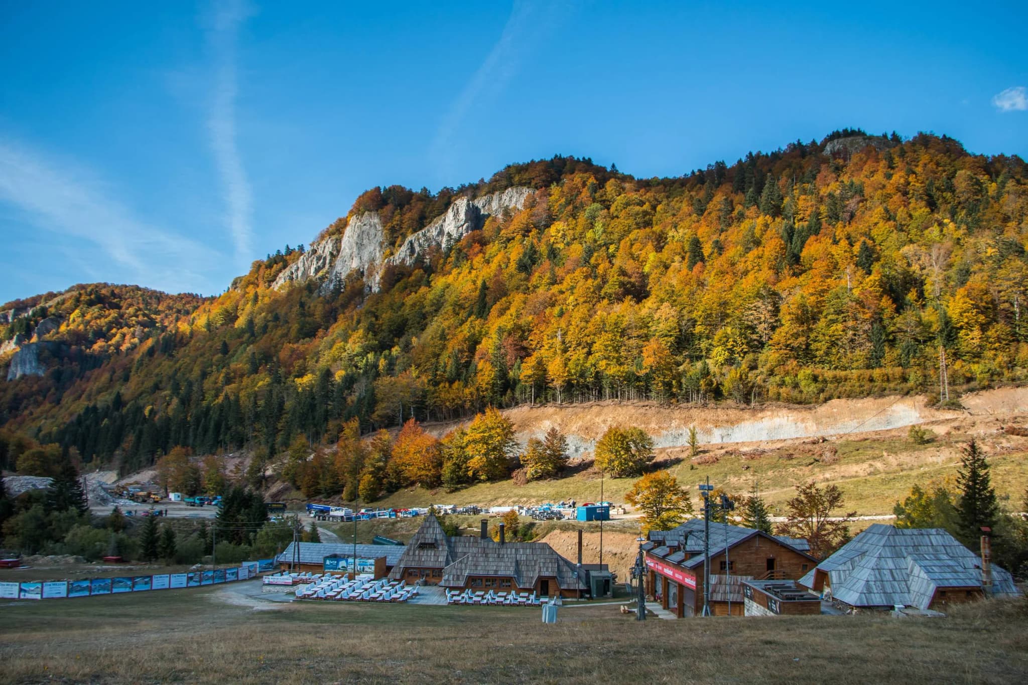
This URL inherited the name of a proposed Lago di Monte resort. The proposal is not used here as visitor infrastructure, a booking option, an access route or a parking authority. No current official evidence reviewed for this article establishes that a resort reception serves lake visitors. Do not enter a development parcel or follow marketing imagery to reach the water.
The editorial purpose is now distinct: identify Pošćensko Lake from current public evidence and help visitors decide whether a lawful, low-impact stop is feasible. Questions about any accommodation or development require a separate operator, registry and booking-status verification and should not be folded into lake access.
Frequently asked questions
Is Pošćensko Lake inside Durmitor National Park?
Šta kažu izvori
Yes. The 2024 water register expressly places the lake inside the park, and UNESCO says the World Heritage property has coincided with national-park boundaries since 2005. That status does not by itself define the route or permitted activities.
Can I drive directly to the lake?
Do not assume so. The register says the lake lies 150–200 metres east of the Nikšić–Žabljak road, but it does not identify an authorised parking space or drivable approach. Ask the park for current directions and never stop where doing so obstructs or endangers traffic.
Can I walk around the whole shoreline?
No official maintained circuit was verified. The 0.70-kilometre figure describes shoreline length, not a trail. Wet ground, vegetation, pastoral use and boundaries may prevent a complete lawful circuit.
Can I swim or drink the water?
No current bathing permission, water-quality assessment or potable-water statement was found. Do not drink untreated water, and confirm any water activity with the park before considering it.
What are the correct elevation and area?
This guide uses the newer 2024 register: 1,488 metres and 0.025 square kilometres. An older official gallery gives 1,495 metres and 0.092 square kilometres. The conflict is unresolved, so the values should not be blended.
Is summer automatically safe?
No. June–October is only a broad high-massif hiking range from the national tourism organisation. Same-day weather, park notices, road conditions, daylight and group ability control the decision.
Is the old Lago di Monte proposal a visitor facility?
Not on the evidence used here. This guide does not treat the proposal as open accommodation, public parking, a reception, a lawful route or permission to enter land.