_mncom.webp&w=2048&q=75)
A fortress hill the Ottomans held for four centuries, halfway between Podgorica and Danilovgrad — and, since 1951, the address of Montenegro’s prison.
Spuž je gradić u dolini rijeke Zete blizu Danilovgrada, nadviren ruševinama istorijske tvrđave smještene na dominantnom brežuljku. Tvrđava, stara više vjekova, nekada je čuvala strateški put kroz središnju Crnu Goru. Okolna dolina dio je sve razvijenije vinske regije, a lokalni vinogradi imaju koristi od tople kontinentalne klime i plodnog priobalnog tla. Spuž nudi miran predah putnicima koji istražuju crnogorsko zaleđe između Podgorice i Nikšića.
Where the plain grew
Settlement population change, 2003 → 2023 census
The villages of the Bjelopavlići plain doubled and trebled in twenty years. Spuž added a fifth, because it was already the biggest of them.
The municipality by settlement
Residents by settlement, 2023 census
The hill is the point — about 130 metres of it over a valley floor at 45, with the Zeta running 250 metres away. The Ottomans held it from 1474 to 1878, as long as they held Podgorica eleven kilometres down the road. Widths are to scale.
A day on the corridor
How the Podgorica road runs, hour by hour
Pretražite hiljade hotela i apartmana sa aktuelnim cijenama.
Možemo zaraditi proviziju putem partnerskih linkova. To nam pomaže da zadržimo Montenegro.com besplatnim za putnike.
Pretražite hotele, apartmane i pansione sa trenutnom dostupnošću.
Možemo zaraditi proviziju putem partnerskih linkova. To nam pomaže da zadržimo Montenegro.com besplatnim za putnike.

MONSTAT counts settlements, not built-up areas: Spuž is the largest single settlement in the municipality, while the seat’s 1,632 leaves out Glavica, Pažići and Grlić, which stand against the town and add 3,032 more.
The 1378 charter and the early-18th-century rebuild: Serbian Wikipedia. The Ottoman kaza of 1474–1878, the 1788 siege and the Berlin award: English Wikipedia. 1951 and the three prison units: ZIKS.
Spuž je na rijeci Zeti oko 15 km sjeverozapadno od Podgorice, na starom putu prema Danilovgradu i Nikšiću. Zauzima nisko brdo iznad ravnice, zbog čega je uopšte i utvrđen.
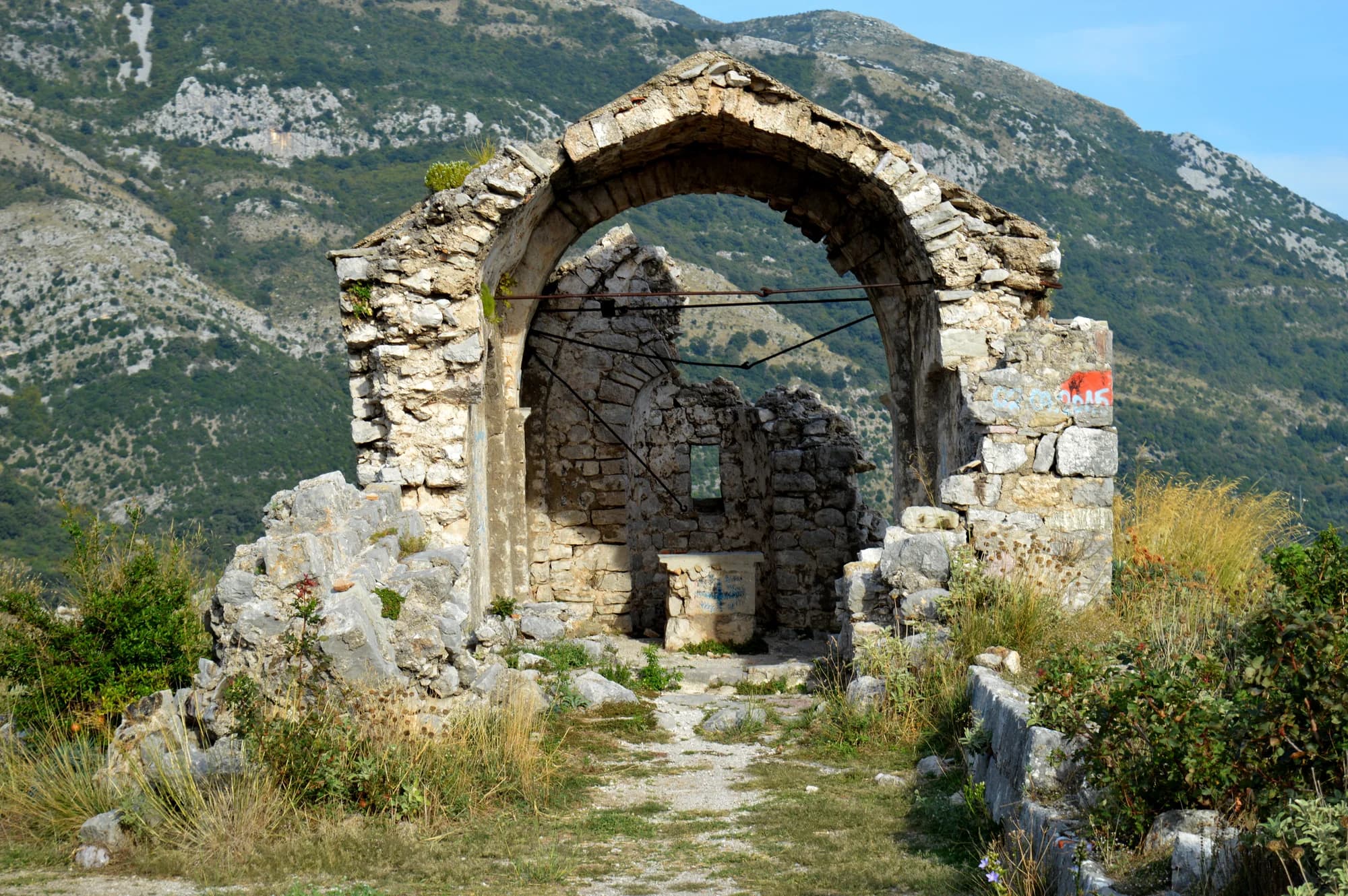
Osmansko utvrđenje na brdu iznad rijeke, jedno iz niza koja su čuvala prilaze dolini Zete. Crna Gora ga je zauzela 1878. nakon decenija borbi na ovoj granici; dijelovi zidina i danas stoje iznad naselja.
Zbog zatvora. Glavna kazneno-popravna ustanova u državi je ovdje, i Spuž se u govoru i štampi koristi kao njen sinonim, kao što drugdje ime jednog grada igra istu ulogu.
Ravan, navodnjavan i rodan — to je Bjelopavlićka ravnica, povrtarski vrt Crne Gore. Odavde idu breskve, grožđe i povrće, a tezge uz put ih prodaju cijelo ljeto.
Samo po sebi ne mnogo. Brdo s tvrđavom daje dobar pogled na ravnicu, a Zeta se ljeti koristi za kupanje, ali Spuž je usputna stanica prije nego odredište, na putu od Podgorice do Ostroga.
Autom za dvadesetak minuta iz Podgorice, ili autobusima Podgorica–Nikšić koji idu starim putem. Pruga Beograd–Bar prolazi blizu, a naselje ima stajalište.
Ne — najbliži je aerodrom Podgorica (TGD), 23 km putem.
11 km putem, oko 26 min vožnje.
Britansko Ministarstvo inostranih poslova (FCDO) nema upozorenje protiv putovanja u Crnu Goru; svoje smjernice je posljednji put revidiralo 13. avgusta 2026. To je njihova procjena države u cjelini, ne naša i ne ocjena o ovom gradu, pa je pročitajte sami prije puta. Broj za hitne slučajeve u Crnoj Gori je 112.
Spuž u brojkama
the medieval town of Spuž appears in a charter of that year
the hill fortification rebuilt and extended under Hodaverdi-paša Mahmutbegović
2023 census — the municipality’s largest single settlement
passes 250 m from the fort on its way from Mt Vojnik to the Morača
the valley floor; the castle hill above the town reaches about 130 m
MONSTAT, Popis 2023 (settlement level) · chronology from the Serbian and English Wikipedia
Najbliža mjesta mjestu Spuž, na svojim stvarnim položajima — Bogetići je udaljeno oko 25 km vazdušnom linijom.
Šematski prikaz. Položaji i udaljenosti mjereni su vazdušnom linijom, prema koordinatama koje imamo za svako mjesto; zbog planinskih puteva vožnja je duža. Podebljana linija označava obalu na dijelu koji prolazi kroz ovaj prikaz. Obala i Skadarsko jezero © OpenStreetMap contributors.
Nekoliko sati
One hill and half an hour. The ruin at the top is the visit; the valley road does the rest.
Cio dan
A frontier fort, a planned capital and a monastery in a cliff face, inside forty kilometres of valley road.
Danilovgrad
Najbolje za the municipal seat, ten kilometres north and a station on the same railway line
Podgorica
Najbolje za eleven kilometres south: the capital, with Spuž a short detour off the Nikšić road
Ko posjećuje Crnu Goru
Udio noćenja stranih gostiju, 2025.
MONSTAT · 2025
Popis stanovništva, opština Spuž
Spuž counted 497 people in 1948 and 1,864 in 2023, and it did all that growing without becoming a town. Podgorica is eleven kilometres down the road, Danilovgrad ten kilometres up it, and the plain between them filled.
U međuvremenu — 1878
Spuž, 1878: Montenegro is handed Nikšić, Kolašin, Spuž, Podgorica, Žabljak and Bar, and grows from 4,405 to 9,475 square kilometres. Four hundred and four years of Ottoman rule on this hill end.
Sixteen years earlier — the Peace of Rijeka Crnojevića, signed 8 September 1862, had given the Ottomans the right to raise forts along the Nikšić–Spuž road. The European powers made the Porte pull the new ones down again the following year.
Berlin, 13 July 1878: the same treaty recognises the independence of Montenegro, Serbia and Romania. Spuž is one line in a document that redraws the Balkan map.
Today — the castle on the hill is a ruin, and the hill’s business has moved two kilometres south into the plain: three of the four units of Montenegro’s prison service stand at Spuž.
“The Ottomans gained the right to raise fortresses along the Nikšić–Spuž road.”
Terms of the Peace of Rijeka Crnojevića, 8 September 1862
The Serbian-language record of the treaty lists the clause among its terms, and records that in 1863, under pressure from the European powers, the Porte agreed to demolish the new forts. Spuž stood at that road’s far end.
Najbolje vrijeme: april · maj · oktobar
| Mjesto | Putem | Vožnja |
|---|---|---|
| Klicevo | 11 km | oko 26 min |
| Danilovgrad | 11,7 km | oko 20 min |
| Podgorica | 15,2 km | oko 24 min |
| Gradac | 17,4 km | oko 42 min |
| Budva | 70,6 km | oko 1 h 33 min |
| Kotor | 82,6 km | oko 1 h 45 min |
| Žabljak | 115,2 km | oko 2 h 31 min |
Udaljenosti putem izračunate na osnovu OpenStreetMap podataka, © OpenStreetMap contributors. Vremena vožnje su bez gužve i ne računaju ljetnji saobraćaj ni čekanje na trajektnoj rampi.