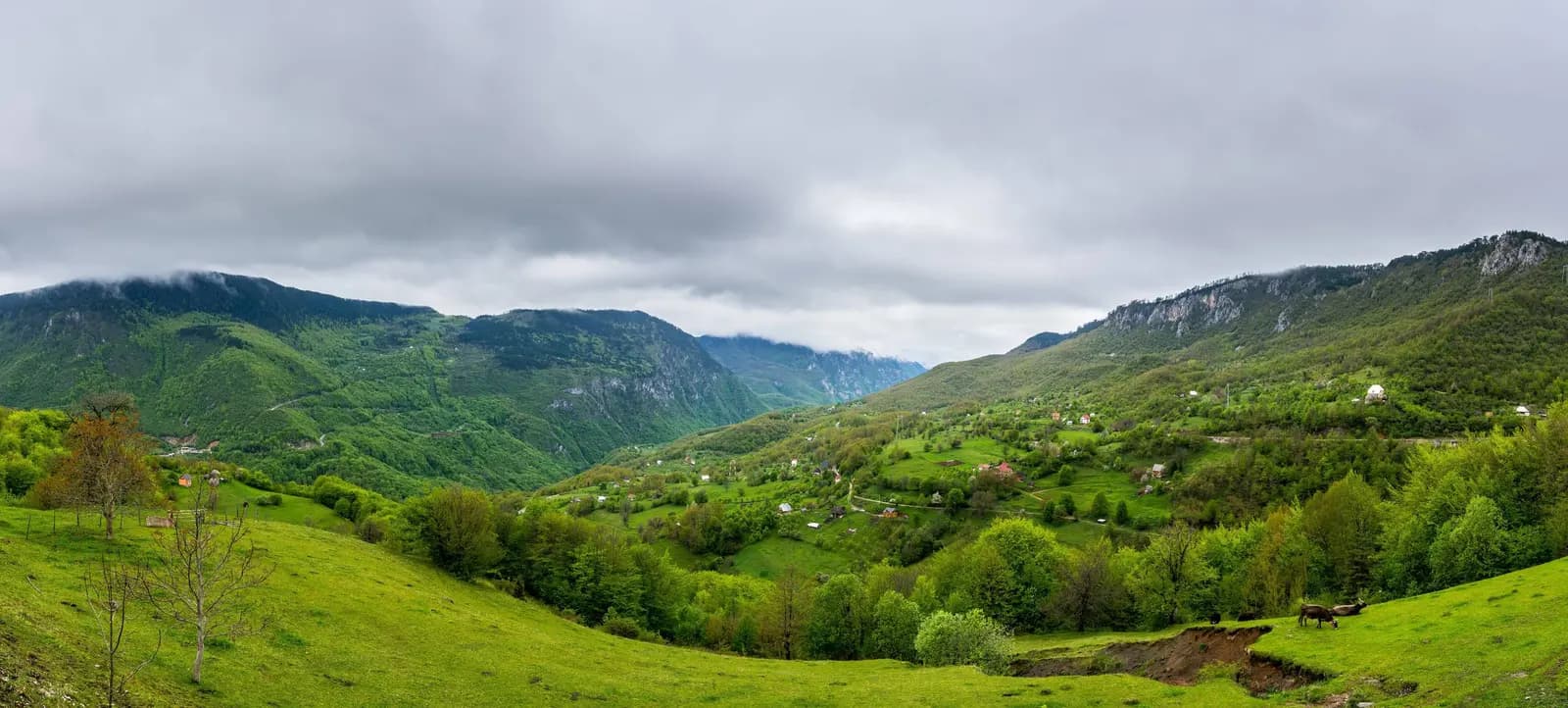
Mojkovac with its eleven villages, which got their current names during the economic and cultural boom of the medieval Serbian state, is located in the most picturesque part of northern Montenegro,
Mojkovac with its eleven villages, which got their current names during the economic and cultural boom of the medieval Serbian state, is located in the most picturesque part of northern Montenegro, at an altitude of 853 m. Mojkovac and its basin are framed by mountain Bjelasica, whose highest peak Crna Glava reaches a height of 2137 m, and mountain Sinjajevina with its highest peak Babin Zub at 2253 m. These two mountains, on which even in the summer months snow remains on the peaks and hollows, in addition to rich pastures and hayfields, are abundant with suitable terrains for winter sports. Next to Mojkovac flows the river Tara. This wonderful mountain river divides the municipality of Mojkovac almost into two equal parts. On the left bank of Tara, in its middle course, as if in a row, there are villages lined up: Gornja Stitarica at an altitude of 1013 m and Donja Stitarica at an altitude of 957 meters. These places in the valley between Veliki Prepan and Govedarnik are known for their beauty. Then there are the villages: Podbisce, Gornja and Donja Polja, Gojakovici Bistrica and Gornja and Donja Dobrilovina, where the altitude is 825m. It is difficult to judge which of these villages, tucked under the slopes of the Sinjajevina mountain, is more beautiful and tame. One thing is certain that whoever passes through them once will want to visit them again and enjoy their beauty. Along the right bank of Tara are the villages: Bjelojevice, Mojkovac, Stevanovac, Proscenje and Bjelovine, which also catch the eyes of passers-by with their luxurious beauty. North of Mojkovac, 10 km away, located around the Lepesnica river, is the village of Lepenac at an altitude between 875 and 1081 m above sea level. Northeast of Mojkovac, about 15 km away, at an altitude of about 1000 meters (the highest point is 1182 m), is the village of Zari. Mojkovac with its eleven villages, which got their current names during the economic and cultural boom of the medieval Serbian state, is located in the most picturesque part of northern Montenegro, at an altitude of 853 m. Mojkovac and its basin are framed by mountain Bjelasica, whose highest peak Crna Glava reaches a height of 2137 m, and mountain Sinjajevina with its highest peak Babin Zub at 2253 m. These two mountains, on which even in the summer months snow remains on the peaks and hollows, in addition to rich pastures and hayfields, are abundant with suitable terrains for winter sports. Next to Mojkovac flows the river Tara. This wonderful mountain river divides the municipality of Mojkovac almost into two equal parts. On the left bank of Tara, in its middle course, as if in a row, there are villages lined up: Gornja Stitarica at an altitude of 1013 m and Donja Stitarica at an altitude of 957 meters. These places in the valley between Veliki Prepan and Govedarnik are known for their beauty. Then there are the villages: Podbisce, Gornja and Donja Polja, Gojakovici Bistrica and Gornja and Donja Dobrilovina, where the altitude is 825m. It is difficult to judge which of these villages, tucked under the slopes of the Sinjajevina mountain, is more beautiful and tame. One thing is certain that whoever passes through them once will want to visit them again and enjoy their beauty. Along the right bank of Tara are the villages: Bjelojevice, Mojkovac, Stevanovac, Proscenje and Bjelovine, which also catch the eyes of passers-by with their luxurious beauty. North of Mojkovac, 10 km away, located around the Lepesnica river, is the village of Lepenac at an altitude between 875 and 1081 m above sea level. Northeast of Mojkovac, about 15 km away, at an altitude of about 1000 meters (the highest point is 1182 m), is the village of Zari. All these villages existed back in the Nemanjica era, when they got their names, which they have preserved to this day. The names of some villages and towns are related to the medieval Brskovo silver mine. In a charter of King Uros I (XIII century), by which he donated certain land to the Monastery of the Virgin Mary, the following settlements are mentioned: Brskovo, Proscenje, Stricina, Gostilovila, Bistrica, Dobrilovina, Bjelojevina and others. In the 12th and 13th centuries, Mojkovac and its territory were part of Raska.After the arrival of the Turks, who occupied it in 1399, and during their rule, it belonged to Herzegovina, and for some time to the Bjelopolje and Prijepolje regions. According to the Turkish partition, the Tara River was the border between Upper and Lower Kolasin. Due to its geographical location and the roads that pass through it, Mojkovac occupies a central place among the cities of northern Montenegro. Although Mojkovac with its close and wide surroundings belongs to hilly-mountainous land, the climatic conditions of its basin are very favorable for the development of tourism, animal husbandry and some agricultural crops. Cultural and historical monuments - Six kilometers east of Mojkovac, at an altitude of about 1,100 meters, there are the remains of the medieval town - Brskovo square. Apart from the castle and the place where the church was located, there are no other remains of this mining settlement. The place where the city was located is overgrown with forest, and so far no archaeological research has been carried out. According to written documents, Brskovo was first mentioned in 1254. According to preserved archival documents, this town-square, where the Saxons mined and smelted silver and lead ore, reached its greatest economic, political and cultural development between 1250 and 1350. During the economic boom, Brskovo was also a large trading center. Trade between Brskov, on the one hand, and Dubrovnik and Kotor, on the other, was especially developed. It is likely that the exploitation of silver in Brskov was also extensive, because K. Jiricek, according to a document from July 1280, comes to the conclusion that silver from Brskov was exported to western countries. In the vicinity of Kragujevac in 1928, 46 dinars were found with the image of King Uros I, which were most likely minted in Brskov.