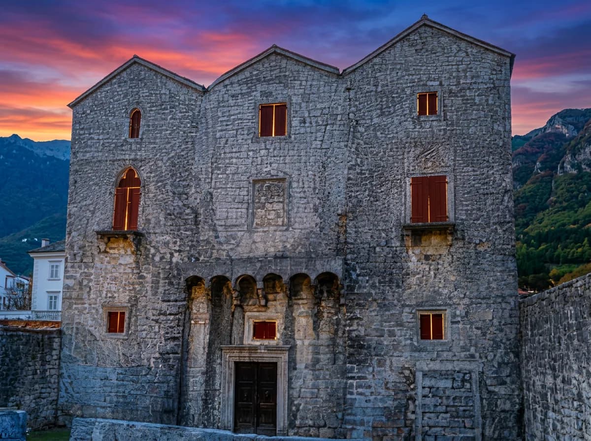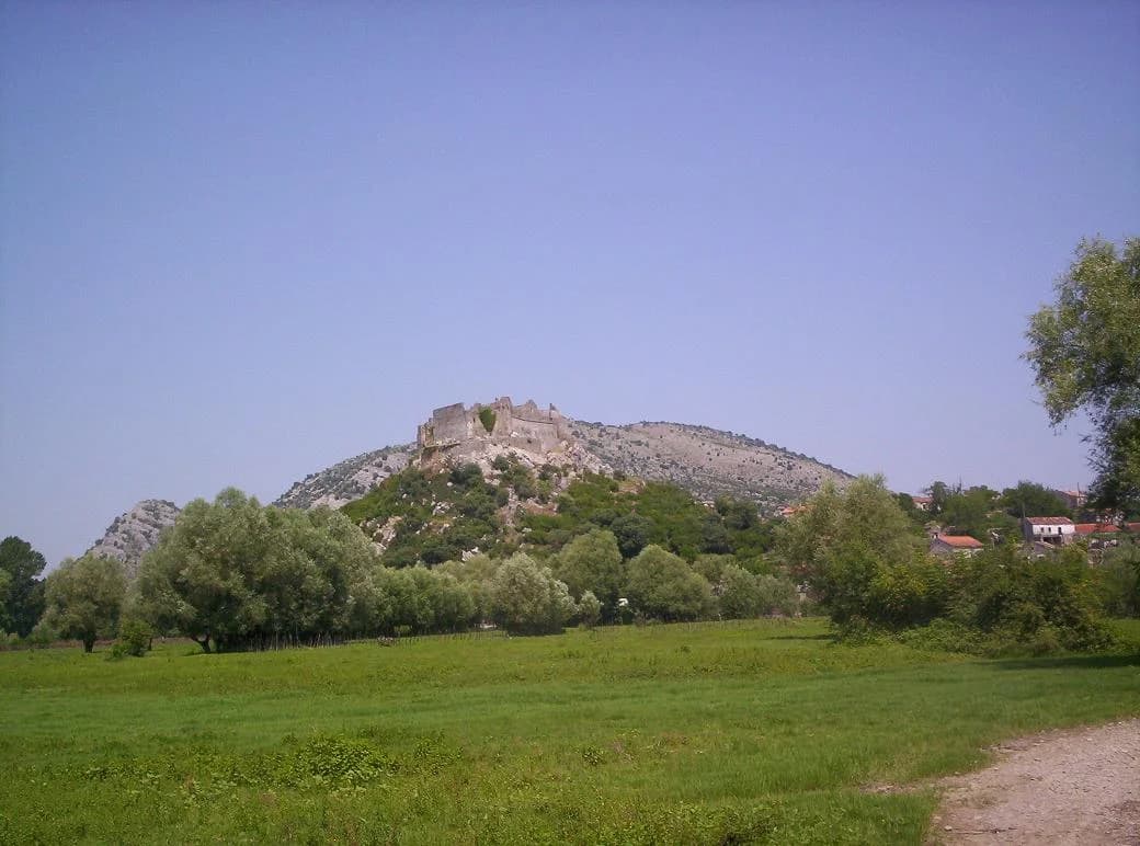
Žabljak Crnojevića is a medieval fortified town on a low, steep-sided hill near the Morača delta and Lake Skadar. It was a political and military centre of the Crnojević era, later an Ottoman stronghold, and is now a protected archaeological landscape rather than a conventional, fully serviced attraction. The reward is unusual: architecture, state formation and wetland geography can be read together from one compact site.
This is not Žabljak beside Durmitor. The better-known northern town is covered in our Žabljak and Durmitor guide; Žabljak Crnojevića lies in central Montenegro, within the Lake Skadar landscape. Use the full name when searching maps or asking for directions.

Why this fortress mattered
Location explains much of the story. The hill overlooks approaches through the Zeta plain and movement on Lake Skadar. The Montenegrin Academy of Sciences and Arts describes an eastern approach protected more strongly than the other sides, with the position allowing control of both the surrounding plain and lake navigation. Inside were a Crnojević court, a water cistern, and buildings with economic, military and residential roles. This was therefore more than a defensive shell: it was an administrative seat.
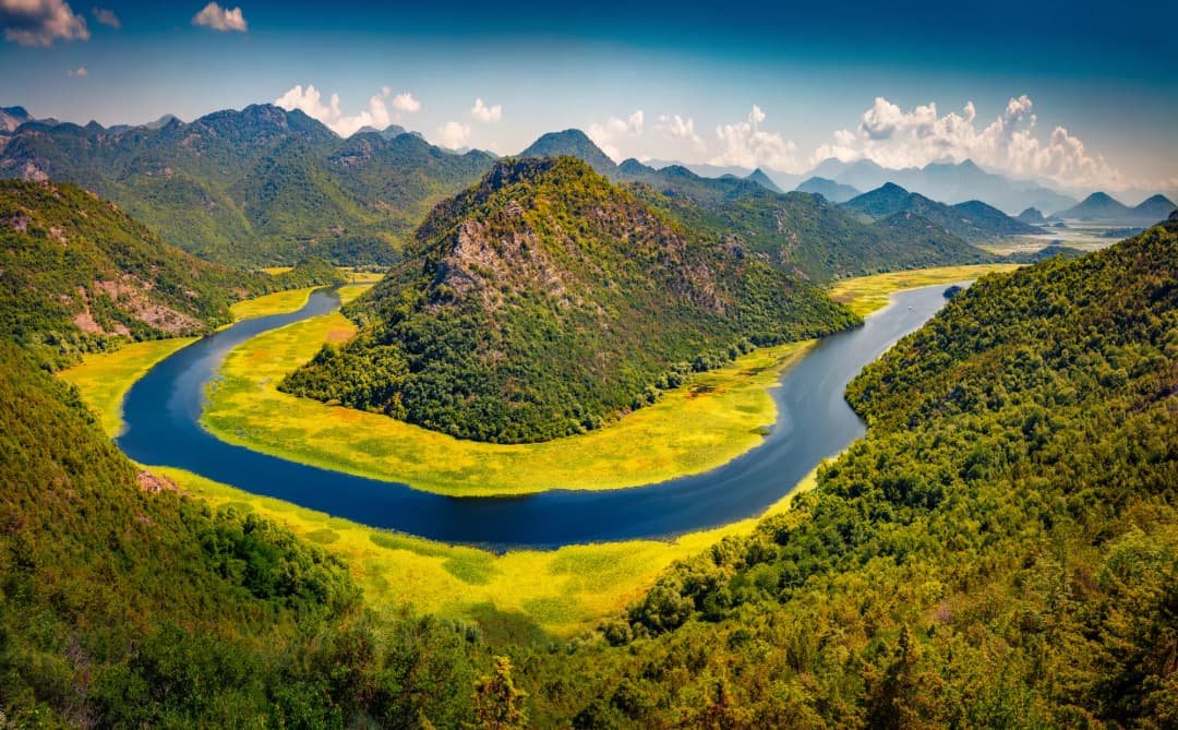
The same geography changes with water levels. Wetlands, channels and seasonal inundation once strengthened the hill’s isolation, while the lake connected it to other settlements. For a wider view of that transport landscape, compare the Virpazar–Rijeka Crnojevića route and our Lake Skadar guide.

A history with uncertain beginnings
Stories often push Žabljak’s origin back to the Vojislavljević period in the tenth or eleventh century. The National Parks cultural overview presents that as tradition, not a documented construction date. The academy’s specialist entry instead places the fortress in the first quarter of the fifteenth century. The responsible conclusion is simple: an early association belongs to local historical memory, but the surviving fortified complex should not be confidently labelled tenth-century.
The academy chronology identifies Žabljak as a seat associated with members of the Crnojević family before Stefan Crnojević regained it in 1460. Under Ivan Crnojević, the town held officials of the ruler’s administration and supported lake operations during conflict around Shkodra in 1474. Growing Ottoman pressure then drove Ivan to establish a new seat at Obod, connected with present-day Rijeka Crnojevića.
The academy dates the Ottoman attack and surrender to 1478. Some later summaries use 1479, probably reflecting the wider sequence of the Ottoman–Venetian war and the transfer of Shkodra. Rather than forcing false precision, visitors should understand 1478–79 as a transition in the regional conflict, with the detailed national reference placing Žabljak’s surrender in early autumn 1478. Ottoman authority lasted until the changes confirmed around the Congress of Berlin in 1878.
Reading the surviving architecture
Look first at the relationship between hill, approach and walls. The National Tourism Organisation describes ramparts reaching up to 15 metres high and two metres wide, with six towers. Its masonry summary distinguishes older hewn-stone work in lime mortar from later sections with different building characteristics. Those observations are useful, but the site is layered: assigning every visible joint to a ruler or century without a conservation plan would be guesswork.
Within the enclosure, documented elements include the court area, cistern, service buildings and the Church of St George. The church’s later conversion and the long military use of the compound mean that “original appearance” is not a single moment. What survives records rebuilding as well as foundation. The National Parks cultural inventory consequently places Žabljak among the lake basin’s most important monuments.

What archaeology has changed
The site is not merely waiting for someone to “discover” it. Government records document systematic investigation. A 2018 campaign opened trenches and recorded walls, paving, rock-cut steps and a cistern, along with ceramics, glass, nails, ammunition and a bronze ring. A later protection programme reported research between 2018 and 2020 and planned further archaeology plus conservation of the cistern and movable finds. The programme said evidence indicated four phases of active life at the location.
Work continues to evolve. Montenegro’s 2025 cultural-property funding decision allocated €25,000 for protection measures on ramparts and internal structures. In 2026, the Ministry of Tourism announced a digital reconstruction created with UNIDO, intended to communicate the historical space through new technology. That is interpretation, not a claim that the physical fortress has been rebuilt. The distinction matters at a ruin whose fabric remains vulnerable.
| Layer | What evidence supports | What not to assume |
|---|---|---|
| Origin tradition | Association with the Vojislavljević era survives in local and park narratives | A securely documented tenth- or eleventh-century fortress |
| Fifteenth century | Crnojević court, administration, defence and lake control | That every visible wall belongs to one building campaign |
| Ottoman period | Long military occupation and architectural adaptation | That alterations erased every earlier feature |
| Modern research | Excavated structures, objects, cistern study and digital recording | That the ruin is a completed visitor attraction |
The fortress inside a protected wetland
Žabljak cannot be separated from Lake Skadar. The national park management plan lists it among the representative fortified complexes of the basin and warns that neglected fortifications suffer wall collapse and vegetation growth. The surrounding settlements and traditional buildings are also part of the cultural landscape, not empty scenery.
In June 2026 UNESCO added the Skadar Lake Watershed to its World Network of Biosphere Reserves. Montenegro’s ecology ministry described the status as a framework for balancing conservation, responsible tourism, research and local participation. The designation does not turn every point into an unrestricted recreation zone; it makes low-impact behaviour more important. Use established access, keep noise down, do not disturb nesting or roosting wildlife, and leave plants, stone and archaeological material where they are.
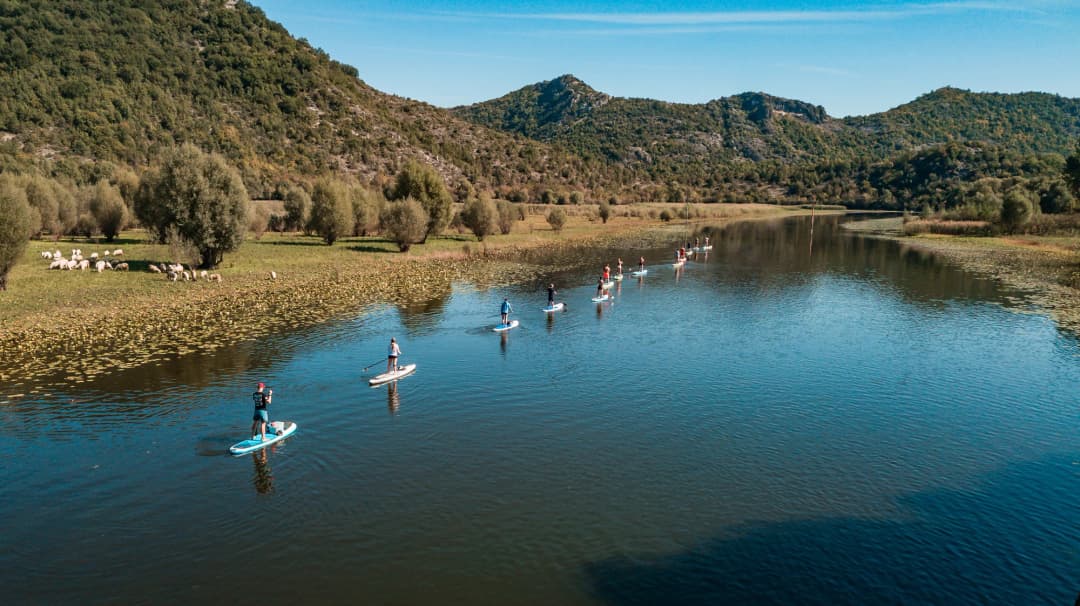
Wildlife changes how a fortress visit should be paced. A quiet approach creates a better chance of seeing the transition from open water to reed bed and floodplain, while rushing between viewpoints encourages shortcuts across vegetation. Binoculars are more useful than a drone: aircraft can disturb wildlife, and local restrictions or permits may apply. If a route is flooded, muddy or closed, turn back instead of cutting a new line through the wetland.
Practical visit planning
Confirm access before setting out. A February 2025 field report described signposting and an asphalt approach to the settlement, but no visitor infrastructure at the fortress beyond a national-park information board. Archaeology, conservation, weather and water can still change what is reachable. Do not treat a map pin as proof that a road, gate or internal area is open. Ask the Lake Skadar national park service or a locally licensed guide for current conditions, especially after rain, during high water, or when works are active.
Expect a ruin, not a museum circuit. Wear shoes with grip, carry water, and avoid climbing walls or entering unstable interiors. Loose masonry, vegetation, heat and insects are normal site hazards. Children need close supervision. If barriers or conservation notices are present, follow them even when another visitor ignores them.
Verify park charges. At the research date, the official Lake Skadar information page displayed a €5 daily ticket including the visitor centres at Vranjina and Virpazar. Prices, collection points and inclusions can change, so check the page again rather than relying on a screenshot or old blog post.
Do not improvise a boat landing. Water access depends on levels, weather, protected-zone rules and a safe landing. Arrange any trip through a properly authorized operator and confirm whether the fortress is actually included. A general cruise from Virpazar or a visit to Rijeka Crnojevića should not be assumed to stop here.
A useful Lake Skadar itinerary
Treat Žabljak as one focused stop, not a box to tick between distant attractions. Begin at a national-park visitor centre if current opening information fits your day. Combine the fortress with either Rijeka Crnojevića or Virpazar, leaving time for weather and access uncertainty. Our responsible Podgorica–Lake Skadar day-trip guide explains how to avoid an overfilled route.
The strongest visit has three scales: the masonry immediately in front of you, the hill’s relationship to water and plain, and the wider movement of the Crnojević state toward Obod and Cetinje. Photographing only the view misses the administrative town; reading only the battles misses the wetland that made the position powerful.
Frequently asked questions
Is Žabljak Crnojevića the same place as Žabljak near Durmitor?
No. Žabljak Crnojevića is the Lake Skadar fortress. Žabljak in northern Montenegro is the mountain town used as a base for Durmitor National Park.
How old is the fortress?
A tradition associates the place with the Vojislavljević era, but reliable evidence does not establish a tenth- or eleventh-century fortress. The Montenegrin Academy dates the built complex to the first quarter of the fifteenth century.
Was it Montenegro’s capital?
It was a political and administrative seat of the Crnojević rulers in Zeta. Calling it a Crnojević capital is reasonable when kept within that fifteenth-century context; it was not a modern national capital.
Can I drive directly into the fortress?
Do not assume so. Published conservation research describes poor approach and limited infrastructure. Confirm current land access and any active works with the national park or a knowledgeable local operator.
Is there an admission fee?
The official park page displayed a €5 Lake Skadar daily ticket when this article was researched in August 2026. Verify the current amount, scope and collection arrangements before visiting.
Can I climb the walls?
No. The walls are protected archaeological fabric and may be unstable. Stay on evident safe surfaces, respect barriers and never remove stones or finds.
References
- Montenegrin Academy: Žabljak Crnojevića
- Ministry of Tourism: 2026 digital reconstruction
- 2025 cultural-property programme
- 2022 archaeology and cistern programme
- National Parks: Lake Skadar culture
- National Parks: current Lake Skadar information
- National Tourism Organisation: fortresses
- Lake Skadar National Park management plan
- Ecology ministry: 2026 biosphere designation
- Portal Analitika: 2025 field report
Original article by Gordan Stojović; substantially researched and updated by the Montenegro.com editorial team.