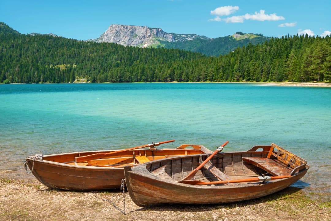
Few places in the Balkans can match the raw grandeur of Zabljak and Durmitor National Park. Sitting at 1,456 metres above sea level, Zabljak holds the distinction of being the highest town in the Balkans — a small settlement of about 1,400 people (2023 census) that serves as the gateway to one of Europe's last truly wild mountain landscapes. Limestone peaks shatter the skyline, glacial lakes shimmer in impossibly deep shades of blue and green, and the Tara River has carved one of the deepest canyons in Europe.
This guide covers what to do from Žabljak: Durmitor National Park, Black Lake, the hiking trails, Tara Canyon and the ski slopes. For the town itself, its history, culture, food and key facts, see our Žabljak town guide.
Whether you come for the skiing in winter, the hiking in summer, or simply to breathe air that feels untouched by any city, Zabljak Montenegro delivers an experience that stays with you long after you leave. This guide covers everything you need to plan your trip — from the trails and the rafting to where to eat hearty mountain food and where to lay your head after a day spent above the clouds.
About Zabljak
Zabljak is not the kind of place that overwhelms you with size or spectacle on first arrival. It is a compact mountain town — a cluster of hotels, restaurants, and wooden houses gathered on a high plateau in northwestern Montenegro. But what it lacks in urban grandeur, it makes up for in setting. In every direction, the jagged limestone teeth of the Durmitor massif rise above dark forests of spruce and pine.
At 1,456 metres, Zabljak is officially the highest town in the Balkans. That altitude shapes everything — the climate, the culture, the food, and the rhythm of daily life. Winters are long and cold, with heavy snowfall blanketing the plateau from November through April. Summers are pleasantly cool even when the Montenegrin coast is sweltering at 35 degrees. This makes Zabljak a genuine year-round destination, something few mountain towns in the region can claim.
The 2023 census counted about 1,400 residents in the town (2,941 in the whole municipality), though numbers swell during the summer hiking season and winter ski months. You will not find luxury resorts or international chains here. What you will find is authentic mountain hospitality, generous portions of lamb and polenta, and a pace of life that encourages you to slow down.
For centuries, the high plateau served as summer pasture for the semi-nomadic herding communities of northern Montenegro. Shepherds would drive their flocks up from the river valleys each spring and spend the warm months in temporary settlements called katuni, a tradition that shaped the character and identity of this region. The town itself only began to take its modern shape in the 20th century, growing as a regional centre and, eventually, as a base for exploring Durmitor. Today, it functions almost entirely as a gateway to the national park, whose boundary lies just a few minutes' walk from the centre.
Durmitor National Park
What the sources say
Durmitor National Park is one of those rare places where superlatives feel earned. Designated a UNESCO World Heritage Site in 1980, the park covers approximately 390 square kilometres of high-altitude terrain. Within that area: 48 peaks exceeding 2,000 metres, 18 glacial lakes known locally as "mountain eyes," dense old-growth forests, alpine meadows, and one of the deepest river canyons in Europe.
The geology is predominantly limestone and dolomite, shaped by glacial and karst processes into a landscape of dramatic contrasts — sheer cliff faces and gentle rolling pastures, deep sinkholes and expansive plateaus, hidden caves and open ridgelines. The park sits at the junction of Mediterranean and continental climate zones, producing extraordinary biodiversity. UNESCO counts more than 1,600 vascular plants in the wider Durmitor massif, including several endemic to the Dinaric Alps.
Wildlife includes brown bears, wolves, chamois, wild boar, and eagles. Chamois are frequently spotted on higher ridges, and golden eagles circle above canyon rims with impressive regularity. The old-growth black pine stands at higher elevations are among the most ecologically significant forests in southern Europe.
The park entrance fee is €5 per person per day (under-15s free) and goes toward trail maintenance, ranger patrols, and conservation. You will need to pay it to access Black Lake and most main trailheads, with tickets available at entrance booths near Zabljak.
Black Lake (Crno Jezero)
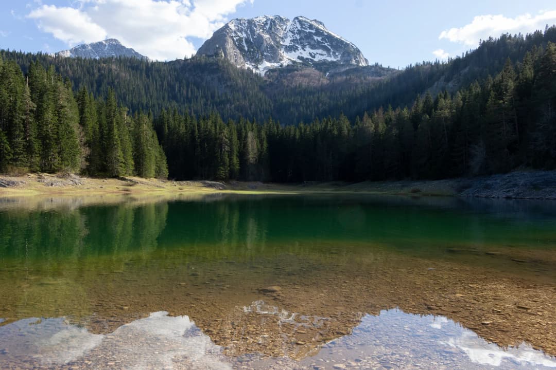
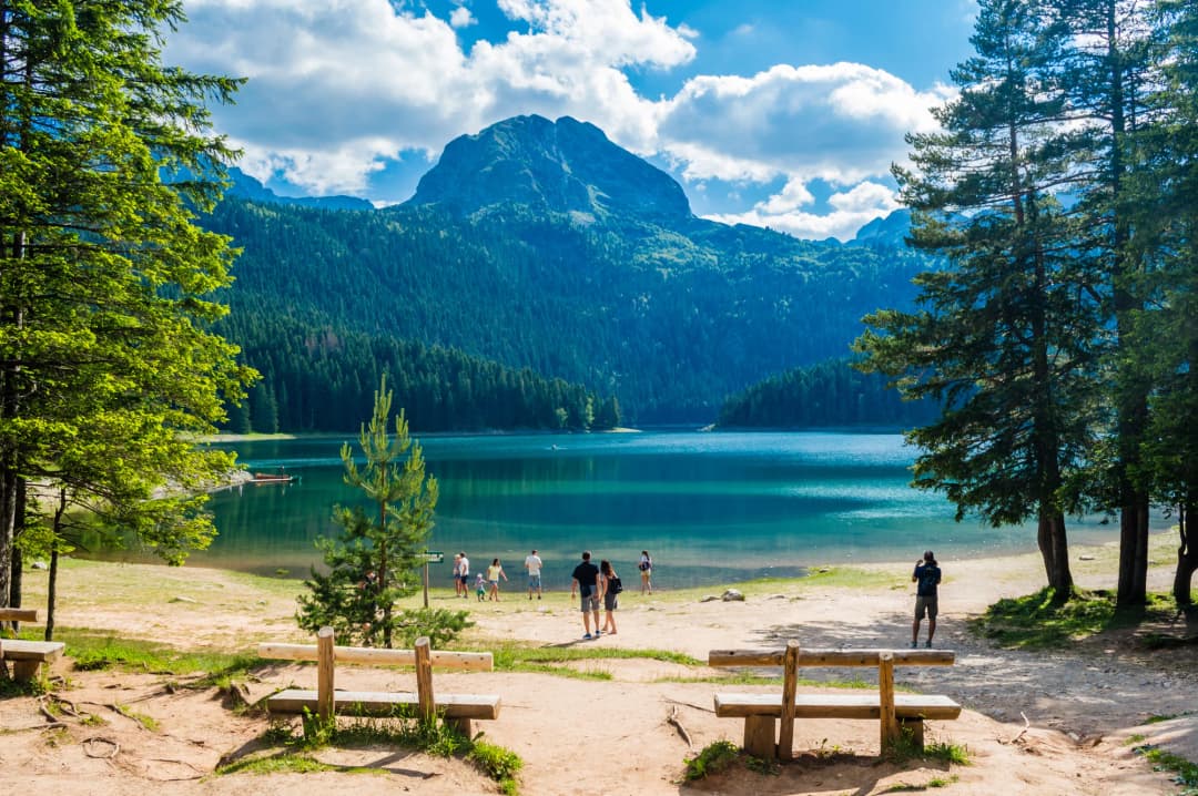
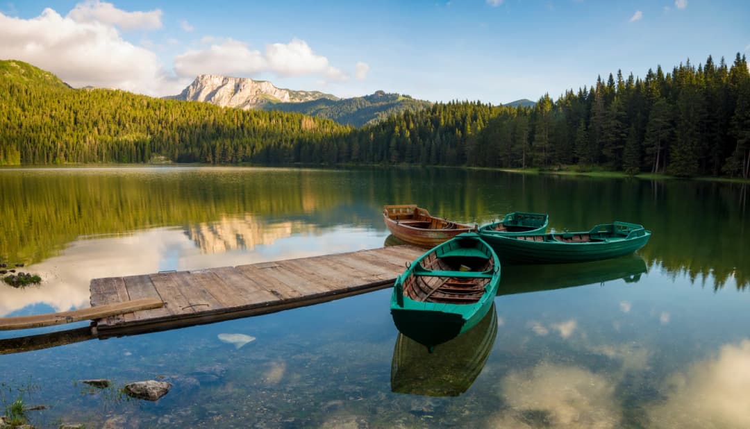
If Durmitor has a single iconic image, it is Black Lake. Sitting in a glacial basin 30 to 40 minutes' walk from Zabljak town centre, Crno Jezero is the largest and most visited of the park's 18 glacial lakes. The name comes from the dark appearance of the water, which reflects the dense conifer forest and the imposing bulk of Medjed peak (2,287m) rising directly behind it.
The lake is actually two connected bodies of water — Veliko Jezero (Big Lake) and Malo Jezero (Small Lake) — joined by a narrow strait that can dry up in late summer. Combined, it stretches about 1,200 metres, with depths reaching 49 metres.
A well-maintained walking trail of about 3.6 kilometres loops around the entire lake. The path is mostly flat and suitable for all fitness levels, including families with children. Allow about an hour for a leisurely circuit, more if you stop frequently for photographs — and you will, because the reflections of Medjed in the still morning water are the kind of thing that makes you understand why people carry cameras.
The best time to visit Black Lake is early morning, before tour groups arrive and while the water surface is still glassy calm. During summer months, locals and visitors swim in the lake, though the water temperature rarely climbs above what I would generously describe as refreshing. There is a small cafe near the lake entrance for coffee or a cold drink, but I recommend bringing your own water and snacks for a picnic on the shore.
In winter, Black Lake freezes solid and the surrounding trails become cross-country skiing and snowshoeing routes. The landscape transforms entirely — what was green and reflective becomes white and silent, with only the sound of snow under your boots.
Hiking Trails
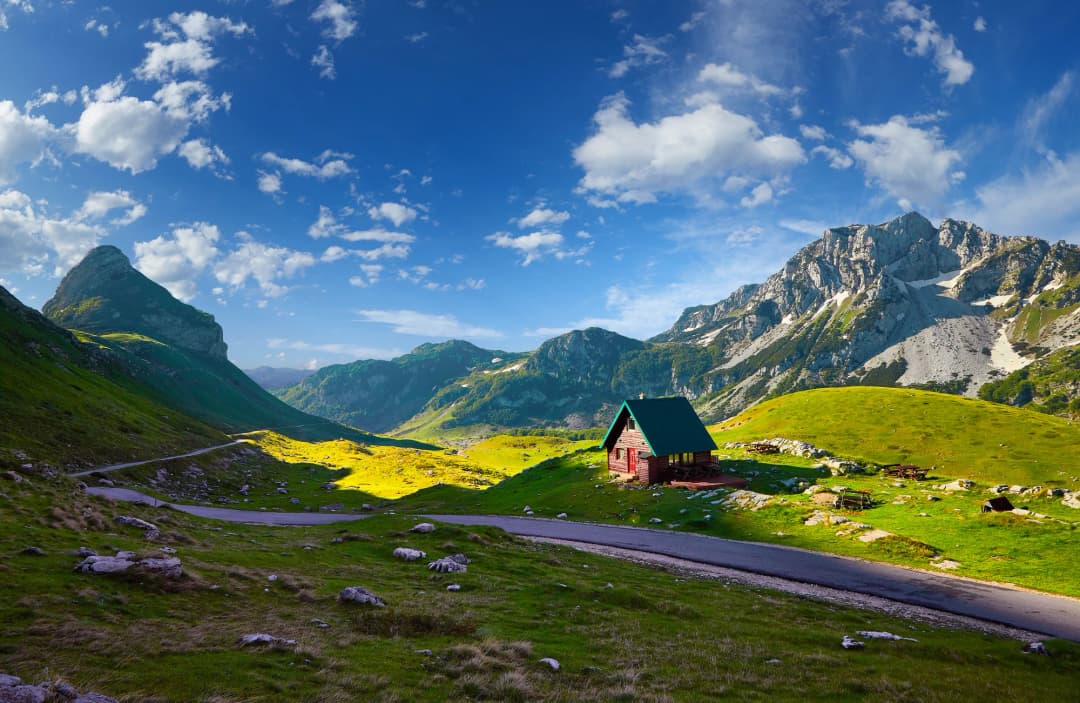
Durmitor is, above all else, a hiker's mountain. The park offers trails ranging from gentle lakeside strolls to demanding full-day summit scrambles across exposed limestone ridges.
Bobotov Kuk (2,523m) — The Highest Peak
The crown of Durmitor. Expect 6 to 8 hours round trip from the Sedlo Pass trailhead, accessible by car or taxi from Zabljak. The trail climbs through alpine meadows before entering stark karst limestone. The final approach involves light scrambling — no technical equipment needed, but sturdy boots and a head for modest exposure are essential. From the summit on a clear day, you can see the entire Durmitor massif, down into the Tara Canyon, and sometimes all the way to the Adriatic.
Difficulty: Strenuous. Distance: ~12.7 km round trip from Sedlo. Elevation gain: ~720m. Best time: Late June to September.
Ice Cave (Ledena Pecina)
A cave at about 2,160 metres that contains permanent ice formations year-round. The marked route starts at Black Lake and climbs via katun Lokvice, 6.55 km each way; the national park says to allow at least 3 hours each way. Entry to the cave has been prohibited since August 2026: the national park has put up barriers to protect the ice and the cave's microclimate, so the walk ends at the barrier.
Difficulty: Moderate. Distance: ~13 km round trip (6.55 km each way). Altitude: 1,425–2,185m.
Skrka Lake Trail
A beautiful mid-range hike to one of Durmitor's more remote glacial lakes, sitting in a dramatic cirque surrounded by high cliffs. The trail passes through meadows blanketed with wildflowers in June and July — a quieter alternative to Black Lake with a stronger sense of wilderness solitude.
Difficulty: Moderate. Distance: ~17 km round trip from the Sarban car park (8.6 km each way), a full day. Elevation gain: ~860m in total.
Zminje Lake and Jablan Lake
Two smaller glacial lakes making excellent half-day hikes from Zabljak. Zminje Lake (Snake Lake) is a peaceful spot ringed by forest, while Jablan Lake offers open meadow views with Durmitor's peaks as backdrop. Both are accessible via well-marked trails near town or the Black Lake entrance.
Difficulty: Easy to moderate. Distance: 4-8 km round trip. Elevation gain: Minimal to moderate.
Hiking Tips
- Trail markings: Generally well-marked with red and white blazes. Carry a topographic map regardless — mobile signal is unreliable on many routes.
- Weather: Mountain weather changes rapidly. Thunderstorms develop within an hour on summer afternoons. Always carry a waterproof layer and warm mid-layer.
- Water: Bring at least 2 litres per person for longer hikes.
- Footwear: Sturdy hiking boots with ankle support are essential beyond the Black Lake loop.
- Start early: For summit hikes, aim for first light to beat afternoon storms.
Tara River Canyon
The Tara River Canyon is among the deepest canyons in Europe. At its most dramatic point, the walls plunge up to 1,333 metres from rim to river. The canyon stretches 82 kilometres, and the Tara River is famous for its clarity — but treat or filter the water before drinking it.
Durdevica Tara Bridge
The most accessible viewpoint is the Durdevica Tara Bridge, an elegant concrete arch completed in 1940. Standing 172 metres above the river, the bridge spans 365 metres and offers vertigo-inducing views into the canyon's green depths. It is one of Montenegro's most photographed landmarks.
The bridge is about 23 kilometres east of Zabljak, a 30 to 35-minute drive. Parking, cafes, and souvenir stalls sit at both ends. Three zip lines send riders across the canyon at the bridge (the shortest, Red Rock, costs €20) — simultaneously terrifying and exhilarating.
Rafting the Tara
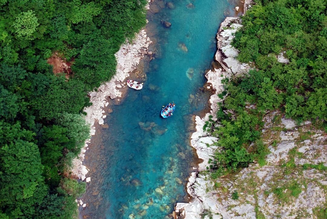
White-water rafting on the Tara is one of Montenegro's signature adventure activities. The most popular route covers approximately 18 kilometres through rapids whose grade varies with the water level — exciting enough for adrenaline, manageable for beginners with a good guide when the water is at its summer level.
The local tourist organisation recommends rafting from 1 July to 15 September, when the water level is safest. In May and June snowmelt can push the river too high; trips then, if they run at all, are for experienced rafters only. Most tours depart from Scepan Polje at the Bosnian border, including transportation, equipment, a guide, and a riverside lunch of grilled meat and local wine — because this is Montenegro and no outdoor activity is complete without a proper meal.
A trip means 2 to 3 hours on the water, about 5 hours in all. Expect to get wet, laugh a great deal, and see the canyon from a perspective no road or bridge can offer.
Skiing in Zabljak
Zabljak may not have the polished infrastructure of the Alps, and that is precisely part of its charm. Skiing here is affordable, uncrowded, and set against dramatic mountain scenery.
Savin Kuk Ski Centre
The main ski area sits a few kilometres from town. Lifts reach 2,213 metres, offering about 700 metres of vertical drop and 4.6 km of slopes for beginners through advanced skiers. Limited snowmaking on a beginner slope at the base was planned from the 2025/26 season, but the season still depends on natural snow. Lift passes are a fraction of Alpine prices, and the lack of crowds means skiing run after run without queuing.
Javorovaca Slopes
A gentle town slope with a relaxed atmosphere, popular with families. There is currently no organised skiing and no working ski lift, so people come to sledge and walk back up; skiers should head to Savin Kuk.
Season and Conditions
The season usually runs from late December into March or April, snow permitting, with the best snow in January and February. Compared to Western European resorts, Zabljak is raw and authentic — do not expect groomed pistes or gourmet mountain restaurants. Do expect friendly locals, empty slopes, stunning views, and the satisfaction of skiing somewhere genuinely undiscovered.