Žabljak, Montenegro: Town Guide, History and Key Facts
Žabljak at 1,456 m is the highest town in the Balkans. Its history, culture, food and events, key facts, day trips and where to stay, in one reference guide.
1,440residents
124 kmto the airport
Jun–Septhe busy months
Updated Originally published 45 min readby Pavle Obradović
Overview
Žabljak is the highest town in the Balkans, sitting at an elevation of 1,456 metres (4,777 feet) above sea level in the heart of northwestern Montenegro. The town held 1,440 residents at the 2023 census and the whole municipality 2,941, spread over 445 square kilometres — so Žabljak is a village-sized base for a mountain the size of a county. It is the gateway to Durmitor National Park, a UNESCO World Heritage Site. It is also Montenegro’s best-known mountain town and its second ski area after Kolašin, with skiing usually from late December into March or April, snow permitting, and the place people sleep before hiking, rafting or canyoning the rest of the year. One hill, one canyon, one massif — none of it on the Alpine scale, all of it half an hour from the door.
The town sits under a massif of around fifty peaks above 2,000 metres — 48 by the tourist organisation’s count, “some fifty” in UNESCO’s inscription text — with 18 glacial lakes below them, known locally as mountain eyes, and the Tara River Canyon beyond. UNESCO calls the Tara “the deepest gorges in Europe”; Wikipedia ranks it second on the continent behind the Sulak canyon in Dagestan. Either way it is 1,333 metres deep at its deepest and 1,073 metres on average. In 1991 Montenegro declared itself the world’s first ecological state — and the declaration was adopted in Žabljak itself, at an open-air session of the republic’s parliament held on 20 September 1991.
48
peaks above 2,000 metres surrounding Žabljak on the tourist organisation’s count, with 18 glacial “mountain eyes” beneath them
Day trips
How far a day reaches
17 min
32 min
39 min
59 min
Top attractions
Most of what follows lies inside Durmitor National Park, and one €5 day ticket covers all of it — the terms are under Durmitor National Park below. The Đurđevića Tara bridge is the exception: it carries a public road and costs nothing to stand on.
Durmitor is the largest of Montenegro’s four mountain national parks and the second largest of the five overall, after Lake Skadar. It is a landscape shaped by glaciers, rivers and underground streams, and it sits inside the much larger Tara River Basin Biosphere Reserve [1][2].
Key statistics: - Area: 32,100 hectares for the World Heritage property, which is UNESCO’s own figure. The national park is harder to pin down: the tourist organisation and Wikipedia say 39,000 hectares, while the park authority’s own management plan zones 34,000 and UNEP-WCMC records the 1997 boundary fixing at 34,000 - Peaks: 48 summits above 2,000 metres per the tourist organisation and Wikipedia; UNESCO’s inscription text says “some fifty”, and the management plan says “more than 40” - Glacial lakes: 18, locally “gorske oči”, mountain eyes - Highest point:Bobotov Kuk at 2,523 metres - Hiking trails: 25 marked routes covering about 150 km - Biodiversity: more than 1,600 vascular plant taxa in the wider massif and roughly 700 species within the park; some 130 bird species; brown bear, grey wolf, European wild cat, river otter and chamois [1][22][27][41][49]
The park contains old-growth forest of European black pine in which, UNESCO notes, 400-year-old specimens reach heights above 50 metres. The Ice Cave (Ledena pećina) is a relict of the last glaciation and one of the features UNESCO names in the inscription, for “its impressive ice stalactites and stalagmites” [1][14]. Entry to the cave has been prohibited since August 2026; see Ice Cave below.
UNESCO inscribed the property in 1980 on three counts: criterion (vii) for scenic beauty, (viii) for geology and (x) for biodiversity. Most summaries name only the first two.
Ticket:€5 a person a day, which is how the national parks’ own Durmitor price list words it: “Ticket (including visits to the Visitor Center and Educational Paths) 5,00 € / per day / per person”. Their online checkout words it differently — “the ticket can be used within 30 days of the date of purchase” — but that is a redemption window on a pre-bought e-ticket, not thirty days of admission. Budget per day.
Free: children under 15, on proof of age.
All five parks: €13.50 for an annual pass, valid for visits to 31 December 2026. Bought singly the five cost €5 at Durmitor and Skadar Lake, €4 at Biogradska Gora and €3 each at Lovćen and Prokletije, so the pass pays for itself on a third day at Durmitor alone.
Ticket booth: on the road from Žabljak to Black Lake; take cash, and note that the same ticket is sold online through nparkovi.me [36].
Also on the park price list: a boat on Black Lake at €10 an hour (€5 if it is your own), a day’s sport-fishing permit at €20, bicycles at €3 an hour or €8 a day, snowshoes at €4 a day, and a park guide at €40 for four hours or €80 for eight [40].
One line in the property’s World Heritage listing is worth knowing before you book. Under Integrity, the statement of outstanding universal value reads: “Other concerns requiring adequate control and management responses include the rapid expansion of the nearby resort town of Zabljak.” The town you sleep in is, in the committee’s reading, one of the risks to the thing you came to see.
Black Lake: Durmitor’s front door
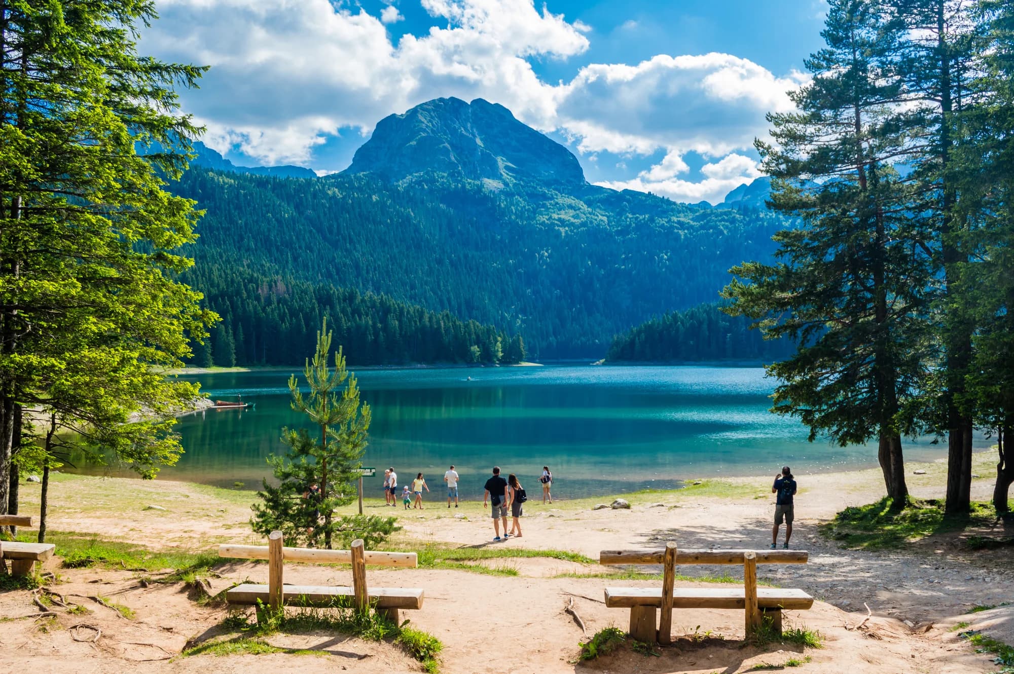
Black Lake is the most visited place in the park and the reason most people come to Žabljak at all. Žabljak’s tourist organisation puts it three kilometres south-west of the town centre; by road it is 2.6 km, which is five minutes in a car and a walk of a little over half an hour. Its altitude is published two ways, two metres apart: 1,416 metres on Wikipedia, 1,418 by the tourist organisation [4][8].
Key facts: - Structure: two basins joined by a natural strip of land called the struga — Veliko jezero (Great Lake) and Malo jezero (Small Lake) - Maximum depth: 49.1 metres, but that is the small basin. Veliko jezero, the one in every photograph, is 24.5 metres deep. The two are commonly reported the other way round - Surface: 0.515 km² in total — 0.338 for Veliko, 0.177 for Malo - Circuit walk: a level 3.6 km loop, an hour to an hour and a half - Surroundings: black pine and spruce to the waterline, under the grey wall of Meded
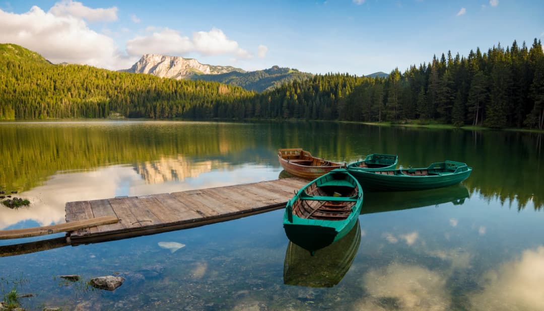
In summer you can hire a boat for €10 an hour from the national park — €5 if you bring your own — and fish on a €20 day permit. The surface freezes in the deepest winter months. Two details the shoreline does not advertise: the water level swings so that Veliko drains into Malo in summer and Malo into Veliko in winter, and the lake’s underground outflow forks, some of it reaching the Tara and some the Piva. Do not drink it untreated; refill at the facilities or filter [4][8].
Tara River Canyon: 1,333 metres deep
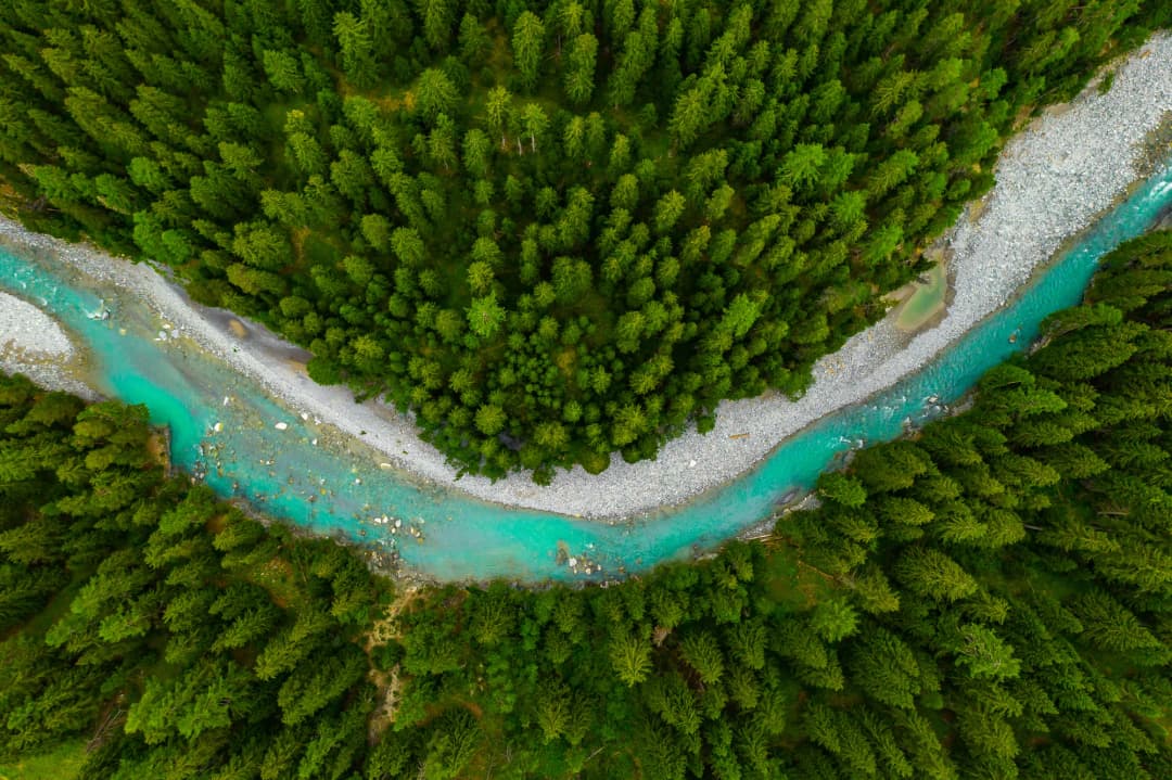
How deep the Tara ranks depends on who is counting, and the sources do not agree. UNESCO’s inscription text for Durmitor says the Tara has “the deepest gorges in Europe”. Wikipedia puts it second in Europe behind the Sulak canyon in Dagestan, while also calling it the deepest in continental Europe — which is the same claim as UNESCO’s if the Caucasus is left out. The measurement everyone agrees on is the one that matters on the road: the walls stand up to 1,333 metres above the water, and average 1,073 [5][7][9].
Key dimensions: - Depth: up to 1,333 metres, 1,073 on average - Length: 82 kilometres on Wikipedia and on Žabljak’s tourist organisation, 78 in the park authority’s own management plan; more than sixty of them lie inside Durmitor National Park. The canyon runs from Bistrica in Montenegro to Hum in Bosnia and Herzegovina, where the Tara meets the Piva and becomes the Drina - River: the Tara is called the “Tear of Europe” for the clarity of its water
What the sources say
The Tara basin was recognised in 1976 as a UNESCO Biosphere Reserve under the Man and the Biosphere programme. Its dense pine forests are interspersed with glacial lakes and harbour a wide range of endemic flora. The river, together with the Drina, is Europe’s main habitat and spawning ground for the huchen (Hucho hucho), the Danube salmon, which UNESCO records as endangered but still living in the park’s rivers. Other fauna includes trout, grayling, capercaillie, griffon vultures, bears, wolves and chamois [5][7][9].
Đurđevića Tara Bridge: the 1940 arch
The Đurđevića Tara Bridge is a concrete arch bridge over the Tara canyon, and the most photographed structure in northern Montenegro [10][11].
Construction and design: - Designed by: Engineer Mijat Trojanović - Built: 1937–1940 in the Kingdom of Yugoslavia - Constructor: Andonović company from Belgrade; chief engineer Isak Ruso - Length: 365 metres - Height above the river: about 170 metres. The Montenegrin press and Wikipedia print 172; the weekly Monitor says 168, the engineering database Structurae 150, and the bridge database highestbridges.com, which has gone through the published figures, calls the height “somewhat murky” and settles on 140 - Arches: five; largest span 116 metres - At the time of completion, it was the largest vehicular concrete arch bridge in Europe
World War II history: In 1942 Italian forces held the bridge. Yugoslav Partisans, aided by the bridge’s own engineer Lazar Jauković, blew an arch to halt the advance across the Tara — the smallest arch, on the left bank, according to Vijesti and the mayor of Šavnik quoted in CdM. Jauković was captured and shot on the bridge in August 1942; Vijesti says Chetniks shot him, CdM says the Italian occupying forces did. He is remembered as a national hero. The bridge was rebuilt in 1946 [10][11].
Today the bridge is the busiest stop on the road and the launching point for three zip lines across the canyon; the nearest of them, Red Rock, costs €20 and takes 45 seconds. It is 23 kilometres from Žabljak, about 32 minutes by car. There is free parking opposite the zip-line start (see Nature and activities).
Bobotov Kuk: the 2,523-metre summit
Bobotov Kuk is the highest peak in Durmitor National Park and the highest peak located entirely within Montenegro’s borders. It is a crest of white limestone at the centre of the massif, and the first recorded ascent was made in 1883 by the Austrian cartographer Oscar Baumann. Its height is given as 2,523 metres by Wikipedia and by Žabljak’s tourist organisation, 2,525 by UNESCO’s inscription text and 2,522 by UNEP-WCMC and by Baumann’s own Austrian biography — three metres of limestone that nobody has settled [12][13].
Hiking details: - Difficulty: hard, on the tourist organisation’s rating, and the last 500 metres are a scramble over exposed rock - From Sedlo: about 12.7 kilometres return with 722 metres of total ascent on the tourist organisation’s route card, which reckons about 3 hours up and 2.5 down; allow 5.5 to 7 hours with stops - From the town: the tourist organisation’s route from Ivan Do over the summit and down to Žabljak is 15.32 kilometres with 1,186 metres of climbing. Walking it one way, Sedlo down to Žabljak, is 17 kilometres and about seven hours, and is the version most people who have done both recommend - Trailhead: the Sedlo pass, about 14 kilometres and 17 minutes from Žabljak by the shortest road (OSRM, 13 September 2026, via a local road rather than the signed Ring); the pass itself is at 1,907 metres - Safety: fixed safety ropes on some of the exposed sections; start early, because the afternoon thunderstorms are the hazard - Season: June to September, and expect snowdrifts even then
Geographic note: Bobotov Kuk is often called Montenegro’s highest peak, and it is not. Three summits in the Prokletije, the Accursed Mountains on the Albanian border, stand higher: Zla Kolata, the country’s high point, at 2,534 or 2,535 m depending on which table you read; Dobra Kolata at 2,528; and Rosni vrh, Maja e Rosit on the Albanian side, at 2,524 in the Real Estate Directorate’s list and 2,525 in its own entry. The last of those is a metre or two above Bobotov Kuk — inside the measurement error, not a gap you could see. What is not in doubt is that all three straddle the border, so Bobotov Kuk keeps the narrower title: the highest summit lying wholly inside Montenegro [12][13].
Ice Cave: ice at 2,160 metres
Entry prohibited since August 2026; the trail ends at the barrier. Barriers went up on 22 August 2026 on researchers’ advice, to protect the cave’s ice and microclimate, and the national park’s notice gives no end date. The approach walk itself is not banned. The Ice Cave lies high on the Durmitor plateau above the katun at Lokvice, and it is one of the features UNESCO names in the inscription — “the ‘Ice Cave’, with its impressive ice stalactites and stalagmites”. Its altitude is published loosely: the Montenegrin press says 2,156 metres, durmitor.rs 2,160, the cave database showcaves.com 2,180, and 2,164 is the figure most travel sites repeat. Call it about 2,160 [1][14].
Key facts: - Main chamber: 40 metres by 20. The Montenegrin accounts read that as forty long and twenty wide; showcaves.com reads it as forty wide and twenty high - Formation: water seeping through limestone and freezing, over centuries, into a network of ice tunnels and chambers - Ice persistence: the ice and its stalactites and stalagmites last through the summer, though visitors may no longer go in to see them - Hiking access: the marked route is the tourist organisation’s Black Lake – katun Lokvice – Ledena pećina, 6.55 km one way, climbing from 1,425 to 2,185 metres [45]. Reckon on three to four hours up; the walk now ends at the barrier at the cave entrance. Descriptions that send you from Sedlo are describing a different line, not the marked one - Best season: June to September, for the walk to the barrier only - Difficulty: moderate to challenging
The Ice Cave is not Durmitor’s only relic of the ice ages. In a steep north-east-facing cirque under Šljeme (2,455 m) lies Debeli Namet, a pocket glacier that survives on avalanche snow, wind drift and shade. Djurović’s survey in Acta geographica Slovenica puts it between about 2,050 and 2,160–2,170 metres and gives its area as roughly 0.025 to 0.032 square kilometres, and records that its lowest point has sat near 2,050 metres for more than half a century. The thing usually said about it that the record does not support is that it is Europe’s southernmost ice: Snezhnika in Bulgaria, at 41°46′ N, and the Calderone in Italy both lie further south. What is remarkable is the stability. Measurements from August 1954 to September 2010 found the glacier had not significantly fluctuated in size in fifty years, varying with each winter’s snowfall rather than trending away [38].
56 years
of measurement, 1954 to 2010, over which the Debeli Namet glacier did not significantly change in size
Culture, food and events
The culture here is pastoral and the food follows from it: sheep, maize, potatoes and cream, cooked long. It is also cheap by Montenegrin standards — an espresso runs about €1.20 and dinner for two in a konoba €30–40, a fraction of the coast in August.
Katuns and mountain culture
Žabljak’s culture is rooted in the highland pastoral traditions of the Durmitor region. Many of the surrounding villages have katuns — seasonal shepherd settlements used through the summer grazing months. The Durmitor Ring road passes one, Ograde Kolibe, about two kilometres beyond the village of Mala Crna Gora on the descent toward the Sušica canyon, which is the easiest to see without arranging anything [19][37].
The region’s fierce independence is a defining cultural trait. Highland communities maintained their autonomy through centuries of Ottoman presence, and the Partisan resistance during World War II is a source of enduring local pride [3][6].
Traditional highland cuisine
The cuisine of northern Montenegro is hearty mountain fare, emphasising meat, dairy, and root vegetables – a stark contrast to the Mediterranean flavours of the coast [19].
Signature dishes: - Kačamak: The most famous Montenegrin highland dish – a rich, filling blend of cornmeal, potatoes, and cheese (often kajmak, a creamy dairy product). It is said to have appeared in the north of the country soon after Bishop Petar I Petrović Njegoš brought potatoes back to Montenegro from Russia in 1786, though that link is tradition rather than record. Historically, it was a common meal for shepherds and farmers, prepared in large communal pots, making it a social and community-oriented food [19]. - Cicvara: A savory cornmeal porridge enriched with butter and cheese - Lamb under sac: Lamb and potatoes slow-cooked under a metal or ceramic bell (sac) covered with hot embers – a traditional method producing exceptionally tender meat - Priganice: Fried dough balls, often served with honey or jam - Local cheeses: Aged mountain cheeses from highland dairies
Two ingredients explain most of the menu. The sheep is the Pivska pramenka, also called Jezeropivska, the local breed of the mountains around Durmitor and Sinjajevina; the cream is skorup, which ripens for at least two months in a mješina, a sheep or goat skin. Skorup is a protected product, and the protected area is exactly these three municipalities — Žabljak, Plužine and Šavnik. Order kačamak with skorup, or lamb under the sač, and reckon on about €1.20 for an espresso and €30–40 for dinner for two; Konoba Luna, the town’s best-reviewed, prices dinner at €15–20 a head. Cash is easier than a card outside the hotels [19][26].
Festivals and events
The town’s ski culture dates to the Yugoslav era, when state investment turned a burnt-out highland village into a winter sports resort, and the season still sets the calendar: events cluster on the snow between December and April and on the trails between June and September. Dates move from year to year, so check with the tourist organisation before you build a trip around one [3][6].
Nature and activities
Four things bring people here, and all four have a published price: a lift pass at Savin Kuk (€16 a day, €10 for children), a rafting seat on the Tara (€70 for a half day, €150 for a full one), the zip line at the Tara bridge (€20), and a guided canyoning descent of Nevidio (from €130). The park ticket is €5 a day on top.
Skiing
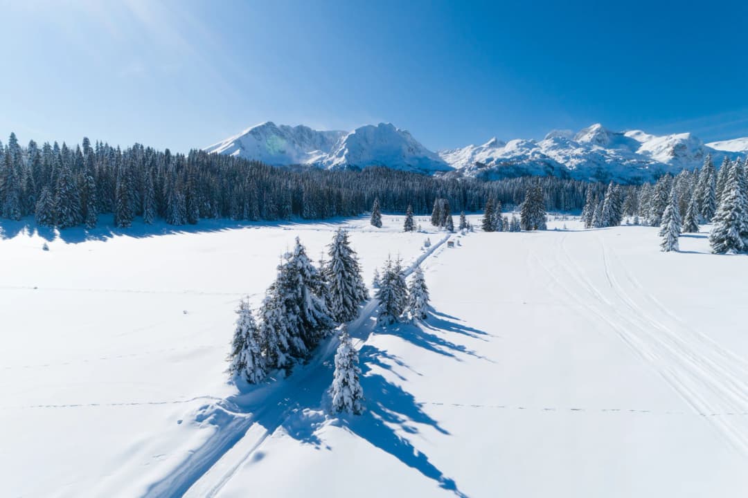
Žabljak is Montenegro’s second ski area after Kolašin, where the 1450/1600 resort has more than 45 km of slopes; here, in practice, it means one lift-served hill and one slope you walk back up [16][17].
Savin Kuk, in figures:
Day pass: €16 adult and €10 child on the current Savin kuk price list; half a day €10 and €6, two days €29, three days €42. Check the current season’s list before you go. Lifts run 09:00–16:00 [28][43]
Season: usually from late December into March or April, snow permitting
Skiable range: 1,515 m at the base to 2,212 m at the top station — a vertical of 697 metres. Žabljak’s tourist organisation puts the upper cable car at 2,213 m and the drop at 700. The 2,313 m and 750-metre figures widely quoted for the ski area are the height of the peak, not of the top station
Runs: 4.7 km in total — 2.6 easy, 1.2 intermediate, 0.9 difficult. The tourist organisation counts three blue, one red, one black and a baby slope over 4.6 km, which is the same hill measured slightly differently
Lifts: six. Savin kuk I climbs 1,550 m of cable to 1,907 m; Savin kuk II runs a further 700 m to 2,213 m and serves an 800-metre black run. Three surface lifts follow, one floodlit for night skiing, plus a children’s lift
Capacity: 3,000 skiers
On site: rental, ski school, service, a medical point and food
Javorovača is the 440-metre town slope beside the bus station, and it is not a lift-served ski area. Žabljak’s own tourist organisation says there is currently no organised skiing and no active ski-lift infrastructure on it: people sledge and ski it and walk back up, which suits small children and nobody else. The €8 adult and €5 child day passes still quoted for it online come from a 2015/16 price list [43]; check at the tourist office before you count on a lift.
January and February are the weeks you can count on the snow: Žabljak’s tourist organisation puts the town under snow for 120 days a year, at depths above 15 centimetres [16][17][28][39].
Rafting on the Tara River
Rafting the Tara is the single most-sold day out in northern Montenegro, and the one most often mispriced [18].
“Rafting the Tara” is three different journeys, and the reason quoted prices range from €69 to €150 is that people are pricing different ones. Žabljak’s tourist organisation lists the runs; the operators price them.
Run
Length
On the water
Price, and who quotes it
Splavište (camp II) – Žugića luka
14 km
3–4 hours
€70 for a half day of about 10 km paddling, transport from Žabljak included — Durmitor Adventure
Splavište – Žugića luka – Radovan luka
24 km
5–6 hours
€150 full day including lunch and transport; €100 a head for a private boat, minimum four — Durmitor Adventure
Brštanovica – Šćepan Polje (the lower gorge, sold from the camps at Šćepan Polje)
18 km, 21 rapids
2–3 hours afloat, about 5 hours in all
€85 for one person falling to €69 in a group of ten or more — Montenegro Adventure
Splavište all the way to Šćepan Polje
60 km
10–11 hours
Sold as two or three days; no single-seat price published
Other details: - Season: the tourist organisation calls 1 July to 15 September the safest window; operators run from May to October, and Durmitor Adventure notes that the spring melt is too high to raft rather than too tame - Difficulty: Class 3 to Class 5 depending on the month, hardest in spring - Family months: July, August, September, when the water is lowest - Included: wetsuit, boots, life vest, anorak, boat, skipper and insurance; lunch on full-day trips - No experience needed: a briefing precedes every descent, and Tarasport Rafting states that every skipper it puts on the water holds an International Rafting Federation licence — worth asking any operator - If you are quoted €50 for “a one-day trip”, ask which run: Tarasport Rafting’s one-day Tara-and-Drina trip is priced there, and the cheap seats are on the lower gorge, sold from the camps at Šćepan Polje — an hour and a half from Žabljak rather than from the town itself [18][29][30]
Besides Durmitor Adventure, the operators working this stretch include Tarasport Rafting, Rafting Montenegro and Blue River Tara. Whoever you book, check that the price quoted is for the run you think you are buying, and that transport from Žabljak is in it [18].
Hiking
Durmitor offers approximately 25 marked hiking routes covering 150 km, ranging from easy lakeside strolls to demanding alpine scrambles [20][21].
Durmitor is also a section of the Via Dinarica White Trail, the 1,261 km high-mountain route that runs the limestone spine of the Dinaric Alps from Razdrto in Slovenia to the Valbona valley in the Albanian Alps. Žabljak is one of the few towns anywhere on it with hotels, gear shops and a bus station within a day’s walk of the high line.
Trail
Distance
Difficulty
Duration
Highlights
Black Lake circuit
3.6 km loop
Easy
1–1.5 hours
Two basins joined by the struga, conifer forest
Bobotov Kuk (from Sedlo)
12.7 km return
Hard
5.5–7 hours
The highest summit wholly inside Montenegro
Ice Cave (from Black Lake, via katun Lokvice)
6.55 km one way
Moderate–challenging
3–4 hours each way
Entry prohibited since August 2026; the trail ends at the barrier
Planinica (2,330 m)
22 km
Challenging
7 h 35
High alpine plateau, forest, lakes, grassland
The 18 glacial lakes include Crno Jezero (Black Lake, the largest), Zmijinje jezero (Snake Lake), Barno Jezero, and numerous smaller mountain tarns. The lakes are scattered across the massif at various elevations, many accessible only by hiking trails [20][21].
Both the Black Lake circuit and the Ice Cave route are mapped by the AllTrails community, which is where most people pick up the GPS track before they go [4][14][20].
You do not have to book privately for a guide. The national park’s own price list sells guide services at €40 for four hours and €80 for eight, and runs the Durmitor Ring as an organised tour — €20 a head by van, €30 by jeep, park entry included. Žabljak’s agencies, Durmitor Adventure and Nomad & Outdoor Montenegro among them, stitch rafting, hiking, zip-lining and canyoning into one itinerary, which is how most people fit the massif into three days [25].
Zip-lining over the Tara canyon
Three lines cross the canyon at the Đurđevića Tara bridge, not two, and only one of them has a published price. The operator, Durmitor Adventure, sells them as Red Rock, Montenegro (the yellow line) and Extreme Tara (the green one) [24]:
Red Rock, the one at the bridge: 350 metres of cable, 170 metres above the canyon, a 45-second flight, €20 a person. You walk back over the bridge — 350 metres, about ten minutes
Montenegro (yellow) and Extreme Tara (green): longer crossings with transport back to the start included. The operator publishes neither a length nor a price for either; the lengths that circulate online — 824 m and 1,050 m — are not on its own site, so ask at the desk
Height: 170 metres above the canyon on Red Rock, which is the operator’s figure. The 100 metres often quoted for these lines is not
Season: daily 1 May to 1 October, no exceptions; April and October depend on the weather; closed November to March
Children: under about seven or eight they fly harnessed to an adult. The upper weight limit moves with the wind, between 110 and 130 kg
Getting there:32 minutes, 23 km from Žabljak, with free parking across the road from the start
Busy hours: 13:00 to 15:00 in July and August, and even then the wait is minutes
Safety: built under engineering supervision, cables rated over 10 metric tons of breaking load. The line took the national tourist board’s Wild Beauty Award in 2013
No advance reservation required, though groups of ten or more are asked to message ahead
Mountain biking
Durmitor’s terrain offers excellent mountain biking, from gentle lakeside rides to demanding alpine routes [25].
Durmitor Ring: a 76-kilometre signposted circuit, which is the figure Žabljak’s tourist organisation and Wikipedia both publish; the 85 km quoted by several travel sites is not theirs. It crosses the Sedlo pass at 1,907 metres — the figure on the national park’s own trail signage, though the tourist organisation’s panoramic-roads page says 1,895 — and passes the turning for Štuoc at 1,952 metres, the highest point in Montenegro you can reach on asphalt. Signposted both ways; the organisation suggests anticlockwise for its audio guide and clockwise for campers. Parts are narrow and parts are macadam
Bike rental: the national park hires bicycles at €3 an hour or €8 a day. For an e-bike, Durmitor Adventure charges €35 for half a day and €55 for a full one on a hard-tail, €45 and €80 on full suspension; its guided rides are €70 for the village loop round Žabljak and from €80 for the Ring [40][44]
Terrain: alpine meadows, glacial lake shores, dense forest, cliff-edge roads
Canyoning
Canyoning here means climbing, swimming, jumping and abseiling down a gorge with a guide. The Nevidio Canyon is the one people come for, and its window is short — roughly late June to early September, when the Komarnica is low enough: it is 39 minutes and 30 km from Žabljak, in Šavnik municipality, and Durmitor Adventure guides it from €130 [25][31].
Other activities
Tandem paragliding over the massif, from €100 a person
Rock climbing on the limestone faces, from €90
Horse riding through the alpine meadows, from €30
Fishing in the glacial lakes and rivers: a day’s sport-fishing permit on Black Lake is €20 from the park
Jeep safaris over the plateau — the park runs the Durmitor Ring itself, €30 a head by jeep and €20 by van, park entry included
Wild swimming in the glacial lakes from June to September
Guided walks from Durmitor Adventure are priced per group rather than per head, which makes them cheap for four and dear for two. Jablan Lake short, 8 km and 3 hours with 118 m of climbing: €60 for up to five people, €80 for five to ten, €100 above that. Jablan Lake long, 19.9 km and 6 h 20 with 437 m of climbing: €90/€120/€150. Crvena Greda, 19.5 km and 6 h 24 with 835 m of climbing between 1,416 and 2,101 m: €120/€150/€190. Walking season May to October [25][31][44].
Practical information
Getting to Žabljak
Žabljak is located in northwestern Montenegro. There is no airport or railway station in the town; access is by road [23].
Two figures for each road below: what Žabljak’s tourist organisation publishes, and what the OSRM router measures for a car, re-run on 11 September 2026. They agree closely, and both matter because the second is the one that will be on your phone. Podgorica is often given as 170 km away; it is about 120.
The roads are paved and signposted but they wind and climb; from 15 November to 1 April winter tyres (minimum 4 mm tread, no studs) are compulsory on all four wheels in winter conditions, and you should carry chains as well. By bus, reckon on about 2 h 30 from Podgorica and €13–14. Four carriers work the route — Radulović Prevoz, Stanišić, Glušica and Marko Turs — and between them they run seven or eight departures a day, of which Radulović’s are about two. No operator posts a standing timetable or fare: the tourist organisation sends visitors to busticket4.me and lists station telephone numbers for Podgorica, Nikšić, Pljevlja and Mojkovac. Book the day before in summer and confirm the last departure back before you commit to a day trip. By private transfer, door-to-door from Podgorica, Tivat, Kotor or Dubrovnik, which is the sensible choice in winter or with small children. From Dubrovnik allow 4–5 hours plus the border [23][32].
Peak tourist months: July and August for summer activities; January and February for skiing.
Optimal adventure months: June and September offer the best balance of warm weather, fewer crowds, and full availability of activities [18][23].
What 1,456 metres does to your trip
Žabljak is the highest town in the Balkans at 1,456 metres — the town’s own tourist organisation rounds it to 1,450. Either way, arriving from the coast:
Not altitude sickness: 1,456 metres is well below the height at which that begins. What the altitude does is change the air and the light, not your blood
UV: stronger at altitude, and stronger again over snow; sunscreen and sunglasses year-round
Cold evenings: the average August night falls to about 9 °C while the coast stays warm. Bring layers even in high summer
Winter extremes: the record low since 1958 is −26.4 °C, in January; the tourist organisation counts 120 days a year with more than 15 centimetres of snow on the ground, and from 15 November to 1 April winter tyres (minimum 4 mm tread, no studs) are compulsory on all four wheels in winter conditions; carry chains as well [23][39]
Currency and payments
Montenegro uses the Euro (EUR). Card payments are accepted at hotels and larger restaurants, but carrying cash is advisable for smaller establishments, park fees, and mountain huts.
Day trips from Žabljak
Žabljak is a base, not a destination in itself, and almost everything worth driving to is inside ninety minutes. Times and distances are OSRM driving measurements, re-run on 11 September 2026; where the tourist organisation publishes its own figure, both are given above under Getting to Žabljak.
The Sedlo pass and the Durmitor Ring (17 minutes, 14 km by the shortest local road) — 1,907 metres, the Bobotov Kuk trailhead, and the start of a 76-kilometre circuit that takes a full day if you stop.
Ćurevac, the Tara canyon overlook (32 minutes, 14 km, then 640 metres on foot) — the classic view down into the gorge; the road ends short of the viewpoint (OSRM, 13 September 2026).
Đurđevića Tara bridge and the zip lines (32 minutes, 23 km) — the 1940 arch, about 170 metres over the water, and a €20 flight across the canyon. If you make only one drive out of Žabljak, make it this one.
Šavnik and the Nevidio canyon (39 minutes, 30 km) — the Komarnica gorge, guided descents only, from €130.
Plužine and Lake Piva (59 minutes, 49 km) — a drowned canyon, a 220-metre dam and a monastery that was carried uphill. See below.
Pljevlja (86 minutes, 60 km) — the nearest town of any size, and the Husein-paša mosque, built around 1569–1573.
Šćepan Polje (92 minutes, 72 km) — the rafting camps at the Bosnian border, where the Piva meets the Tara.
Mojkovac (100 minutes, 69 km) — down the Tara on the east side, for the Biogradska Gora forest beyond it.
Nikšić (101 minutes, 74 km) — the road you probably arrived on, and Montenegro’s second city by population.
Kolašin (102 minutes, 86 km) — the country’s other mountain resort, over the Tara and up.
Piva canyon and Lake Piva
Fifty kilometres due west, in Plužine municipality, is the most engineered landscape in northern Montenegro. The Mratinje dam — 220 metres high, 268 across the crest, 820,000 cubic metres of concrete, begun in 1971 and completed in 1975, and still among the highest in Europe — closed the Piva canyon and made Lake Piva: 45 kilometres along the drowned valley, 12.5 square kilometres of surface, 188 metres deep, the water at 675 metres. The old town of Plužine is on the bottom. Piva Monastery, built 1573–1586, was taken apart from 1969, carried about three kilometres uphill and a hundred metres higher, with its 1,260 square metres of frescoes lifted off in more than a thousand fragments, and stood complete again in 1982.
Below the dam the Piva canyon runs 33 kilometres and up to 1,200 metres deep, on a road with fifty-six short and mostly unlit tunnels. Regional Park Piva, 32,500 hectares and Montenegro’s first regional nature park, was declared on Earth Day, 22 April 2015. Via Ferrata Piva, by the river bridge in Plužine, opened on 3 October 2024; the cross-border project that built it calls the route about 4,500 metres, while the operator’s own site describes an 800-metre protected climb from the bridge [47]. Kayaking, swimming, trout and chub fishing and boat tours of the canyon are all sold on the lake. The zip line over the water is advertised by its operator as Montenegro’s longest, at 1,400 metres across two lines — the length is theirs and so is the record claim, which nobody independent has checked [15][34][35][48].
Where to stay in Žabljak
The town is small enough that the only real decision is how far from the main street you want to be, and whether you want to walk to the bus station or to the meadow. Six places listed with us, with what each is actually near. Nightly rates are read from each property’s own record rather than printed here, so they cannot go stale on the page.
For a whole house rather than a room, this five-bedroom cottage has a garage, a fireplace and the lake and the trails a few kilometres off — the right shape for a family week in the snow.
Frequently asked questions
How much is the Durmitor National Park ticket, and how long is it valid?
Five euro a person a day. That is the wording on the national parks’ own Durmitor price list; their online checkout says instead that a ticket “can be used within 30 days of the date of purchase”, but that is a redemption window on a pre-bought e-ticket, not thirty days of entry. Children under 15 are free.
The ticket covers the visitor centre at Black Lake and the park’s educational trails. It is sold at the booth on the road from Žabljak to Black Lake — take cash — and online at nparkovi.me. If you are staying a few days, an annual pass to all five national parks is €13.50 and runs to 31 December 2026, so it pays for itself on a third day at Durmitor.
How far is Black Lake from Žabljak, and how long is the walk round it?
Three kilometres south-west of the town centre on the tourist organisation’s figure, 2.6 kilometres by road — five minutes in a car, a little over half an hour on foot. The shoreline circuit is 3.6 kilometres, level, and takes an hour to an hour and a half.
It is the easiest serious view in the park and the busiest place in it. The national park hires boats at €10 an hour, or €5 if you bring your own. The lake is two basins joined by a strip of land called the struga; the deep one, at 49.1 metres, is the small one, not the photogenic Veliko jezero, which is 24.5 metres. Do not drink the water untreated.
How do you get to Žabljak from Podgorica, and is there an airport?
No airport and no railway station in the town. From Podgorica it is 121 to 124 kilometres and about two and a half hours by car, over Nikšić and Šavnik; from Podgorica airport, 131 kilometres and about 2 h 40.
The tourist organisation publishes 124 km and 2 h 20; OSRM measures 121 km and 2 h 29. Buses run daily — seven or eight departures a day across four carriers, at about €13–14 — though no operator posts a standing timetable, so confirm the return before you rely on it. Kotor is 153 km and about 3 h 15; Budva 159 km and 3 h 20. From 15 November to 1 April winter tyres (minimum 4 mm tread, no studs) are compulsory on all four wheels in winter conditions; carry chains as well.
Can you ski at Žabljak, and what does a lift pass cost?
Yes, at Savin Kuk: €16 a day for an adult and €10 for a child (check the current season’s list), lifts 09:00 to 16:00, usually from late December into March or April, snow permitting. The skiable range is 1,515 to 2,212 metres, with 4.7 kilometres of runs on six lifts.
It is one hill, not a resort in the Alpine sense — 2.6 km of easy, 1.2 intermediate and 0.9 difficult, with an 800-metre black run off the top station. January and February are the weeks the snow is reliable. Javorovača, the town slope, is a separate matter: the tourist organisation states there is currently no organised skiing and no active ski-lift infrastructure there.
What does rafting the Tara cost?
From Žabljak, €70 for a half day of about 10 kilometres and €150 for a full day of 24, both with transport from the town. The 18-kilometre lower gorge from Brštanovica to Šćepan Polje is €69–85 a head depending on group size.
Those are three different runs, which is why quoted prices vary so much. The tourist organisation calls 1 July to 15 September the safest window; operators sell from May to October, and the spring melt is too high rather than too gentle. Wetsuit, boots, vest, boat, skipper and insurance are included, and lunch on the full day.
How hard is Bobotov Kuk, and how long does it take?
About 12.7 kilometres return from the Sedlo pass, 5.5 to 7 hours with stops, and rated hard by the tourist organisation. From the town, the tourist organisation’s route from Ivan Do over the summit and down to Žabljak is 15.32 kilometres with 1,186 metres of climbing.
Sedlo is about 14 kilometres and 17 minutes by car from Žabljak on the shortest route, and the pass itself is at 1,907 metres. The season is June to September; the last 500 metres are an exposed scramble with fixed ropes on some sections; start early, because the afternoon thunderstorms are the real hazard rather than the mileage. At 2,523 metres it is the highest summit lying wholly inside Montenegro — three higher peaks straddle the Albanian border.
When is the best time to come?
June and September. Daytime highs run 17 to 22 °C, the passes are clear, the rafts are running and there is room on the trails, without the July and August crowds. For snow, come in January or February.
By the 1991–2020 normals, winter days run from about −7 °C overnight to 4 °C at best, and the record low since 1958 is −26.4 °C; spring is 0–15 °C with the rafting water at its highest and hardest; autumn is −2 to 13 °C and the best light of the year on the Black Lake beeches. Whenever you come, the town is at 1,456 metres and the evenings are cold — this is not a coastal packing list.
What travellers and guidebooks say
Lonely Planet describes Durmitor as a massif that “stuns with dizzying canyons, glittering glacial lakes and nearly 50 limestone peaks soaring to over 2000m; the highest, Bobotov Kuk, hits 2523m.” Its Montenegro round-up puts the town first — “The best hub for exploring Durmitor is the town of Žabljak” — and adds that “From April to October, a rafting expedition on the green waters of the Tara River is the best way to experience the deep and dramatic Tara River Canyon” [21][46].
That Žabljak is the country’s outdoor adventure destination is not only a marketing line: UNESCO’s own listing calls it “Montenegro’s primary ski resort”, a line that has dated now that Kolašin 1450/1600 has more than 45 km of slopes, and TripAdvisor puts Durmitor National Park, Black Lake and the Tara River Canyon among the top-rated attractions in the country. None of that is a measurement, and all of it predates the 2026 season [1][7][8][18].
Key facts
Fact
Detail
Elevation
1,456 m (highest town in the Balkans)
Population
1,440 (town) and 2,941 (municipality) at the 2023 census (MONSTAT final results)
National Park
Durmitor, est. 1952; 39,000 ha per the tourist organisation, 34,000 in the park’s own zoning
UNESCO inscription
1980 under criteria (vii)(viii)(x); boundary extended 2005
Highest peak
Bobotov Kuk, 2,523 m — highest wholly inside Montenegro; three border peaks are higher
Glacial lakes
18
Peaks over 2,000 m
48 per the tourist organisation; “some fifty” per UNESCO
Tara Canyon depth
1,333 m max, 1,073 m average; deepest in Europe per UNESCO, second per Wikipedia
Tara Canyon length
82 km (78 km in the park’s management plan)
Ski areas
Savin Kuk, 1,515–2,212 m, 4.7 km of runs, €16 a day; Javorovača, 440 m, no working lift
Ecological state capital
Designated 1991
Park ticket
€5 a person a day; under-15s free; €13.50 annual pass to all five parks
Sedlo pass
1,907 m, on the 76 km Durmitor Ring
Highest asphalt in Montenegro
Štuoc, 1,952 m
Distance from Podgorica
121–124 km, about 2 h 20–2 h 30 by road
A brief history of Žabljak
Žabljak has almost nothing old left standing: the town burned in the Second World War and was rebuilt as a resort. What it has instead is a long record of who held the plateau above it, and a town charter younger than most of the churches on the coast — the name dates from 1870, when a school, a church and a captain’s house were all begun in a single day.
Early settlement and the medieval period
The Durmitor highlands have been inhabited since antiquity, with human presence shaped by the harsh mountain environment. East of modern Žabljak, above the Tara, stand the ruins of Pirlitor — a medieval fortress known in South Slavic epic poetry as the stronghold of Duke Momčilo, and usually dated to the 14th century. Neither the date nor the distance is settled. Visit Montenegro puts the ruins eight kilometres east of the town, Wikipedia sixteen; and Wikipedia adds that Pirlitor is named in no medieval source at all, dating it instead by association with Sandalj Hranić, a lord of the 15th century [3][6].
During the medieval period, the Durmitor region was organised as a župa, a district, within the broader Serbian and later Montenegrin political landscape. The main line of the Balšić family ended in 1421 with Balša III, who left Zeta to his uncle the Serbian despot Stefan Lazarević; the Crnojevići took the lordship thirty years later, in 1451. A point of frequent confusion is worth untangling here. The Žabljak where Stefan Crnojević held his seat, and where Ivan Crnojević (Ivan the Black) held a celebrated court, was Žabljak Crnojevića, a fortress where the Morača enters Lake Skadar in the far south of the country. It shares nothing with this mountain town but a name, and the confusion recurs even in local histories [6].
Ottoman Period
In 1482 the Durmitor region came under Ottoman rule, and the tourist organisation and the local histories run the Turkish period from that year to 1857. The date matters because 1478–79, the year usually printed for “Žabljak”, belongs to the other Žabljak, the fortress on Lake Skadar. The Ottomans introduced new administrative structures here, but the highland population resisted full subjugation; through nearly four centuries the Turks never managed to settle their vassals in the Durmitor area or establish complete authority [3][6].
Integration into Montenegro
In 1878, following the Congress of Berlin, the territory of Durmitor became part of the Principality of Montenegro. The modern town of Žabljak was formally established in the 19th century as a small highland settlement serving pastoral communities [6].
Yugoslav Era and World War II
During World War II, Žabljak and the Durmitor region played a critical role in the Yugoslav Partisan resistance against Axis forces. The Đurđevića Tara Bridge, a vital crossing over the Tara Canyon, was partially destroyed by Partisans in 1942 to halt an Italian offensive (see section on the bridge below) [10][11].
After the war, the Yugoslav government invested heavily in Žabljak’s infrastructure, transforming it from a remote highland village into a mountain resort destination. The establishment of Durmitor National Park in 1952 – with Black Lake receiving protected status as early as 1907 – cemented the town’s identity as a tourism centre [2][5].
UNESCO Recognition
Durmitor National Park was inscribed as a UNESCO World Heritage Site in 1980 under criteria (vii), (viii) and (x) — scenic beauty, geology and biodiversity. The Tara River Basin had already received UNESCO recognition in 1976 as a Biosphere Reserve under the Man and the Biosphere (MAB) Programme — 1977, the year usually printed locally, is when the canyon was decreed a nature reserve and monument under Montenegrin law. In 2005, the World Heritage property boundary was extended to fully coincide with the National Park borders, bringing the protected property to 32,100 hectares [1][2].
The ecological state, and after
On 20 September 1991, at an open-air session held in Žabljak, the Montenegrin parliament adopted the declaration that made the republic the world’s first self-proclaimed ecological state. The choice of venue was the point: the assembly met under the mountain it was legislating about. Fifteen years later, on 21 May 2006, Montenegro voted to leave the union with Serbia, and in 2005 the World Heritage boundary had been redrawn to follow the national-park border exactly.
The town has been emptying throughout. Žabljak held 1,937 people at the 2003 census, 1,723 in 2011 and 1,440 in 2023; the municipality fell from 4,204 to 2,941 over the same twenty years, which leaves it the third-smallest in Montenegro. The beds, meanwhile, multiplied — enough that the statement of outstanding universal value on the property’s World Heritage listing names the rapid expansion of the nearby resort town among the concerns requiring control. That is the modern history of Žabljak in one sentence: fewer residents, more visitors, and a World Heritage committee watching the difference [1][3][33][42].
Climate at a glance
Best time: July · August · September
Written by
Pavle Obradović
Pavle Obradović is from Herceg Novi. He was Manager of Montenegro.com, then Director of the Herceg Novi Tourism Organization, and is now Coordinator for Investment and Development Projects at the Municipality of Herceg Novi. He holds a BSc in International Hospitality and Service Management from the Rochester Institute of Technology (RIT).
···
Updated · Originally published
Montenegro Travel Newsletter
Get weekly stories, guides, and insider tips about Montenegro delivered to your inbox.