The Tara is not one attraction with one entrance. A bridge stop, a Ćurevac viewpoint walk, a park-run boat descent from Splavište and a commercial raft from Brštanovica are different days with different access, documents, equipment and risk. Decide which experience you want before comparing prices.
This guide replaces an archive page that showed five unrelated Plav photographs, called rafting “completely safe” and blended river length, canyon depth, wildlife and route claims without defining their source. Use it with the Durmitor and Black Lake guide for a wider mountain itinerary.
Practical Tara choices: choose the experience first
| Experience | Best for | Main control | Do not assume |
|---|---|---|---|
| Đurđevića Tara Bridge | Short road stop and canyon context | Parking, traffic, safe pedestrian route | A bridge stop includes rafting |
| Ćurevac viewpoint | High canyon view with a walk | Trail, weather, edge exposure, park ticket | Road access reaches the viewpoint |
| Upper-canyon boat or multi-day raft | Longer protected-landscape immersion | Exact launch, finish, operator and logistics | Every trip runs the whole canyon |
| Brštanovica–Šćepan Polje raft | Compact commercial whitewater day | Licensed provider, border documents, inclusions | A quoted price is a universal tariff |
The Đurđevića Tara Bridge guide covers the road stop in detail. The Šćepan Polje guide explains the downstream rafting base and the Tara–Piva confluence. Neither should be mistaken for an upper-canyon launch instruction.
| What do you want to do? | Place | Plan for | Also plan for |
|---|---|---|---|
| Road stop | Tara Bridge | parking + traffic | pedestrian safety |
| High view | Ćurevac walk | trail + weather | edge exposure |
| Short raft | Brštanovica | licensed provider | documents + kit |
| Deep canyon | long itinerary | exact launch + camp | finish + transfer |
Source: montenegro.travel, nparkovi.me
What UNESCO protection actually covers
The Tara has two related UNESCO designations. The World Heritage property is Durmitor National Park: 32,100 hectares, inscribed in 1980 and enlarged in 2005. UNESCO describes the Tara Gorge within it as Europe's deepest and highlights a largely undisturbed canyon, old-growth European black pine and a landscape shaped by glaciers, rivers and karst.
The larger Tara River Basin Biosphere Reserve covers 182,889 hectares and dates to 1976. Its profile gives an approximately 80-kilometre canyon reaching 1,300 metres at the deepest point. This is not the same legal outline as the World Heritage property, and neither designation turns the entire riverbank into open visitor space.
What the sources say
Numbers differ because sources define different things. The National Tourism Organisation publishes 144 kilometres for the river, 78 kilometres for the canyon from the Bistrica mouth to Šćepan Polje and 1,333 metres for maximum depth; another tourism page labels the canyon 149 kilometres. Rather than blend those into false precision, use the UNESCO MAB figures for its defined canyon profile and the tourism figures only when their segment is stated.
2026 Durmitor fees: entry is not a rafting package
The current National Parks price list charges €5 per person per day for Durmitor. It says entry includes the visitor centre at Black Lake and educational paths. The 2026 annual pass for all five national parks is priced at €13.50, so its face value is lower than three separate €5 park days. However, the live official checkout says online annual-pass sales are currently suspended and tells visitors to call about physical sales points. Treat that live notice as controlling; do not build a budget around buying the pass until a physical point confirms stock and sale.
The same list separates guide services, boats, kayaks, camping, parking-related uses, fishing permits and river craft charges. It publishes €40 per person for a park boat ride from Splavište to Žugića Luka and €90 to Radovan Luka, with park entry included. Those are listed park services, not proof of daily departures, a commercial rubber-raft package, downstream border arrangements or return transport.
A National Tourism Organisation listing for 2026 advertises one commercial 18-kilometre Brštanovica–Šćepan Polje rafting day from €75, with two to three hours on the water, equipment, meals, transfer and a €4 tourist tax included. It runs from 1 May to 1 October in that listing. Treat this as a dated example from one provider, not a universal price or entitlement.
How to vet a rafting provider
Montenegro's Ministry of Tourism requires a commercial rafting provider to hold authorization. Its published checklist requires at least one boat leader with a national qualification or International Rafting Federation licence, liability insurance, participant insurance, a vessel navigation permit and safety-conformity documentation. The provider must also be registered in the Central Tourist Register.
Before paying, request the operator's exact legal name and current authorization, then ask which licensed skipper leads your boat. Confirm the river section, launch and finish, expected time on water, road-transfer time, group size, minimum age, swimming rule, medical exclusions, cancellation threshold and refund terms. Ask whether wetsuit, footwear, helmet, buoyancy aid, paddle, dry bag, meals, park fee, tourist tax and return transfer are included.
A glossy “family friendly” label is not an individual safety assessment. Water level, temperature and speed change through the season. The National Tourism Organisation describes April to October as the main season and spring snowmelt as the strongest period. That does not mean every April departure is appropriate for every passenger, or that low summer water makes the trip risk-free.
| # | Check | Evidence to request |
|---|---|---|
| 1 | Provider authorization | legal name + Central Tourist Register record |
| 2 | Qualified boat leader | national qualification or IRF licence for the skipper |
| 3 | Insurance + vessel papers | participant cover, liability, navigation permit, safety conformity |
| 4 | Exact itinerary | launch, finish, water time, road transfer, meals and taxes |
| 5 | Passenger fit | age, health, swimming, kit, cancellation and refund rules |
Source: gov.me, montenegro.travel
Documents matter at the downstream border
Šćepan Polje lies at Montenegro's border with Bosnia and Herzegovina. A June 2026 Police operation around Brštanovica checked 1,040 people, 130 vehicles and ten rafting providers. Police issued six sanctions involving crossing outside a border checkpoint, attempting to cross without a valid travel document or using a crossing contrary to its purpose.
That operation does not prove every passenger will be checked. It does prove that the border setting is operational, not decorative. Carry the passport or identity document your operator specifies, confirm visa or entry requirements for your nationality, and ask in writing who handles formalities and whether the raft, vehicle or walking transfer crosses the state border. Do not leave documents at camp because someone says checks are uncommon.
A National Parks entrance ticket is not border permission. A meal package is not transport authorization. If an itinerary finishes outside Montenegro or uses a crossing point, obtain a clear written sequence before departure.
Viewpoints without rafting
The Tara Bridge is the simplest canyon overview for a road itinerary, but traffic, parking and roadside walking require attention. Use designated parking and pedestrian space, keep children physically controlled and do not stand in the carriageway for photographs. A zipline is a separate commercial activity with its own operator, equipment and terms.
Ćurevac offers a higher viewpoint, reached by a walk rather than a roadside glance. Confirm the approach, park-ticket point, current trail condition, weather and edge exposure. Forest and karst terrain can be slippery after rain or under remaining snow. The Montenegro hiking guide explains general mountain preparation; the Durmitor spring-thaw guide shows why a calendar season is not a surface report.
Crna Poda is a strict nature reserve noted for old-growth European black pine. Treat a named protected locality as a conservation area, not a picnic shortcut or permission to leave marked access. Ask National Parks where stopping, walking and photography are permitted on the day.
Reading a rafting itinerary
Names such as Splavište, Ljutica, Radovan Luka, Sušica, Bajlovića Sige, Brštanovica and Šćepan Polje recur in Tara descriptions, but a place list is not a schedule. Ask the provider to mark the launch, overnight stop if any, final landing and road-transfer route on one map. Then ask which features are passed from the water, which permit a landing and which depend on flow or park restrictions.
An upper-canyon trip beginning near Đurđevića Tara is not the same product as the compact downstream run from Brštanovica. Longer does not automatically mean harder, and shorter does not mean safer: water conditions, rapids, cold, remoteness and evacuation access matter. Compare like with like.
Do not rely on “15 to 85 kilometres” from the old article. No single current source reviewed here established that as a standard package range. Obtain the operator's exact river kilometres, and keep road hours separate from time on the water.
Your trip-day control card
Before boarding, listen to the safety briefing and practise the instructions the skipper gives for holding the paddle, staying in the boat, responding to a swimmer and approaching shore. Wear the assigned helmet and correctly fitted buoyancy aid throughout the instructed section. Keep necessary medication secure and tell the provider about relevant health conditions before departure, not at the launch.
Carry dry layers in the method the provider approves. Leave valuables behind unless they are essential. Cold water, wind and shade can matter even on a warm road journey. The Montenegro safety guide covers broader emergency preparation.
The Ministry of Interior says calls and SMS messages to 112 are free, and the 112 MNE app can transmit GPS coordinates by SMS without internet. Save the number, but do not use emergency contact as a substitute for a legal operator, suitable equipment or a cancellation decision.
| Light | Confirm | Then confirm |
|---|---|---|
| ID | travel document | border process |
| LEGAL | provider + skipper | insurance + boat |
| ROUTE | launch + finish | conditions + transfer |
| KIT | helmet + buoyancy | thermal protection |
| BRIEF | listen + practise | follow skipper |
Source: montenegro.travel, gov.me
Families, accessibility and health
No universal minimum age or suitability rule was established for every Tara product. Ask the licensed provider for its exact age, weight, swimming and health criteria for the date and river section. Give children's ages and sizes before paying so correctly fitted equipment can be confirmed. A discount does not establish suitability.
Standard rafting involves uneven boarding ground, a moving boat, cold water, instructions under noise and a vehicle transfer. Ask for the surface and steps at camp, changing area, toilet, transport, launch and landing; the ability to transfer into the raft; seating and bracing demands; and the evacuation plan. Do not accept “accessible” without a task-by-task answer.
Pregnancy, significant cardiac or respiratory conditions, recent surgery, seizure risk, impaired mobility and medication needs require individual discussion with a clinician and the provider. The operator decides what it can safely support; a traveller still decides whether the residual risk is acceptable.
Responsible canyon travel
The Tara is a living protected river system, not a wilderness set. Use authorized operators and permitted launch points, take all waste out, keep soaps and food out of the water, do not collect plants or rocks and do not approach wildlife. At viewpoints, remain on the permitted route and do not create informal edge paths.
The 2026–2030 park plan identifies Black Lake, Tara Bridge and Splavište among the busiest control and payment points. Expect concentrated pressure and avoid adding roadside parking, noise or litter. “Untouched” is inaccurate: protection depends on management, local work and visitor restraint.
Frequently asked questions
Is Tara Canyon the deepest canyon in Europe?
UNESCO describes the Tara Gorge as Europe's deepest. This article does not repeat the tourism claim that it ranks second in the world, because global rankings depend on inconsistent definitions.
How long is Tara Canyon?
UNESCO MAB says about 80 kilometres. Montenegro's tourism authority gives 78 kilometres for the Bistrica-mouth–Šćepan Polje segment, while another page gives 149 kilometres. Always attach a number to its defined segment and source.
How much is Durmitor entry in 2026?
The current National Parks list says €5 per person per day, including the Black Lake visitor centre and educational paths. Activity, craft, guide, parking and camping fees are separate.
How much does Tara rafting cost?
There is no universal tariff. One dated 2026 tourism-board listing starts at €75 for an 18-kilometre Brštanovica–Šćepan Polje day. Compare exact route, dates, meals, taxes, equipment, transfers and cancellation terms.
When is rafting season?
The National Tourism Organisation gives April to October as the broad season, with stronger spring snowmelt. A particular launch still depends on provider operation, water, weather and passenger suitability.
Do I need a passport?
Carry the valid travel document specified by your operator, especially for downstream itineraries in the border area. Confirm nationality-specific entry and visa rules and whether the trip crosses the state border.
Can beginners raft the Tara?
Some providers accept beginners, but suitability belongs to the exact section, water level, skipper, equipment and person. Ask for written age, health, swimming and cancellation criteria.
Can I see the canyon without rafting?
Yes. The Tara Bridge is a road stop, while Ćurevac requires a viewpoint walk. Both still require traffic, parking, trail, weather and edge-safety decisions.
Methodology and source limits
What the sources say
This guide was checked on 29 August 2026 against UNESCO's World Heritage and biosphere-reserve records; National Parks price, management and annual-pass material; current National Tourism Organisation pages and a dated 2026 offer; Montenegro's rafting authorization rules and law; June 2026 Police reporting; and Ministry of Interior emergency guidance.
Contradictions remain visible. Canyon lengths and depth figures use different boundaries. Promotional global rankings are narrower than UNESCO's defensible European claim. A dated commercial offer is not converted into a market price. The older promise of complete safety is rejected.
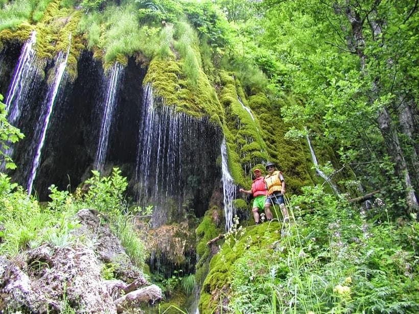
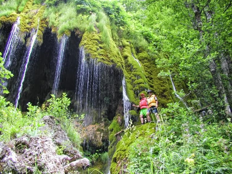
Five Plav photographs, unsupported wildlife lists, the “New Age” Ćurevac label, water-potability implication and precise package distances were removed. One repository-licensed Tara photograph is used for place context; diagrams carry the planning comparisons and cite their sources directly.