Snow can still cover the forest floor around Black Lake while the Montenegrin coast is already behaving like summer. That contrast made Mirko Kosić's Durmitor photographs memorable. It also hid a dangerous assumption in the original story: green patches and open water do not mean that summer hiking has begun. This replacement reads the archive as evidence of a mountain in transition, then uses current official sources to build a safer visit.
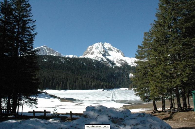
Durmitor is not one season at a time
UNESCO describes Durmitor as a glacially shaped limestone massif in the Dinaric Alps, with around fifty peaks above 2,000 metres and Bobotov Peak at 2,525 metres. Elevation, slope orientation, forest cover and wind redistribute snow. Žabljak, Black Lake, a shaded forest track and a high pass can therefore occupy different practical seasons on the same day.
The old article called Durmitor Montenegro's highest mountain. The World Heritage description supports the elevation of Bobotov Peak, not that national superlative, so this edition removes it. More importantly, a peak statistic is poor trip planning. What matters is the surface and exposure on the exact route.
Montenegro's climate communication classifies Žabljak as mountainous and identifies July and August as its warmest months. That is climate, not a daily forecast. Spring warmth can accelerate melt in the afternoon; a cold night can refreeze wet paths by morning. Rain on snow can increase water flow. Use the national hydrometeorological service for the day and ask park staff how those conditions affect the intended route.

The archive shows a sequence, not a date
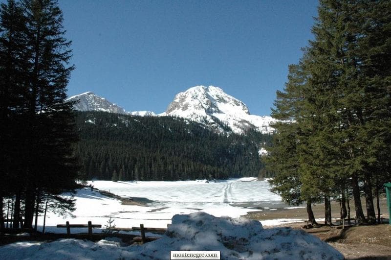
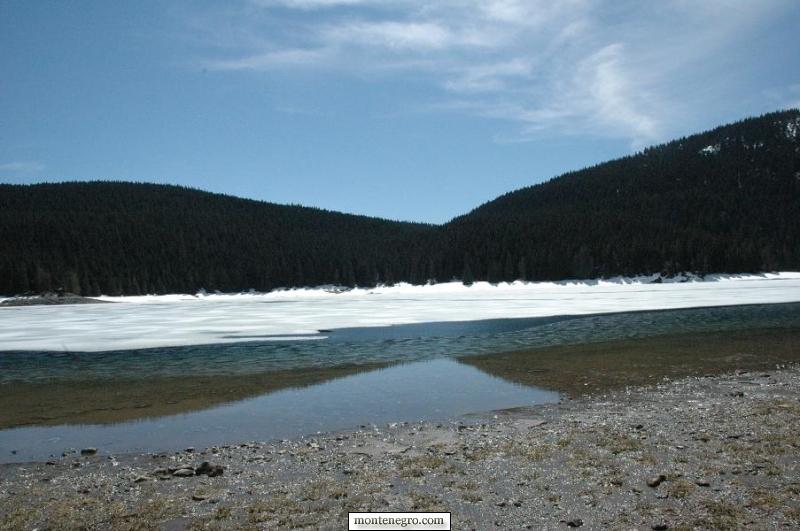
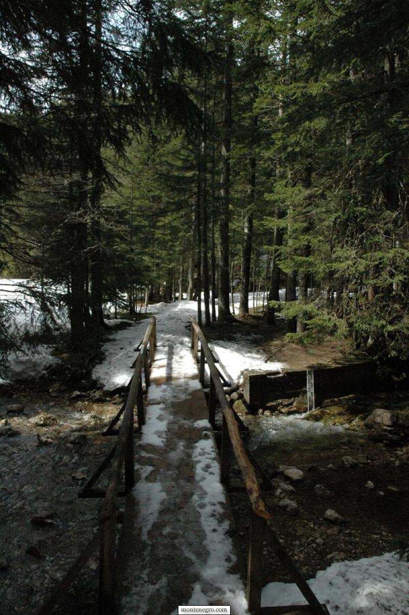
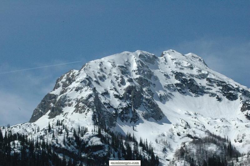
Nine photographs credited to Mirko Kosić were reviewed together. They show deep snow under conifers, a timber footbridge, open water along a frozen lake edge, snow-covered crags, wet ground and a road cut through high snowbanks. Their filenames refer generally to Durmitor and the lake but do not preserve a day, year or route.
The sequence is still useful. Open water indicates active thaw at the shore. It does not establish ice thickness elsewhere. Bare soil beside a bridge does not establish that a shaded approach is clear. A ploughed road does not establish that the next pass is open. Each image is a clue about uneven transition, not a promise to a later visitor.
Official warnings show why dates cannot be recycled
On 7 May 2025, Montenegro's Mountain Rescue Service and the park warned of snow, ice and low temperatures, stating that Durmitor's trails were not yet open for summer hiking. On 30 April 2026, the park again appealed to visitors not to use mountain trails or organize summit ascents because heavy snow made conditions unfavorable and rescue response harder.
Those notices are dated evidence, not today's status. Their value lies in the year-to-year difference and recurring lesson: “late spring” is not an opening date. A route that was dry in one May may remain winter terrain in another. Search the park's current notices, contact its visitor centre and ask about the named route, not “Durmitor” in general.
| Stage | Checks |
|---|---|
| 1 SEE THAW | open water; bare patches; melt streams |
| 2 VERIFY | park notice; forecast; road status |
| 3 MATCH | exact route; skills + gear; return margin |
| 4 DECIDE | go short; change route; or turn back |
| Bottom line | Scenery begins the question. Only current evidence completes the decision. |
Source: nparkovi.me
Practical plan: separate a lake visit from a mountain ascent
The park's active-holidays page lists 25 marked mountain-walking trails totaling about 150 kilometres. It gives the educational circuit around Black Lake as roughly 3.6 kilometres, circular and about one hour. Those figures describe the route on the published network; they do not certify a clear surface on your date.
Build two plans. Plan A is the staff-confirmed Black Lake visit, with footwear for mud or residual ice and a turnaround wherever the maintained path becomes unsafe. Plan B is a lower-risk Žabljak activity if the park advises against the circuit. A high route—Bobotov Kuk, the Ice Cave, Prutaš or another summit—requires its own current briefing, equipment and competence. Do not promote Plan A into a summit day because the first kilometre looks dry.
| Observation | What it can mean | Decision |
|---|---|---|
| Open water beside lake ice | Active and uneven thaw | Stay off all lake ice and behind current barriers |
| Bare path in sun | Local melt only | Ask about shaded forest and return surface |
| Hard snow in morning | Overnight refreeze | Do not cross without terrain-specific skill and equipment |
| Soft snow in afternoon | Hidden holes and deep post-holing | Reverse before fatigue and wet clothing compound risk |
| Strong meltwater | Crossing may be higher later | Do not cross if the safe return is uncertain |
| Road between snowbanks | One section has been cleared | Confirm the full route and legal opening separately |
Road access is a separate gate
The official Durmitor Ring map is a route-planning resource, not a guarantee that every high section is open. Snow clearance, rockfall, maintenance and visibility can affect road access independently of Žabljak town conditions. Check current road information before departure and ask locally about the exact segment and direction.
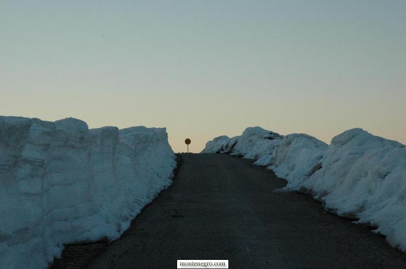
Carry winter-capable clothing even for a short stop. Park without obstructing ploughs or emergency vehicles. Do not enter a narrowing snow corridor if turning space is unknown. A rental car's summer tires, low clearance and contract conditions may rule out a road that a local utility vehicle can use.
Base the trip in Žabljak and choose accommodation with our where-to-stay guide when conditions require an early briefing or flexible second day. The broader Durmitor guide explains park geography; the Black Lake guide keeps the lake visit distinct from summit ambitions.
Gear and group decisions during thaw
For a confirmed low-level walk, carry waterproof footwear with grip, insulating and waterproof layers, gloves, sun protection, water, food, a charged phone, offline map, light and a small emergency kit. Spare socks matter when meltwater enters shoes. Trekking poles can improve balance for practiced users but do not make unsafe snow safe.
Snow traction is not a universal solution. Microspikes, snowshoes, crampons and an ice axe address different surfaces and consequences. Owning equipment is not competence. If the route requires a tool the group cannot select and use correctly, choose a clear lower route or a qualified guide. Our Montenegro hiking guide covers the wider planning system.
Share the route and return time with someone off-mountain. Keep the group together, especially where snow hides the trail edge. Turn around for missing markers, deepening snow, wet feet without spare insulation, rising water, deteriorating visibility or a slower-than-planned return. In a genuine emergency call 112; Montenegro's Interior Ministry says the centre coordinates emergency services nationwide around the clock. Give coordinates, injuries, group size and the last confirmed landmark.
The thaw as natural and cultural history
UNESCO's account links Durmitor's present landscape to glaciers, rivers, underground streams, alpine meadows and living summer-pasture traditions. Snowmelt is therefore not dead time between ski and hiking seasons. It is part of the hydrological cycle that reconnects lake, karst, forest and canyon—and part of the seasonal calendar that shaped work on the plateau.
Watch without collecting. Stay on the current path, avoid widening muddy sections, keep out of restoration areas and carry out all waste. Do not approach livestock or assume a hut is abandoned. The park's ecological value depends on more than scenic peaks; UNESCO notes forests, freshwater systems, rare plants, birds and large mammals across a wide elevation range.
A comparison with Lovćen or Biogradska Gora can deepen a Montenegro mountain itinerary, but do not transfer conditions between ranges. Each park, route and elevation needs a fresh check.
Frequently asked questions
When does summer hiking begin on Durmitor?
There is no reliable calendar date. Snowpack, temperature, route elevation and maintenance vary by year. Park warnings in early May 2025 and late April 2026 demonstrate the variation. Ask about the exact trail on the day.
Can I walk around Black Lake in spring?
The park publishes a 3.6-kilometre circular educational route, but its actual surface may include snow, ice, mud, water or closures. Obtain current confirmation and turn back where conditions exceed the group's footwear and skill.
Can I walk on the frozen lake?
No recommendation in this guide treats lake ice as safe. The archive shows open water beside remaining ice, a visibly unstable transition. Stay off unless a competent authority has created and controls a specific activity.
Does a clear road mean the summit trails are open?
No. Road clearance and trail condition are independent. A ploughed approach may end before a high pass, and a dry parking area says nothing about shaded or exposed terrain above it.
Are the photographs from June?
The original text said late spring, but the files contain no reliable capture date. They are presented as an undated seasonal archive, not evidence for a particular week or today's conditions.
What is the safest alternative after a no-go decision?
Ask the visitor centre for a currently open interpreted activity, use a documented viewpoint accessible by an open road, or spend the day in Žabljak. A conservative alternative is a successful mountain decision, not a failed trip.