Faith across eras
A Latin Catholic bishopric and Orthodox communities shared the bay. Romanesque churches, later Baroque rebuilding and Kotor’s icon-painting tradition make belief visible in both architecture and art.
Montenegro then and now · Bay of Kotor
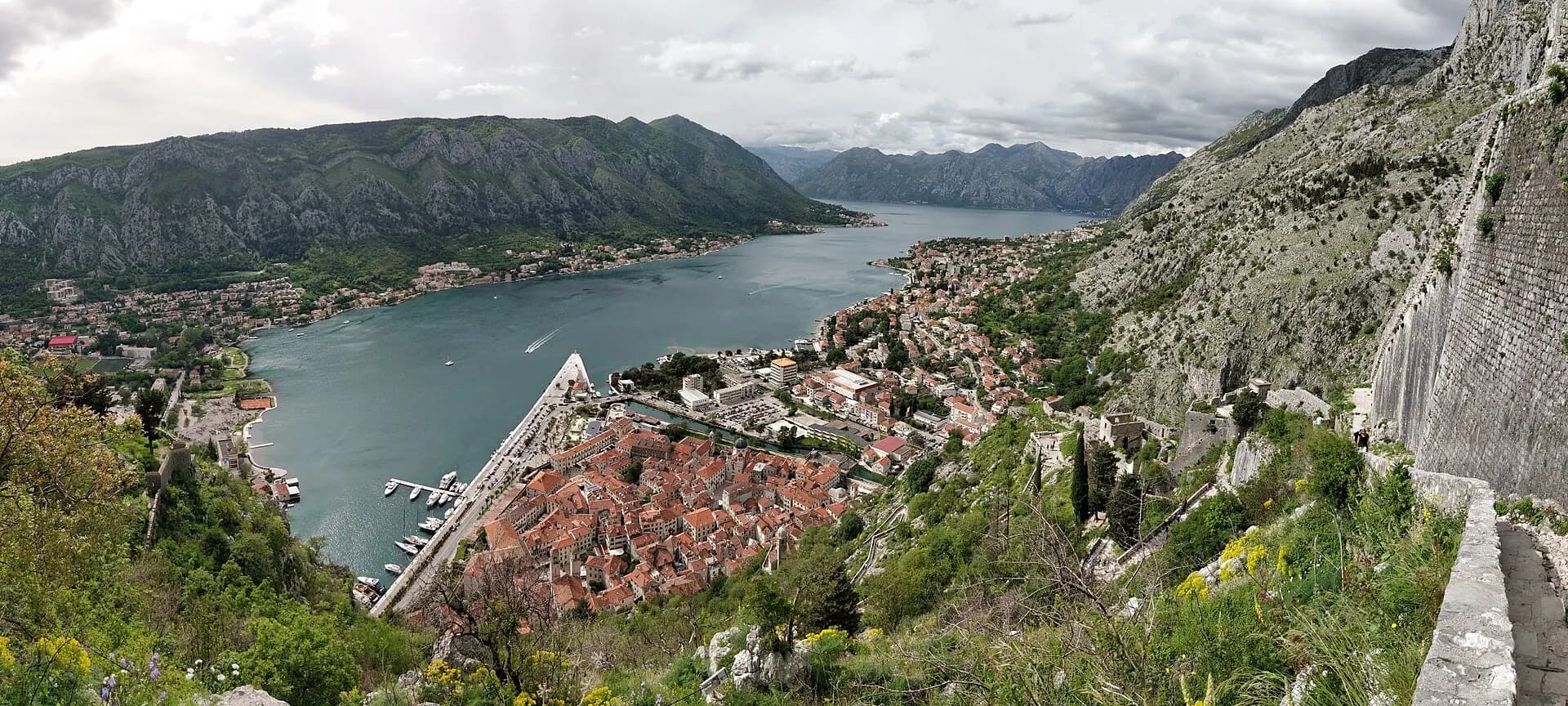
The mountain profile barely moves. Almost everything below it does. Pull the divider across Kotor to follow a working Adriatic port into the present-day city.
Historical names: Cattaro
Go deeper
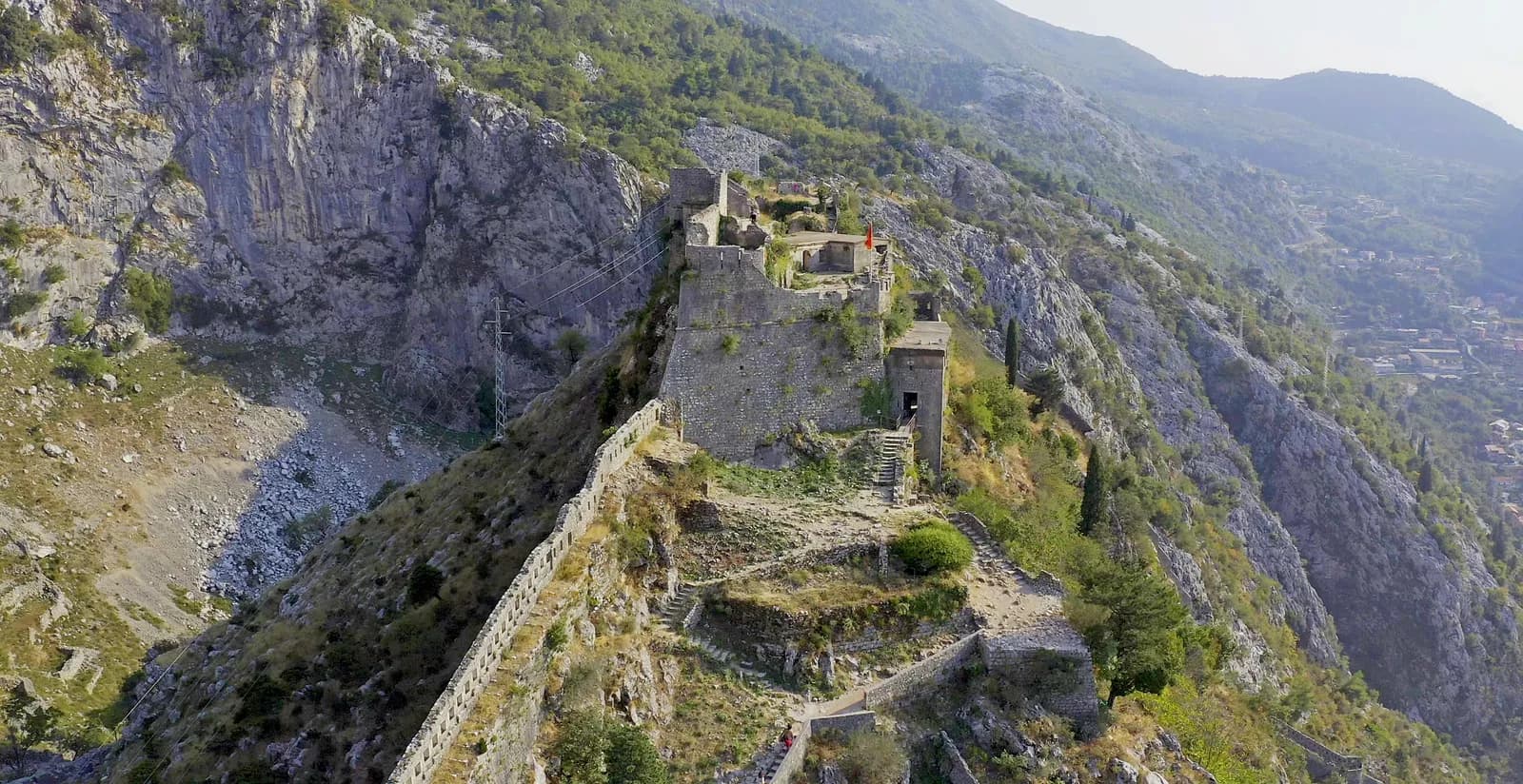 San GiovanniFour and a half kilometres of fortification climbing 260 metres of cliff, built by four civilisations, and listed by UNESCO and declared in danger on the same day.
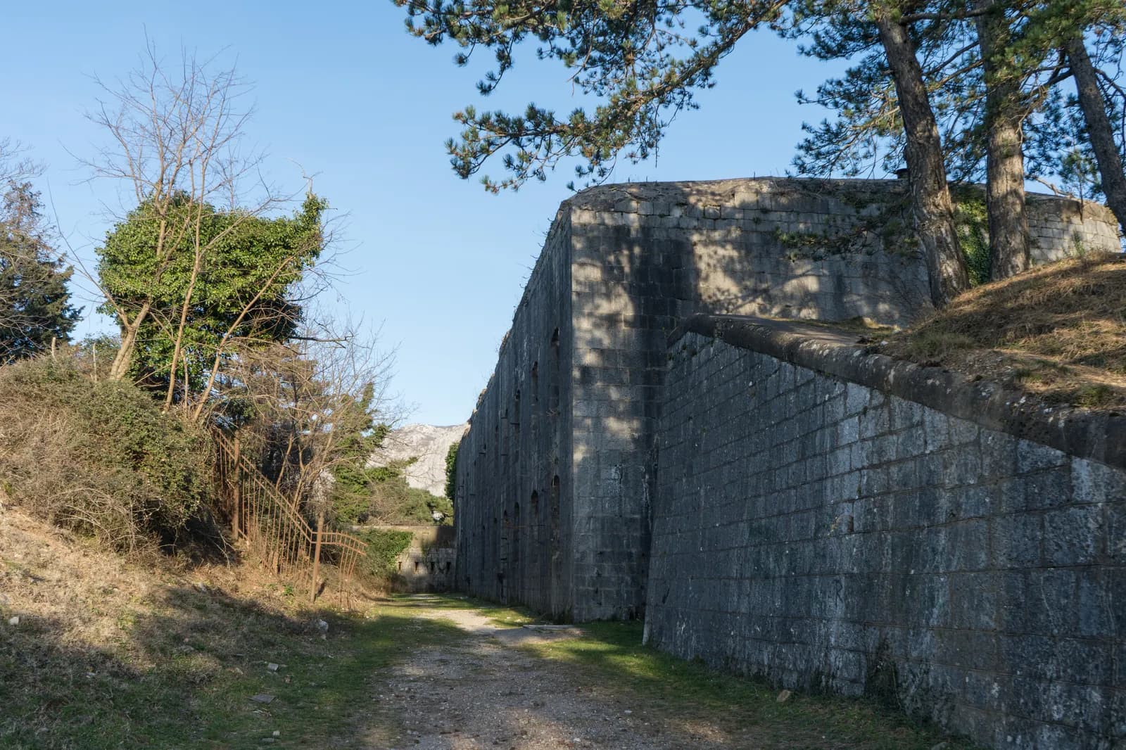 Fort VrmacA concrete pentagon at 480 metres with four Škoda cupolas on its roof, bombarded for two years by an army it could not reach, and patched up the moment that army was pushed away.
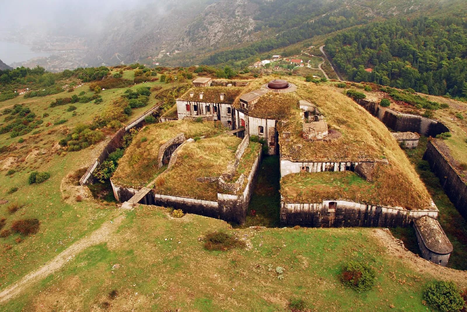 Fort GorazdaA hundred tonnes of German armour turned by two men with a crank — and the only one of its kind left anywhere in the world.
The mountain profile barely moves. Almost everything below it does. Pull the divider across Kotor to follow a working Adriatic port into the present-day city.
6 eras · source-linked
Selected chapter · 4 of 6
Notice how directly the walls meet the working harbour.
Move through the city’s rule
A Latin Catholic bishopric and Orthodox communities shared the bay. Romanesque churches, later Baroque rebuilding and Kotor’s icon-painting tradition make belief visible in both architecture and art.
The medieval street plan and fortified triangle survived Venetian construction, Habsburg port works, earthquakes and modern traffic. The walls, cathedral and mountain-to-water geometry are the fixed witnesses.
Notice how directly the walls meet the working harbour.
Historical timeline
1166
St Tryphon’s Cathedral was consecrated in 1166. Its twin-towered presence anchors a city whose public, religious and commercial life was already concentrated inside a very small fortified footprint.
Find the church towers inside the dense roofscape.
1420
Facing pressure from the Ottoman frontier, the city entered the Venetian Republic and remained within it until 1797. The long relationship is still legible in the gates, palaces and defensive system.
Look for the walled triangle between mountain and water.
1667
The destructive Adriatic earthquake of 1667 damaged Kotor’s churches, palaces and walls. Baroque rebuilding did not erase the medieval plan; it added another visible layer to it.
The city’s apparent unity is made from repeated repair.
1890s
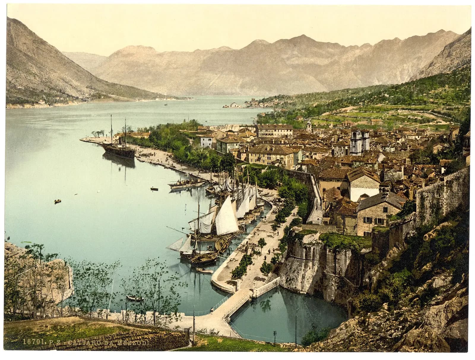
The Library of Congress photochrom records a compact city, sail-powered waterfront and cultivated lower slopes. Kotor is connected by sea, while the modern road edge and marina have not yet taken shape.
Notice how directly the walls meet the working harbour.
1979
The 15 April earthquake caused grave damage across the historic region. UNESCO support, specialist surveys and a long restoration programme helped recover monuments while keeping the city’s inherited plan readable.
Survival here is the result of conservation, not accident.
Now
The walls, roofscape and churches remain the visual anchors. Roads, cruise traffic, marinas and development now crowd the narrow meeting point between the old city, bay and mountain.
The unchanged geography makes every new intervention visible.
Then: Working quay at the walls
Now: Road, marina and visitor gateway
Then: Terraces and open lower slopes
Now: A denser strip of settlement
Then: Walled triangle and tiled roofs
Now: The same mountain-drawn silhouette
Dates and interpretations are tied to the archive and research sources below. Image limitations are disclosed in the comparison.