The story
Water on two sides
Every fortification in this series is an answer to a piece of ground. Forte Mare answers a bay mouth; Španjola answers a hill; Mamula answers a strait. Ribnica answers a fork — the point where the Ribnica river runs into the Morača, with water on two sides and only one way to walk in.
The fortress was built in the late fifteenth century, around 1477, under Ottoman rule, above the confluence. It was one of two fortifications guarding what is now Stara Varoš, the old quarter of Podgorica. The other, a short walk away, is Depedogen — from the Turkish Depedöğen, meaning under the hill.
Neither is large by the standards of the coast. They did not need to be: this is an inland river crossing, not the entrance to the Bay of Kotor, and the enemy arrived on foot rather than in a hundred-gun ship of the line.
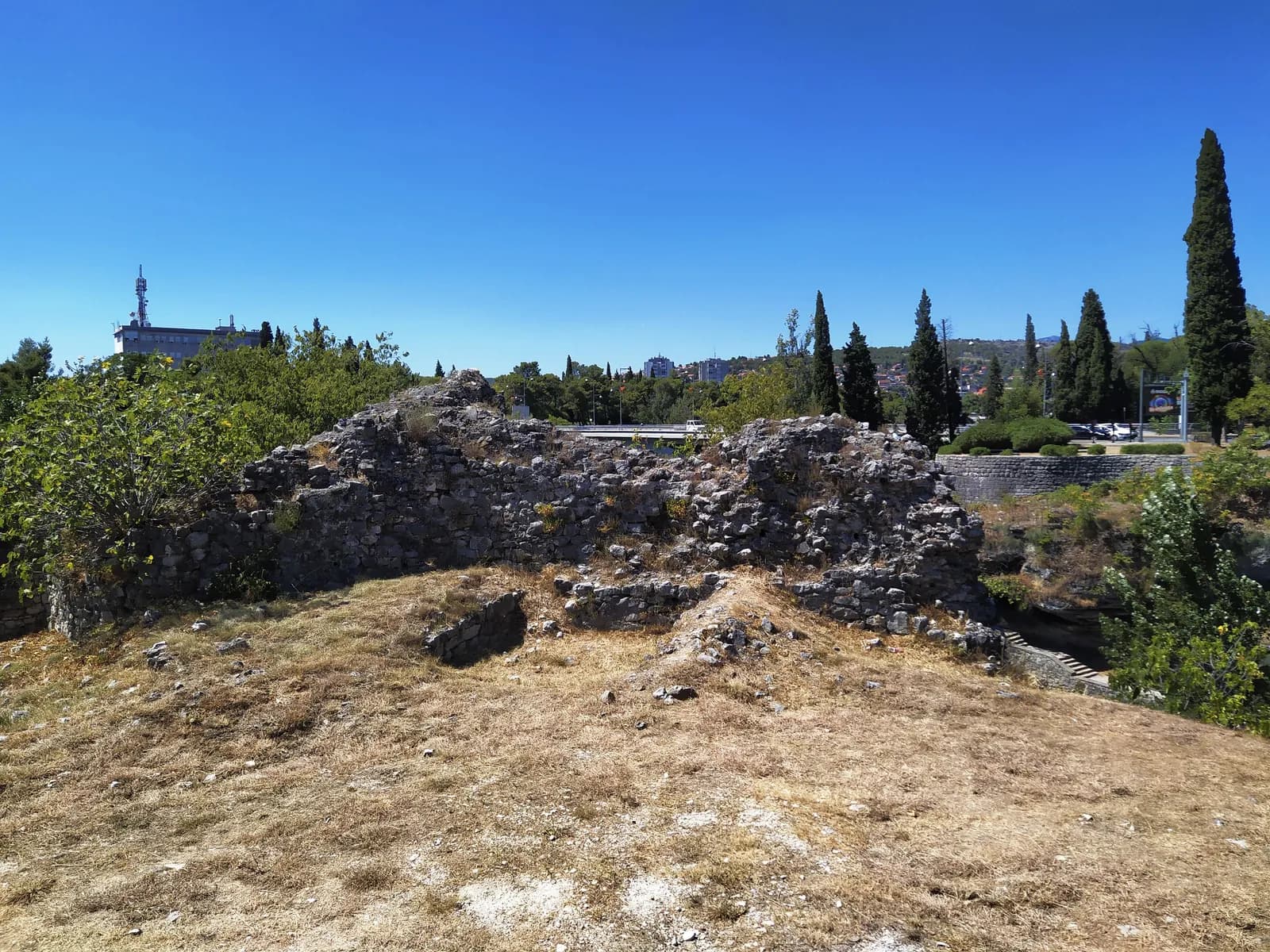
- The wall, and what is inside it. A rubble core faced with stone, most of the facing now gone. This is what an unrestored fifteenth-century fortification actually looks like when nobody has tidied it for a century and a half.
- The drop to the river. The ground falls away here to the Ribnica. Two sides of this promontory are river gorge, which is the entire reason a fortress was put on it.
- The bridge. A modern road crossing, directly behind the fortification that once controlled the crossing. The function survived; the building did not.
- The capital, arriving. An office block and a telecom mast, a few hundred metres from a fifteenth-century wall. Podgorica grew around this ruin rather than preserving a distance from it.
- No fence, no sign. Dry grass, loose stone and open access. Of the fortifications in this series only Španjola and Tajno brdo are as unmanaged as this one.
The name
Whose fortress is it?
Ribnica is widely called Nemanjin grad or Nemanjića grad — Nemanja's town — and Orthodox ceremonies are held at the site. The name attaches it to Stefan Nemanja, founder of the Nemanjić dynasty, who by long tradition was born at Ribnica in the twelfth century.
The building, however, is dated to the Ottoman period, around 1477 — roughly three centuries after Nemanja. Both things are commonly stated in the same paragraph, and they do not sit together.
The honest position is that these are two separate claims about the same patch of ground. That a twelfth-century settlement existed at the confluence is a tradition of long standing; that the walls now standing there are Ottoman work of the late fifteenth century is what the fortification itself is dated to. A place can be much older than the fortress on it — every other article in this series turns on exactly that distinction.
1878 → today
Killed by its own magazine
Depedogen was used for a long time as an ammunition warehouse. In 1878 a thunderstrike triggered an explosion that destroyed a large part of the fortress, inside and out.
It is worth pausing on how mundane that is. Nothing in this series was lost to a siege — not one. Forte Mare survived Barbarossa and was smoothed over by a restoration; the Citadela was ended by an earthquake; Mamula was emptied by peace and reopened by a lease. Depedogen was destroyed by weather and bad storage.
What remains today is a low ruin of broken wall on dry grass, with a road bridge and an office block in the same view, in the middle of a capital city that grew up around it. There is no fence, no lighting and nothing to buy. It is the least visited fortification in this series and, for anyone who wants to see what an unmanaged fifteenth-century wall actually looks like, one of the most useful.
c.14 → today
The full timeline
Dated events only. Where sources disagree, the conflict is stated in the entry rather than resolved silently.
Disputed
before 147712th c.
The Nemanjić tradition
A long-standing tradition places the birth of Stefan Nemanja at Ribnica, and the site is widely called Nemanjin grad. The standing fortification is dated three centuries later.
Ottoman
c.1477–1878c. 1477
The fortress is built
Late 15th century, under Ottoman rule, above the confluence of the Ribnica and the Morača. One of two fortifications guarding Stara Varoš.
c. 1477
Depedogen, the second fortress
From the Turkish Depedöğen — under the hill. Later used for a long period as an ammunition warehouse.
1667
Podgorica gets its clock tower
The Sahat kula, about 19 m tall, is built by Hadži-paša Osmanagić — the same year as the clock tower at Herceg Novi.
1878
Lightning, and an explosion
A thunderstrike sets off the powder store. A large part of Depedogen is destroyed inside and out.
Montenegrin
1878–today20th c.
The capital grows around it
Podgorica expands past both fortresses. Neither is restored.
today
Open ground, no interpretation
A low ruin on dry grass beside a road bridge, freely accessible and largely unmanaged.
Corrections
What the internet gets wrong
These claims circulate widely online and do not survive checking. If you have read about Ribnica elsewhere, you have probably met at least one of them.
Widely repeated
“A 12th-century Nemanjić fortress.”
The standing fortification is dated to the Ottoman period, about 1477. The Nemanjić association is a tradition about the site, not a date for the walls. The two are routinely merged into one sentence.
Often confused
Ribnica and Depedogen are two fortresses.
They are a pair, both Ottoman, both guarding Stara Varoš. It was Depedogen that the 1878 explosion destroyed; accounts frequently attach that event to Ribnica.
Check before you go
There is nothing there but the ruin.
No fence, no lighting, no signage and no ticket. It sits in open ground beside a busy road in the middle of the capital.
Sources and image record
Dates and interpretations are tied to the archive and research sources below. Where they conflict, the conflict is named in the text rather than smoothed over.
- Wikipedia — Ribnica (fortress)
Construction about 1477 under Ottoman rule; the position above the confluence; the Nemanjić tradition
- Military Wiki — Depedogen
The name, the ammunition store and the 1878 lightning strike and explosion
- Wikipedia — Clock Tower (Podgorica)
Built 1667 by Hadži-paša Osmanagić, about 19 m tall
- Wikimedia Commons — Ribnica fortress
Radosław Botev · CC BY 3.0 PL · the annotated photograph
- Plan (archaeology) — the phasing convention
The colour-by-period phase plan this page’s visual system borrows