The story
A fort for a line on a map
Fort Kosmač was the southernmost fortress of the Austro-Hungarian Empire. That is not a piece of trivia; it is the entire explanation for the building.
The border was demarcated in 1841 and construction began shortly afterwards, finishing around 1850. Until 1878 this hilltop stood at the point where Austro-Hungarian, Montenegrin and Ottoman territory met, above the road running from Budva on the coast up to Cetinje, then the capital of Montenegro. A pass-blocking fortress, in the extended defensive system of Budva, at the very end of an empire.
It was garrisoned by six officers and 248 soldiers and armed with 240 mm cannon — a serious armament for a single building watching a mountain road, and a good measure of how nervous that frontier made everybody.
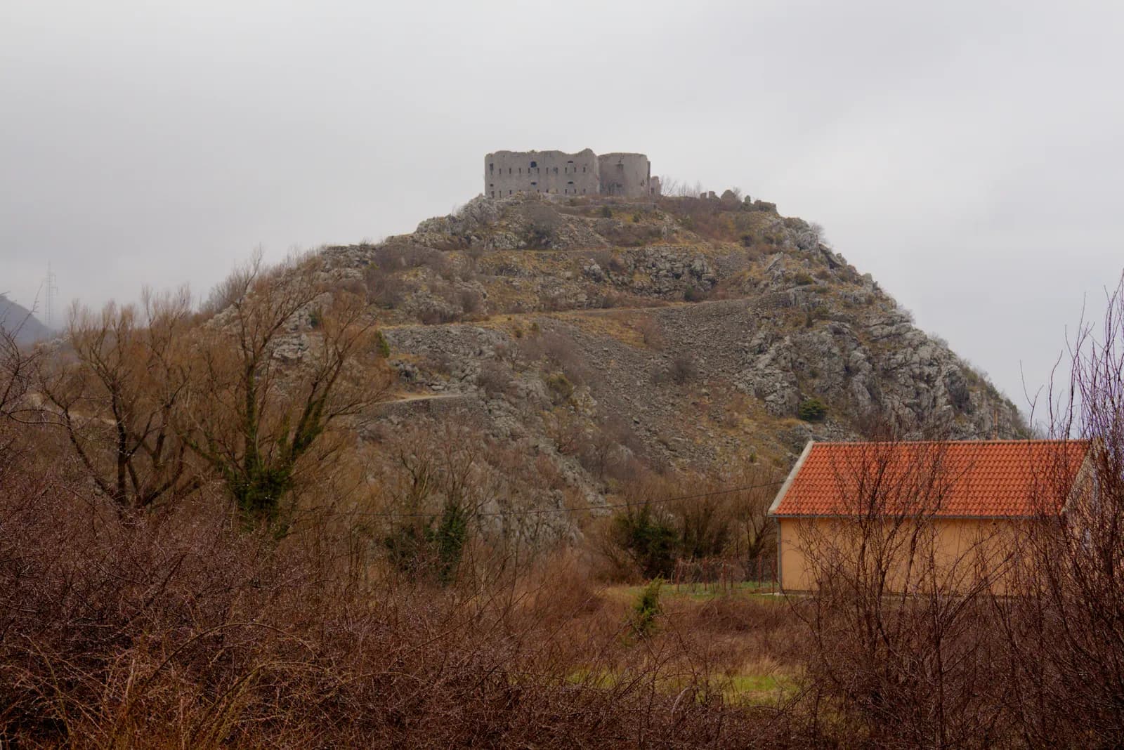
- The block. One large rectangular building, two ranges of openings, no towers and no bastions. By 1850 the answer to a mountain road was a barracks with guns on it, not a castle.
- Sky through the windows. You can see daylight through the upper openings. The roof, the floors and the central staircase are all down; what stands is the outer shell and nothing else.
- Where the guns were. 240 mm cannon were mounted here, for six officers and 248 men. That is a very heavy armament for a building watching a road.
- The road below. The route from Budva on the coast up to Cetinje. The fort exists to close it, and until 1878 the frontiers of three empires met within sight of this hill.
- Bare ground. No fence, no path, no sign. Kosmač is the most exposed ruin in this series and the easiest to see from a car — it is directly above the road.
1918 → today
The shell, and nothing in it
The fort was attacked during a rising in 1869 — as far as the record goes, the only time it was fought over. After 1918 it passed to the new Yugoslav state, and Italian troops garrisoned it for a period during the Second World War. Then it stopped being anybody's.
What has happened since is the most complete collapse in this series short of the Citadela. The roof has gone. The interior walls have gone. The floors have gone, and so has the central staircase. What stands is the outer shell, and if you look through the upper windows you see sky.
It is also the easiest ruin here to find: it sits directly above the Budva–Cetinje road, in plain view from a car, unfenced and unsigned. There has been academic work on protecting and rehabilitating it. Nothing has been done.
The roof, the interior walls, floors and central staircase collapsed.
The current condition of Fort Kosmač, in the sources’ own words
1841 → today
The full timeline
Dated events only. Where sources disagree, the conflict is stated in the entry rather than resolved silently.
Austro-Hungarian
1841–19181841
The border is demarcated
Construction of the fort begins shortly afterwards.
c. 1850
The fort is completed
A pass-blocking fortress above the Budva–Cetinje road, in the extended defensive system of Budva. Garrison: 6 officers and 248 soldiers. Armament: 240 mm cannon.
1869
Attacked during a rising
1878
The triple point disappears
Until this year the Austro-Hungarian, Montenegrin and Ottoman borders met here. The fort stays garrisoned for another forty years.
Italian occupation
1941–19431918
The fort passes to Yugoslavia
WWII
Garrisoned again by Italian troops
For a period during the Second World War.
Abandoned
1943–todaytoday
A roofless shell
The roof, interior walls, floors and central staircase have all collapsed. Unfenced, unsigned, and directly above the road.
Corrections
What the internet gets wrong
These claims circulate widely online and do not survive checking. If you have read about Fort Kosmač elsewhere, you have probably met at least one of them.
Often overstated
It is a barrack block, not a castle.
Kosmač has no towers and no bastions. By 1850 a pass-blocking fort was a large defensible building with heavy guns on it, which is what this is.
Dates differ
“1841–50”, approximately.
Construction probably began shortly after the 1841 border demarcation and finished around 1850. No precise start or completion date is on the record.
Check before you go
The interior has collapsed.
Roof, floors and central staircase are down. The shell is unfenced and people do go inside; there is nothing holding anything up.
Sources and image record
Dates and interpretations are tied to the archive and research sources below. Where they conflict, the conflict is named in the text rather than smoothed over.
- Wikipedia — Fort Kosmač
The southernmost fortress of the empire; 1841–50; the triple point; the garrison, armament and current condition
- Protection and Rehabilitation of Fort Kosmač at Brajići
Academic assessment of the fort's condition and what conserving it would take
- Wikimedia Commons — Fort Kosmač from the Budva–Cetinje road
Prioryman · CC BY-SA 4.0 · the annotated photograph
- Plan (archaeology) — the phasing convention
The colour-by-period phase plan this page’s visual system borrows