Tivat, Montenegro: Town Guide, History and Practical Information
Tivat in facts: a municipality of 16,338 on the Bay of Kotor, the 1889 naval Arsenal that became Porto Montenegro, culture, events, registration and tax.
6th centuryfirst recorded
250 mof beach
4 kmto the airport
€10a sunbed
Updated Originally published 40 min readby Pavle Obradović
Tivat is a coastal town and municipality on the Bay of Kotor (Boka Kotorska) in southwestern Montenegro, on the eastern shore of its own inner bay, with Montenegro’s coastal airport 4 km south of the town centre [1][28][29]. Its waterfront is Porto Montenegro, a superyacht marina on the former Austro-Hungarian naval Arsenal, and the free Pine promenade, which runs along the shore into the marina past the Naval Heritage Collection and its walk-through P-821 Heroj submarine [3][13][18]. It is not a walled old town like Kotor; its best-preserved medieval aristocratic building is the Buća-Luković summer residence, a 14th-century noble estate beside the Great City Park [15][16]. Central beaches mix concrete platforms, pebbles and small sand sections, and the sandy bays for a beach day, Pržna Bay (Plavi Horizonti) and Oblatno, are on the Luštica peninsula, 13.6–15 km away by road.
Tivat at a glance
Size — the Municipality of Tivat gives its area as 46 square kilometres, of which about 5 face the open sea, and displays 16,338 residents. MONSTAT’s 2023 census counts 10,743 people in the town settlement itself, and the two are not interchangeable.
What to see — Porto Montenegro and its quays, the Pine promenade, the Naval Heritage Collection with the P-821 Heroj submarine, the Buća-Luković complex and the Great City Park. The promenade, the park and the marina quays are free; the museums publish no admission price.
Beaches — concrete platforms, pebbles and small sand sections in town; sand at Pržna Bay (Plavi Horizonti), Oblatno and Velja Špilja on Luštica. Two loungers and an umbrella cost €10–40 a day.
Airport — Tivat Airport (TIV) is 4 km and an indicative five minutes from town, with no delay; add a traffic buffer in summer.
Distances from the centre — Kotor 10.7 km and 15 minutes through the Vrmac tunnel, Budva 23.4 km and 32 minutes, Herceg Novi 22.8 km and 39 minutes by the Lepetane ferry.
Ferry — Kamenari–Lepetane, €5 for a car at the booth, free on foot or by bicycle, every 15–20 minutes in summer.
Car — not needed for a central stay. Add a car or confirm local buses for Solila, Krtoli, Radovići and the Luštica beaches.
Best time — May–June and September–October for fewer crowds; the sea is comfortable for swimming from roughly June to early October.
Costs and tax — espresso €1.50–3.50, dinner for two €40–90; visitor tax €1 a night per adult, free under 12, €0.50 for ages 12–18.
Day trips
How far a day reaches
15 min
32 min
37 min
39 min
What to see in Tivat
Pine and Porto Montenegro fit into one waterfront walk, and the Buća-Luković complex deserves a separate pause. The promenade, the Great City Park and the marina quays are all free; the two museums need their hours checked on the day.
Compare
The beaches, to scale
Kotor to Tivat traverse:785 m
Ponta Seljanova250 m
Pebble
Tivat beaches250 m
Sand · Pebble
Opatovo200 m
Shade · Sand · Pebble
Oblatno100 m
Amenities · Sand
Velja Špilja100 m
Sand
Župa70 m
Shade · Sand
Porto Montenegro
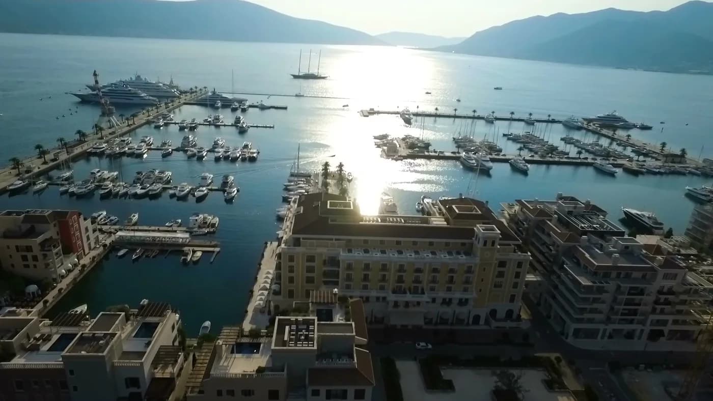
Porto Montenegro is a 24-hectare complex that occupies the former Arsenal shipyard and naval base and has been reimagined as a luxury lifestyle village [3][10]. Porto Montenegro begins north of the centre, and treating a private development as the whole town is the most common misreading of Tivat.
The marina: The marina takes vessels from 6 metres to superyachts of up to 250 metres, with shore power to 1,000 amps for the largest boats. How many berths there are depends on which of the operator’s own pages you read: the berthing page heads with 580, its own list of answers gives 481, and the 450 that circulates most widely, our own Tivat city page included, is not attributed to a source. It was the world’s first marina to receive the TYHA Platinum rating, and has been repeatedly named among the world’s top superyacht marinas, including World’s Best Superyacht Marina from ACREW [3][10].
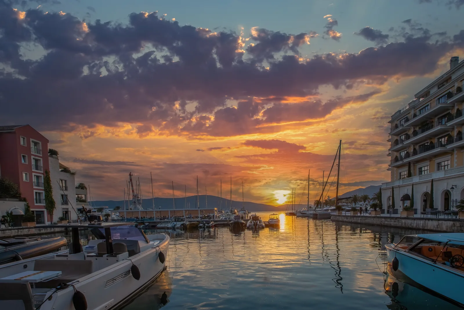
The village: Beyond the marina, Porto Montenegro has over 440 luxury residences (including the Elena Residences, Regent Pool Club Residences, and Boka Place), more than 30 restaurants, bars, and cafes, designer boutiques and leisure facilities [11][22]. The five-star Regent occupies a five-storey terracotta-roofed building modelled on a Renaissance Venetian palazzo, with a spa, an infinity pool and direct marina access [11][22]; it has 175 rooms and suites. The Porto Montenegro Yacht Club, established in 2019, runs regattas on Boka Bay [12], and its 64-metre outdoor infinity pool looks straight down the berths.
What it costs to be here. Walking the quays costs nothing — no gate, no ticket. Three things are unpublished: the lido pool day pass, the sports club’s court and class fees, and berthing, which the operator quotes as tailor-made packages and discusses on +382 32 661 061.
Porto Montenegro occupies the former naval-Arsenal waterfront; the public promenade connects it with central Tivat.
Pine promenade and the town waterfront
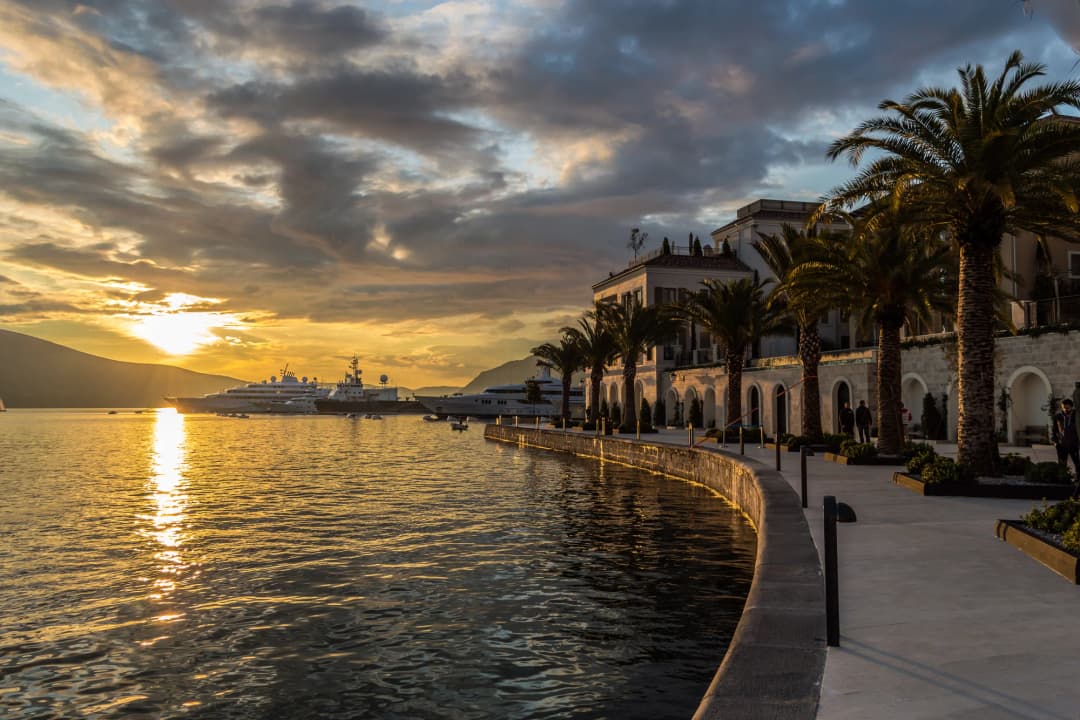
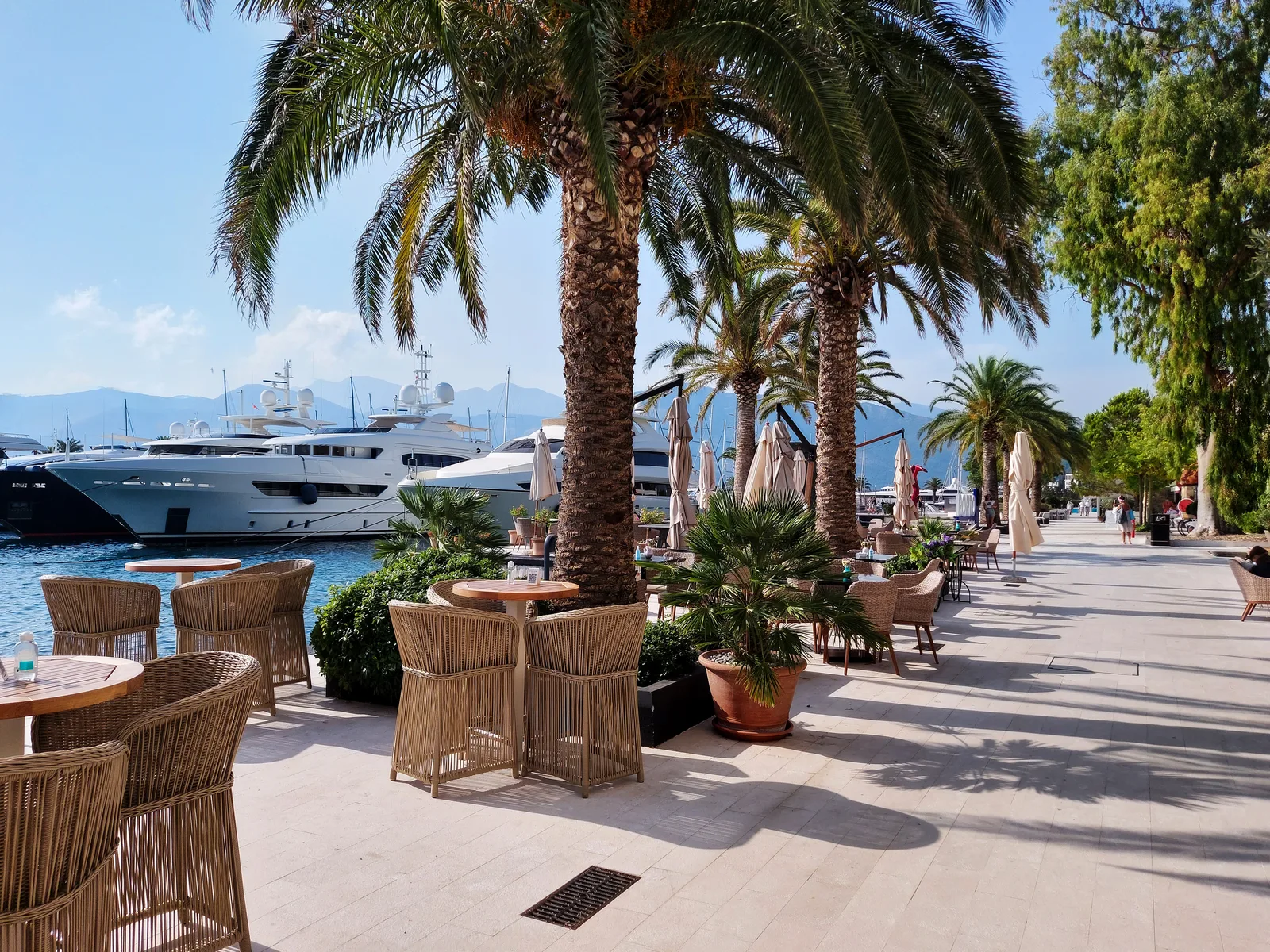
Pine (pronounced “Pee-neh”) is Tivat’s main waterfront and the social heart of the town. The promenade stretches along the bay, lined with cafes, gelato stands and souvenir shops, with views of the water and the surrounding mountains [18].
How long it actually is. Our mapped Pine promenade corridor runs 5.8 km from Donja Lastva in the north to Kalardovo in the south: Donja Lastva to Porto Montenegro is 15 minutes on foot, on to the Buća park 8, to Pine itself 6, to Belane 12, and a further 36 to Kalardovo — about an hour and a quarter end to end at a seaside pace, flat the whole way, and free.
From Pine you can see the masts of the sailing ship Jadran [18], a Montenegrin Navy training ship launched in 1931 whose ownership is disputed with Croatia. Pine is also the departure point for daily boat trips to Bay of Kotor attractions including the Blue Cave and Our Lady of the Rocks island church [18][19].
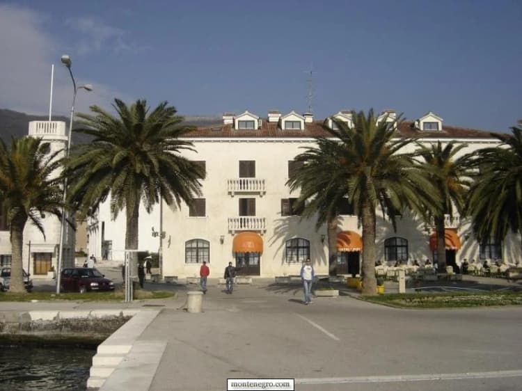
A palm-lined building on Tivat's civic waterfront in an archive photograph. Pine and the town shore should not be conflated with the entire Porto Montenegro development.
Naval Heritage Collection and the P-821 Heroj submarine
Housed in a restored 19th-century sawmill at the north end of the Porto Montenegro marina, the Naval Heritage Collection shows more than 300 artifacts including rare Austro-Hungarian naval equipment, industrial machinery and historical documentation of the Arsenal shipyard [13][14].
The star exhibits are two dry-docked Yugoslav Navy submarines. The larger one, the P-821 Heroj (meaning “Hero”), has been fully restored and is accessible via guided tour. Visitors can explore the interior, turn the wheels, press the buttons, and even peer through the still-functional periscope for views across the bay [13][14].
Hours and admission. The only published schedule is Porto Montenegro’s own: Tuesday to Saturday, 09:00 to 17:00. The Tourist Organisation’s culture directory gives no hours, and no admission price is published by the operator or the tourism board. Ring +382 69 356 031 or write to [email protected], and ask specifically whether P-821 Heroj is open inside rather than only whether the building is. Narrow naval spaces may not be accessible to all visitors.
The boat itself: launched at Split in August 1967, entered on the Yugoslav fleet list on 10 September 1968, almost 23 years in service, ashore at Tivat from 1991, and open as a museum exhibit since July 2013. Tivat’s culture brochure gives a complement of 28 and records that an opening was cut through the 28 mm pressure hull so visitors can walk the length of it. Our history of the P-821 Heroj submarine sets out what the sources agree on and where they conflict.
Buća-Luković summer residence: Tivat’s old core
Tivat has no walled old town. What it has is the Buća-Luković summer residence, the most monumental and best-preserved medieval aristocratic building in Tivat. Dating from the 14th century, the complex was built by the Buća noble family of Kotor – a dynasty that produced prominent businessmen, financiers, diplomats, and theologians throughout the 14th and 15th centuries [15][16].
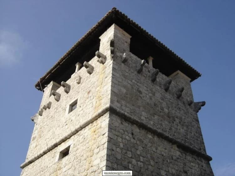
The complex includes a residential building, an economic building, a chapel of St. Mihovil in the atrium, and a 15-meter-high fortified tower dating from 1548 that now serves as an art gallery. The museum within houses Roman archaeological finds, an ethnographic collection of fishing and farming artifacts, jewelry and folk costumes, and rotating exhibitions of modern painting and sculpture [15][16].
The palace is protected as national cultural heritage. Before industrial Tivat, families from Kotor and Perast held agricultural and residential estates along this shore. Our dedicated account of Buća Palace and Tivat's Great Park gives the complex a fuller reading: an estate broadly dated to the fourteenth century, the fortified tower dated specifically to 1548, Luković ownership from 1812, a property transfer in 1888, and the museum founded in 2017.
Hours. The tower, residence and chapel now hold the municipal Museum and Gallery, at Trg od kulture 4. Two official pages give two different opening times: the Tourist Organisation's culture directory publishes 08:00-20:00, while the museum's own site lists Tuesday to Sunday, 10:00 to 16:00, closed Monday. Neither publishes an admission price. Ring +382 32 674 591 or email [email protected] on the day, and check the Tourist Organisation's Buća-Luković page before expecting a gallery exhibition or open interior.
The Buća-Luković complex represents Tivat's pre-industrial estate landscape. This archive photograph does not establish current gallery access or opening hours.
Great City Park (Veliki gradski park)
The Great City Park sits beside the Buća complex and carries a founding inscription from 1892 — it was laid out next to the Austro-Hungarian naval base, not before it. Tall pines, palms and magnolias, walking paths, benches and memorials; it links the town centre with the waterfront and is the shade the promenade does not have. Its 2022–2026 management plan gives a protected area of 59,158 square metres, about 5.92 hectares, and calls it Tivat’s largest planned green space. It was first protected in 1968 and reclassified in 2015 as a natural monument. The park is public, open and free.
Church of St. Sava
The largest church in Tivat is a neo-Byzantine building whose construction stretched from 1938 to 1967. The domed interior is grander than a town of this size suggests, and the grounds give a view over the rooftops toward the bay.
Seeing Tivat in one or two days
A first day on foot covers Pine, the marina quays, one museum, the Great City Park and Ponta Seljanova; beyond coffee and lunch it costs nothing. For a second day, choose nature or beach — not both. Use it for either Gornja Lastva and Vrmac or Solila and Krtoli. For nature, visit Solila, then continue to Miholjska Prevlaka. For a beach day, take the bus or drive toward Radovići and Pržna Bay.
Tivat beaches
Tivat is a waterfront city, but “beach” covers concrete platforms, pebbles, small sand sections and natural coves. The official beach directory distinguishes central Town Beach, pebble Belane, Ponta Seljanova, Kalardovo near the airport, and Luštica choices such as Pržna Bay and Velja Špilja. Concessions, furniture and access change by season.
In town: Tivat’s immediate waterfront is more promenade than beach, with several small swimming areas near Pine and toward Donja Lastva; for a quick swim without transport, choose the centre or Seljanovo.
The measured beaches, with sizes from the Tourist Organisation’s own directory:
Ponta Seljanova: a pebble beach of about 250 metres and 1,700 m², walkable from the centre, right beside the marina district and marked by its own small lighthouse.
Opatovo: about 200 metres of pebble, sometimes sandy, 3 km from the centre on the ferry road, divided by a lighthouse, with natural shade and beach furniture.
Oblatno (Almara beach): about 100 metres of fine white sand on the Luštica shore, 15 km and about twenty-five minutes from the town centre by road (the Tourist Organisation estimates thirty) — a managed cove with a restaurant, a beach bar and full furniture, and the sunset on the right side [25].
Velja Špilja (Pecka): 100 metres of sand and 1,420 m² on Luštica, part private and part public, with the 21 Beach Club running the summer bar.
Župa: a small sandy beach of about 70 metres backed by dense pine, which is what makes it work in August.
Plavi Horizonti, in Pržna bay (Blue Horizons): On the Luštica Peninsula in the southern part of Tivat Bay, this crescent-shaped sandy beach is surrounded by olive groves and pine forest that give natural shade, and its water stays shallow up to 20 meters from shore. The gradual entry suits families with young children. The beach holds the international Blue Flag certification for water quality and facilities, and the Tourist Organisation calls it the largest sandy beach in the municipality [24][25]. No official length is published for it.
Pržna Bay is Plavi Horizonti. Pržna is the name of the bay; Plavi Horizonti is the popular name inherited from the hotel that stood behind it. It is not a stroll from central Tivat: 13.6 km and about twenty minutes by road from the centre, 11 km and sixteen minutes from the airport junction, with a local Plavi Horizonti–Tivat bus running from 06:45 to 22:00.
And what the furniture costs. No official page publishes a sunbed tariff for any Tivat beach, and the concessions change hands from season to season. Prices checked in the town in 2026 run €10–40 a day for two loungers and an umbrella — the low end at the town beaches, the high end for a beach-club front row. Public sections are free to walk onto; where the public section ends and the concession begins is a question to ask at the beach on the day.
Tivat beach selector by trip need — choose the beach type, not just the town name
Beach
Setting
Shore
Access / trip length
TOWN BEACH
central
concrete + sand
walkable
BELANE / PONTA
near urban core
pebble options
easy half-day
KALARDOVO
airport side
sandy setting
plan road access
LUŠTICA
coves + sand
coves + sand
full-day trip, transport needed
Caveat
Always recheck public access, concessions, sea conditions and facilities.
—
—
Source: tivat.travel
Getting there and around
Tivat Airport (TIV)
Tivat Airport (IATA: TIV, ICAO: LYTV) is one of Montenegro’s two international airports and serves as the primary gateway to the Montenegrin coast. The airport is located just 4 km south of Tivat’s town center and only 8 km from Kotor [28][29]. Airports of Montenegro gives an indicative five-minute road trip between Tivat and the airport, a no-delay estimate rather than a summer transfer guarantee: the airport sits on the Adriatic Highway, and congestion, flight peaks and road incidents can stretch the trip sharply. The official schedule is seasonal, and the official airport page carries live flight information.
The runway is aligned with the bay valley, with Runway 14’s threshold sitting just 100 meters from the Bay of Kotor coastline, and the approach has earned Tivat the nickname “the Kai Tak of Europe” among pilots [28]. Traffic is highly seasonal, with 80 percent of annual passenger volume handled between May and September [28].
Transfer times from the airport. Airports of Montenegro publishes its own table: Tivat 4 km and 5 minutes, Kotor 8 km and 12 minutes, Budva 21 km and 27 minutes, Herceg Novi 23 km and 1 h 11 m, Bar 60 km and 1 h 19 m. Measured on the OpenStreetMap road network from the airport’s highway junction on 10 September 2026, the same journeys come out at 3.5 km and 5 minutes to the town centre, 4.8 km and 8 minutes to the marina district, 8.1 km and 10 minutes to Kotor, and 20.7 km and 28 minutes to Budva. For Herceg Novi the extra half hour in the published time is the ferry.
Fares and parking. Neither the airport nor the municipality publishes a taxi tariff, a bus fare or a car-park price for Tivat: the tariff page on the airports site carries Podgorica’s figures, and there is no published Tivat equivalent. Third-party airport guides put the ten-minute taxi into the marina district at roughly €10–15; agree a price before the door closes.
Local buses
The municipality lists local or suburban corridors linking Tivat with Gradiošnica, Krašići, Lepetane, Ostrvo Cvijeća and Radovići, from the bus station at Bonići I, and the Tourist Organisation’s bus page carries the departures. Krašići has seven buses each way, with a gap of three and a half hours across the middle of the day. Ostrvo Cvijeća runs at 07:00, 12:00, 12:15, 13:40 and 18:45; Plavi Horizonti has departures spread from 06:45 to 22:00. No fare is published for any of these routes; the bus station’s information line is +382 32 66 33 66, open 07:00 to 21:30. Pick the return before you leave, and do not tie a last bus to a flight.
The Kamenari-Lepetane car ferry crosses the narrowest point of the bay near Tivat, saving considerable driving time for those heading to Herceg Novi or Dubrovnik [29][30]. The operator’s 2026 plan says summer service runs continuously every 15–20 minutes from 4 May through 14 October. The winter pattern is different — 20-minute departures from 06:00 to midnight, then hourly — so read the dated plan rather than assuming last year’s. A quiet alternative on the opposite shore is explored in our Njivice guide.
Kamenari–Lepetane fares — one booth price all year since February 2025
Traveller
Fare
Condition
On foot or by bicycle
free
also free for people with disabilities
Motorcycle
€2.50
at the booth, all year
Small car or pickup
€5
at the booth, all year; €4 off-season online only
Van, minibus, trailer, truck
separate class
read the detailed list; do not assume the car rate
Since 12 February 2025 the booth price has been the same all year: €5 for an ordinary car or pickup and €2.50 for a motorcycle, as Investitor.me reported when the Government set it; an off-season €4 car rate survives only for tickets bought online. Pages that still print a €4 car fare, the Tourist Organisation of Herceg Novi’s among them, describe the old off-season booth price or the online rate. The crossing saves about 21 km of driving round the inner bay — 22.8 km to Herceg Novi by ferry against 43.9 km by road — and the ramp is 5.1 km and about six minutes from the town centre.
Tivat transport decision flow — where are you going? Start with the consequence of delay
Destination
Planning choice
Watch out for
CENTRE
walk first
taxi if needed
LUŠTICA
check local bus
or car for flexibility
AIRPORT
pre-plan transfer
add traffic buffer
NORTH BAY
ferry can shorten road
queue still matters
Rule
Do not tie a last bus or ideal map time to a flight departure.
From central Tivat, re-measured — and the routes that have two honest answers
Destination
Distance
Drive time
Route
Kotor
10.7 km
15 min
Vrmac tunnel
Lepetane ferry ramp
5.1 km
6 min
shore road north
Herceg Novi
22.8 km
39 min
via the Lepetane ferry, queue excluded
Herceg Novi
43.9 km
68 min
round the inner bay, no ferry
Budva
23.4 km
32 min
over the ridge
Perast
24.5 km
37 min
round the bay
Cetinje
49.9 km
67 min
up to the plateau
Podgorica
82.6 km
1 h 47 m
inland
Dubrovnik
69.0 km
1 h 36 m
via the ferry, before the border queue
Source: OSRM on the OpenStreetMap road network, 10 September 2026
Kotor (15 minutes, 10.7 km) — the walled town on the far side of Vrmac, reached through the tunnel rather than round the water. For a medieval old town, give Kotor its own day; compare it with our Kotor versus Dubrovnik guide.
Perast (37 minutes, 24.5 km) — a bell-tower village on the inner bay with two church islets offshore; the road follows every indentation of the shore.
Budva (32 minutes, 23.4 km) — the coast’s busiest resort, with its own walled quarter, over the ridge and down to the open sea.
Herceg Novi (39 minutes, 22.8 km) — the stepped town at the mouth of the bay, using the Lepetane crossing; round by land it is 43.9 km and about 68 minutes, so the ferry queue decides.
Dubrovnik is 69 km and about an hour and a half by the ferry route before you join the border queue, and the border is the part that decides that day.
Islands and the bay
Island of Flowers (Ostrvo cvijeća, Miholjska Prevlaka)
About 2.7 km south of the town centre in a straight line (a little over 5 km by road, near the airport), the Island of Flowers is a small island (300 m long by 200 m wide) connected to the mainland by a narrow isthmus [5][17].
The island was named Miholjska Prevlaka in honor of the Monastery of the Archangel Michael, founded in the 6th century (some sources date the monastery to the early 13th century under Saint Sava). Between the 13th and 15th centuries, it served as the seat of the Eparchy of Zeta [5][17]. Our Bjelila guide puts St Sava’s foundation of the Zeta see here in 1219, and dates the Holy Trinity church that stands on the island now to 1833. The monastery was destroyed in the mid-15th century. Serbian Orthodox tradition holds that its monks were poisoned, and a 1997 analysis by the Military Medical Academy in Belgrade is said to support that account.
Today, the island has a functional Holy Trinity Church and the partially reconstructed Monastery of Holy Archangel Mikhail, with restoration work still underway. The island is lush with the palms, flowers and subtropical plants that give it its popular name [5][17].
Getting there, and what it costs. The link to the mainland is a strip of sand and a bridge, and the Tourist Organisation warns that a high tide can cover it: do not force a flooded crossing. There is no admission charge and no published opening time. A dedicated Ostrvo Cvijeća bus returns to Tivat at 18:30 (outbound times are under Local buses above); by road the causeway is 5.4 km and about eleven minutes from the town centre, or 3.7 km from the airport junction. The evidence and visit rules for the monastery site are detailed in our Miholjska Prevlaka guide.
Sveti Marko and the Krtoli islands
Across the shallow bay, the Krtoli group includes Miholjska Prevlaka, Sveti Marko and Gospa od Milosti. They do not share one access policy. Miholjska Prevlaka is connected by a causeway and contains an active monastery; the other islands require authorised boat access or permission. Sveti Marko — Stradioti — is the largest island in the whole Bay of Kotor at 34 hectares, and no universal public landing or timetable for it was verified. Use a licensed operator and confirm permission, landing point, weather and return arrangements rather than assuming access from a map pin.
Boat trips from Tivat
Popular excursions by boat include:
Our Lady of the Rocks (Gospa od Škrpjela): An artificial island near Perast with a historic church.
Blue Cave (Plava špilja): A natural sea cave on the Luštica peninsula. Since 25 May 2026 a navigation-safety rule from Montenegro’s Ministry of Maritime Affairs prohibits motor-powered vessels from entering the cave area; only craft without motor propulsion may go in. Ask the operator what happens when entry is ruled out.
Island of Flowers: A short hop from the Tivat waterfront.
Mamula Island: A 19th-century Austrian fort on a small island at the entrance to the bay, an Italian prison camp in the Second World War and now the Mamula Island by Banyan Tree hotel.
The Porto Montenegro Yacht Club and numerous private operators offer sailing charters, boat rentals, kayaking, paddleboarding, and diving excursions [12][18].
What a boat day costs. Porto Montenegro’s own boat-tour page names no price and refers enquiries to [email protected]; no tariff for the Blue Cave run, private charters, kayaks or paddleboards is published.
The Luštica peninsula
The sandy coves of Pržna Bay, Oblatno and Velja Špilja are on Luštica. The official “Life on Luštica” road is about 40 winding kilometres, promoted as a full-day circuit, and the Tourist Organisation recommends an entire day for it; narrow roads, summer traffic and heat make that a planning minimum, not a challenge to beat.
Tivat and the Kotor World Heritage area
The Natural and Culturo-Historical Region of Kotor is a UNESCO World Heritage property centred on the inner, south-eastern Bay. Tivat should not be casually labelled part of its inscribed core, but UNESCO's defined buffer zone encompasses the entire Bay of Kotor. UNESCO warns that new tourism centres, coastal construction and infrastructure can gradually and irreversibly change landscape integrity. For the geographic whole, continue with our Bay of Kotor guide.
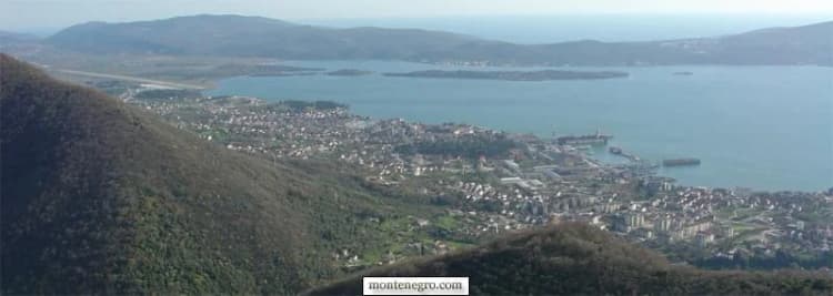
Tivat Bay in a wide archive view. The municipality includes dense waterfront development, villages, wetlands and peninsula landscapes rather than one continuous resort.
Solila, Vrmac and Gornja Lastva
Solila Nature Reserve
The Solila Nature Reserve is a 150-hectare wetland opposite Tivat’s city center in Krtole Bay. The shallow salt pans were worked from the Middle Ages and abandoned in the 20th century when price declines made production unprofitable; nature reclaimed them, and aquatic plants and shellfish flourished, attracting vast numbers of birds [26][27].
Solila is one of the rare wetlands on the Adriatic Flyway, a migratory corridor between Northern Europe and West Africa. Cormorants, grebes and grey herons are what you are most likely to see; flamingos are what people come hoping for. The reserve is listed as a Wetland of International Importance under the Ramsar Convention (since 2013) and as a Special Flora and Fauna Reserve under Montenegrin law [26][27]. Morsko Dobro describes about 140 hectares protected as a special nature reserve since 2008, one of the remaining eastern-Adriatic halophyte habitats.
The species count is not one number. The Tourist Organisation publishes 178; the reserve manager now reports 185; a broader publication gives 114; the official 2023 management report records 45 species across seven survey dates between January and November. A cumulative inventory is not a list of what is on the water this morning.
Entrance is free and the reserve is open all year. The Tourist Organisation describes hiking and cycling trails with benches, two observation towers and a roadside lookout on the way to Krtoli. No daily opening schedule is published, so an early or late visit needs checking on site. Spring and autumn passage are the two windows; allow two to three hours for a first visit. It is 5.4 km and about eleven minutes from the town centre, or 3.7 km and eight minutes from the airport junction — the best free half-day the municipality has.
Stay on established routes, keep voices low, avoid playback of bird calls and do not approach birds for photographs. Our Tivat Solila birdwatching guide explains timing and field etiquette in more depth.
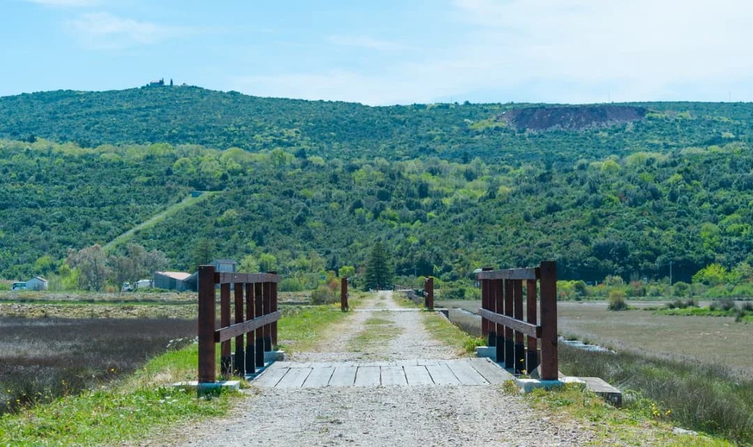
Solila is a protected wetland and bird habitat. Stay on established routes and keep disturbance low.
Gornja Lastva
Perched at 300 metres above sea level on the slopes of Vrmac — 6.3 km and about eleven minutes above the town by road, and free to walk into — Gornja Lastva is a medieval stone village with stone houses with archaic architecture, narrow rustic roads and the Church of the Nativity of the Virgin Mary (1410) [20]. The village preserves a 19th-century olive mill that remains functional, though no longer in active use. Each August, the traditional “Festivities of Lastva” celebrate the culture, traditions, and cuisine of the Boka Kotorska region [20].
Tivat's tourism organisation describes a postwar movement of residents downhill toward the growing town, and the source itself says only a few occasional residents remain. Keep voices low near homes and churches, and confirm any church, mill or festival access locally.
Vrmac ridge hiking
The Vrmac Ridge separates Kotor Bay from Tivat Bay and carries some of the best hiking in the Bay of Kotor area. The ridge follows an old Austro-Hungarian military road and gives views of both bays [23].
Kotor to Tivat traverse: The full ridge hike covers approximately 18 km and takes 5–6 hours, and its highest point is Sveti Ilija at 785 metres above sea level [23].
Fort Vrmac loop: A shorter option targeting the Austro-Hungarian Fort Vrmac, established in 1860 with the current structure built between 1894 and 1897. The round trip is approximately 8.5 km and takes around 3 hours [23].
Donja Lastva trailhead: Located just north of Tivat, this trail leads directly up to the ridge and is the most convenient starting point for visitors based in Tivat [23].
The ridge suits moderate to experienced hikers. There is nothing to pay. Routes add heat, gradient and navigation demands; the official active-holiday page links maps, but a promotional map is not a live trail-condition report.
Cycling
The Luštica peninsula loop from Tivat is a well-used ride of about 30–40 km, and Solila’s own paths are signed for cycling as well as walking, free to use. The flat option is the 5.8 km promenade corridor from Donja Lastva to Kalardovo. Further afield, the Epic 25 Turns Bike Descent on the serpentine road leading from Lovćen National Park has 25 switchbacks [19].
Best time to visit and events
The Municipality of Tivat calls it the sunniest town on the Bay of Kotor, with 2,446.2 hours of sunshine a year and a mean annual air temperature of 15 degrees Celsius; winters average 5–10 degrees and July peaks around 31 [4][32]. The two sources disagree about rain, so both are given: the municipality publishes an average of 1,755 mm a year, Weather Spark roughly 1,300 mm, and both put most of it in the cold half of the year. Either way the summer is dry. The Adriatic Sea temperature averages 19 degrees Celsius annually, comfortable for swimming from roughly June to early October.
Shoulder season (May–June, September–October): Warm and sunny with fewer crowds, ideal for hiking and sightseeing. Sea temperatures usually remain comfortable for swimming into early October.
Off season (November–April): Quieter, cooler and wetter; many marina-district venues stay open in winter, but hours shrink, so check ahead.
Events
Purgatorije – Tivat Cultural Summer: Tivat’s main cultural event, organized by the Tivat Cultural Center and running from mid-June through the end of August, with theater performances, concerts, art exhibitions, film screenings, and literary events across venues in the town and municipality [21].
Summer of Good Taste: A roving gastronomic celebration held at restaurants, taverns, hotels, and aboard the Water Carriage, with Mediterranean cuisine and folklore performances [21].
Fish and Wine Fest: Held in July and August in the nearby settlements of Lepetane and Krašići, offering free fish and local wine with live music [21].
Gastro Weekend at Porto Montenegro: A family-friendly festival with master chefs, live music, and food from focaccias and burgers to Asian fusion, Indian, and Mexican [21][22].
PMYC Regattas: A series of sailing races on Boka Bay organized by the Porto Montenegro Yacht Club [12].
Sunreef Yachts Rendezvous: An annual gathering of the Sunreef catamaran community at the marina [12].
Festivities of Lastva: each August in Gornja Lastva [20].
The Centre for Culture, at Luke Tomanovića 4, takes programme questions on +382 32 674 587, and the Gayo gallery at Porto Montenegro opens Monday to Saturday, 14:00–20:00.
Where to stay and eat
Where to stay: match the area to the trip
A booking labelled “Tivat” can be central, suburban or across the bay-facing peninsula: Lepetane and the ferry lie north; the airport, Solila and Krtoli lie south; Radovići and Luštica require a longer road journey. Check the exact pin before judging convenience.
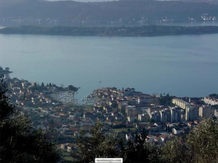
Tivat's urban waterfront occupies a narrow strip between the Bay and Vrmac. This Montenegro.com archive image is used for geographic context, not to document current construction or traffic.
Four practical zones for planning Tivat — the municipality is larger than the walkable centre
Zone
What it covers
NORTH · LEPETANE
ferry for Kamenari and the Herceg Novi side
CENTRE · PINE · SELJANOVO
walkable promenade, Porto Montenegro, parks, museums
SOUTH · AIRPORT · SOLILA
short distance, but highway traffic and habitat rules matter
KRTOLI · RADOVIĆI · LUŠTICA
beaches and villages; plan bus, car or licensed transfer
Montenegro’s national tourism authority says an accommodation provider must register and deregister guests, with registration within 12 hours of arrival. Otherwise a foreign visitor registers through the local tourist organisation, police or competent local authority within 24 hours. Ask your host to confirm your residence registration instead of assuming an online booking completed the legal step.
Tivat’s tourism organisation currently publishes a visitor tax of €1 per person per day, no tax for children under 12 and a 50% rate for ages 12–18. If you stay in more than one municipality you must register in each one where you spend more than 12 hours, and an owner who registers the property is exempt from the tax along with parents, children, brothers and sisters. Rates read on 10 September 2026; recheck the official registration page for rates, exemptions, office hours and documents before acting.
Where to eat
The dining scene spans the full range from traditional konobas serving slow-cooked lamb and fresh grilled fish to the upscale international restaurants of the marina village [19][21]. What to look for:
Seafood: Fresh sea bass (brancin), sea bream (orada), octopus (hobotnica), mussels, and squid prepared in traditional Dalmatian and Montenegrin styles.
Cured meats and cheese: Njeguski prsut (dry-cured ham from the mountains above Kotor) and Njeguski sir (aged cheese).
Olive oil: from groves on the Luštica Peninsula and the Vrmac hillsides.
Wine: Montenegrin wines, particularly Vranac (red, notably from Crmnica) and Krstač (white, mainly from around Podgorica), are widely available.
What a meal costs. Dinner for two runs €40–90, konoba against marina waterfront (prices in the table below). The green market, Zelena pijaca, trades under Magnolia Square every day from 07:00 to 18:00, Sundays until noon, and is the cheapest lunch in town.
What a day in Tivat costs
Tivat runs two economies along one shore, and the marina gate is the line between them. The figures below were checked in the town in summer 2026. A dash means no operator or public body publishes a figure for that item — not that it is free.
What things cost in Tivat — and the five prices nobody publishes
Item
Price
Where the figure comes from
Espresso
€1.50–3.50
town café against marina quay
Dinner for two
€40–90
konoba against marina waterfront
Waterfront restaurant, per head
€20–35
our Porto Montenegro guide
Bakery or konoba meal
under €15
our Porto Montenegro guide
Two loungers and an umbrella
€10–40
town beach against beach-club front row
Marina parking
—
no published tariff found
Ferry, small car
€5
booth fare all year since Feb 2025; €4 online off-season
Airport taxi into the marina district
€10–15
about ten minutes; third-party airport guides, no official tariff
The Pine promenade and the whole 5.8 km corridor are free, so are the Great City Park, Solila’s paths and observation towers, the causeway to the Island of Flowers, the Vrmac ridge, and walking the marina quays. Tivat’s best half-days cost the price of a coffee.
History
Illyrians, Romans and the medieval estates
The earliest known inhabitants were the Illyrians, and local tradition connects the town’s name to the Illyrian Queen Teuta, who ruled the region in the 3rd century BC. The town appears in medieval records as Teude, Theode, and Theudo. The reviewed municipal sources do not establish these name derivations. Archaeological remains from the Illyrian period are scarce, as the Illyrian kingdom fell to Rome in 168–167 BC [1][2]. Tombs and tombstones from the Roman period have been discovered in the nearby settlements of Lastva and Opatovo [2].
During the Middle Ages, the fertile lands around Tivat belonged primarily to aristocratic families from Kotor, Prčanj, and Dobrota, and the area was dotted with estates and summer residences. The collective church of St. Anton, dating from 1373, is among the surviving landmarks from this era [1]. In the 13th century Saint Sava, the founder of the Serbian Orthodox Church, established the seat of the Eparchy (Bishopric) of Zeta on the Prevlaka peninsula near Tivat, one of the most important religious centers in the medieval Serbian state [2][5].
Venetian rule (1420–1797)
Known as Teodo during the Venetian period, Tivat came under the Republic of Venice as part of Albania Veneta in 1420 and remained so until the republic’s fall in 1797. During these centuries the town attracted many Serb refugees fleeing Ottoman-held territories, and Kotor’s noble families built summer residences along the shore [1][2].
1889: the Austrian naval arsenal
The municipality’s history of Tivat records that its municipal council transferred land – between Seljanovo and Pakovo – for an Austro-Hungarian naval Arsenal in 1889, and presents the decision as the hinge between an economy oriented toward agriculture and one increasingly shaped by crafts and industrialisation. The bay’s deep, sheltered waters gave the Imperial and Royal Navy a harbor from which the entire southern Adriatic and the Strait of Otranto could be controlled. By 1912, the Tivat Arsenal had become the leading shipyard in the southern Adriatic [1][6].
Workers, engineers, and military personnel moved into Tivat, and ship repair, trades and industry drove the settlement’s modern urban growth.
Tivat waterfront transformation — the waterfront changed function, not identity all at once
Period
Waterfront function
BEFORE 1889
agriculture and estates
1889
Arsenal land decision
20TH CENTURY
naval repair and industry
MID-2000s+
marina and heritage reuse
Legacy
Naval history remains visible in collections, objects and place names.
Source: opstinativat.me, tivat.travel
The Yugoslav naval base
Between the wars the naval base served the Royal Yugoslav Navy; Italy used it during the 1941–43 occupation, and after 1945 it became a base of the Yugoslav People’s Army (JNA). After the Second World War, the Naval Technical Repair Institute “Sava Kovačević” became, in the municipality's words, the backbone of the city. The Tivat base became home to a significant portion of the Yugoslav Navy, including submarines and warships, and was also used by Russia and Libya for maintenance, repair, and overhaul of their naval vessels [6][7]. For decades the military presence kept Tivat isolated from tourism development.
From military shipyard to Porto Montenegro (2006–present)
Following Montenegro’s independence in 2006, the Arsenal site was sold to Adriatic Marinas, led by Hungarian-born Canadian Peter Munk, for about €3.26 million, to transform the decommissioned military facility into a marina and luxury lifestyle destination [6][8]. Porto Montenegro opened its first phase in 2009, and since 2016 the marina has been owned by the Investment Corporation of Dubai. The redevelopment attracted international investment, luxury hotels, and a new demographic of visitors [8][9]. The scale of the change is easiest to read at the runway: Tivat airport handled 1.37 million passengers in 2019, against a town of about ten thousand people.
A 2021 peer-reviewed study by three University of Montenegro architecture scholars dates the sale agreement to October 2006. The Arsenal regeneration study, which combined historical analysis with a survey of Montenegro residents (187 eligible responses), reports clear economic and partly ecological benefits from redeveloping a contaminated industrial site. It also identifies social, spatial and cultural risks: loss of an older collective identity, pressure from new investment, and the danger that accelerated building outruns the landscape's capacity.
The surviving crane, submarine and industrial references are fragments of the earlier working town. Our history of the P-821 Heroj submarine explains one retained object. A comparable but distinct barracks-to-resort transformation appears in our Portonovi history.
How the change is judged
Lonely Planet describes the transformation succinctly: “Tivat has undergone a major makeover courtesy of the multimillion-dollar redevelopment of its old naval base into a first-class marina… it is now attracting the uberwealthy and less-loaded rubberneckers in droves.” The guide notes that while prices are expensive for Montenegro, they remain reasonable by broader European standards [10]. Travel and Tour World calls Tivat “a glamorous yet budget-friendly escape” [9]. Superyachts.com calls Porto Montenegro “the definitive superyacht village” [31].
International travel coverage often treats different Montenegrin coast towns as complements rather than substitutes, a pattern examined in our 20-year press verdict.
Frequently asked questions
Does Tivat have an old town?
Not a walled one like Kotor. The Buća-Luković summer residence, dating from the 14th century, is the most monumental and best-preserved medieval aristocratic building in Tivat; the stone village of Gornja Lastva sits 300 metres up on Vrmac.
How many people live in Tivat?
What the sources say
The municipal page displays 16,338 for the Municipality of Tivat. MONSTAT’s 2023 census counts 10,743 people in the town settlement; the two are different geographic measures.
Can you visit the submarine?
Yes, P-821 Heroj at the Naval Heritage Collection is accessible via guided tour. Porto Montenegro publishes Tuesday to Saturday, 09:00 to 17:00, and no admission price; ring +382 69 356 031 and ask whether the submarine interior is open that day.
Can you visit the island of Sveti Marko?
It is reached by sea, but no universal public landing or timetable was verified. Use a licensed operator and confirm permission, landing point, weather and return arrangements.
Is Tivat accessible?
The central promenade is comparatively level. The airport’s accessibility portal says passengers can arrange PRM assistance through their airline and describes step-free routes and accessible toilets within the terminal. That does not certify every pavement, beach, boat, bus, museum or hotel; confirm each link in the journey directly.
Can I get into the Blue Cave from Tivat?
Only in a boat without an engine. Since 25 May 2026 a rule from Montenegro’s Ministry of Maritime Affairs prohibits motor-powered vessels from entering the Blue Cave area, so a motorboat trip stops outside and entry depends on a compliant transfer and the sea state.
About this guide and its sources
This article was researched on 26 August 2026 from the Municipality of Tivat, Tivat Tourism Organisation, Airports of Montenegro, UNESCO World Heritage Centre and a 2021 peer-reviewed study by University of Montenegro authors, and revised on 10 September 2026. Where two sources disagree — the berth count, the annual rainfall, the museum’s opening hours, the bird species total — both figures are printed with their attribution and no verdict is given. Where nothing is published, a dash is printed rather than a guess. Schedules and access change; use the linked official sources before travel.
Pavle Obradović is from Herceg Novi. He was Manager of Montenegro.com, then Director of the Herceg Novi Tourism Organization, and is now Coordinator for Investment and Development Projects at the Municipality of Herceg Novi. He holds a BSc in International Hospitality and Service Management from the Rochester Institute of Technology (RIT).
···
Updated · Originally published
Montenegro Travel Newsletter
Get weekly stories, guides, and insider tips about Montenegro delivered to your inbox.