Bay of Kotor: Complete Guide to Montenegro's Drowned River Canyon
The bay cuts 28 km inland below limestone walls over 1,000 m high: Kotor's ramparts, Perast's palazzi, Our Lady of the Rocks and the Kamenari ferry.
3rd century BCfirst recorded
2offshore islets
90 kmto the airport
Jul–Augthe busy months
Updated Originally published 35 min readby Pavle Obradović
The first time you see the Bay of Kotor from above — perhaps from the serpentine road descending from the Croatian border, or through the window of a plane banking toward Tivat Airport — the reaction is always the same: disbelief that something this dramatic exists in Europe without being a household name. A deep blue waterway slices 28 kilometers inland through sheer limestone mountains that rise over 1,000 meters straight from the water's edge, past medieval towns with terracotta rooftops, tiny islands crowned by churches, and fishing villages where nets still dry on stone walls. The Bay of Kotor (Boka Kotorska) is often called Europe's southernmost fjord. That label is not technically accurate — geologists classify it as a submerged river canyon, carved by a river system and then flooded by rising sea levels rather than gouged by glaciers — but the visual comparison to Scandinavian fjords is irresistible, and the reality may be even more beautiful. The whole bay, together with the old town of Kotor, is a UNESCO World Heritage Site. This is one of the most spectacular natural harbors on Earth, and it has been shaping civilizations, inspiring artists, and sheltering sailors for over two millennia.
Planning your days in Kotor? Our guide to things to do in Kotor covers the Old Town, the fortress climb, the bay, food and day trips.
What makes the Bay of Kotor so memorable is the way history and nature are layered together. The shoreline strings together a series of atmospheric medieval towns — Kotor with its walled old town and fortress, romantic Perast with its Venetian palaces, ancient Risan with Roman mosaics, and the long waterfront village of Dobrota. Off Perast float the two famous islets, Our Lady of the Rocks (an artificial island crowned by a blue-domed church) and the cypress-covered St George. The vibe is calmer and more contemplative than the open Adriatic beach resorts further south. You come to the Boka for the scenery, the boat trips, the seafood konobas, the church-topped islands and the slow waterside promenades — and for swimming in sheltered, glass-clear water with a mountain backdrop. It is a place to linger, not to rush.
This comprehensive guide covers everything you need to plan your visit to Boka Kotorska: every town worth stopping in, the best activities on and off the water, practical logistics including the famous Kamenari ferry, seasonal events, photography locations, and where to base yourself depending on your travel style.
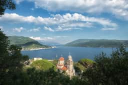
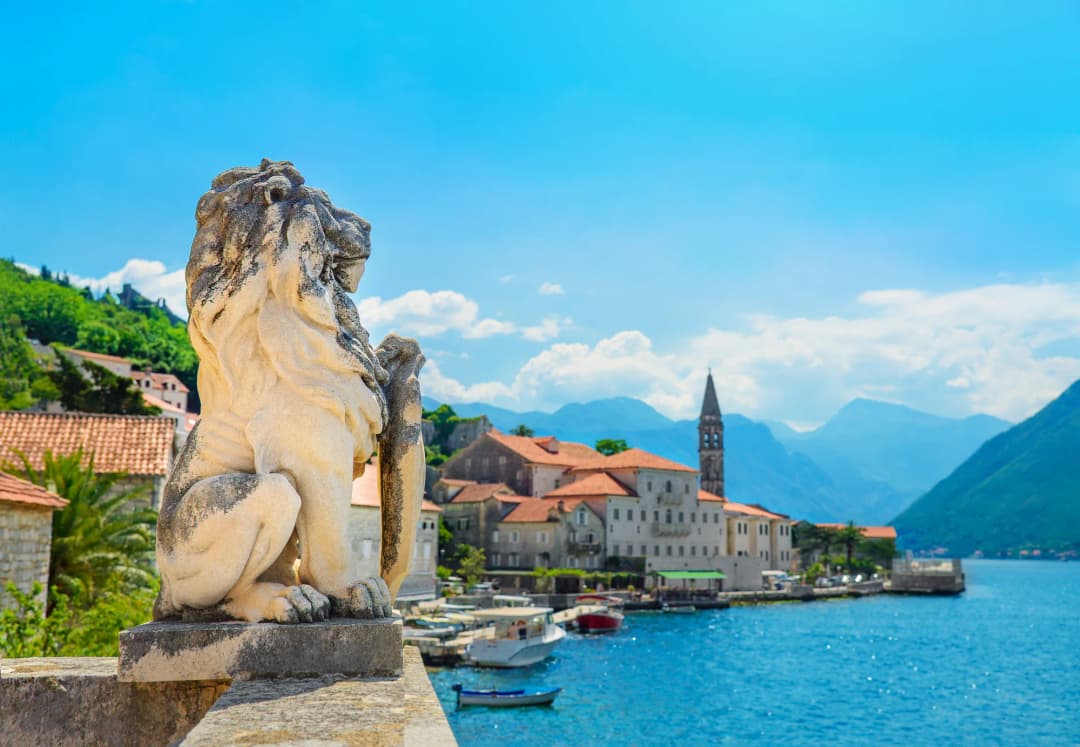
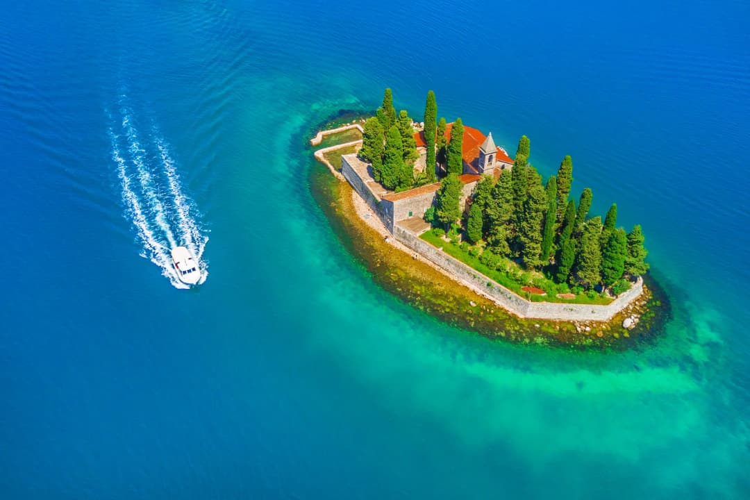
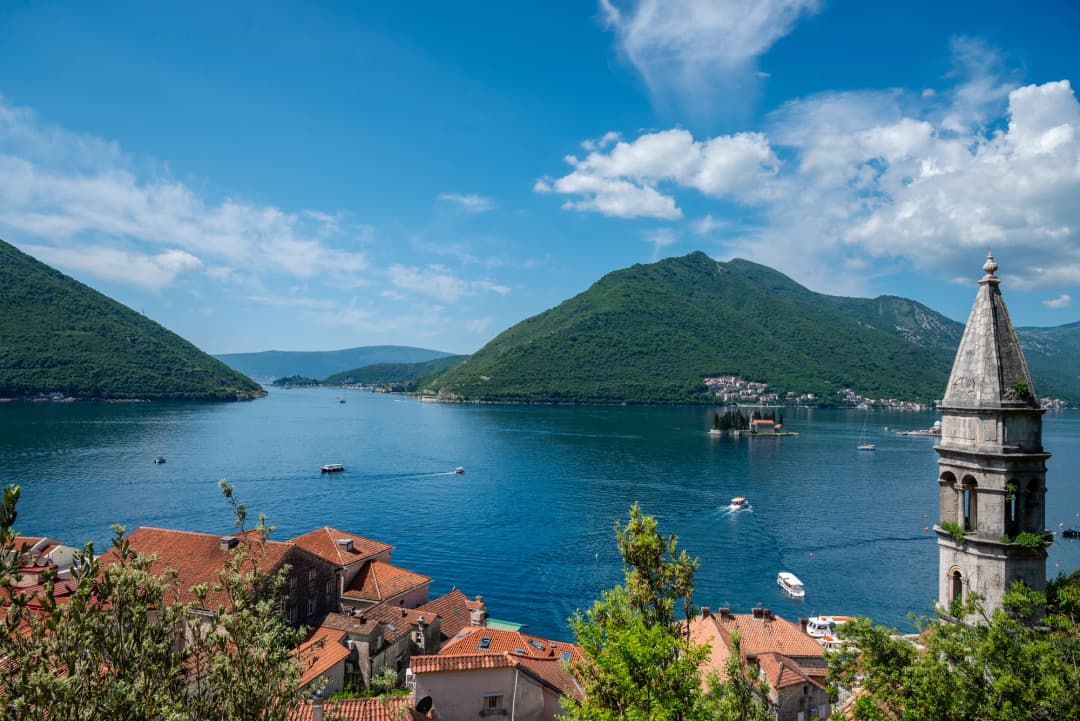
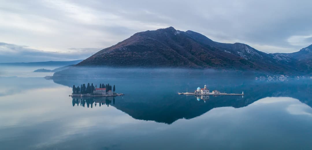
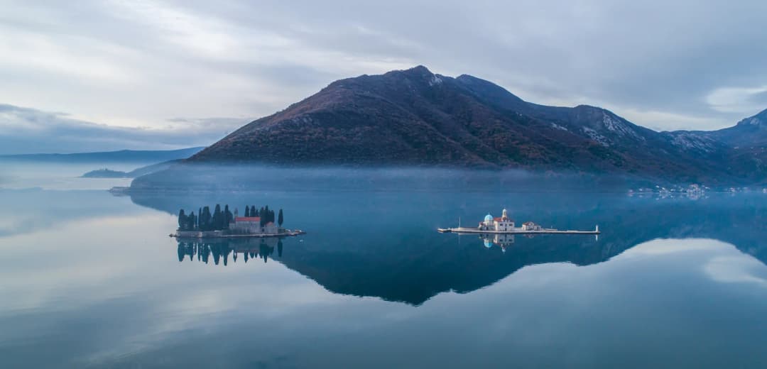
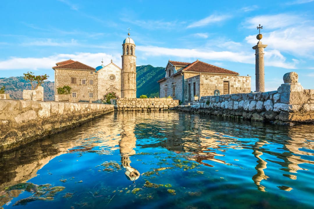
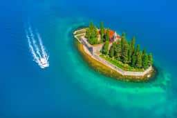
The two islets off Perast sit in the middle distance: Our Lady of the Rocks, which is man-made, and the cypress-covered St George, which is not.
What is the Bay of Kotor?
The Bay of Kotor (Boka Kotorska) is a 28-kilometre inlet on Montenegro's Adriatic coast, made up of four connected inner bays — Herceg Novi, Tivat, Risan and Kotor — joined by the 300-metre-wide Verige Strait. Mountains rise straight from the water to 1,895 metres at Orjen above Herceg Novi and 1,749 metres at Lovćen above Kotor. It is a drowned river canyon rather than a glacial fjord, and Kotor's walled old town has been on the UNESCO World Heritage list since 1979.
Is Boka Kotorska a fjord?
Boka looks like a fjord, but the resemblance ends at the shoreline. Tectonic uplift built its mountain frame, rivers and karst cut the valleys, and a rising Adriatic flooded them; nearby Orjen glaciers left an outwash fan at Lipci, while bay-scale glacial excavation is not documented.
Boka and a fjord share steep mountain walls and branching seawater, but not the same origin. Graphic: Montenegro.com. Sources: Magaš; Adamson and colleagues; Vlahović and colleagues; Argnani; Ferrante and colleagues; Lambeck and colleagues; NOAA; USGS.
Boka lies within the Dinarides formed by convergence between Adria and Eurasia. Folding, thrusting and uplift placed resistant limestone and dolomite beside softer flysch; rivers then widened the weaker rock into basins and cut tighter passages through the carbonate ridges, while groundwater dissolved conduits through the karst. Research on the bay’s geomorphology and submerged landscape supports this cumulative tectonic–erosional history. The 1979 thrust earthquake showed that regional compression remains active, but no single earthquake created the bay.
The four inner bays of Boka Kotorska, from the Adriatic inward
Inner bay
Local name
Position
Main town
Character
Herceg Novi Bay
Topaljski zaliv
Outermost, opening to the Adriatic through the Verige Strait
Herceg Novi
Most open-sea influence; slightly cooler and cleaner water
Quietest and least visited; water almost lake-like on windless days
Kotor Bay
Kotorski zaliv
Innermost
Kotor
Narrows to the walled town; Perast guards its entrance
Understanding the Bay: Geography and Layout
The Bay of Kotor is not a single body of water but rather a series of four interconnected bays, each with its own character and settlements. Together they form the largest natural harbor in the eastern Adriatic, reaching depths of up to 60 meters and covering roughly 87 square kilometers of water surface.
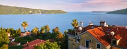
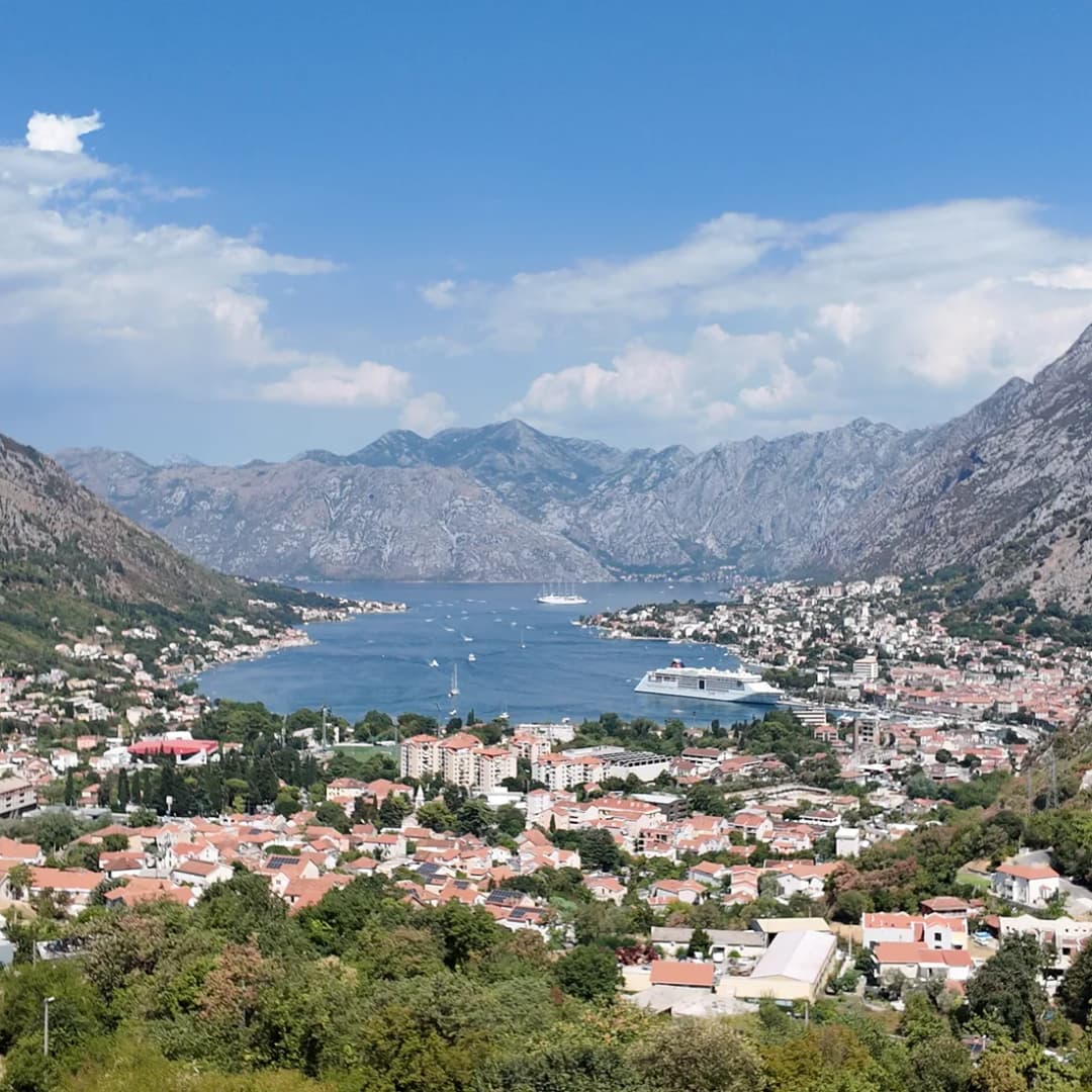
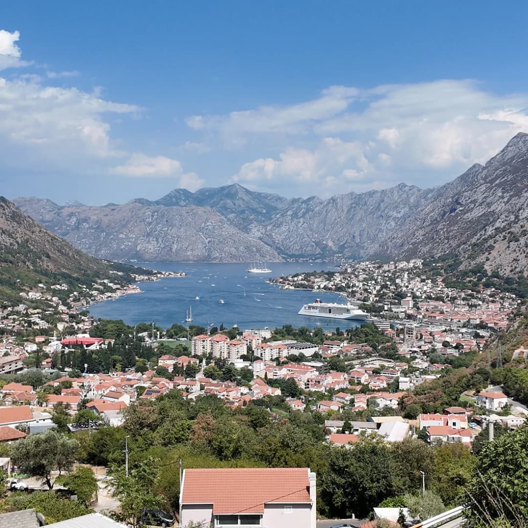
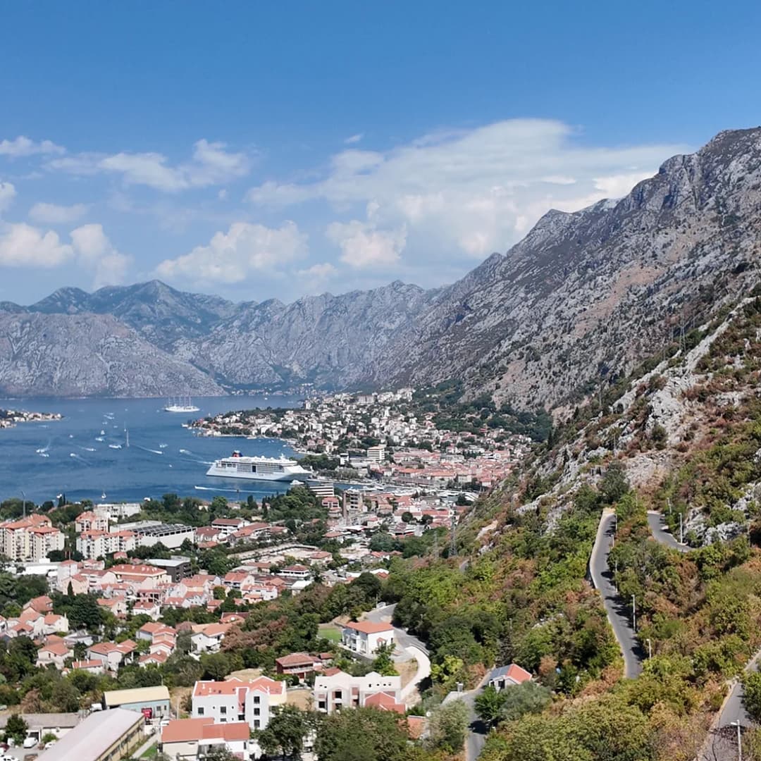
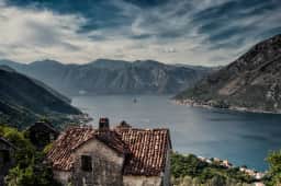
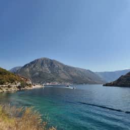
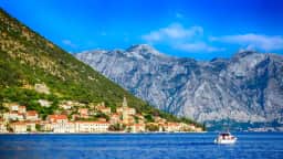
A single vantage point takes in both the water and the ridgeline that hems it in — useful for orienting yourself before setting out.
The Four Inner Bays
Herceg Novi Bay (Topaljski zaliv) is the outermost section, opening to the Adriatic Sea through the Verige Strait. The town of Herceg Novi dominates its northern shore, with the Luštica Peninsula forming the southern boundary. This bay receives the most open-sea influence, making its waters slightly cooler and cleaner than the inner reaches.
Tivat Bay (Tivatski zaliv) sits to the southeast, separated from Herceg Novi Bay by the narrow Verige passage — the word "verige" means "chains," a reference to the defensive chains that were once stretched across this 300-meter-wide strait to block enemy ships. Tivat, with its airport and the gleaming Porto Montenegro marina, occupies the eastern shore.
Risan Bay (Risanski zaliv) extends to the northeast, the quietest and least-visited of the four. The ancient town of Risan, founded as a Greek colony in the 3rd century BC, sits at its head. The water here is the calmest, almost lake-like on windless days.
Kotor Bay (Kotorski zaliv) is the innermost and most famous section, narrowing dramatically as it approaches the medieval walled town of Kotor, wedged into the corner where the mountains meet the water. Perast, with its two island churches, guards the entrance to this innermost bay, and the long waterfront suburb of Dobrota stretches north from Kotor along the shore.
The entire bay is surrounded by mountains reaching 1,895 metres (Mount Orjen above Herceg Novi) and 1,749 meters (Mount Lovćen above Kotor), creating a microclimate that is noticeably warmer and more humid than the open coast.
Four bays rather than one, joined at the Verige narrows. Verige means chains — defensive chains were once stretched across the passage.
Driving the Bay: The Coastal Circuit
Driving the full circuit of the Bay of Kotor is one of the great European road experiences, a journey of approximately 80 kilometers that takes 2 to 3 hours without stops — though you will want to stop constantly. A coastal road hugs the entire shoreline, so you can drive the full loop around the bay. The road follows the waterline for most of its length, passing through towns, alongside stone walls, and under fortress ruins. At points it narrows to barely one lane, squeezing between ancient buildings and the water.
Route Overview
Starting from Kotor and driving counterclockwise, you pass through Prčanj (grand sea captains' palaces), Stoliv (tiny hamlet, steep church hike above), Lepetane (southern ferry terminal), and then around the bay's southern shore past villages to Tivat. From Tivat, the road continues to the Verige Strait, past Luštica Peninsula turnoffs, and reaches Herceg Novi. From Herceg Novi, the road follows the northern shore past Bijela (shipyard town), Kamenari (northern ferry terminal), and winds along the dramatic stretch between Risan and Perast, one of the most photographed road segments in the country, before dropping back into Kotor.
The Kamenari-Lepetane Ferry
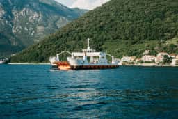
This tiny car ferry is one of the most useful shortcuts in Montenegrin travel. Rather than driving the full 45-minute route around the innermost part of the bay, the ferry crosses the narrow Verige Strait in just 5 minutes, connecting Kamenari on the northern shore to Lepetane on the southern shore. It runs continuously near Tivat and saves a long detour — particularly useful when driving in from Tivat airport or the southern coast.
Kamenari → Lepetane
Verige Strait crossing
By ferry5 min
Round the bay45 min
Car, passengers included
€4.50
Motorcycle
€2
On foot
€1
Runs 24 hours a day, all year, with a boat every 10 to 15 minutes.
0006121824
No wait
Up to one sailing
30–45 min queue
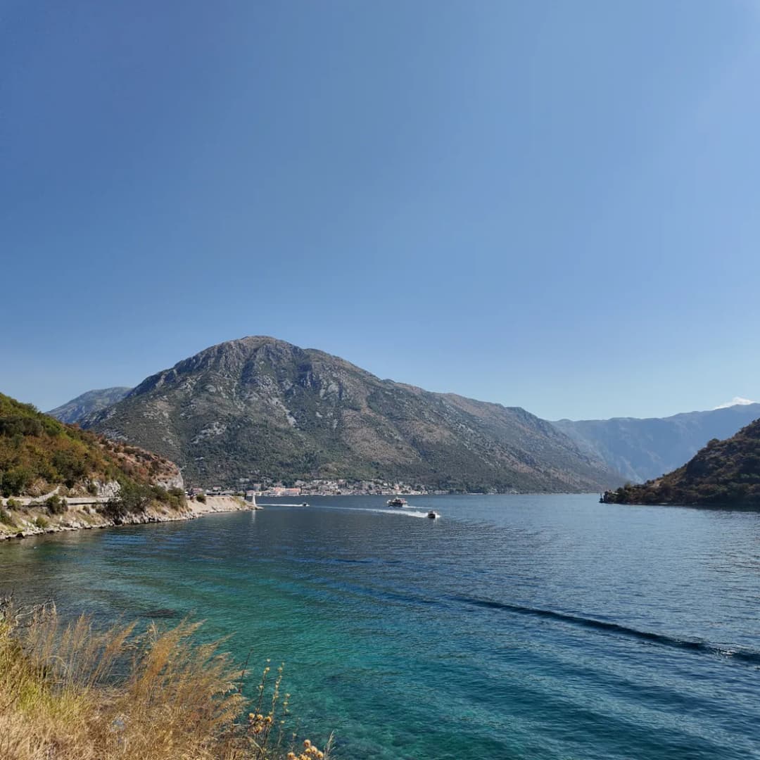
The ferry also provides one of the best photo opportunities in the bay: from the middle of the strait, you get a perfect view looking inward toward Perast and the islands, with mountains framing both sides.
Five minutes across the strait, against forty-five round the head of the bay. That difference is the whole argument for joining the queue.
Herceg Novi (population approximately 13,000) sits at the bay's entrance, spilling down steep hillsides from its fortresses to the waterfront. Founded in 1382 by Bosnian King Tvrtko I, the town changed hands between Ottoman, Venetian, Spanish, French, Austrian, and other rulers — each leaving architectural traces that make Herceg Novi one of the most eclectic towns in Montenegro.
Forte Mare is the seaside fortress at the harbor, originally built in the 14th century. Entry costs EUR 2, and the views from the ramparts at sunset are magnificent. In summer, the fortress courtyard hosts concerts and film screenings.
Kanli Kula (the "Bloody Tower") looms above the old town. This imposing Ottoman-era fortress was once a prison; today its interior has been converted into an open-air amphitheater seating 1,000, hosting the Herceg Novi Film Festival and summer concerts. Entry is EUR 2 when no events are scheduled.
Savina Monastery is the town's spiritual heart, a Serbian Orthodox monastery complex dating to the 11th century (with the current Large Church built in 1777-99). The monastery treasury contains a remarkable collection of icons, some dating to the 14th century. Entry is free, but modest dress is required. The monastery sits in a fragrant garden of Mediterranean pines and palms, and the walk from the town center takes about 15 minutes along a shaded path.
The Šetalište Pet Danica (Five Danica Promenade) stretches 7 kilometers along the waterfront, connecting Herceg Novi to the suburb of Igalo. This is one of the finest promenades on the Adriatic — shaded by palms, oleander, and subtropical plants, passing beaches, cafes, and swimming platforms. A full walk takes about 90 minutes at a leisurely pace.
Blue Cave excursion: Boat trips from Herceg Novi or from Žanjic Beach on the Luštica Peninsula visit the Blue Cave (Plava Špilja), near the bay's mouth, where sunlight refracts through an underwater entrance to create an ethereal blue glow inside the grotto. Half-day trips cost EUR 25 to 35 per person and typically include swimming stops at Žanjic and other beaches.
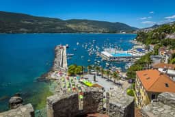
Forte Mare has guarded the harbour since the fourteenth century. The promenade now runs along its foot.
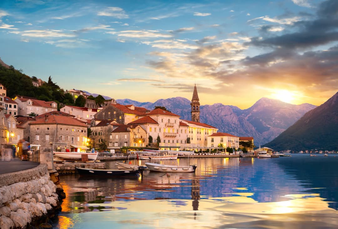
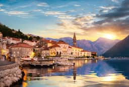
If you visit only one small town in Montenegro outside of Kotor, make it Perast. This astonishing little settlement — population 237 at the 2023 census — punches absurdly far above its weight in beauty and historical significance. Strung along the waterfront at the point where the bay narrows before Kotor, Perast was a powerful maritime republic under Venetian protection, and its wealth from seafaring built 17 baroque palaces, 16 churches, and a legacy of navigation and shipbuilding that earned it the nickname "the town of 100 captains."
The town center is closed to cars, and the entire waterfront — about 940 metres long — can be walked in a quarter of an hour. But you will linger much longer. Every building is stone, every view includes water and mountains, and the two tiny islands sitting just offshore complete what may be the most photogenic scene on the Adriatic.
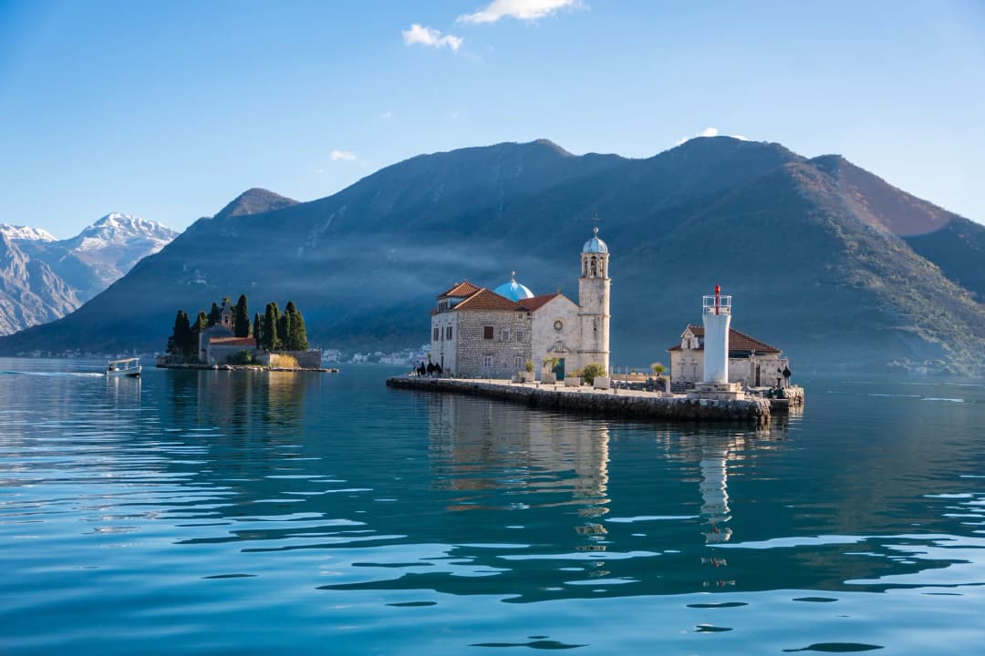
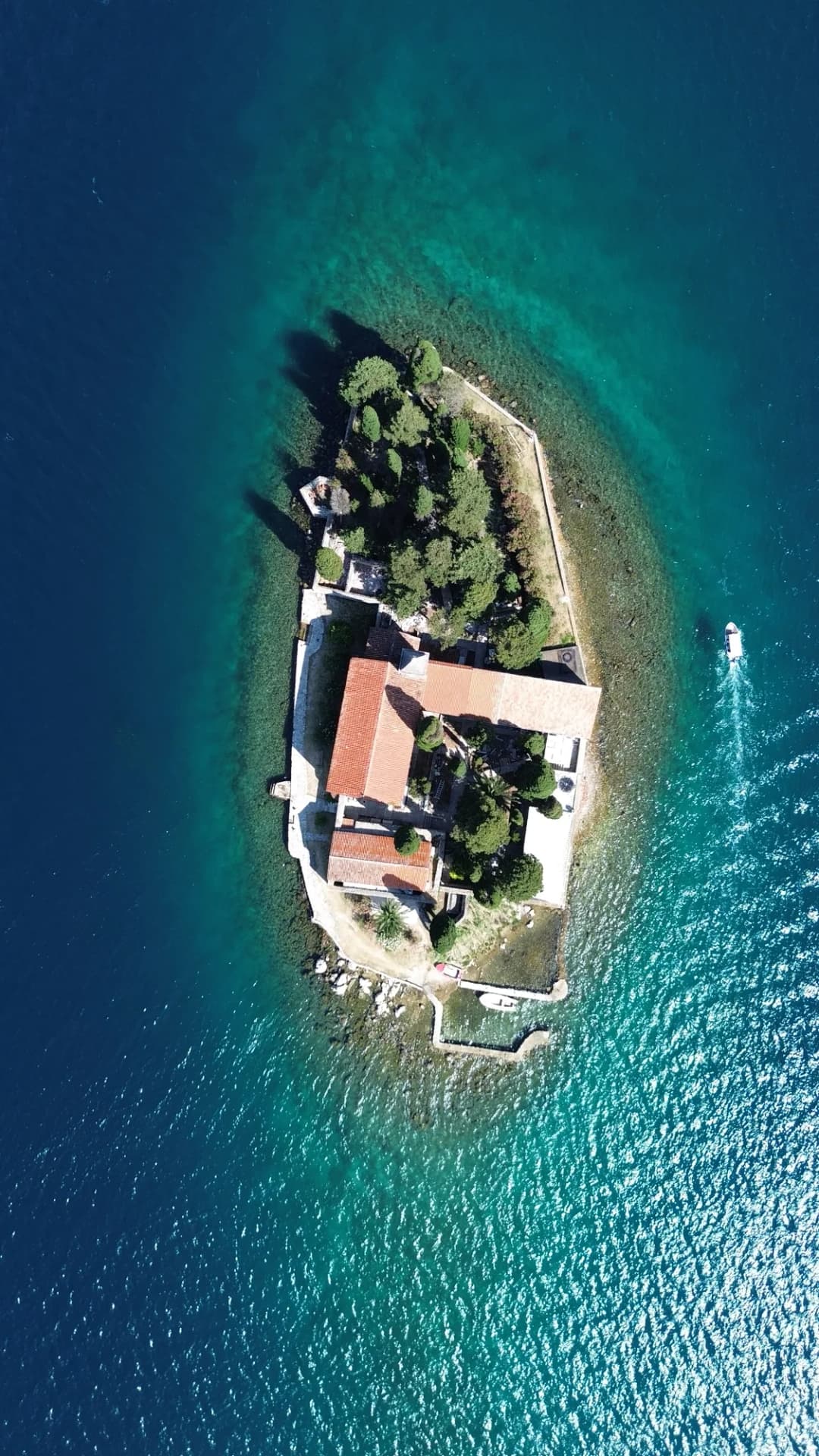
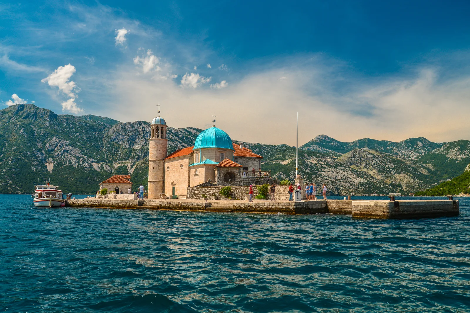
Our Lady of the Rocks (Gospa od Škrpjela) is the more famous of the two islands, and unlike most church islands in the Mediterranean, this one is entirely man-made; its neighbour, St George, is a natural islet covered in cypresses. According to tradition, fishermen found an icon of the Madonna on a rock in the bay on July 22, 1452. Over the subsequent centuries, locals built up the island by throwing stones around the rock — a tradition maintained to this day during the Fašinada festival each July 22, when local boats parade to the island and throw stones into the water. The current blue-domed church, dating to 1630, contains 68 paintings by Tripo Kokolja, a 17th-century Perast artist, plus thousands of silver votive plaques left by grateful sailors, and there is a small museum alongside it. Water taxis shuttle visitors from the Perast pier for EUR 5 round trip (5-minute crossing); some operators quote EUR 5 to 10 return. Combining Perast and the islands in one short boat trip is the bay's most iconic, photogenic excursion.
The Museum of Perast, housed in the grand Bujović Palace on the waterfront, chronicles the town's maritime history with model ships, paintings, weapons, and historical documents. Entry is EUR 8 (EUR 5 for children under 12, EUR 4 for students).
Dining in Perast: The waterfront restaurants offer some of the bay's most memorable meals, and the family-run konobas along the Perast and Dobrota waterfronts serve some of the best food on the coast. Conte (EUR EUR EUR) is the most upscale, with creative Mediterranean cuisine served on a terrace directly over the water. Admiral (EUR EUR) offers excellent seafood risotto and grilled fish with a slightly more accessible price point. Reservations are essential at both during summer evenings.
Both islets in one frame: Our Lady of the Rocks under its blue dome, St George under its cypresses. The hop across from the quay is about EUR 5 to 10 return.
Risan is the oldest continuously inhabited settlement in the Bay of Kotor, founded as the Greek colony of Rhizon in the 3rd century BC. It later became the seat of the Illyrian Queen Teuta, who defied Rome from these shores before her eventual defeat in 229 BC. Today Risan is a quiet, unhurried town that most tourists drive through without stopping — which is a mistake.
The Roman Mosaics are the main attraction, discovered in the remains of a 2nd-century Roman villa. The finest mosaic depicts Hypnos, the Greek god of sleep, reclining with poppies — one of only three known mosaic representations of Hypnos in the world. Entry costs EUR 2, and the small site can be visited in 20 minutes.
Risan also serves as a base for hiking on Mount Orjen (1,894m), the highest mountain on the eastern Adriatic coast, which receives more precipitation than almost anywhere else in Europe.
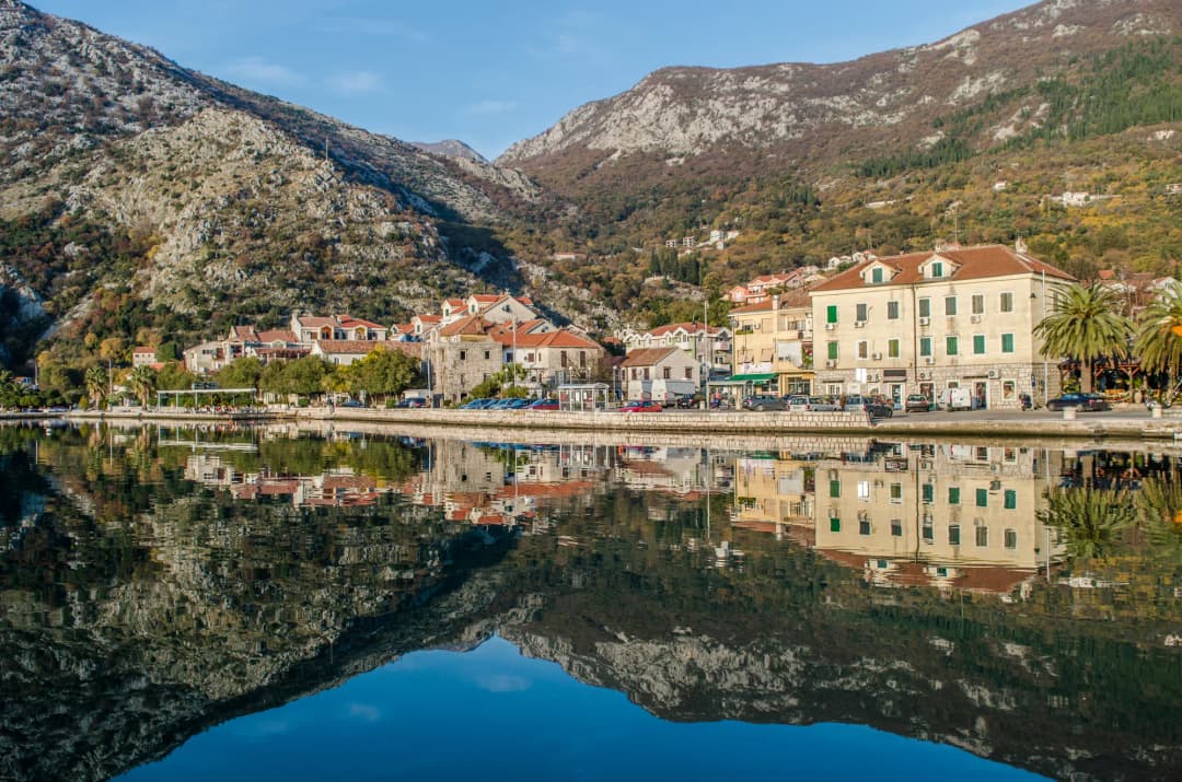
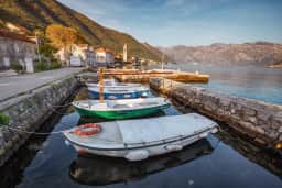
Risan's quay, mirror-still out of season. This is the town most visitors pass on the coastal road without stopping.
Kotor: The UNESCO Crown Jewel
Kotor deserves its own full guide (and we have written one), but no Bay of Kotor article would be complete without covering its essentials. The medieval walled town, wedged into the innermost corner of the bay beneath the dramatic San Giovanni fortress, earned UNESCO World Heritage status in 1979 for its unique combination of Venetian-influenced architecture, medieval urban layout, and spectacular natural setting.
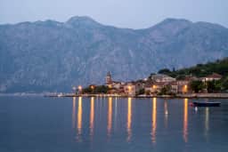
Škaljari sits just south of the old town, close enough to walk in but far enough to escape the cruise-day crush.
The Old Town is entered through three gates, the most impressive being the Sea Gate (Vrata od Mora), built in 1555. Inside, a labyrinth of narrow stone alleys opens onto squares where you will find the 12th-century Cathedral of Saint Tryphon (EUR 4 entry), numerous churches, palaces, and one of the best-preserved medieval urban centers in the Adriatic.
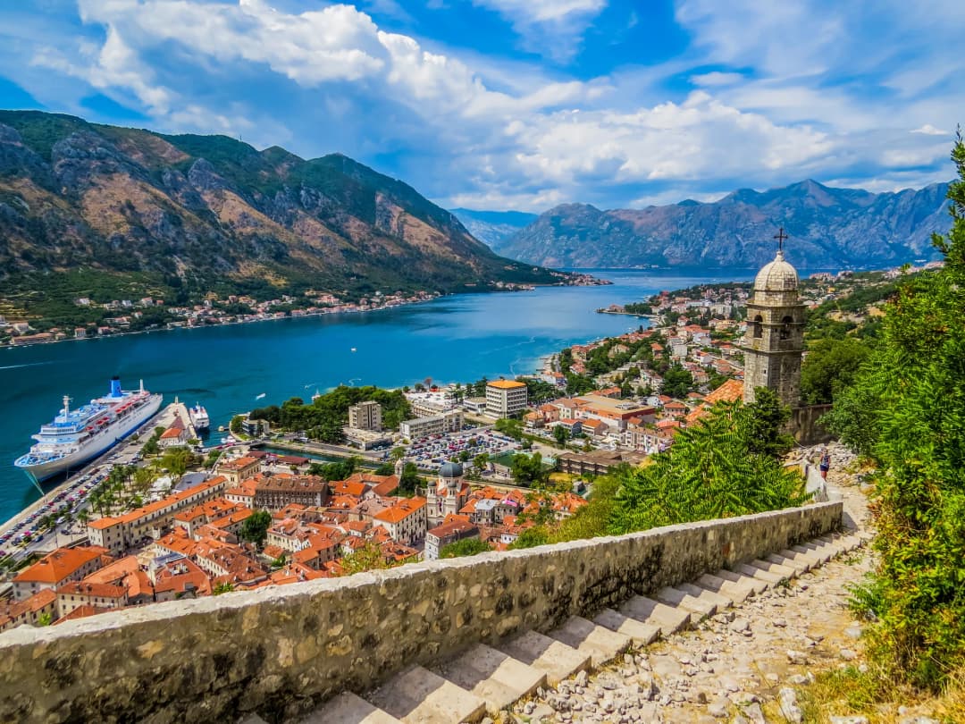
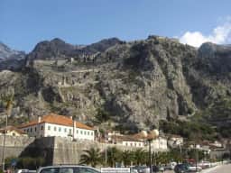
The Fortress of San Giovanni climb — 1,350 steps carved into the mountainside, following Kotor's medieval walls up the slope — rewards with the single most spectacular panorama of the bay and the classic postcard view. The official entry is EUR 8, but locals know that access is free after 8:00 PM, making a sunset or early evening climb particularly magical. Allow 1 to 1.5 hours for the ascent.
North of the old town, the waterfront suburb of Dobrota stretches for several kilometres along the shore, its promenade linking small pebble coves, stone bathing platforms, private jetties and a run of family-run konobas — the most convenient stretch of the bay to stay on if you want water access and old-town proximity at once.
The old town is wedged into the innermost corner of the bay, with the San Giovanni walls climbing the slope behind it — 1,350 steps to the top.
Tivat was long overshadowed by its historic neighbors, known mainly as the location of the bay's main airport. That changed dramatically with the opening of Porto Montenegro, a luxury marina development built on the site of a former Yugoslav naval shipyard. Today Porto Montenegro berths some of the world's largest superyachts (slips accommodate vessels up to 250 meters), and the surrounding complex includes designer boutiques, upscale restaurants, a pool club, and the Naval Heritage Collection — a free museum in the restored Arsenal building that chronicles the bay's military maritime history from Venetian times through the Yugoslav Navy era.
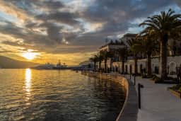
Beyond Porto Montenegro, Tivat has its own quieter charms. The Buća-Luković Palace complex near the waterfront dates to the 16th century. The town's waterfront promenade, lined with cafes, fills with a local evening passeggiata that feels genuinely Montenegrin rather than tourist-oriented.
Tivat Airport (TIV) is the primary gateway for most bay visitors, with direct connections to numerous European cities, particularly during summer. The airport is just 7 kilometers from Porto Montenegro and about 9 kilometers from Kotor — some sources put the airport-to-Kotor distance at about 8 kilometers, roughly a 15-minute drive around the bay either way.
The Luštica Peninsula forms the southern arm of the bay's entrance, and while development is accelerating (the Luštica Bay resort is one of Montenegro's largest tourism investments), much of the peninsula remains wild and sparsely populated.
Žanjic Beach is the peninsula's star, a pebble beach with water so clear you can count stones on the seabed at 5 meters depth. Reachable by car (narrow road, limited parking in summer) or by boat from Herceg Novi, Žanjic consistently ranks among the cleanest swimming spots in the entire bay.
Mirište Beach, adjacent to Žanjic, is even quieter and equally beautiful. The Blue Cave (Plava Špilja) can be reached by small boat from either beach, but motorboats must stop outside: you can go in only by swimming or in a craft without a motor, depending on sea conditions (RTCG).
Fort Arza, an impressive 19th-century Austro-Hungarian circular fortress at the peninsula's tip, overlooks the entrance to the bay. It is partially ruined but explorable, and the walk out to it passes through aromatic scrubland with views across to Prevlaka (Croatia) and the open Adriatic.
Žanjić, on the outer bay. The clearest water in the Boka is out here rather than in the sheltered inner reaches.
Rose, at the end of the road. No hotel, no ATM, no souvenir shop — which is the reason to come.
If you want to see the Bay of Kotor as it was 50 years ago, drive to Rose. This minuscule fishing village clings to rocks at the very entrance of the bay, at the end of a single-lane road that discourages casual visitors. Perhaps 30 stone houses, a small harbor where fishing boats bob, two simple restaurants serving whatever was caught that morning, and swimming directly from smooth rocks into the open Adriatic.
Rose has no hotel, no ATM, no souvenir shop. It has the most authentic atmosphere in the entire bay, and spending a long lunch here watching the light change on the water is one of Montenegro's most quietly perfect experiences.
Stretched along the southern shore between Kotor and Stoliv, Prčanj was historically one of the bay's wealthiest maritime communities. Its grand palazzo facades — many now faded but still elegant — line the waterfront road, silent testaments to the sea captains who built them with fortunes earned from trade across the Mediterranean. The unfinished Church of the Nativity of the Blessed Virgin Mary, started in 1789 and never completed, would have been the largest church in the bay had funds not run out.
Stoliv: The Hidden Climb
Stoliv is barely a village, a cluster of stone houses at the water's edge. Its attraction is the steep trail climbing from the shore to the Church of Saint Elijah, perched high on the mountainside above. The 45-minute climb rewards with panoramic views across the bay that rival the Kotor fortress without the crowds or the admission fee.
Activities on and Around the Bay
Despite the mountain setting, the Boka is very much a swimming bay, and the sheltered water that makes it good for bathing also makes it ideal for paddling, boating and sailing. There is no entry fee to the bay itself — small fees apply only to specific attractions such as Kotor's old town walls and the church on Our Lady of the Rocks.
Boat Tours
Exploring the bay by water is essential — the perspective from the water is entirely different from the road. Options range from large group boats to private charters, with small boats and water taxis running regularly from Kotor and Perast.
Group boat tours (half day): EUR 25 to 40 per person. Typically depart from Kotor or Herceg Novi, visit Our Lady of the Rocks, swim stops, and one or two villages. Duration 3 to 4 hours.
Full-day boat tours: EUR 50 to 80 per person. Cover more of the bay, often including the Blue Cave, Žanjic Beach, and lunch at a waterfront restaurant.
Private speedboat charter: EUR 200 to 300 for a half day, accommodating 4 to 8 passengers. You set the itinerary. This is the best way to reach hidden swimming spots and quiet coves inaccessible from the road.
Short island hop: the classic quick excursion is the crossing from Perast to Our Lady of the Rocks, around EUR 5 to 10 return.
Kayaking and Paddleboarding
Guided sunset paddles launch from Kotor or Perast and turn for home as the light goes off the water. EUR 35 to 50 per person.
Sea kayaking has boomed in the bay over the past decade, and for good reason — the calm, sheltered waters are ideal for paddling, and the kayak-level perspective of the medieval towns and mountain walls is unforgettable. Stand-up paddleboarding is equally popular on the flat water; rentals run around EUR 10 to 15 per hour.
Guided sunset kayak tours (EUR 35 to 50 per person) typically launch from Kotor or Perast, paddle to Our Lady of the Rocks or along the old town walls, and return as the sun drops behind the mountains and the bay turns gold. No experience necessary. Duration 2 to 3 hours.
Swimming and Beaches
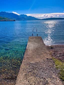
The bay has dozens of designated swimming areas and many more informal ones. Beaches here are mostly pebble coves or concrete bathing platforms rather than wide sandy strands — the Dobrota waterfront in particular is a string of small pebble coves and stone platforms, and many hotels and villas have private jetties. Expect calm, transparent water rather than surf. Most waterfront towns have concrete swimming platforms (often free, sometimes EUR 2 to 5 for a sunbed) dropping into deep, clean water; at the busier spots in summer, sunbeds and parasols typically cost EUR 10 to 20 for two loungers and an umbrella, with beach bars serving cold drinks and coffee. The best swimming for water clarity is on the outer bay, particularly around Žanjic, Rose, and the Luštica Peninsula. Inner bay waters around Kotor are warm and pleasant but slightly less clear.
Cycling
The flat waterfront road between Kotor and Perast (approximately 12 kilometers one way) is popular with cyclists, though you should be aware that the road is shared with cars and buses. Early morning rides, before tourist traffic builds, are recommended. Bike rental is available in Kotor and Tivat from EUR 10 to 20 per day.
Sailing and Yacht Charter
Porto Montenegro has made Tivat a credible sailing base. Bareboat yacht charters (if you have a skipper's license) start around EUR 150 per day for a small sailboat, while skippered charters for groups range from EUR 300 to 600 per day depending on the vessel.
Eating in the Boka
The bay is famous for seafood — fresh mussels and oysters farmed in the Boka, grilled fish, black risotto and local Vranac wine. Family-run konobas along the Dobrota and Perast waterfronts serve some of the best meals on the coast, and the waterfront restaurants of Perast (see above) are the special-occasion choice.
Seasonal Events
Boka Night (Bokeljska Noć) — August
The largest and most spectacular event in the bay, held on the third Saturday of August. Decorated and illuminated boats parade through the bay around Kotor, competing for the best display, while fireworks explode over the water and the old town. The tradition dates to 1420. The entire bay comes alive, with music, food, and celebration in every town. If you are anywhere near Montenegro in mid-August, do not miss this.
Carnival of Kotor (Kotorski Karneval) — February
One of the oldest carnivals in the Mediterranean, documented since the 14th century. A month of masked balls, parades, and satirical performances culminates in a grand procession through the old town. Far smaller and more authentic than Venice's carnival, and significantly less expensive to attend.
Fašinada — July 22
The annual ceremony in Perast where boats gather around Our Lady of the Rocks and townspeople throw stones into the water around the island, maintaining the centuries-old tradition of building up the artificial island. A unique and moving cultural event.
Summer Festivals
Throughout June, July, and August, the bay's towns host music festivals, theatre performances, and cultural events. Herceg Novi's Summer Festival (Hercegnovski Ljetnji Festival) brings classical music, jazz, and theatre to Kanli Kula fortress and other venues. The KotorArt festival in Kotor combines music, visual arts, and film in atmospheric old-town venues.
Photography Guide
The Bay of Kotor is one of the most photogenic locations in the Mediterranean. The most magical light comes in the early morning or at sunset, when the cruise crowds thin and the mountains glow. Here are the essential shots and how to get them.
Perast Waterfront with Islands
Location: Waterfront promenade in Perast, anywhere between the Museum and the Church of St. Nicholas. Best time: Early morning for soft light and no crowds, or late afternoon when the sun illuminates the church domes. Tip: A telephoto lens compresses the two islands and the mountains behind them beautifully.
Kotor from the Fortress
Location: Top of the San Giovanni fortress walls, after the 1,350-step climb. Best time: Late afternoon (the sun illuminates the old town and bay, with mountains in shadow for contrast) or sunrise (requires an early start or staying overnight inside the old town). Tip: The triangular shape of the old town is most visible from about two-thirds of the way up.
Shooting from height lets the switchbacks lead the eye down into the bay — best worked into the frame rather than cropped out.
Rose Village
Location: The small harbor of Rose. Best time: Midday, when the sun penetrates the clear water and lights up the stone buildings. This is one of the rare Mediterranean locations that photographs well in harsh midday light. Tip: Look for the fishing boats with reflected light patterns dancing on their hulls.
Verige Strait
Location: From the Kamenari-Lepetane ferry, or from the road on either side of the strait. Best time: Any time of day — the narrow passage with mountains on both sides is dramatic regardless of light. Tip: Shoot from the ferry for a unique perspective.
Panoramic Road Above Kotor
Location: The serpentine road climbing from Kotor toward Lovćen National Park, particularly the hairpin bends between the first and third switchbacks. Best time: Late afternoon. Tip: There are several informal pullover spots. The higher you climb, the more of the bay you see, but the foreground interest diminishes.
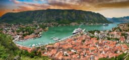
The view that pays for the 1,350 steps: the old town as a triangle at the water’s edge, and whatever is at anchor that morning.
Practical Information
Getting There
The bay is extremely easy to reach, because the town of Kotor sits at its innermost point and most travellers base themselves right on the water.
By air: Tivat Airport (TIV) is directly on the bay, 9 kilometers from Kotor (about 8 km and roughly a 15-minute drive by other measures). Direct flights from many European cities operate seasonally (April-October). Podgorica Airport (TGD), Montenegro's main airport, is about 90 km away — 90 minutes by road from Kotor. Dubrovnik Airport (DBV) in Croatia is approximately 2 hours from Kotor, crossing one border.
By car: From Dubrovnik, the coastal road (E65) takes approximately 2 hours including the border crossing at Debeli Brijeg. From Podgorica, the drive to Kotor is about 90 minutes via the Sozina tunnel (toll EUR 2.50) or 2 hours via the scenic Lovćen road. Once here, the coastal road lets you drive the full loop, and the Kamenari–Lepetane ferry (EUR 4 per car off-season, EUR 5 in season) shortcuts the narrows near Tivat.
By bus: Regular bus services connect Kotor, Herceg Novi, and Tivat with Podgorica, Budva, and Dubrovnik. The Kotor-Dubrovnik bus takes about 2.5 hours (EUR 15 to 20 one way).
By boat: Small boats and water taxis run from Kotor and Perast, and the classic excursion is the short hop to Our Lady of the Rocks (about EUR 5 to 10 return from Perast). Cruise ships also call at Kotor.
Getting Around the Bay
On foot: Within Kotor and along the Dobrota and Perast waterfronts, exploring is best done on foot along the seafront promenades.
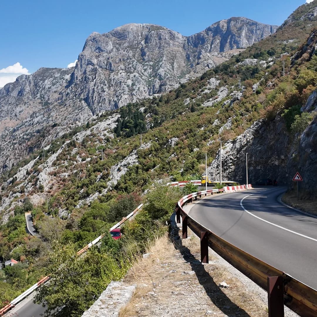
Hairpins like these are narrow and two-way; allow far more time than the distance on the map suggests.
Local buses: Frequent service connects the main towns (Kotor-Herceg Novi approximately every 30 minutes, EUR 3 to 5). Buses are generally reliable but can be crowded in summer.
Rental car: The most flexible option. Roads are generally good but narrow in places. Parking in Kotor's old town area is paid and limited in summer, costing EUR 1 to 2 per hour — arrive early or stay somewhere with private parking. Book cars early for summer.
Water taxi: Small boats connect various points around the bay. Particularly useful for reaching Perast from Kotor without the traffic (approximately EUR 10 to 15 per person, or EUR 50 for a private boat).
Ferry: The Kamenari-Lepetane ferry (see details above) is indispensable if you are driving between the northern and southern shores.
Best Time to Visit
May and June: Ideal conditions. Warm enough for swimming (water 20 to 23 degrees Celsius), flowers blooming, long days, manageable tourist numbers. Arguably the single best month is late May.
July and August: Peak season. Hot (30 to 35 degrees Celsius), crowded, especially when cruise ships dock in Kotor (up to 4 ships per day). Prices highest. But Boka Night in August is worth the crowds.
September and October: Excellent shoulder season. Water still warm (22 to 24 degrees in September), crowds thinning, prices dropping, autumn light beautiful. September may be the best month for photography.
November to March: Many restaurants and hotels in smaller towns close. Kotor and Herceg Novi remain lively year-round. Winter can be rainy but dramatic, with snow on the mountaintops above the bay. Carnival of Kotor in February is a highlight.
In short, May, June and September are the sweet spot — warm, swimmable water, lower prices and far fewer crowds than the July–August peak.
Practical Tips
Bring water shoes — most bathing spots are pebble or rock platforms, so they protect your feet and make getting in easier.
Beat the cruise crowds by exploring Kotor's old town and the walls early in the morning or after 5 pm.
Use the Kamenari–Lepetane ferry to save time when driving in from Tivat airport or the southern coast.
Combine Perast and the islands in one short boat trip — it is the bay's most iconic, photogenic excursion.
Visit in shoulder season (May–June or September) for warm water, lower prices and a more relaxed atmosphere.
September and October: the water still 22 to 24 degrees, the crowds thinning, and the light at its best.
Where to Stay
The most convenient base for the bay is Kotor and its waterfront suburbs of Dobrota, Muo and Stoliv, all directly on the Boka — within walking or short-drive distance of the beaches, the old town and the boat docks. But each town around the bay suits a different kind of trip.
Kotor
Best for: first-time visitors, history lovers, nightlife seekers. Widest selection of restaurants and bars. Can be noisy in summer, especially when cruise ships are in port. Boutique hotels inside the old town walls (EUR 100 to 250 per night) offer the most atmospheric stays.
Perast
Best for: romance, tranquility, photography. Very small (limited restaurant options), but extraordinarily beautiful. Several boutique hotels in restored palazzo buildings (EUR 120 to 300 per night). Quiet after day-trippers leave.
Herceg Novi
Best for: longer stays, beach access, local atmosphere. Better value than Kotor or Perast, with a wider range of dining options and a more lived-in, less touristy feel. Good base for Blue Cave trips and Luštica Peninsula beaches. Apartments from EUR 40 to 80, hotels EUR 70 to 180.
Tivat
Best for: luxury seekers, families, airport convenience. Porto Montenegro offers high-end accommodation (EUR 200 to 500+). The town has a modern, polished feel. Excellent restaurant scene. Best if you want marina vibes and modern amenities.
Risan
Best for: budget travelers, hikers, solitude seekers. The most affordable base in the bay, with a handful of apartments and small hotels from EUR 30 to 60 per night. Very quiet, limited dining options.
Luštica Peninsula
Best for: beach lovers, nature immersion. The Luštica Bay resort offers resort-style accommodation (EUR 150 to 400). Outside the resort, options are limited to private apartment rentals.
Places to Book on the Bay
For a fuller breakdown of neighbourhoods and which area suits your trip, read our guide to where to stay in Kotor, or browse all Kotor accommodation — currently 47 properties across the bay, from budget apartments to waterfront villas and luxury hotels.
Frequently Asked Questions
Is the Bay of Kotor actually a fjord?
No, not in the strict geological sense. Fjords are formed by glacial erosion, while the Bay of Kotor (Boka Kotorska) is a submerged river canyon — a ria — formed by the river system that once flowed here, subsequently flooded as sea levels rose after the last ice age. However, the visual similarity to Scandinavian fjords is striking, and the "southernmost fjord" label has stuck in popular usage. Regardless of classification, it is one of the most dramatic coastal formations in Europe.
Is the Bay of Kotor (Boka Kotorska) worth visiting?
Absolutely. It is a UNESCO World Heritage Site and one of Montenegro's most spectacular landscapes, combining a fjord-like bay, medieval towns and church-topped islands. It is widely regarded as a must-see on any trip to Montenegro.
How many days do I need for the Bay of Kotor?
A minimum of 2 days allows you to see Kotor and Perast with a brief boat tour. Three to 4 days is ideal for exploring all the major towns, taking a boat trip to the Blue Cave, climbing the Kotor fortress, and enjoying waterfront meals without rushing. A full week allows you to discover the quieter settlements like Rose and Stoliv, hike in the mountains above the bay, and truly absorb the pace of life here.
Is the Bay of Kotor free to visit?
Yes, there is no charge to enter the bay or to swim at its public beaches. Small fees apply only to specific attractions, such as Kotor's old town walls and the church on Our Lady of the Rocks.
Is the Bay of Kotor sandy or pebbly?
Mostly pebbly. The bay's beaches are typically small pebble coves or concrete bathing platforms rather than wide sandy beaches, but the water is calm, sheltered and exceptionally clear. Water shoes are worth packing.
Is the Kamenari-Lepetane ferry reliable?
Yes, very. The ferry operates 24 hours a day, 365 days a year, departing every 10 to 15 minutes. The crossing takes just 5 minutes and costs EUR 4 per car off-season and EUR 5 in season. The only caveat is summer weekend afternoons, when queues can build to 30 to 45 minutes. Early morning and evening crossings rarely have any wait at all.
How do you get to the Bay of Kotor?
Fly into Tivat airport, just 15 minutes from Kotor, or Podgorica about 1.5 hours away. From there you can reach the bay by car along the coastal road, by boat from Kotor or Perast, or on foot along the waterfront promenades. Dubrovnik airport in Croatia is a third option, around 2 hours away including the border crossing.
Can I swim in the Bay of Kotor?
Absolutely. Swimming is popular throughout the bay from June through September (and May/October for those who tolerate cooler water). Water temperatures range from 20 degrees Celsius in early June to 26 degrees in August. The cleanest and clearest water is in the outer bay, particularly around Žanjic Beach and the Luštica Peninsula. Inner bay water around Kotor is warm and pleasant but slightly less transparent.
What is the best time to visit the Bay of Kotor?
Late spring and early autumn — May, June and September — offer warm, swimmable water and fewer crowds than the busy July–August peak. Early morning and sunset give the best light for photos.
Are the cruise ship crowds a problem in Kotor?
Cruise tourism has been a growing concern. On peak days in July and August, Kotor can receive up to 4 large cruise ships, disgorging thousands of passengers into the small old town for a few hours. The effect is concentrated between roughly 9:00 AM and 4:00 PM. Strategies for avoiding the crush include visiting the old town early in the morning, late afternoon, or evening (after 5 pm); timing your visit for non-cruise days (check the Kotor port schedule online); or visiting during shoulder season (May, June, September, October) when cruise traffic is lighter.
How do I get from Dubrovnik to the Bay of Kotor?
The most common route is by car or bus along the coastal road (E65), crossing the Montenegro border at Debeli Brijeg. The drive from Dubrovnik to Kotor takes approximately 2 hours, including the border crossing (allow 15 to 30 minutes at the border in summer, sometimes longer). Direct bus service operates several times daily (EUR 15 to 20 one way). Private transfers cost approximately EUR 80 to 120 for up to 4 passengers. There is also a scenic option via the Prevlaka/Oštro border crossing, which avoids the sometimes-congested main crossing point.
Plan your stay on the Bay of Kotor
Ready to wake up to those sheer canyon walls and church-topped islands? Read our guide to where to stay in Kotor, then browse all 47 Kotor properties on montenegro.com to book your perfect base on the Bay of Kotor (Boka Kotorska).
Written by
Pavle Obradović
Pavle Obradović is from Herceg Novi. He was Manager of Montenegro.com, then Director of the Herceg Novi Tourism Organization, and is now Coordinator for Investment and Development Projects at the Municipality of Herceg Novi. He holds a BSc in International Hospitality and Service Management from the Rochester Institute of Technology (RIT).
···
Updated · Originally published
Montenegro Travel Newsletter
Get weekly stories, guides, and insider tips about Montenegro delivered to your inbox.
The drive only closes into a loop at the Verige narrows, where the ferry crosses. Tivat and Herceg Novi sit off the ring and are driven there and back.





.webp&w=256&q=65)