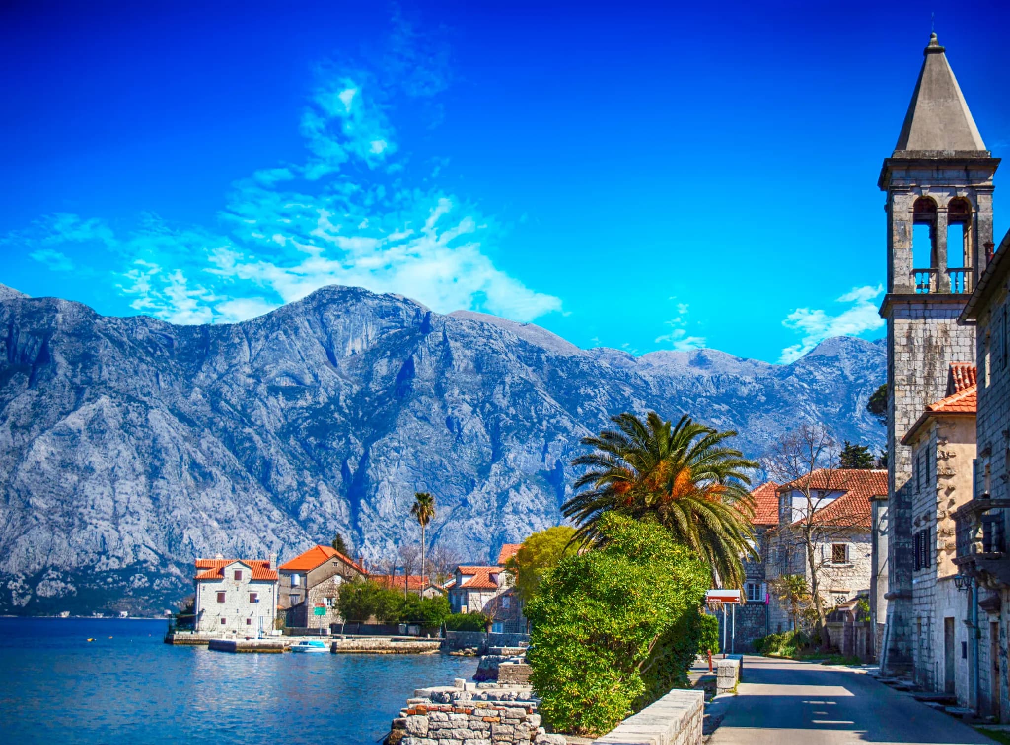
Two villages, one name: the old one up in the chestnut woods, and the captains’ waterfront its people came down to build.
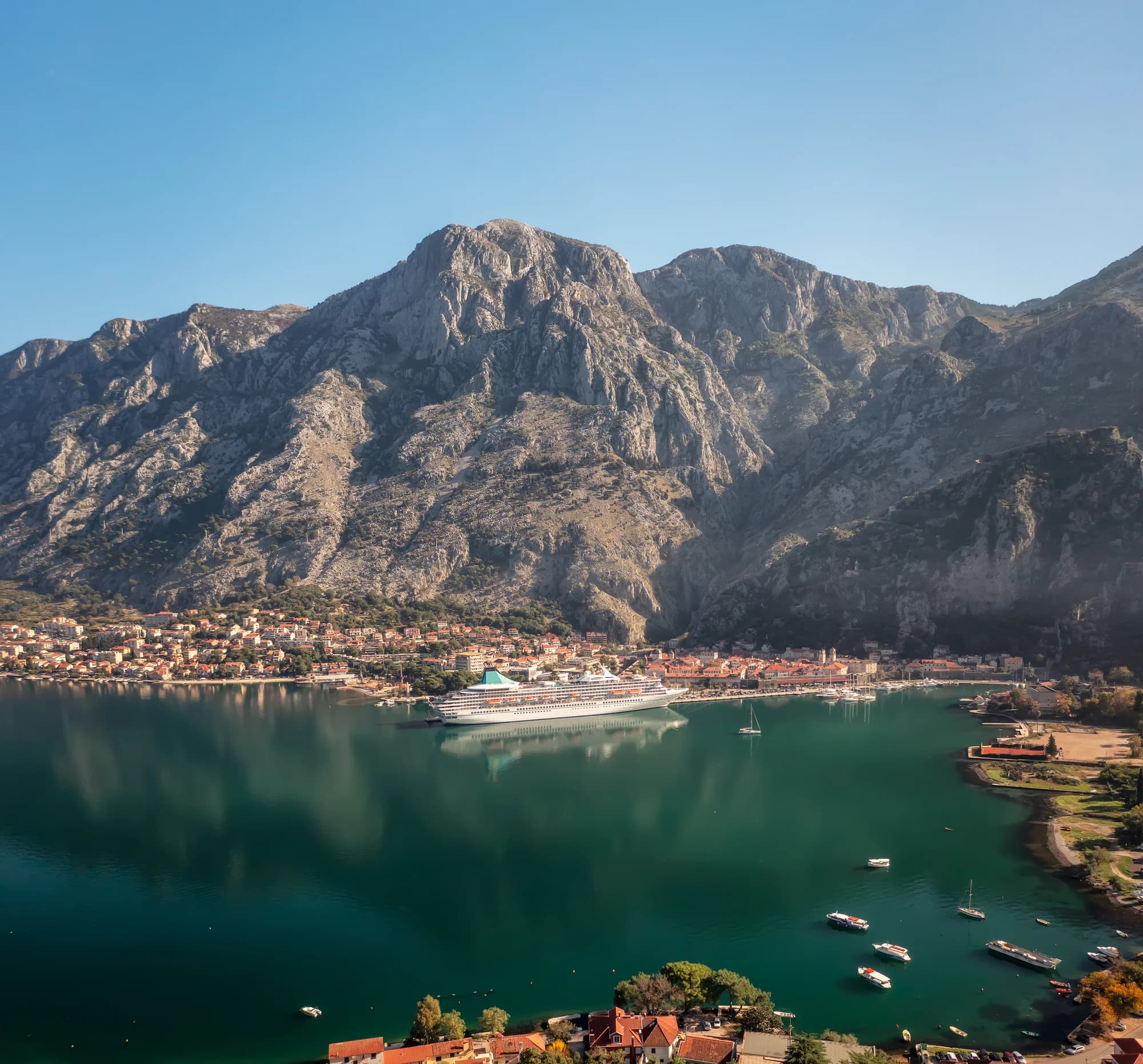
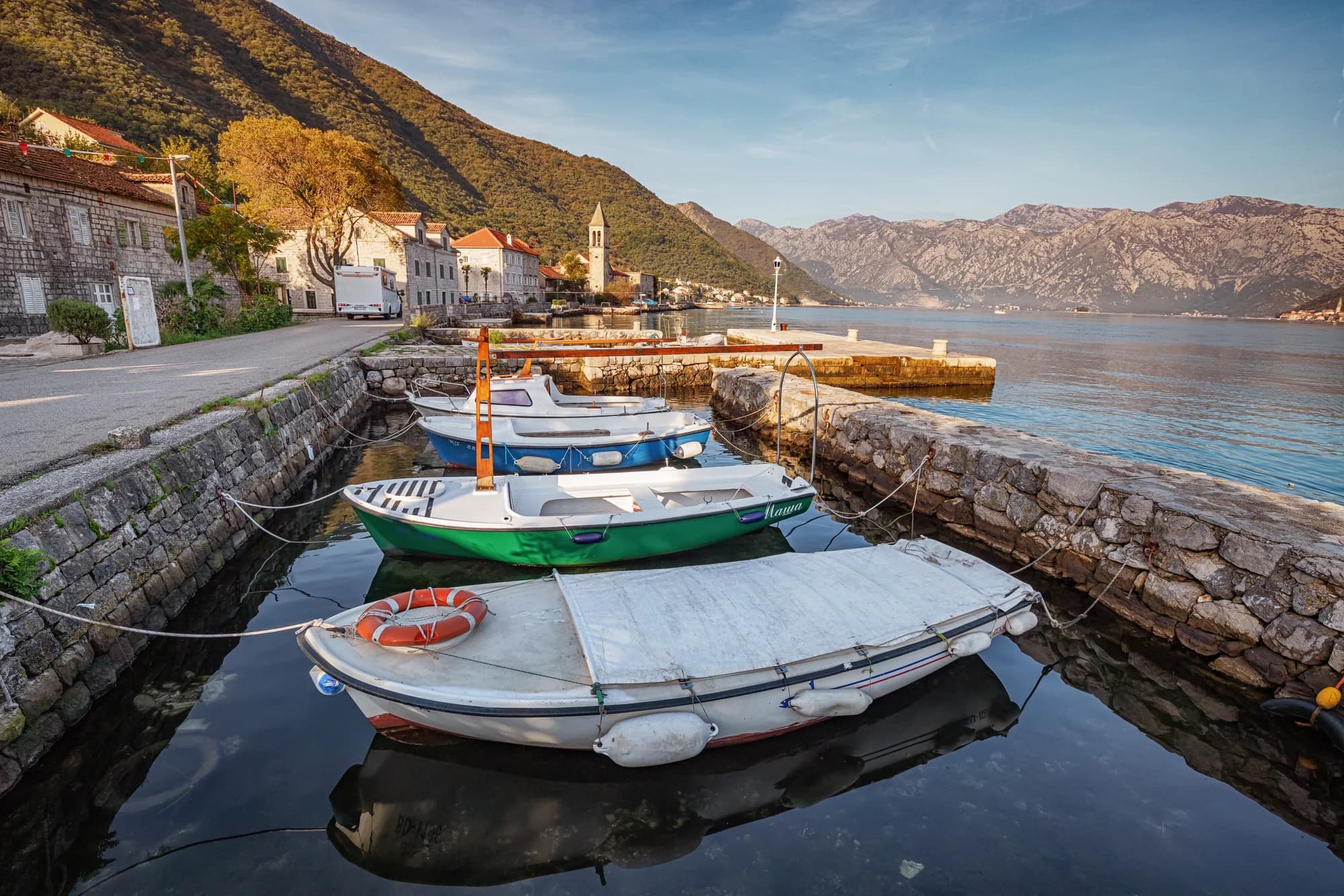
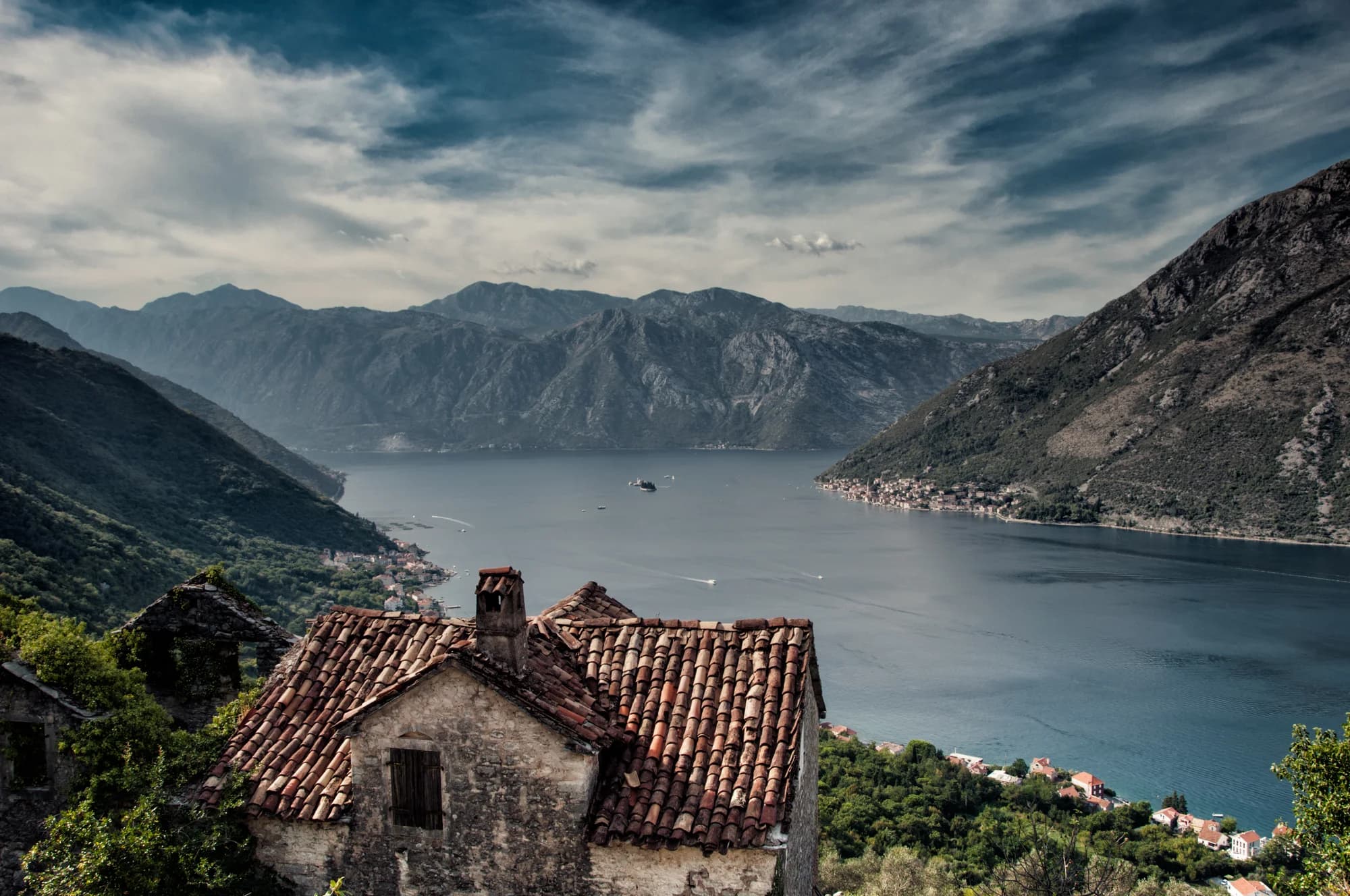
Stoliv is one of the bay's most secluded corners, a small village folded into the slopes beneath the Vrmac ridge on the western shore, looking across the water towards Perast. Its name is said to derive from the words for "one hundred olives", recalling an old local custom by which a young man hoping to marry was expected to plant a hundred olive trees. The village is duly wrapped in ancient olive groves, some trees reputedly over a thousand years old, threaded with Mediterranean greenery, camellias and chestnut woods. Stoliv divides in two: Lower Stoliv (Donji Stoliv) hugs the shore, a quiet line of stone houses and a small church with clear, calm water for swimming straight off the rocks; Upper Stoliv (Gornji Stoliv) clings to the hillside high above. Reaching Upper Stoliv is a reward in itself. From near the waterfront, an old pebbled stairway-path zigzags steeply uphill through olive terraces and chestnut forest, a walk of roughly forty-five minutes to the near-abandoned hamlet at around 240 metres. At the top stands the Church of St Elijah, with a panorama over almost the entire Boka. Stoliv has long associations with the camellia, introduced to the bay in the nineteenth century by a local sea captain returning from Japan, and the flower is celebrated each spring during the month-long Days of Camellia festival across Boka. Stoliv lies between Prčanj and Lastva on the western shore, around fifteen to twenty minutes' drive from Kotor's Old Town and a similar distance from Tivat airport. It suits walkers, nature lovers and anyone seeking genuine peace; there is little in the way of restaurants or shops, so come prepared and settle into the slow rhythm of the olive groves.
A few hours
Twenty minutes buys you the waterfront. The other half of Stoliv is uphill.
One full day
The Donji Stoliv waterfront
Best for apartments in and behind the old stone row — you swim off the quay and drive nowhere
The slope above the road
Best for newer houses stepped up the hillside among the chestnuts, with the bay and Perast below
Prčanj, east along the shore road
Best for more rooms and more kitchens, and the largest church in the Boka
3 accommodations in Stoliv
The shore road, village by village
Residents in 2023, from Kotor’s walls to the end of the road at Stoliv — with Perast, straight across the water
Stoliv is the smallest place on the road. All five settlements along it together come to 2,947 people — barely more than a third of Dobrota, on the opposite shore.
Who stayed
Population change by settlement, 2011 to 2023
Every settlement on this bay lost people. Stoliv lost a seventh; only Kotor’s own settlement, down from 961 to 562, lost more.
Who visits Montenegro
Share of foreign overnight stays, 2025
MONSTAT · 2025
Census population, Stoliv municipality
Down a seventh in twelve years — 348 people in 2011, 298 in 2023 — and that is only the village on the water. MONSTAT withholds the Gornji Stoliv figure as a protected number, which means fewer than ten were counted; local accounts remember 1,200 people up there, with four shops, four bakeries and two oil mills.
Stoliv has been an address in Kotor’s district since 1326 — the commune’s first, then Venice’s for nearly four centuries. Widths are to scale.
Historical Archives of Kotor, via NGO Kamelija Stoliv (Total Montenegro News, 2018); M. Bacci, Balcanica LV (2024) 123–160; Wikipedia (sh) for the 1721 maritime status.
A day on the shore road
Village hours, not resort hours
Meanwhile, in 1451
Mržep, in November 1451 Stefan Kalođurđević — chancellor and Slavic translator in Kotor — raises a small single-nave church from the ground up on the Vrmac shore near Donji Stoliv, dedicated to the Virgin Mary. It is known today as St Basil’s.
The painter — a Serbian inscription along the lower margin names him: Mihailo of Kotor, a pupil of master Jovan of Debar, who painted the walls a little after the building went up. Petka and Nedelja carry Serbian titles; Francis, on the wall opposite, a Latin one.
The argument — Vojislav J. Đurić, writing in 1996, read that mixture as a local reflection of the union of the churches declared at Ferrara-Florence in 1438–39. Michele Bacci, in Balcanica in 2024, reads it instead as one donor’s own strategy for his family’s soul.
Edirne: Mehmed II takes the Ottoman throne the same year. Two years later he takes Constantinople, and every trading calculation in the Adriatic is redrawn.
“The young man of Stoliv had to plant a hundred olive trees to be able to marry.”
Local legend
Romeo Mihović, NGO Kamelija Stoliv
“The first camellia was brought from the Far East by Stoliv seamen, in the early eighteenth century.”
Total Montenegro News, on how the flower arrived
The village has kept a spring feast for it for decades; Radio Kotor put the 2026 edition on 29 March, the year Stoliv marked seven centuries on paper.
Search thousands of hotels and apartments with live prices.
We may earn a commission from partner links. This helps us keep Montenegro.com free for travelers.
Search hotels, apartments and guest houses with live availability.
We may earn a commission from partner links. This helps us keep Montenegro.com free for travelers.

Climb from Donji to Gornji Stoliv through a protected chestnut landscape, read the churches and stone settlement careful

Follow the old waterfront road from Kotor through Muo, Prčanj and Stoliv to the Lepetane ferry, with maritime history, p
Stoliv sits on the western shore of the Bay of Kotor, between Prcanj and the narrows, facing Dobrota across the water. It is about 8 km from Kotor by the shoreline road and is made up of two settlements: Donji Stoliv on the sea and Gornji Stoliv on the slope above.
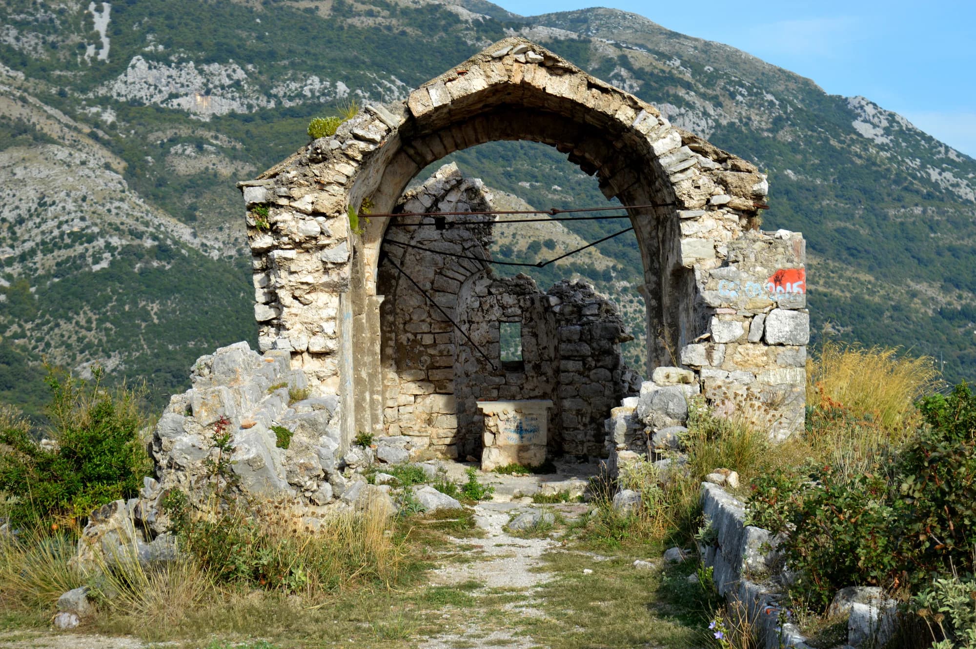
Gornji Stoliv is the original upper village, perched a few hundred metres above the shore and now almost entirely abandoned. Stone houses stand roofless among the chestnuts, with the church of St Elijah at the top — one of the most atmospheric places in the whole bay.
On foot, by an old stone stairway that climbs from Donji Stoliv through the chestnut woods. Allow roughly 40 minutes up and rather less down. The steps are uneven and slippery when wet, so proper shoes matter; there is no road access worth attempting.
Its chestnuts. The slopes above the village hold old sweet-chestnut woods, and the harvest is still marked locally in autumn. Together with the abandoned upper village and the captains' houses along the shore, that is what draws people here rather than beaches.
MarFešta kamelija — the camellia feast, run by NGO Kamelija on the last weekend of March or the first of April — a landing play in which a sailor brings the first flower ashore, and the Camellia Trophy race for wooden boats. In 2026 it fell on Sunday 29 March, 700 years after the village’s first mention.
OctKostanjada — the chestnut feast, run by NGO Kamelija since 2006, at the end of October or the first days of November — around All Saints, the date after which the old village rule let anyone gather chestnuts on anyone’s land. Sweet and salted tastings, and a walk up through the plantation.
The local plate
The woods above Donji Stoliv are not a wood but a plantation, set out under Venice and one of the biggest on the Adriatic coast; the oldest trees are past four hundred years, and Kotor’s archives record herdsmen gathering the fruit here in 1332. At the autumn feast the village cooks them sweet and salted. The rest of October you pick them up yourself on the way uphill.
Where The Kostanjada tasting in the village; the plantation on the stone path to Gornji Stoliv
Stoliv in numbers
"Vinnea de Stalivo", the vineyards of the notary Petar Vitin, in Kotor’s notarial books
Gornji Stoliv, in the chestnut plantation straight above the shore
2023 census, Donji Stoliv; the Gornji Stoliv count is withheld as a protected figure
sacral buildings in Stoliv — St Elijah above, the Name of Mary on the quay, St Basil’s at Mržep
the oldest chestnuts in the plantation; gathering here is on record from 1332
MONSTAT 2023 census · Historical Archives of Kotor, via NGO Kamelija Stoliv
The shape of the bay
Towns at their true positions; the water drawn as a ribbon
Schematic — not a nautical chart.
Best time: May · June · September
| Place | By road | Driving |
|---|---|---|
| Kamenari | 4.8 km | about 13 min |
| Prčanj | 4.9 km | about 9 min |
| Bijela | 7.4 km | about 16 min |
| Muo | 7.4 km | about 15 min |
| Kotor | 18.4 km | about 25 min |
| Budva | 30.6 km | about 39 min |
| Podgorica | 90.3 km | about 1 h 57 min |
Routes marked ⛴ cross on the Kamenari–Lepetane ferry. Road distances routed over OpenStreetMap data, © OpenStreetMap contributors. Driving times are free-flow and take no account of summer traffic or a queue at the ferry ramp.
Small pebble strips and concrete bathing platforms along the waterfront rather than a proper beach. The water is calm, clean bay water and the setting is superb, but anyone wanting sand should look outside the bay.
Yes, for the walk up to Gornji Stoliv above all. It is a half-day out of Kotor that most visitors never make, combining an easy shoreline village with a genuinely striking abandoned settlement in the woods above it.
No — the nearest is Tivat Airport (TIV), 18 km away by road.
From about 13 °C in February to 25 °C in August. It holds above 22 °C from June to September, which is the swimming season. Regional normals from the Herceg Novi station, not a city-precise reading.
4.8 km by road, about 13 min by car. The route crosses on the Kamenari–Lepetane ferry; the times do not include the wait at the ramp.
The UK Foreign, Commonwealth & Development Office (FCDO) has no advisory against travel to Montenegro; it last reviewed its guidance on 13 August 2026. That is their assessment of the country as a whole, not ours and not a judgement about Stoliv, so read it yourself before you travel. The emergency number in Montenegro is 112.
The rare Boka village where the climb, not the quay, is the reason to come.