Exclusively for Montenegro.com, for the first time, the routes of one of the most sparsely populated coastal regions are described – Lower Grbalj. Paradise beaches, forgotten villages, narrow roads and untouched nature.
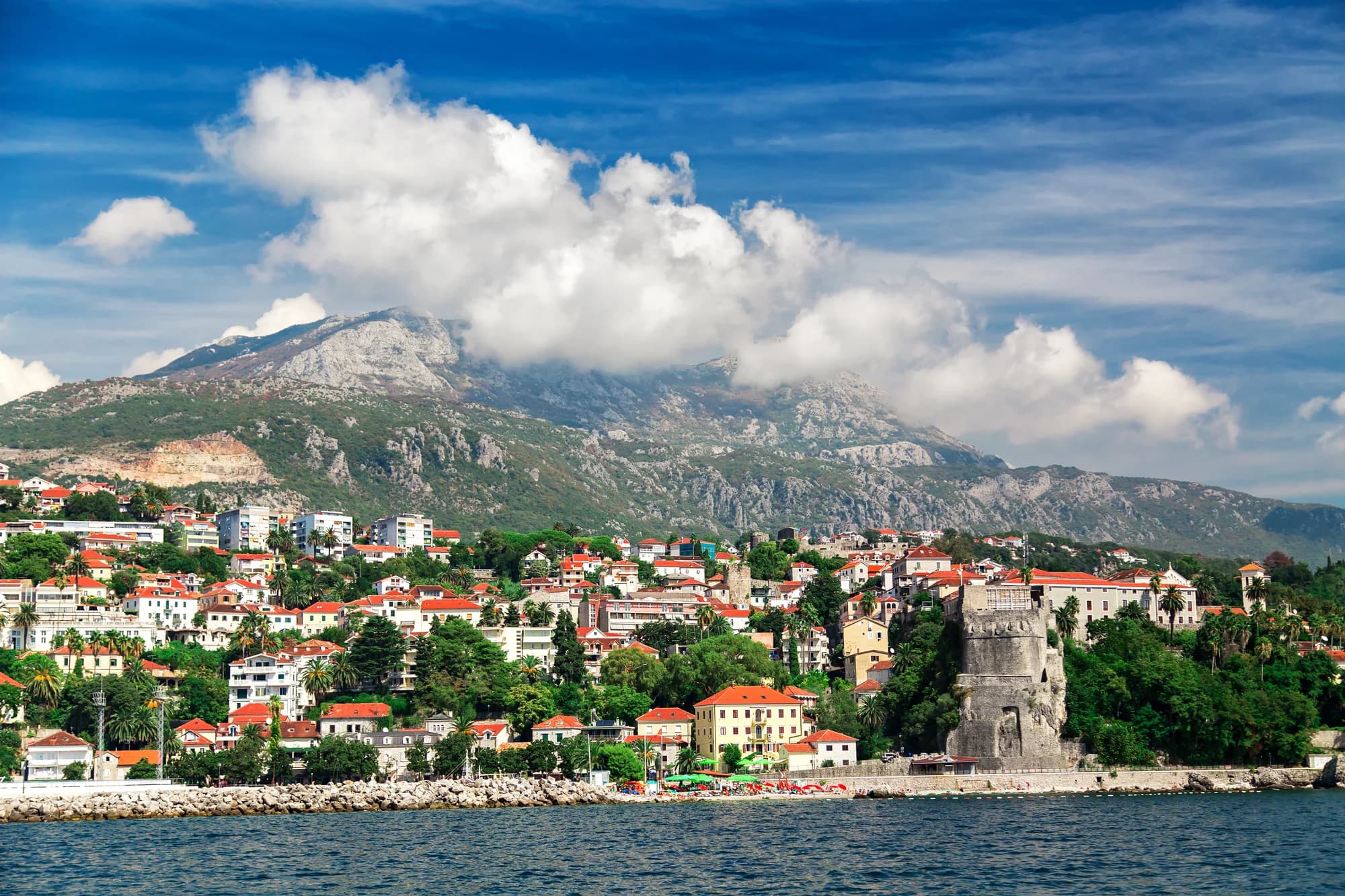
From Kotor to Budva stretches the fertile Grbalj field, once the principal granary – at the same time the largest and most fertile plain of the Bay of Kotor. To the right of the Adriatic Highway (including all hills down to the coast) extends Lower Grbalj, and to the left – from the highway to the foot of the Lovćen massif – Upper Grbalj.
Grbalj has 20 villages. In the past, the Grbalj region was divided into 4 municipalities (with a Statute from 1427). Because of its nourishing significance, Grbalj was a field of contention between Kotor, the Duklja and Zeta rulers, the Nemanjić dynasty, the Turks and the Venetians. Yet it managed to preserve at least partial autonomy. A large part of Grbalj was a metochion of the Prevlaka monastery (an island place where St. Sava founded the first Zeta episcopacy in 1219).
Before visiting all of Lower Grbalj, we bought a map of Grbalj in one of the Kotor bookstores. Not overly detailed, but simply the only one on the market.
Since we're on the subject of maps, the most precise map of the Bay of Kotor (Montenegro) was made by Geokarta, and there are also Intersistem's, Mapina's and some others (not counting military ones), mostly derived from the aforementioned.
And now, no matter how many maps we unfolded before us, we didn't find a single one that was completely accurate. Geokarta's map correctly marks the coastal contours, the positions of cities and settlements, sea depths and mountain peaks, but not all secondary roads. The worst of all maps is precisely the map of Grbalj, Upper and Lower, but its advantage is that it marks, more precisely than others, although not entirely accurately, the majority of the peninsula's roads including some unpaved ones.
Before we set out in a terrain vehicle through Lower Grbalj, we recalled one among truly many sensible sentences by the brilliant Predrag Matvejevic, who in his work 'Mediterranean Breviary' writes precisely about maps: 'Countries that have not granted cartography an official status do not record great maritime enterprises.' That thought momentarily transported us to the Kotor Maritime Museum where Coronelli maps hang on the walls – our favorite old bay maps, patinated, yet still not in execution – our aforementioned sheet... And we came to lament a little, such cartographers as we were and remained: yet in the XXI century we don't have a precise map of the Bay!
Okay, with some sort of maps we set out from Kotor toward the south, because our idea was this: to go to the turn toward (Budva) Jaz beach, and by roads marked on the Grbalj map, to circle a good portion of the peninsula, and then after all our circuit return to Kotor.
From the now well-known Jaz beach (not only for the Rolling Stones and Madonna concerts, but also for its God-given size and beauty), when you turn right, the road continues to Trsteno Cove. Bounded by fierce cliffs, Trsteno Cove welcomes guests with the finest-grained sand, what a marvel! The view of the cove from the road that continues further is simply fascinating. The sea is white-green, and azure blue, deepening with depth. Yet a true geographical marvel is found a few kilometers further – the former military fort Platamuni. Today it is Ploče beach, unique on the entire Montenegrin coast, with monolithic cascades within whose natural cuts pools have been made!
Exactly above Trsteno, the road branches: one way goes through the Luštica (Lower Grbalj) villages of Višnjevo-Glavata-Kubasa, and another through Krimovica to a circular road that encompasses the village of Zagora, and further to Kovač, ending at Kubasa. From Kubasa one can go left down to Glavatičići or straight to Pobrđe. In Pobrđe there is another crossroads: one can go toward Vranović, then either to Biga or to the Adriatic Highway (for Tivat, Kotor, Budva), or from Pobrđe one can go to Radanović (on the highway).
Such is the route if one orients oneself by the Grbalj map. However, Geokarta's map testifies that at the place above Trsteno Cove there are also Kunjići, which we also saw from the terrain vehicle, and further Popović, Maslovari, Čolani, Trešnjica, Ukropci and Lazarevići!
In all these villages, our time does not flow. Rather, time there has stopped, and by everything observed around, the few old inhabitants live in some time of their own, a past time. In houses from that era. Without water even today, only with cisterns. Old households come alive in summer, sons and daughters return, and all theirs, even tourist-Robinsons, but all leave when the summer season ends, when the autumn rains begin. Only those most in love with the old region remain, those old ones, with ever-smaller herds of goats, sheep, and cows. There they truly make good peninsula cheese.
Geokarta's map marks in Lower Grbalj the peaks of Sveti Srđa, Velju Hill at 350 m and Gradište at 425 m, and the mountains Strijekavica, Ptičja Glava, Kosmač, Vučjak and Kupa, the latter right at Cape Platamuni. The quite poor Grbalj map does not mark a single Orthodox church, while Geokarta's marks them: Sveti Nikola on the reef – below Krimovica (one of the smallest churches overall), one in the village of Kunjići (where was the unfortunate husband of the woman from Perast, Jacinta, who for 25 years embroidered the famous Tapestry waiting for her love in vain), one in Zagora, one in Popović, one in Glavata. As for the church of Sveti Andreja, it's not clear who it belongs to, whether to Krimovica or to whom, then there is one in Lazarevići, one in Kubasa, in Kovač, in Pobrđe, in Vranović, and in Lješevići. Along the way we saw many, and supposed that many are also omitted from all maps, there are so many churches in Lower Grbalj!
Be that as it may, from Trsteno Cove we turned to the road to Ploče beach. About Ploče beach one could say that it represents Semiramis's hanging (touristic!) gardens of the Bay of Kotor! The landscape is dominated by stone masses, specifically layered and working together with each other, like slabs. Of course, steps lead from each level to the one closer to the sea, so every access is easy. A restaurant, a garden, and every other civilizational amenity are simply assumed. From Ploče there is a unique view, either of part of the Budva Riviera or of the open sea across which, here and there, intercontinental ships or yachts sail. Like screen-savers!
From there, from Cape Platamuni, guided by the Grbalj map, we turned to the village of Krimovica. The village is dominated by vacation homes. Along the road old houses go unnoticed. Some of the buildings there would look fine even if they were right by the foam. A narrow asphalt road, patches of untilled land and an atmosphere that, by all accounts, even in season cries out for something better.
Behind Krimovica, closer to Zagora, suddenly, a pine grove. We note it as a minor botanical deviation from the general rule by which everywhere around, as far as the eye reaches, the impenetrable Mediterranean maquis reigns. In the pine grove, a pastoral wonder. A small flock of sheep. We parked the terrain vehicle and breathed in the scents of pastoral life. The lambs were skipping, while the stern ram-leader examined our vehicle with his horns. Then he proudly rang his bell and disappeared into the brushwood. We did not notice the shepherd.
Okay, we continued further and, driving between the old boundaries of the village of Zagora, discovered an unmarked (on all maps!), unpaved road that through a double row of vacation homes leads to the coast. There our terrain vehicle proved to be a fortunately chosen vehicle: it was an undertaking from the village of Glavatičići to break out to Žukovica Cove.
To be truthful, from the stories we heard, we lived in the belief that Žukovica Cove would be more picturesque. It is indeed enchanting, and in that it is one of the rare Luštica coastal landing places, it is certainly rare. At one spot there is a crossroads. You can go left, toward clear waters full of waves and a few houses. If the terrain vehicle returns to that crossroads and turns right, a real Chamel Trophy ensues: an exceptionally bad road that climbs steeply. From the rise you can see foaming sea around the nearby Cape Kalafata. The road continues again to the very coast, that is, to a third approach to Žukovica's foam. There is barely room to turn around, though the road continues unexpectedly uphill, but where – none of the available maps tell us...
So we had to return to the village of Glavatičići. Darkness was already beginning to fall. Tiny jackal dogs began to howl from the low maquis forest, thereby testifying to Montenegro's official slogan – Wild beauty.
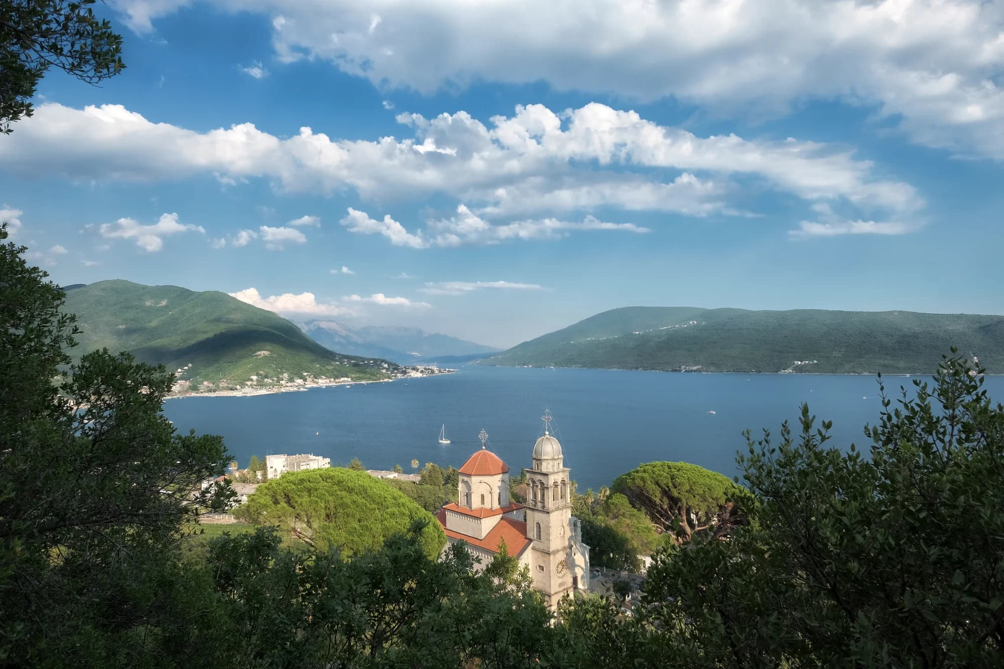
Nevertheless, via local macadam roads, or rather Mediterranean lesser-known paths, we managed to reach the village of Glavatičići and from there continue to Pobrđe. There, at dusk, we were drawn by the light from the church of Sveti Jovan, with as many as three altars: Sveti Petar, Sveti Jovan and Sveti Đorđe.
Through now complete darkness we reached Radanović, and from there it was easy to get to Kotor...
We think we were the first to speak about this route through the paths of Lower Grbalj at all.
We also established that all available maps on our market lag considerably behind reality.
With the attested experience of bay travelers, we can add at the end that Predrag Matvejevic was indeed right when in his masterwork 'Mediterranean Breviary' he wrote precisely about maps thus: 'Countries that have not granted cartography an official status do not record great maritime enterprises.' Hm, that thought again temporarily transported us to the Maritime Museum of the Bay of Kotor. There on the walls, it is true, hang Coronelli maps, our favorite bay maps, old, artistic, patinated, but still not in execution – our aforementioned sheet...
From our travelogue jaunt through Lower Grbalj we bid farewell to any similar tale described in words...