Rožaje, Montenegro's easternmost town on the Ibar River under Prokletije: Ottoman mosques, Hajla trails, the road to Kosovo and Serbia, stays and 2026 tips.
Updated Originally published 29 min readby Pavle Obradović
Overview
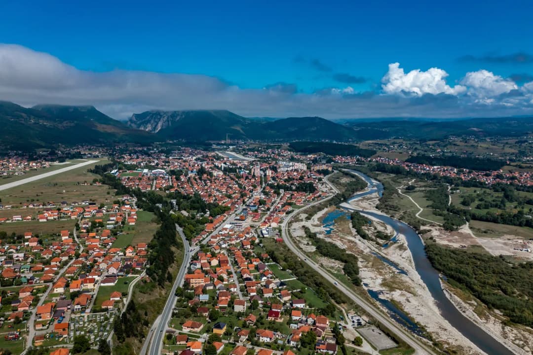
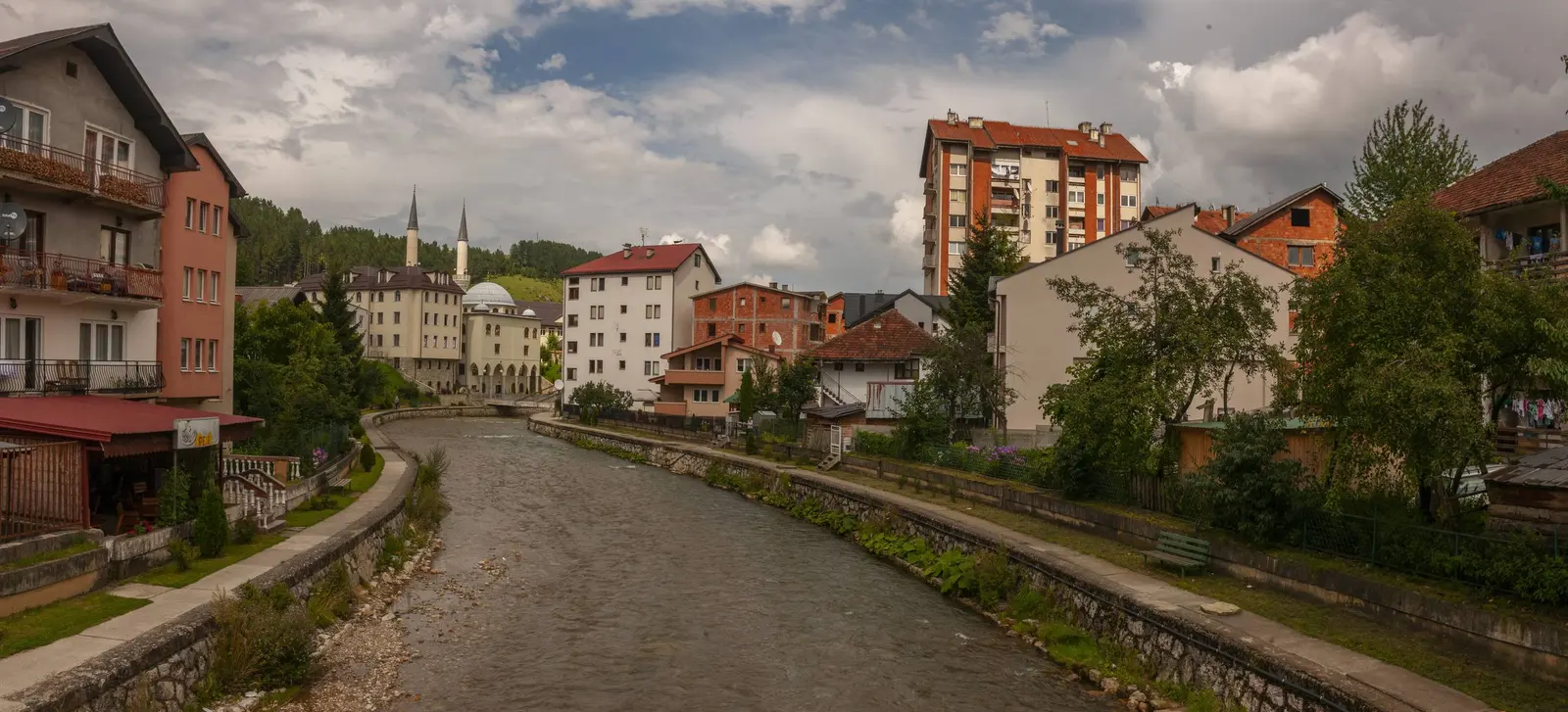
Rožaje is a captivating town located in the northeastern part of Montenegro, nestled in a picturesque valley surrounded by the majestic Prokletije Mountains (also known as the Accursed Mountains). As the easternmost town in Montenegro and the cultural center of the country’s Bosniak community, Rožaje offers visitors a unique blend of Ottoman heritage, Islamic architecture, stunning natural beauty, and authentic Balkan culture that sets it apart from Montenegro’s coastal destinations.
What the sources say
The town sits along the Ibar River, which has its source in the surrounding mountains, and serves as an important crossroads between Montenegro, Serbia, and Kosovo. With 84.66% of its population identifying as Bosniak according to the 2023 census, Rožaje is considered the heart of the Bosniak community in Montenegro and maintains strong cultural connections to the historic Sandžak region.
Top Attractions
Ganića Kula (Heritage Museum)
One of Rožaje’s most iconic landmarks, Ganića Kula is a residential tower located just a two-minute walk from the main square. Built in 1797, this defensive tower represents the traditional kula architecture common in Montenegro, Albania, and Kosovo. A kula was not just a defense against invaders but was particularly useful for protecting families during interfamily blood feuds.
Today, the tower houses a revamped ethnographic museum with a well-presented collection of costumes, crafts, and artifacts that display objects from life, culture, housing, clothing, arts, and crafts of Rožaje in the spirit of Islamic tradition. The tower is the symbol of the town and appears in the official coat of arms of the municipality of Rožaje.
Sultan Murat II Mosque
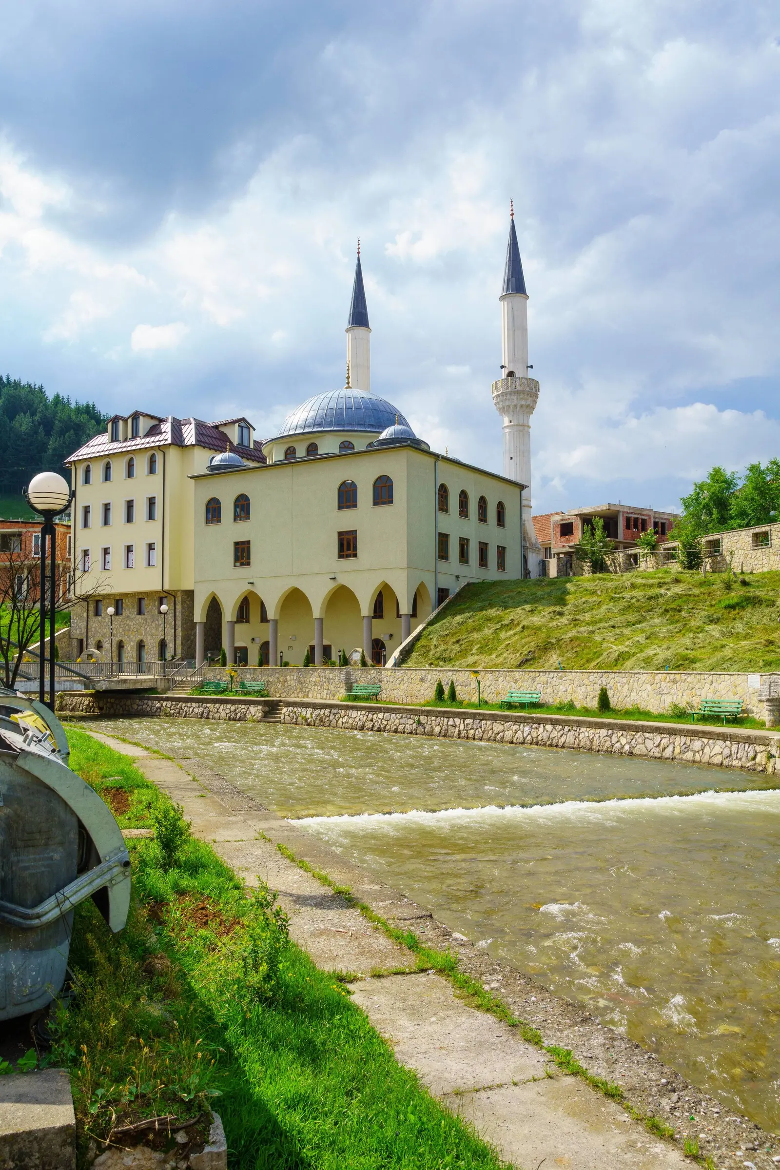
The Sultan Murat II Mosque is the largest mosque in both Rožaje and all of Montenegro, standing as a magnificent example of Ottoman Islamic architectural design. Built by Ottoman Sultan Murat II in 1450 at the same time as the nearby fortress, the mosque was primarily constructed in the style of old houses in Rožaje. It was reconstructed by the Islamic Council in 1967 and underwent a complete rebuild in 2008.
The mosque features multiple domes and twin minarets, with intricate interior decorations. Tiling in geometric patterns completely covers the interior and includes an image of the Kaaba in Mecca above the prayer niche. The mosque also has a turbe (mausoleum), built by order of Hurshid-pasha Bagdadli in 1854 on the tomb of Muhamed Užičanin, a famous Bosniak writer and fighter for justice who was murdered by janissaries in 1750.
This structure serves as the social and spiritual heart of Rožaje, functioning as a central historical and communal landmark that demonstrates the enduring Ottoman legacy in the region.
Stara Čaršija (Old Bazaar)
The Stara Čaršija, or old bazaar/market area, features narrow streets and small family shops where traditional crafts, local produce, and bakeries still operate. This living marketplace offers visitors an excellent spot to taste local burek, grab tea, and soak up authentic town life. The bazaar maintains its traditional character as a center of artisanal production and local commerce, providing a window into the daily rhythms of Rožaje’s community.
Lake Rujište
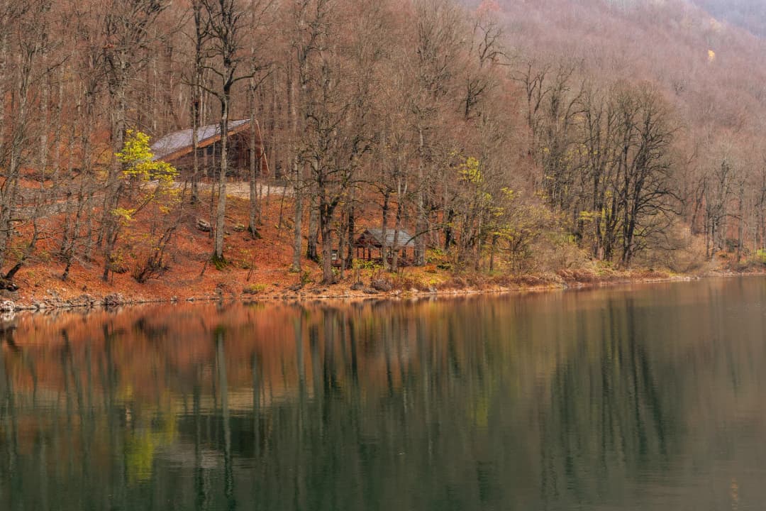
Lake Rujište, located in Biševo, a local center in Rožaje, is one of the most visited natural locations in the area. Next to the lake is an alp called Gospođin Vrh, offering scenic mountain views. The lake provides a peaceful natural retreat surrounded by the stunning mountain landscape of the Prokletije range.
Nature and Outdoor Activities
Hajla Mountain
Standing at 2,403 meters, Hajla is not just a single peak but a 10-kilometer-long massif with several connected peaks, all higher than 2,000 meters. The summit stands on the border between Montenegro and Kosovo, offering panoramic 360-degree views across both countries.
Hiking Details: - Distance: Approximately 14-21 km depending on route - Duration: 4-8 hours including breaks - Elevation gain: Around +603m from typical starting points - Difficulty: Moderate, suitable for reasonably fit individuals - Best season: June to October
The main trailhead for climbs to Hajla is the town of Rožaje in Montenegro, situated north of the mountain. The hike traverses alpine meadows, springs, and rocky ridges, with untouched natural beauty throughout. The geological composition varies between limestone and volcanic silicates, creating a jagged relief and variety of formations that make Hajla one of the most beautiful mountains in Montenegro.
From the summit, hikers can gaze upon numerous mountaintops and urban areas across the region, experiencing the peaceful beauty of the border country.
Prokletije (Accursed) Mountains
The Prokletije Mountains, also known as the Albanian Alps or Accursed Mountains, form the southernmost subrange of the 1,000-kilometer-long Dinaric Alps. The range extends from northern Albania through western Kosovo to northeastern Montenegro, with the Montenegrin municipalities of Plav, Gusinje, Andrijevica, Berane, and Rožaje all located within this spectacular mountain region.
The Montenegrin part of the mountain range was declared Prokletije National Park in 2009, comprising an area of 16,000 hectares. The range includes Zla Kolata at 2,534 meters, the tallest mountain in Montenegro, and offers breathtaking views and excellent hiking opportunities. Whether you are a beginner or an experienced hiker, you can explore numerous trails that lead to hidden waterfalls, crystal-clear lakes, and panoramic viewpoints.
Ibar River
The Ibar River originates from six springs on Hajla mountain in eastern Montenegro. More specifically, the river begins on the wild northern part of Hajla Mountain (2,400 meters), close to the town of Rožaje and the border with Serbia. The picturesque Ibar river source (Vrelo Ibra) is situated in deep forests of northern Hajla Mountain’s slopes, below the Maja Dramadol peak (2,120 meters).
The town of Rožaje is divided in half by and contains the source of the river Ibar. After emerging from its spring, the Ibar River flows for 30 kilometers through Montenegro via truly scenic gorges before entering Serbia. The river is exceptionally advantageous for fishing, boating, and kayaking, providing excellent opportunities for water-based recreation.
Winter Sports and Skiing
Rožaje has emerged as an important destination for winter tourism in Montenegro, with optimal conditions for winter sports development at altitudes of 1,200-1,600 meters above sea level. The area receives snow for 120 days a year, most of which are sunny.
Hajla (Turjak) Ski Resort: The main ski resort near Rožaje is the Hajla ski resort, formerly also known as Turjak, located just 4 kilometers from Rožaje on the highway towards Berane. The winter sports area is situated between elevations of 1,158 and 1,385 meters.
Facilities include: - 1.2 km of slopes for skiing and snowboarding - 2 ski lifts - 2 ski schools: “Rožaje Ski School” and “Turjak Ski School” with leading skiing instructors holding international licenses - Snowshoe rentals available at the Tourism Organisation of Rožaje
The Government of Montenegro has approved funds for the revival of winter tourism in Rožaje, with the newly established company Hajla Rožaje ski centre and the Municipality of Rožaje managing the facilities. The ski trail on Turjak 2 is fully cultivated and ready for winter sports enthusiasts, positioning Rožaje as a regional hub for winter tourism and ski sports.
Culture and Heritage
Bosniak Identity and Sandžak Connections
What the sources say
Rožaje serves as the cultural center of the Bosniaks in Montenegro, with the 2023 census showing that 84.66% of the population identifies as Bosniak, making it the municipality with the highest concentration of Bosniaks in the country. The town is predominantly Muslim, with 96.52% of the population adhering to Sunni Islam, and historically, Islam has played a significant role in shaping the cultural and social fabric of the community.
Rožaje is one of seven municipalities in Montenegro that comprise the historic Sandžak region, a historical and geo-political area in the Balkans located in the southwestern part of Serbia and the eastern part of Montenegro. This region is inhabited by a majority of ethnic Bosniaks and maintains distinct cultural traditions.
Traditional Sandžak Muslim style is evident in celebrations like weddings, where brides wear dresses decorated with golden ducats, wedding protocols are elaborate, and festivities feature traditional Bosniak folk music with firearms discharged into the air as part of the celebration.
Ottoman Heritage and Islamic Architecture
Rožaje’s cultural heritage prominently reflects its Ottoman-era legacy, featuring Islamic architecture throughout the town. Beyond the Sultan Murat II Mosque, the Central Mosque also features striking Ottoman-style architecture and serves as an important social and spiritual center. The town’s layout, with its traditional bazaar and residential patterns, echoes the urban planning principles of Ottoman cities.
The preservation of this architectural heritage, combined with living traditions, makes Rožaje a unique destination for understanding the Ottoman influence on Montenegrin culture and the continuity of Islamic traditions in the Balkans.
Traditional Cuisine
Rožaje’s culinary traditions reflect the broader Balkan and Bosnian food culture, with influences from Ottoman, Austro-Hungarian, and Slavic cuisines. The town offers authentic experiences of traditional dishes that have been prepared the same way for generations.
Ćevapi
Ćevapi (or ćevapčići) are grilled minced meat rolls that are considered a national dish of Bosnia and Herzegovina and are widely beloved throughout the Balkans. These savory sausages are usually made from a mixture of beef and lamb, seasoned with garlic, salt, and pepper. They are traditionally served in groups of five to ten pieces on a plate or in flatbread (lepinja or somun), often accompanied by chopped onions, kajmak (clotted cream), ajvar (roasted red pepper spread), and salt.
One of the defining features of Balkan cuisine is its use of grilled and roasted meats, which take center stage in dishes like ćevapi.
Burek
Burek is a family of pastries or pies made throughout the Middle East and the Balkans, consisting of thin flaky filo pastry with various fillings such as meat, cheese, spinach, or potatoes. Burek spread from southern Serbia to Bosnia in the 16th century and later, after Yugoslavia was formed, throughout the rest of the northern Balkan peninsula.
In Rožaje’s old bazaar, traditional bakeries still prepare burek fresh throughout the day, offering both locals and visitors an authentic taste of this beloved pastry. The meat-filled version (burek sa mesom) is particularly popular, though cheese burek (burek sa sirom) is also widely enjoyed.
Other Traditional Dishes
The cuisine of Rožaje also includes other Balkan specialties such as: - Pita (layered pastries with various fillings) - Klepe (Bosnian dumplings) - Bosanski lonac (Bosnian pot - a meat and vegetable stew) - Baklava and other sweet pastries influenced by Ottoman dessert traditions - Turkish coffee and traditional teas
Practical Information
Best Time to Visit
The best time to visit Rožaje is from April to October for general sightseeing and hiking. For mountain hiking in the Prokletije and Hajla ranges, June to the end of October offers the most favorable conditions. Winter sports enthusiasts should visit from December through March when snow conditions are optimal at the ski resort.
Getting There and Transportation
By Air: The nearest major airport is Podgorica International Airport (TGD), situated approximately 180 kilometers (57 miles) from Rožaje. The airport has regular flights to major European destinations throughout the year.
By Road: - From Podgorica: Take the IB-22 Highway (Ibarska magistrala), the main regional road connecting Montenegro with Serbia. The Lokve tunnel is considered the gateway to Rožaje municipality when arriving from Podgorica. - From Kosovo: The only way to cross the border from Kosovo is by driving through the P8 road. The Kula border crossing connects Peja with Rožaje. - From Serbia: The E65 highway, built alongside the Ibar river, leads through the villages of Besnik and Bač to the Dračenovac border crossing in Montenegro.
By Bus: You can take a bus from anywhere in Kosovo, Novi Pazar in Serbia, or Podgorica to reach Rožaje. The town has bus stations with regular connections to major cities in Montenegro and neighboring countries.
Local Transportation: Because Rožaje is a small town, the majority of attractions and services are within walking distance. For trips to surrounding mountains and ski areas, local taxis and organized tours are available.
Accommodation
Rožaje offers a range of accommodation options, from budget-friendly hotels to cozy guesthouses:
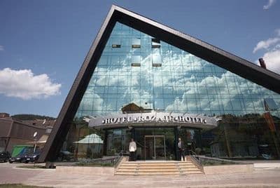
Hotel Rožaje: Located in the center of town, this main hotel comprises 8 one-bed rooms, 22 two-bed rooms, 1 three-bed room, and 2 luxurious apartments. The rooms offer air conditioning, WiFi, and guests can enjoy an on-site pool.
JELA NATURAL RESORT: Situated in Rožaje, this property offers a garden, bar, and mountain and garden views, providing a more nature-focused accommodation experience.
Budget Tips: To save money, consider visiting during off-peak months. Sundays are typically the cheapest days for accommodation. Daily budgets for travelers generally range between €15 and €30, as Rožaje’s main draw is its natural surroundings rather than paid attractions.
Nearby Attractions
For visitors with extra time, several outstanding attractions are located within reasonable driving distance:
Biogradska Gora National Park (near Kolašin): One of Montenegro’s most beautiful national parks, featuring a virgin forest with trees over 500 years old and pristine Biogradsko Lake. Located less than 20 km from Mojkovac and Kolašin.
Lake Plav: A stunning glacial lake in the Prokletije Mountains.
Morača Monastery (near Kolašin): A medieval Serbian Orthodox monastery with important frescoes and religious art.
Border Crossing Information
Rožaje serves as an important transit point for travelers moving between Montenegro, Kosovo, and Serbia. The Kulla (Kosovo)/Rožaje (Montenegro) border crossing is the primary international crossing point for the region. The town is located high in the mountains as the last stop before entering Kosovo from Montenegro, making it a convenient base for cross-border exploration.
Why Visit Rožaje
Rožaje offers travelers a completely different perspective on Montenegro, far removed from the crowded beaches of the Adriatic coast. This easternmost town provides:
Authentic Cultural Experience: As the center of Bosniak culture in Montenegro, Rožaje offers genuine insights into Islamic traditions, Ottoman heritage, and Sandžak culture.
Unspoiled Mountain Beauty: The Prokletije Mountains and Hajla massif provide spectacular scenery and outdoor adventures without the crowds found in more famous mountain destinations.
Off-the-Beaten-Path Adventure: With relatively few international tourists, Rožaje maintains an authentic atmosphere where traditional life continues largely unchanged.
Winter Sports: Growing infrastructure for skiing and snowshoeing offers winter recreation opportunities in a less commercialized setting than larger resorts.
Gateway to Multiple Countries: The strategic location makes Rožaje an excellent base for exploring the border regions of Montenegro, Kosovo, and Serbia.
Affordable Travel: With daily budgets between €15-30, Rožaje offers excellent value for budget-conscious travelers.
Living History: From the 1797 Ganića Kula to the Ottoman mosques and traditional bazaar, the town’s history is not just preserved but actively lived.
Whether you’re seeking mountain adventures, cultural immersion, winter sports, or simply a unique perspective on the Balkans, Rožaje rewards visitors with authentic experiences and warm hospitality in one of Montenegro’s most distinctive communities.
Practical Rožaje planning snapshot
Rožaje trip decisions for 2026
Decision
Official or current baseline
What to confirm
Town scale
23,184 residents in the municipality, 2023 census
Do not treat this as the urban-settlement count
Serbia corridor
Dračenovac–Špiljani; official camera at Dračenovac
Coverage, location detail and realistic response time
The distinction between town and municipality matters. MONSTAT’s final census
counted 23,184 people in Rožaje municipality, not inside the
compact town alone. Its housing release counted 7,519 permanent-housing
dwellings: 6,180 occupied and 1,339 temporarily vacant or abandoned. Those
figures describe a municipality of town, villages and dispersed housing; they
do not prove hotel capacity or visitor demand. See the
final population release
and
dwelling tables.
Read Rožaje as three connected layers
The first layer is the town on the Ibar: shops, food, accommodation and local
institutions. The second is the mountain edge, where road access gives way to
weather-dependent outdoor travel. The third is the border geography, which can
turn Rožaje from a destination into a transit stop. A sound itinerary decides
which layer matters before booking a night.
Ganića Kula belongs to the town layer. The Municipality of Rožaje describes
the institution as a public local museum charged with researching, protecting
and presenting the area’s cultural heritage. A 2026 municipal notice for a 3D
museum and Izlit archaeological-site exhibition shows active programming.
Neither page supplies dependable daily visitor hours, so contact the museum
rather than assuming that an institutional page means an unlocked door. The
municipal listing gives telephone +382 51 272 050; recheck
the number before travel.
Rožaje’s religious and cultural life deserves ordinary respect. Dress with
context in mind around active places of worship, ask before photographing
people, and do not turn prayer time into a sightseeing interruption. A museum
object, market product or architectural detail can be described without making
broad claims about an entire community.
Choose the purpose before the route
Purpose
What it involves
Town
services · museum
Mountain
Hajla · guide · weather
Border geography
Serbia and Kosovo are different corridors
Source: rozaje.me, montenegro.travel
A border checklist that survives changing rules
Start with the traveller: passport nationality, residence permit if relevant,
minors’ documentation and visa rules for both exit and entry. Then check the
vehicle: registration, written authorization if the driver is not the owner,
rental-company permission to cross each frontier, and insurance valid in the
destination. Ask whether a digital document is accepted or an original is
required. Keep the answer from the issuing company, not an anonymous forum.
On departure day, review the official crossing list, government or police
notices, weather and the Dračenovac camera where relevant. A camera is only a
visual clue. It cannot show an unseen queue, explain why traffic is stopped or
confirm that border processing is open to you. In August 2026, a temporary
road closure on the Serbia side led police to divert traffic through
Vuča–Godovo. That event has passed, but it demonstrates why yesterday’s route
plan is not today’s road condition.
Verify in this order — unresolved? Do not improvise at the frontier.
official name · current access · hours · processing limits
4
Road
notices · camera · weather · fuel · daylight
Source: gov.me
Hajla: mountain first, product second
Hajla is a local mountain destination, and Montenegro’s tourism organization
lists a Hajla ski centre roughly eight kilometres from Rožaje. Before setting
out, confirm the current lift calendar, tariff, daily snow report, equipment,
marked-run and staffing status with a local operator or tourism office.
For a walk or ascent, obtain route-specific information from a local tourism
office, registered guide or mountaineering organization. Ask about the actual
trailhead, vehicle access, total ascent, snow patches, navigation difficulty,
water, mobile coverage, hunting or forestry activity, hut access and
turnaround time. Save an offline map, but do not confuse a downloaded line
with a maintained trail. In cloud or forest, a path can disappear faster than
expected.
The National Tourism Organisation’s mountain-safety guidance recommends
suitable equipment, checking conditions and using guides for unfamiliar
terrain. Set a turnaround time, share the exact plan, carry layers and water,
and retreat before weather removes the simple route home. For a wider
comparison of how northern mountain destinations function across seasons, read
the
four-season mountain-stay guide.
Destination name ≠ operating product — depart only when all three agree
Step
What to confirm
1. Tourism page
Hajla belongs on the map
2. Local contact
what operates today?
3. Route check
guide · snow · weather
Source: montenegro.travel
Winter changes both roads and mountains
Rožaje’s elevation and exposed approaches mean that a dry town street does not
establish conditions at Kula or a Hajla trailhead. Check precipitation, wind,
temperature and recent snow at the relevant elevation, not only the town
forecast. Carry equipment required by law and suited to conditions; verify
current tyre and chain rules from official sources rather than copying a date
from an old blog.
Fuel before committing to a high road, keep the windscreen fluid winter-rated,
clear all glass and lights, and preserve daylight for the return. If a
crossing, trailhead or accommodation depends on a minor road, ask the property
or local contact whether the final segment is cleared. The broader
Montenegro winter roads and mountain-safety guide
explains the national pattern, while the
month-by-month weather guide
helps set seasonal expectations.
A clear town is not a clear high road
Gate
Check
Elevation
town ≠ pass ≠ peak
Road
official notice · local call
Vehicle
tyres · chains · fuel
Time
daylight + turnaround
All four acceptable?
Only then continue beyond town
No: use the town fallback
museum contact · meal · daylight walk
Source: montenegro.travel
One night or two?
One night works for a transit-oriented visit. Arrive with
daylight, park, walk the compact centre, confirm Ganića Kula access, eat
locally and complete the next day’s border or mountain checks. Leave only
after conditions and documents are resolved. Do not promise yourself both
Hajla and an international crossing before lunch.
Two nights create a weather buffer. Use the first afternoon
for town orientation and confirmation calls. Reserve the full middle day for
either a guided Hajla outing or a lower-risk local day. Keep the final morning
for onward travel. If Hajla fails, the spare day can become a north-Montenegro
road trip toward Berane, Plav or Bijelo Polje without framing the change as a
ruined holiday.
For a westward cultural continuation, the
Bijelo Polje cultural walk
is a grounded alternative. For a different mountain-and-water base farther
south, compare the
Lake Plav and Ali Pasha Springs guide. These are distinct destinations, not quick add-ons to an already full
Rožaje day.
Buy flexibility, not a packed checklist
Stay
Plan
Best for
One night
Arrival · town orientation; Museum access check; Dinner · documents · weather; Morning: one onward objective
Best for transit
Two nights
Arrival · confirm services; Full day: Hajla if conditions allow; Fallback: town or regional route; Final morning: onward travel
Best for a mountain attempt
Source: rozaje.me, montenegro.travel
Accommodation and registration
Ask a property for its exact map pin, parking arrangement, winter access and
check-in deadline. “Near Hajla” can mean a very different road from central
Rožaje. If you will arrive after a border crossing, do not rely on an exact
time from a routing app. Explain the corridor and keep the host updated.
Ask the host whether visitor registration or tourist tax applies to your stay,
who handles it and what record you will receive. The
Montenegro tourist-registration guide
explains the national process and what to ask.
Mountain incident plan
Save 112, Montenegro’s emergency number, but build the plan
around prevention. Tell a reliable person the route, party, vehicle,
trailhead, intended turnaround and overdue time. Carry enough battery, an
offline map, water, food, insulation, light and basic first aid for the chosen
outing. A satellite communicator can add resilience where mobile coverage is
uncertain, but only if the party knows how to use it.
If lost, injured or overtaken by conditions, stop the situation getting worse.
Give 112 your last known location, coordinates if reliable, route name, party
condition, clothing and remaining battery. Do not keep moving solely to chase
a signal unless the emergency service directs it or staying creates a greater
danger. Rescue is not an on-demand taxi and response time in forest, snow or
darkness cannot be promised.
112 needs usable information
Question
Details to give
Where?
coordinates · last landmark
Who?
party size · injury · condition
What route?
trailhead · direction · time
What remains?
shelter · battery · food
Source: gov.me, montenegro.travel
Why Rožaje feels different
The town sits far from the Adriatic imagery that dominates travel advertising. Wooded slopes close around the valley, winter arrives decisively, and road connections orient daily life toward northeastern Montenegro and neighbouring Serbia and Kosovo. The National Tourism Organisation describes Rožaje as a mountain town crossed by the Ibar and surrounded by rich plant life on Hajla.
Its cultural landscape is equally important. Mosques, churches, tower houses and a characteristic Rožaje house type reflect different periods and communities. Contemporary institutions—museum, library, cultural centre and tourism organisation—keep heritage active rather than frozen. Visitors should avoid treating the town as an “exotic” contrast to the coast; it is a modern municipal centre with its own rhythms, worship and working streets.
For a wider northern route, combine the town with our Berane guide and Bijelo Polje guide. The distances on a map may look modest, but winter conditions and road works can dominate the day.
Rožaje, upper Ibar valley — orientation
Direction
Reference point
West
Berane
East
Serbia
South
Hajla
Source: montenegro.travel, gov.me
Start at Ganića Kula
The municipal Ganića Kula institution describes itself as a complex local museum responsible for researching, collecting, protecting and presenting the movable heritage of Rožaje. An earlier institutional report organized its work across weapons, numismatics, ethnology and literacy. That breadth makes it the best place to begin: objects can replace vague origin stories with material evidence.
The building also represents the region’s tower-house tradition. Municipal planning documents identify the dinaric-oriental tower type through features such as a hipped roof, façade structure and projecting upper elements. Look at how defensibility, household life, storage and status shared one vertical form. Then compare it with ordinary historic houses rather than imagining every family lived in a tower.
The museum’s current municipal page publishes an address and telephone but not dependable daily visitor hours. Call ahead, especially outside a announced exhibition. A 2026 municipal project created a 3D presentation focusing on Ganića Kula and the Izlit archaeological site; digital interpretation is useful context, but it does not guarantee the physical museum is open when you arrive.
Mosques, churches and careful chronology
Rožaje’s municipal culture page lists important religious sites, including the Kurtagića mosque, Kučanska mosque, Ružica church and the church on Gospođin Vrh. These names show a layered landscape, but one published attribution creates a chronological problem: it links a mosque dated 1697 to Sultan Murat II, who belonged to a much earlier century. This guide does not repeat that combination as settled fact.
Use official local interpretation, inscriptions and specialist guidance at each site. Buildings may have been rebuilt, renamed or associated with patrons through tradition. A date attached to the present structure may not date the first sacred use of the location. Responsible history makes uncertainty visible.
These remain places of worship. Dress modestly, remove shoes where requested, silence devices and avoid entry during prayer or a service unless invited. Ask before photographing people or interiors. Donations should go through the community’s normal channel rather than being placed on objects.
Rožaje’s mosques are active community spaces; published names and dates should be checked against careful local interpretation.
Izlit and what archaeology can actually say
The old article made a broad claim about an Illyrian settlement on Brezovica hill. The available municipal evidence is not strong enough to turn that label into a visitor certainty. A better documented current story is Izlit, a fortification near town where the municipality reported renewed archaeological research and conservation work.
Izlit demonstrates why excavation matters. Walls alone rarely reveal a secure date or function. Archaeologists need stratigraphy, finds, building relationships and conservation records. The municipality’s 2026 3D exhibition presented Izlit with Ganića Kula, helping people explore heritage digitally. That does not imply unrestricted access to an active or conserved site.
Before walking there, ask the museum whether visitation is permitted and which approach avoids work areas or private land. Do not remove pottery, metal, stone or plant material. Record an object in place and report it to the museum; moving it destroys context.
Heritage work sequence at Izlit
Stage
Activity
1
Research
2
Conserve
3
Document
4
Interpret
Source: rozaje.me
The Ibar and forest environment
The Ibar begins in the mountain system above Rožaje and organizes the town’s valley. Follow it as landscape, not as a promise of safe swimming or drinking water. Mountain rivers respond quickly to snowmelt and heavy rain; water quality, flow and access can vary. Never enter a gorge or bank area because an old photograph makes it appear calm.
Forests support mushrooms, berries and medicinal plants celebrated in local tourism. Identification errors can be dangerous, and collection can be regulated or ecologically damaging. Join a qualified local activity rather than foraging from an article. Carry out waste and avoid lighting fires, particularly in dry or windy periods.
The Ibar is a dynamic mountain river; bank and water conditions require on-site judgment.
Practical plan for one or two days
Rožaje itinerary framework; confirm all institutional and mountain access locally.
Time
Focus
Verification needed
Morning, day 1
Ganića Kula and town heritage walk
Museum opening; worship schedules
Afternoon, day 1
Ibar corridor and local food
Public access; current menus and prices
Day 2, fair weather
Guided Hajla or Štedim outing
Guide, route, weather, snow and transport
Day 2, poor weather
Culture centre, museum or regional drive
Hours and winter road status
A one-day visit should prioritize town culture rather than force a summit. With two days, reserve the mountain day only after local confirmation. If your wider journey continues toward Plav and Gusinje, our Plav Lake and Ali Pasha Springs guide helps plan the next landscape without assuming a fast connection.
Planning priorities in Rožaje
Priority
What it covers
Verify locally
hours + conditions
Town day
culture + Ibar
Mountain day
guide + equipment
Keep margin
roads + daylight
Source: rozaje.me, gov.me
Food and community etiquette
Rožaje’s food culture reflects mountain pastoral life and regional exchange. Ask what is made locally, check the price before ordering where no menu is displayed, and treat hospitality as a relationship rather than a performance. During Ramadan or religious holidays, opening patterns and the rhythm of meals may differ; follow local cues and current business information.
English may not be universal. Learning simple greetings, carrying cash as backup and asking before photographing craftspeople or markets makes interaction easier. Buy directly where provenance is explained, but do not assume every “traditional” item was made in the municipality.
History
Ancient and Medieval Period
The area of Rožaje was first settled in antiquity by the Illyrians, and later during the Slavic migrations, Slavs established communities in the region. The settlement’s strategic location made it an important crossroads throughout history.
Ottoman Era
During the Ottoman Empire’s rule of this region, the town was known as Trgovište. Rožaje was first mentioned in written Turkish sources in 1571, while the fortress of the same name appeared in a Turkish census from 1640. The Ottomans occupied the region of Bihor and Rožaje in 1455, beginning a period of Ottoman influence that would profoundly shape the town’s culture and architecture.
The settlement surrounding the fort was called Trgovište (meaning “marketplace”), a name it retained until 1912. In 1797, the Ganić kulla, a defensive tower built by the Islamified Kuči clan (Muslim members who supported Muslim authority and culture), was constructed as protection against invaders and during interfamily blood feuds.
Modern History
Forces of the Kingdom of Montenegro captured the city in 1912 from the Ottoman Empire during the First Balkan War. The town was officially ceded to Montenegro following the Treaty of London in 1913, which ended the war. This transition marked the beginning of Rožaje’s integration into the modern Montenegrin state while maintaining its distinct cultural identity.
Written by
Pavle Obradović
Pavle Obradović is from Herceg Novi. He was Manager of Montenegro.com, then Director of the Herceg Novi Tourism Organization, and is now Coordinator for Investment and Development Projects at the Municipality of Herceg Novi. He holds a BSc in International Hospitality and Service Management from the Rochester Institute of Technology (RIT).
···
Updated · Originally published
Montenegro Travel Newsletter
Get weekly stories, guides, and insider tips about Montenegro delivered to your inbox.