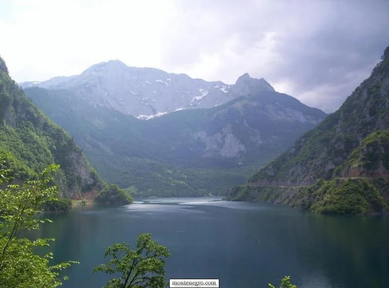
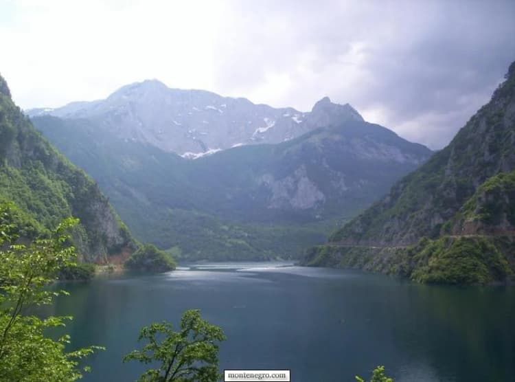
Piva makes most sense when read as a landscape that was deliberately rearranged. A deep river gorge became a hydroelectric reservoir; the old settlement of Plužine disappeared below the new waterline; a sixteenth-century monastery was dismantled and rebuilt higher up; and a replacement road was cut through the limestone. The blue-green lake is spectacular, but the evidence behind it matters as much as the view.
This guide separates four things that are often blurred together: the wider Piva region, Piva Nature Park, the artificial reservoir, and the UNESCO-listed Durmitor property. It also replaces folklore rankings and fixed seasonal promises with source-labelled facts and checks a traveler can perform on the day.
What “Piva” means on a map
Piva can mean a historical and geographic region, a river, a reservoir or the protected landscape administered as Piva Nature Park. Those boundaries do not coincide. The park's official profile places the nature park between the border with Bosnia and Herzegovina and the boundary of Durmitor National Park, describing it as a connection between protected landscapes. That does not make the whole reservoir, town or region part of one legal designation.
The UNESCO distinction is narrower still. The Durmitor World Heritage record covers the national park and describes the Tara River gorge within the property as Europe's deepest. It does not support the familiar claim that Tara is the world's “second-largest canyon after Colorado,” so this guide does not repeat it. UNESCO's biosphere-reserve profile is another designation with another purpose.
| Element | Status | Relationship |
|---|---|---|
| Piva region | Nature Park | Contains reservoir |
| Reservoir | Within Nature Park | — |
| Durmitor | UNESCO property | Adjacent connection, not one boundary |
Source: parkpiva.com, whc.unesco.org, unesco.org
The dam changed more than the river
The Piva hydropower plant began operation on 13 July 1976, according to a contemporary engineering account. Its 220-metre concrete arch dam impounded the river, creating the long reservoir seen today. The park's official lake account records the resulting inundation and the need to relocate the monastery; the replacement settlement and rock-cut transport works show that this was a social and territorial change, not only an engineering object.
Headline engineering numbers need their labels, dates and definitions. IBE, the engineering company whose project page identifies EPCG as client, gives 824 million cubic metres of storage, 342 MW installed capacity and 860 GWh generation in its project profile. The 1976 engineering account likewise uses 860 GWh as a design-era mean annual figure. By contrast, the transmission operator CGES records 746 GWh generated in 2024. A profile or design expectation is not the same measure as one year's output, so they should not be presented as rival estimates of a timeless number.
| Measure | Published value | Source and meaning |
|---|---|---|
| Dam height | 220 m | IBE profile and 1976 engineering account agree |
| Installed capacity | 342 MW | IBE project profile |
| Storage volume | 824 million m³ | IBE project profile |
| Project/design generation | 860 GWh | IBE profile and 1976 engineering paper |
| Actual 2024 generation | 746 GWh | CGES 2024 operating report; one recorded year |
The safe takeaway is modest: the 220-metre dam and 342 MW installed capacity are strongly supported, while annual energy must retain its time basis. A 2022 engineering paper documents upgrades to the dam's seismic-monitoring system, but technical study does not grant visitor access or establish where a traveler may stop.
| Step | Change |
|---|---|
| 1 | Dam works |
| 2 | Reservoir formed |
| 3 | Replacement town |
| 4 | New road and bridge |
| 5 | Monastery relocated |
Source: gradbenivestnik.zveza-dgits.si, ibe.si
A town rebuilt above its predecessor
Present-day Plužine is not an old riverside town that happened to acquire a lake view. It is the replacement settlement created because the earlier town lay in the inundation zone. That distinction explains its elevated position and relatively modern fabric. The reservoir shoreline may rise or fall with operations; a map's blue shape is not a promise that every cove will look identical on arrival.
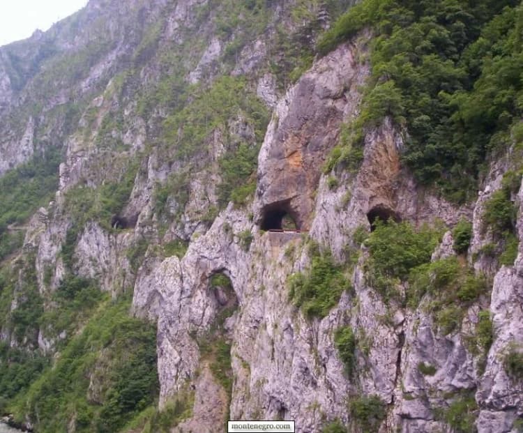
Travelers should also resist treating the road as a passive viewing platform. The approach includes exposed slopes, narrow sections and many rock-cut tunnels. The park's cross-border risk study specifically identifies landslide interruption as a hazard on the corridor linking Plužine, Šćepan Polje and Foča. Pull over only where the road geometry and signs allow it; never stop inside a tunnel or at a blind bend.
The monastery moved above the water
Piva Monastery offers the clearest cultural counterpoint to the dam. The official nature-park profile dates construction of the Church of the Dormition to 1573–1586 and credits Metropolitan Savatije Sokolović. When the reservoir threatened the original site near the river source, the complex was transferred to Sinjac, including its original fresco programme.
The park describes the operation as a unique construction achievement, but that is not proof that no other monastery anywhere has ever been moved. The defensible story is already extraordinary: the complex and its original fresco programme were transferred so the monument could survive a radically altered valley.
It remains a religious site, not a set built for sightseeing. Dress and behave accordingly, keep voices low, and follow any photography restrictions posted on site. Published heritage information does not establish today's hours, service schedule, admission arrangements or guaranteed interior access. Confirm locally before making the church interior the sole purpose of a long detour.
| Claim | Status | Detail |
|---|---|---|
| Church built | Established | 1573–1586 |
| Original site faced reservoir inundation | Established | Moved to Sinjac |
| Fresco programme preserved through relocation | Documented | — |
| “Only monastery ever moved” | Not established | — |
| Today's opening hours or access | Not established | — |
Source: parkpiva.com, gradbenivestnik.zveza-dgits.si
Tara, Piva and the confluence
At Šćepan Polje, the Tara and Piva meet to form the Drina. That geography makes the settlement an operational center for rafting and a border-road junction, but it should not be reduced to a launch ramp. For a focused account of access and the confluence, use the Šćepan Polje evidence guide; for gorge conditions and rafting choices, continue to the Tara Canyon guide.
UNESCO says the Tara runs for more than 60 kilometres through the Durmitor World Heritage property. That supports the gorge's international conservation importance. It does not certify an operator, guarantee a navigable level on a chosen day, or make every activity environmentally harmless. Protected status and commercial safety checks answer different questions.
Rafting: verify the provider, not just the weather
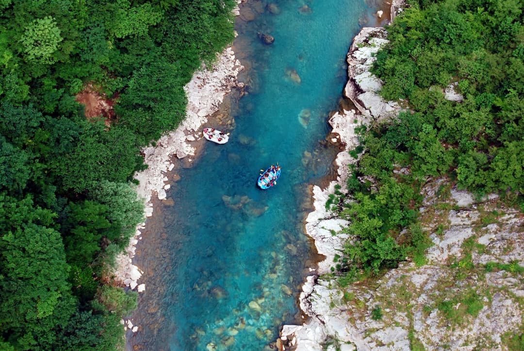
Montenegro treats commercial rafting as a regulated tourism activity. The government's permit requirements call for ministry approval, a nationally qualified or IRF-licensed boat leader, liability and user insurance, a navigation permit and a certificate of compliance with navigation-safety rules. The Rafting Law also requires suitable access, water level, depth and width for an authorized route.
Before paying, ask the provider to identify the licensed leader, the exact route, what insurance applies, whether personal flotation and helmets are included, and what happens if the route is suspended. Ask again on the morning of departure about water and weather. A website saying “season open” is not a substitute for a route-level decision.
For technical canyon trips elsewhere, the same principle applies: use qualified local leadership and a current go/no-go assessment. The Montenegro canyoning safety guide explains why a remembered month or social-media clip cannot establish safe flow.
Practical road decisions: check the same day
Road status here can change with snow, rockfall, construction and temporary controls. Check the AMSCG live road report on the day of travel, then recheck after severe weather. The scenic mountain connection toward Durmitor is not equivalent to the principal approach from Nikšić. A routing app may show a line without conveying road width, tunnel lighting, edge exposure or a temporary closure.
| Check | If no / unclear | If yes |
|---|---|---|
| AMSCG route open? No closure or restriction affecting you? | Pause or reroute — confirm before departure | Next check |
| Weather and local conditions fit? Include recent rain, snow and rockfall | Do not improvise — change plan or wait | Proceed conservatively |
| Rafting | — | Verify permit, leader, route and gear |
Source: amscg.org, gov.me, parkpiva.com
Build a visit around evidence, not mileage
If you have half a day
Choose one coherent focus. See the reservoir from legal stopping places and spend time in the town, or visit the monastery after confirming access. Do not add a distant gorge segment simply because a map suggests short mileage. A short distance on a mountain road can contain the day's highest uncertainty.
If you have a full day
Combine the reservoir landscape, the town and the monastery, leaving substantial margin for tunnels, road works and unscheduled stops. Read the Durmitor thaw and seasonal-risk guide before adding a high mountain crossing. If your route continues east, the Đurđevića Tara bridge guide helps separate a viewpoint visit from a canyon or rafting plan.
If you have two days
Use the first day for the transformed cultural landscape and the second for one weather-dependent activity. That creates room to cancel or substitute a river outing without losing the whole trip. For an alternative road approach and highland context, the Vilusi guide is more useful than assuming every mountain road offers equivalent access.
Responsible decisions on the ground
- Do not treat the road as yours alone. Use signed pull-offs, keep tunnels clear and expect other vehicles around blind bends.
- Do not treat water color as a safety signal. Reservoir operations, cold water, depth and access conditions are not visible in a photograph.
- Keep designations precise. A nature park, national park, biosphere reserve and World Heritage property have different boundaries and rules.
- Ask before photographing worship. Monument status does not cancel religious use or community norms.
- Use regulated operators. Ask for the permit and qualified leader instead of relying on reviews alone.
- Carry a fallback. A road or river plan that cannot tolerate cancellation is a poor fit for a weather-sensitive landscape.
Frequently asked questions
Is Piva Lake natural?
No. It is a reservoir created by the Piva hydropower project and the dam completed in the 1970s.
Is all of Piva inside the Durmitor UNESCO site?
No. The wider region, Piva Nature Park, reservoir and Durmitor World Heritage property are related but not identical. Check the designation governing the exact place.
Was Piva Monastery really moved?
Yes. Official park and EPCG sources document relocation from the inundation zone to Sinjac, including preservation of the fresco programme. They do not establish the inherited global claim that it was the only monastery ever moved.
What is the correct reservoir volume?
IBE's project profile publishes 824 million cubic metres of storage. That is the value used here; a differently labelled operational or usable volume should not be substituted without its definition.
Can I rely on a normal map route?
Use it for orientation, not as a live safety report. Check AMSCG for closures and restrictions on departure day, especially after severe weather.
How do I assess a rafting company?
Ask for its official approval, qualified or IRF-licensed leader, exact authorized route, vessel documentation, insurance, safety equipment and cancellation rule. Reconfirm river and weather conditions that morning.