
Stoliv
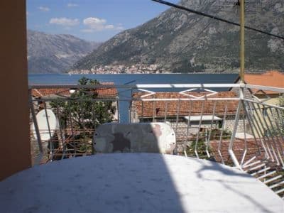
Nema plaže uopšte — betonske platforme i pontoni na kapetanskoj rivi Donjeg Stoliva, okrenuti ka Perastu preko mirne vode, sa kestenovim šumama gornjeg sela u pozadini.
Naša ocjena
Stoliv je iskren u vezi sa onim što nudi: vodič kroz selo kaže da „samo po sebi nema plaža, pa se sve sunčanje odvija na pontonima“, i to je kupanje kakvo jeste — sa betona, u duboku, mirnu vodu zaliva, sa crkvom Imena Marijinog iza leđa i Perastom i njegovim ostrvcima pravo preko tjesnaca. To je kraj šetnice priobalnim putem od Kotora i najmirnija tačka za kupanje na vrmačkoj obali. Ponesite sve; riva ne prodaje ništa.
- plivanje
- mir
- fotografisanje
Stoliv u činjenicama
Obala
Sadržaji
Pristup
Pravila i karakter
Činjenice provjerene 28. septembar 2026. · Dužina: Our 25 Best Beaches list — a nominal figure: OpenStreetMap maps no beach at Stoliv, only piers on the Donji Stoliv waterfront (ways 207657678, 207657679, 207657690); the swimming is off concrete platforms and pontoons · Sadržaji prema izvoru OpenStreetMap contributors, ODbL · Još 6 podataka treba provjeriti na licu mjesta
Stoliv u slikama
Mapa
Osjenčena površina je zvanična kupališna zona mjerne stanice Stoliv 01 — dionica koju JP Morsko dobro zaista uzorkuje, a ne obris plaže.
Kako doći
7.3 km
Kotor
7.6 km
Tivat airport
14 km
Herceg Novi
Rastojanja vazdušnom linijom — crnogorski putevi su planinski, pa je vožnja duža.
- Na šetnji Obalni put kroz BokuObalni put kroz Boku
- AutobusomKotor local bus along the Prčanj–Stoliv shore road (a morning run to Kotor)
- AutomOn the Prčanj–Stoliv shore road, 4.9 km beyond Prčanj (about 9 minutes); park on the road under the campanile of the Name of Mary; the Kamenari–Lepetane ferry is 4.8 km further on
- 1 min pješkeravno — Straight off the shore road onto the waterfront wall and the pontoons
Danas na plaži Stoliv
Orijentacija je izračunata iz OpenStreetMap linije obale, pa se „prema obali“ i „s kopna“ odnose na ovu obalu, a ne na region. Prognoza: Open-Meteo
Voda i priznanja
Odlična
Posljednji zvanični uzorak 29. septembar 2026.: Odlična
More 20.0 °C u trenutku uzorkovanja
7 od 10 uzoraka ocijenjeno odlično u sezoni 2026
Zvanični rezultat JP Morsko dobro, mjerna stanica Stoliv 01
Mirna, čista voda zaliva prema glavnom izvoru; Morsko Dobro ne vodi rezultat za Stoliv
Nema priznanja koje možemo navesti za ovu plažu. I to je informacija.
Znajte prije kupanja
- U vodu se ulazi sa betonskih platformi i pontona pravo u duboku vodu: nema blage obale za djecu, a na ljestve se ne treba osloniti
- Pontoni služe i kao vez — mali čamci pristaju tamo gdje se ljudi kupaju
- Priobalni put prolazi tik iza zida rive i tu se parkira
- Na rivi nema hlada, vode, toaleta ni hrane: ponesite sve
Kad je more toplo
Najtoplije je bilo 27.1 °C, 1. septembar 2026., a najhladnije 20.0 °C, 29. septembar 2026.. Svaka tačka je stvarni izlazak na teren, sa temperaturom izmjerenom na licu mjesta, a ne mjesečni prosjek prepisan sa strane.
Šuplje tačke su 3 uzorkovanja koja nijesu ocijenjena kao odlična.
Prikaži svih 10 uzorkovanja
| Uzorkovano | More | Ocjena |
|---|---|---|
| 29. septembar 2026. | 20.0 °C | Odlična |
| 15. septembar 2026. | 24.5 °C | Dobra |
| 1. septembar 2026. | 27.1 °C | Odlična |
| 21. avgust 2026. | 24.5 °C | Dobra |
| 4. avgust 2026. | 24.8 °C | Odlična |
| 21. jul 2026. | 25.2 °C | Odlična |
| 7. jul 2026. | 22.6 °C | Odlična |
| 25. jun 2026. | 22.6 °C | Zadovoljavajuća |
| 9. jun 2026. | 21.1 °C | Odlična |
| 26. maj 2026. | 20.2 °C | Odlična |
Sezona po sezonu
Voda na plaži Stoliv uzorkovana je 69 puta od 2020. godine: 44 puta ocijenjena je kao odlična, 25 puta niže od toga.
Koliko se voda ugrijala, sezona po sezonu. Prosjek obuhvata samo uzorkovanja u julu i avgustu — stalni prozor, da godina u kojoj su inspektori dolazili rano ne ispadne hladna.
Nekoliko sezona je zapis, a ne trend: ovo rasipanje pokazuje kako izgleda mali broj datiranih mjerenja, a ne dokaz da se more grije ili hladi. Šuplja tačka označava sezonu u kojoj je jedno uzorkovanje bilo ispod ocjene odlična.
| Sezona | Uzorkovanja | Odlična | Ispod | Prosjek jul–avg. | Najtoplije |
|---|---|---|---|---|---|
| 2020 | 9 | 8 | 1 | 24.7 °C | 25.7 °C |
| 2021 | 10 | 6 | 4 | 26.1 °C | 27.9 °C |
| 2022 | 10 | 8 | 2 | 24.7 °C | 26.7 °C |
| 2023 | 10 | 4 | 6 | 25.1 °C | 26.4 °C |
| 2024 | 10 | 4 | 6 | 24.6 °C | 25.9 °C |
| 2025 | 10 | 7 | 3 | 24.4 °C | 25.7 °C |
| 2026u toku | 10 | 7 | 3 | 24.3 °C | 27.1 °C |
Kategorija kupališta
Obala se izdaje u zakup lokacija po lokacija. Stoliv je raspisana kroz 3 lokacije na oko 196 m obale, svaka sa zvaničnom kategorijom.
Ovdje je u zakupu i: ponton za pristajanje i privez plovila ispred plaže.
| Kategorija | Lokacija | Obala |
|---|---|---|
| Javno-porodično | 2 | 109 m |
| Hotelsko kupalište | 1 | 87 m |
Ukupno oko 2,018 m². Ovo je ono što je dato u zakup, a ne ono što smo zatekli: broj ležaljki, sanitarnih čvorova i tuševa po lokaciji utvrđuje se potpisanim ugovorom, koji se ne objavljuje. Tenderi JP Morsko dobro
Plaže u blizini



Stoliv i susjedne plaže
Istih devet podataka za plaže do kojih možete stići istog dana. Podebljano znači da se razlikuje od ove.
| Podatak | Stolivova plaža |  Bajova Kula2.4 km Bajova Kula2.4 km |  Ljuta4.5 km Ljuta4.5 km |  Lipci5.1 km Lipci5.1 km |
|---|---|---|---|---|
| Podloga | betonski platoi | šljunak — razlikuje se | betonski platoi | šljunak — razlikuje se |
| Ulazak u more | strm | umjeren — razlikuje se | strm | kamenit — razlikuje se |
| Dubina | duboko odmah uz obalu | brzo postaje duboko — razlikuje se | duboko odmah uz obalu | brzo postaje duboko — razlikuje se |
| Hlad | nema | prirodni — razlikuje se | nema | nema |
| Karakter | divlja | uređena — razlikuje se | divlja | divlja |
| Dužina | 100 m | 118 m | 10–30 m — razlikuje se | 20–50 m — razlikuje se |
| Posljednji uzorak | Odlična | Odlična | —nema zvaničnog mjernog mjesta — razlikuje se | —nema zvaničnog mjernog mjesta — razlikuje se |
| Gužva | mir | mir | mir | mir |
| Kako doći | automobilom | automobilom | automobilom | automobilom |
Smještaj blizu plaže Stoliv
Sav smještaj u mjestu Stoliv →

Pitanja
- Da li postoji plaža u Stolivu?
- Ne baš. I glavni izvor i vodič kroz selo kažu isto: male trake šljunka i betonske platforme za kupanje duž rive, sa sunčanjem na pontonima. OpenStreetMap ovdje bilježi molove, ali ne i plažu.
- Gdje se nalaze kesteni?
- Na padinama iznad rive, oko Gornjeg Stoliva na 200–250 m: stare šume pitomog kestena, sa stablima za koja se kaže da su starija od 400 godina, i berbom koja se i danas obilježava u selu u jesen. Kamenom stazom se uspinje oko 40 minuta.
- Mogu li ovdje doći pješice iz Kotora?
- Da: šetnica priobalnim putem duga je 10,2 km od Kotora, prolazi kroz Muo, Glavati i Prčanj i završava se u Stolivu. Ujutru postoji autobus nazad za Kotor.
Izvori
- montenegro.com — Stoliv hub (/cities/stoliv) and its source notes: Discover Montenegro on the pontoons, the boka-shore-road corridor, the bus run to Kotor, Commons frame identification
- Our "25 Best Beaches in Montenegro" list, entry 24
- OpenStreetMap — pier ways 207657678, 207657679, 207657690, 207657685; village node 717410785 (Nominatim)