
Stoliv
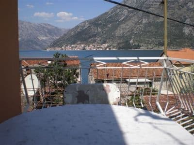
Überhaupt kein Strand — Betonplattformen und Pontons an der Kapitänspromenade von Donji Stoliv, Perast gegenüber über ruhigem Wasser, mit den Kastanienwäldern des oberen Dorfes dahinter.
Unser Urteil
Stoliv ist ehrlich darüber, was es zu bieten hat: Der Dorf-Guide sagt, es „hat selbst keine Strände, sodass alles Sonnenbaden auf den Pontons stattfinden muss“, und genau das ist das Bad — von Beton aus ins tiefe, ruhige Wasser der Bucht, mit der Kirche Mariä Namen im Rücken und Perast und seinen Inselchen direkt gegenüber über die Meerenge hinweg. Es ist das Ende der Küstenstraßen-Wanderung von Kotor und der ruhigste Badeort am Ufer des Vrmac. Bringen Sie alles mit; an der Promenade wird nichts verkauft.
- Schwimmen
- Ruhe
- Fotografie
Stoliv in Fakten
Das Ufer
Ausstattung
Anfahrt
Regeln und Charakter
Fakten geprüft am 28. September 2026 · Länge: Our 25 Best Beaches list — a nominal figure: OpenStreetMap maps no beach at Stoliv, only piers on the Donji Stoliv waterfront (ways 207657678, 207657679, 207657690); the swimming is off concrete platforms and pontoons · Ausstattung laut OpenStreetMap contributors, ODbL · 6 weitere Angaben müssen wir vor Ort prüfen
Stoliv in Bildern
Karte
Die schattierte Fläche ist die amtliche Badezone der Messstelle Stoliv 01 — der Abschnitt, den JP Morsko dobro tatsächlich beprobt, nicht der Umriss des Strandes.
Anfahrt
7.3 km
Kotor
7.6 km
Tivat airport
14 km
Herceg Novi
Luftlinie — Montenegros Straßen sind Bergstraßen, die Fahrt ist also länger.
- Auf dem Weg Die Uferstraße der BokaDie Uferstraße der Boka
- Mit dem BusKotor local bus along the Prčanj–Stoliv shore road (a morning run to Kotor)
- Mit dem AutoOn the Prčanj–Stoliv shore road, 4.9 km beyond Prčanj (about 9 minutes); park on the road under the campanile of the Name of Mary; the Kamenari–Lepetane ferry is 4.8 km further on
- 1 Min. zu Fußeben — Straight off the shore road onto the waterfront wall and the pontoons
Heute an Stoliv
Die Ausrichtung ist aus der OpenStreetMap-Küstenlinie berechnet, auflandig und ablandig meinen also dieses Ufer und nicht die Region. Vorhersage von Open-Meteo
Wasser und Auszeichnungen
Ausgezeichnet
Letzte amtliche Probe 29. September 2026: Ausgezeichnet
Wasser 20.0 °C bei der Probenahme
7 von 10 Proben ausgezeichnet in der Saison 2026
Offizielles Ergebnis von JP Morsko dobro, Messstelle Stoliv 01
Laut Hub ruhiges, sauberes Buchtwasser; für Stoliv liegt kein Morsko-Dobro-Ergebnis vor
Keine Auszeichnung, die wir für diesen Strand belegen können. Auch das ist eine Information.
Vor dem Baden wissen
- Der Einstieg erfolgt von Betonplattformen und Pontons direkt ins tiefe Wasser: kein sanftes Ufer für Kinder, und auf Leitern ist kein Verlass
- Die Pontons dienen zugleich als Anlegestellen — kleine Boote legen dort an, wo Menschen schwimmen
- Die Küstenstraße verläuft direkt hinter der Ufermauer, und dort wird geparkt
- Kein Schatten, Wasser, Toiletten oder Essen an der Promenade: alles selbst mitbringen
Wann das Wasser warm ist
Stoliv war am wärmsten mit 27.1 °C am 1. September 2026 und am kältesten mit 20.0 °C am 29. September 2026. Jeder Punkt ist eine echte Messfahrt mit vor Ort abgelesener Temperatur, kein anderswo abgeschriebener Monatsmittelwert.
Hohle Punkte sind die 3 Messungen, die unter „Ausgezeichnet“ lagen.
Alle 10 Messungen ansehen
| Gemessen | Wasser | Ergebnis |
|---|---|---|
| 29. September 2026 | 20.0 °C | Ausgezeichnet |
| 15. September 2026 | 24.5 °C | Gut |
| 1. September 2026 | 27.1 °C | Ausgezeichnet |
| 21. August 2026 | 24.5 °C | Gut |
| 4. August 2026 | 24.8 °C | Ausgezeichnet |
| 21. Juli 2026 | 25.2 °C | Ausgezeichnet |
| 7. Juli 2026 | 22.6 °C | Ausgezeichnet |
| 25. Juni 2026 | 22.6 °C | Ausreichend |
| 9. Juni 2026 | 21.1 °C | Ausgezeichnet |
| 26. Mai 2026 | 20.2 °C | Ausgezeichnet |
Offizielles Ergebnis von JP Morsko dobro, Messstelle Stoliv 01
Saison für Saison
Stoliv wurde seit 2020 69 Mal beprobt: davon 44 Messungen „ausgezeichnet", 25 darunter.
Wie warm das Wasser wurde, Saison für Saison. Gemittelt werden nur die Probenahmen im Juli und August — ein festes Zeitfenster, damit ein Jahr, in dem früh gemessen wurde, nicht als kaltes erscheint.
Eine Handvoll Saisons ist eine Aufzeichnung, kein Trend: die Streuung hier zeigt, wie wenige datierte Messungen aussehen, nicht ein wärmer oder kälter werdendes Meer. Ein hohler Punkt steht für eine Saison, in der eine Probenahme unter „ausgezeichnet" lag.
| Saison | Probenahmen | Ausgezeichnet | Darunter | Mittel Jul.–Aug. | Höchstwert |
|---|---|---|---|---|---|
| 2020 | 9 | 8 | 1 | 24.7 °C | 25.7 °C |
| 2021 | 10 | 6 | 4 | 26.1 °C | 27.9 °C |
| 2022 | 10 | 8 | 2 | 24.7 °C | 26.7 °C |
| 2023 | 10 | 4 | 6 | 25.1 °C | 26.4 °C |
| 2024 | 10 | 4 | 6 | 24.6 °C | 25.9 °C |
| 2025 | 10 | 7 | 3 | 24.4 °C | 25.7 °C |
| 2026läuft | 10 | 7 | 3 | 24.3 °C | 27.1 °C |
Offizielles Ergebnis von JP Morsko dobro, Messstelle Stoliv 01
Konzessioniert als
Der Staat verpachtet diese Küste Los für Los. Stoliv ist in 3 Lose mit rund 196 m Uferlänge ausgeschrieben, jedes mit einer amtlichen Kategorie.
Ebenfalls konzessioniert: eine Anlegeplattform im Wasser vor dem Strand.
| Kategorie | Lose | Ufer |
|---|---|---|
| Familienbad | 2 | 109 m |
| Hotelstrand | 1 | 87 m |
Zusammen etwa 2,018 m². Das ist das Konzessionierte, nicht das Gesehene: Zahl der Liegen, Toiletten und Duschen je Los steht im unterzeichneten Pachtvertrag, der nicht veröffentlicht wird. Ausschreibungen von JP Morsko dobro
Strände in der Nähe



Stoliv und seine Nachbarn
Dieselben neun Angaben für die Strände, die Sie am selben Tag erreichen. Fett bedeutet: anders als hier.
| Angabe | Stolivdieser Strand |  Bajova Kula2.4 km Bajova Kula2.4 km |  Ljuta4.5 km Ljuta4.5 km |  Lipci5.1 km Lipci5.1 km |
|---|---|---|---|---|
| Untergrund | Betonplattformen | Kies — weicht ab | Betonplattformen | Kies — weicht ab |
| Einstieg | steil | mäßig — weicht ab | steil | felsig — weicht ab |
| Tiefe | tief ab dem Ufer | wird schnell tief — weicht ab | tief ab dem Ufer | wird schnell tief — weicht ab |
| Schatten | keiner | natürlich — weicht ab | keiner | keiner |
| Charakter | wild | bewirtschaftet — weicht ab | wild | wild |
| Länge | 100 m | 118 m | 10–30 m — weicht ab | 20–50 m — weicht ab |
| Letzte Messung | Ausgezeichnet | Ausgezeichnet | —keine amtliche Messstelle — weicht ab | —keine amtliche Messstelle — weicht ab |
| Andrang | Ruhe | Ruhe | Ruhe | Ruhe |
| Anfahrt | mit dem Auto | mit dem Auto | mit dem Auto | mit dem Auto |
Übernachten nahe Stoliv
Alle Unterkünfte in Stoliv →

Fragen
- Gibt es in Stoliv einen Strand?
- Nicht wirklich. Der Hub und der Dorf-Guide sagen beide dasselbe: kleine Kiesstreifen und Beton-Badeplattformen entlang der Promenade, mit Sonnenbaden auf den Pontons. OpenStreetMap verzeichnet hier Stege, aber keinen Strand.
- Wo sind die Kastanien?
- An den Hängen oberhalb der Promenade, rund um Gornji Stoliv auf 200–250 m Höhe: alte Edelkastanienwälder mit Bäumen, die angeblich über 400 Jahre alt sind, und eine Ernte, die im Herbst lokal noch gefeiert wird. Der Steinpfad hinauf dauert etwa 40 Minuten.
- Kann ich von Kotor aus hierher laufen?
- Ja: Der Küstenstraßenkorridor der Boka verläuft 10,2 km von Kotor über Muo, Glavati und Prčanj und endet in Stoliv. Es gibt morgens einen Bus zurück nach Kotor.
Quellen
- montenegro.com — Stoliv hub (/cities/stoliv) and its source notes: Discover Montenegro on the pontoons, the boka-shore-road corridor, the bus run to Kotor, Commons frame identification
- Our "25 Best Beaches in Montenegro" list, entry 24
- OpenStreetMap — pier ways 207657678, 207657679, 207657690, 207657685; village node 717410785 (Nominatim)