
Lipci
Ein Streifen aus Kies und flachen Felsen unterhalb der prähistorischen Hirsche von Lipci, erreichbar über einen schmalen Betonweg, mit klarem Wasser, das tief genug zum Springen ist, und sonst gar nichts.
Unser Urteil
Das ist der „versteckte Strand“ aus dem Lipci-Guide: kein Name, kein Kartensymbol, ein paar Meter Kies und flacher Fels unterhalb der Felsmalereien, und Wasser, das der Guide als glasklar und tief genug zum Springen von den Felsen beschreibt. Das Dorf selbst hat kein Hotel, keine Konoba und keinen Laden, sodass der Strand genauso leer ist, wie das klingt. Kombinieren Sie ihn mit den Zeichnungen darüber — dem Grund, warum die meisten Menschen in Lipci anhalten — und mit Morinj, 1,7 km weiter, zum Mittagessen.
- Ruhe
- Schwimmen
- Schnorcheln
Lipci in Fakten
Das Ufer
Ausstattung
Anfahrt
Fakten geprüft am 28. September 2026 · Länge: Not measured by any source and not mapped on OpenStreetMap; our Lipci guide describes "a strip of pebbles and a few flat rocks" — an order of magnitude, not a survey · 5 weitere Angaben müssen wir vor Ort prüfen
Lipci in Bildern
Karte
Anfahrt
11 km
Herceg Novi
12 km
Tivat airport
12 km
Kotor
Luftlinie — Montenegros Straßen sind Bergstraßen, die Fahrt ist also länger.
- Mit dem BusStops with shelters on the M-1 shore road within 600 m (OpenStreetMap); route names not verified
- Mit dem AutoOn the M-1 between Risan (4.8 km) and Morinj (1.7 km); a small parking area near the rock-art path and a free lay-by on the shore road
- 10 Min. zu Fußunwegsamer Pfad — From the roadside parking near the rock-art path: a narrow concrete path and then rock down to the water
Heute an Lipci
Die Ausrichtung ist aus der OpenStreetMap-Küstenlinie berechnet, auflandig und ablandig meinen also dieses Ufer und nicht die Region. Vorhersage von Open-Meteo
Wasser und Auszeichnungen
Nächstgelegene amtliche Messstelle
Ausgezeichnet
Letzte amtliche Probe 28. September 2026: Ausgezeichnet
Das Monitoring hat an Lipci keine Messstelle. Dieser Wert stammt von der Messstelle Morinj 01, 1.3 km entfernt bei Morinj — dasselbe Gewässer, aber nicht dieses Ufer.
Wasser 20.2 °C bei der Probenahme
6 von 10 Proben ausgezeichnet in der Saison 2026
Offizielles Ergebnis von JP Morsko dobro, Messstelle Morinj 01
„Glasklar und tief genug zum Springen von den Felsen“ laut unserem Guide; bis August um die 25 °C; keine Morsko-Dobro-Station hier
Keine Auszeichnung, die wir für diesen Strand belegen können. Auch das ist eine Information.
Vor dem Baden wissen
- Der Abstieg führt über einen schmalen Betonweg und dann über blanken Fels — vernünftige Schuhe, und keine Route für kleine Kinder oder schlechte Knie
- Springen von den Felsen: die Tiefe jedes Mal selbst prüfen — nichts ist markiert, und niemand passt auf
- Von Zeit zu Zeit fahren Boote durch diesen Teil der Bucht; das Ufer ist geschützt, aber nicht mit Bojen abgegrenzt
- Kein Schatten, kein Wasser, keinerlei Einrichtungen: alles selbst mitbringen und auch wieder mitnehmen
Wann das Wasser warm ist
Lipci war am wärmsten mit 25.8 °C am 31. August 2026 und am kältesten mit 16.8 °C am 25. Mai 2026. Jeder Punkt ist eine echte Messfahrt mit vor Ort abgelesener Temperatur, kein anderswo abgeschriebener Monatsmittelwert.
Hohle Punkte sind die 4 Messungen, die unter „Ausgezeichnet“ lagen.
Alle 10 Messungen ansehen
| Gemessen | Wasser | Ergebnis |
|---|---|---|
| 28. September 2026 | 20.2 °C | Ausgezeichnet |
| 14. September 2026 | 22.4 °C | Ausreichend |
| 31. August 2026 | 25.8 °C | Ausgezeichnet |
| 17. August 2026 | 24.8 °C | Gut |
| 3. August 2026 | 23.1 °C | Ausgezeichnet |
| 23. Juli 2026 | 22.0 °C | Ausreichend |
| 8. Juli 2026 | 19.2 °C | Ausgezeichnet |
| 22. Juni 2026 | 24.0 °C | Gut |
| 8. Juni 2026 | 17.0 °C | Ausgezeichnet |
| 25. Mai 2026 | 16.8 °C | Ausgezeichnet |
Offizielles Ergebnis von JP Morsko dobro, Messstelle Morinj 01
Strände in der Nähe



Lipci und seine Nachbarn
Dieselben neun Angaben für die Strände, die Sie am selben Tag erreichen. Fett bedeutet: anders als hier.
| Angabe | Lipcidieser Strand |  Risan3.3 km Risan3.3 km |  Stoliv5.1 km Stoliv5.1 km |  Bajova Kula6.4 km Bajova Kula6.4 km |
|---|---|---|---|---|
| Untergrund | Kies | Kies | Betonplattformen — weicht ab | Kies |
| Einstieg | felsig | mäßig — weicht ab | steil — weicht ab | mäßig — weicht ab |
| Tiefe | wird schnell tief | wird schnell tief | tief ab dem Ufer — weicht ab | wird schnell tief |
| Schatten | keiner | keiner | keiner | natürlich — weicht ab |
| Charakter | wild | wild | wild | bewirtschaftet — weicht ab |
| Länge | 20–50 m | 200 m — weicht ab | 100 m — weicht ab | 118 m — weicht ab |
| Letzte Messung | —keine amtliche Messstelle | Ausgezeichnet — weicht ab | Ausgezeichnet — weicht ab | Ausgezeichnet — weicht ab |
| Andrang | Ruhe | Ruhe | Ruhe | Ruhe |
| Anfahrt | mit dem Auto | zu Fuß — weicht ab | mit dem Auto | mit dem Auto |
Übernachten in der Nähe von Lipci — Herceg Novi, 11 km entfernt
Alle Unterkünfte in Herceg Novi →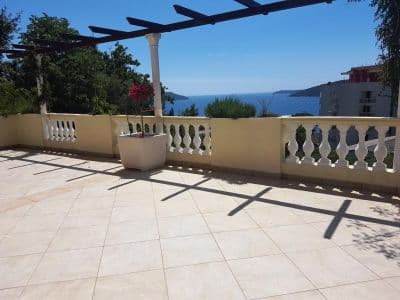


Der ausführliche Guide
Den Guide zu Lipci lesen
Alles oben ist die Kurzfassung. Der Guide enthält die Quellen, die Sektorcodes, die Probedaten und das, was sich innerhalb einer Saison ändert.
Fragen
- Wo liegt der versteckte Strand von Lipci?
- Unterhalb der Felsmalereien, über einen schmalen Betonweg vom Parkplatz am Straßenrand der M-1 aus. OpenStreetMap verzeichnet ihn nicht; unser Guide beschreibt einen Streifen aus Kies und ein paar flachen Felsen zum Sonnenbaden.
- Ist das Wasser tief?
- Der Guide sagt, es sei tief genug zum Springen von den Felsen, während der Hub klares, flaches Wasser vor dem Dorfufer beschreibt — prüfen Sie die Tiefe vor jedem Sprung selbst. Das Wasser erreicht bis August etwa 25 °C.
- Wo sind das nächste Essen, der nächste Laden oder Campingplatz?
- Morinj, 1,7 km westlich: ein Laden, zwei Autocamps, ein Strand mit Bar in der Saison und das Restaurant Ćatovića Mlini bei den alten Mühlen. Risan, 4,8 km östlich, hat Supermärkte und Geldautomaten.
Quellen
- montenegro.com — Lipci guide (/cities/lipci/lipci-comprehensive-travel-guide)
- montenegro.com — Lipci hub (/cities/lipci) and its source notes (Overpass features around the village node, OSRM distances)
- OpenStreetMap — village node 717359007 (Nominatim); parking way 1527881742, node 2313528091, lay-by way 1262012912; no natural=beach mapped at Lipci