
Bajova Kula
Bajova kula
Ein 100 Meter langer Kiesstrand bei Dražin Vrt an der Straße Kotor–Risan, benannt nach dem darüber liegenden Turm von Bajo Pivljanin, mit Perast auf der anderen Seite der Bucht.
Unser Urteil
Bajova Kula ist ein Kiesstrand unterhalb der Küstenstraße zwischen Orahovac und Perast, von OpenStreetMap bei Dražin Vrt verzeichnet, neben dem gleichnamigen Restaurant und dem namensgebenden Turm. Es ist eher ein Ort für einen Sprung ins Wasser auf der Rundfahrt um die Bucht als ein Tagesziel: keine Konzession, ein rascher Einstieg in tiefes Buchtwasser und der Blick nach Westen auf Perast und die Meerenge von Verige. Die Ausgangsliste verortet ihn unter den Mauern von Kotor; die Karte und das Denkmalregister setzen ihn übereinstimmend hierher, 11 km die Küste hinauf.
- Schwimmen
- Ruhe
- Fotografie
Bajova Kula in Fakten
Das Ufer
Ausstattung
Anfahrt
Fakten geprüft am 1. Oktober 2026 · Länge: The JP Morsko dobro board at the beach: "organised public beach — 118 m". Our 25 Best list said 100 m and the OpenStreetMap polygon runs about 120 m; the official figure supersedes both · Ausstattung laut The JP Morsko dobro board at the beach for the length, status and manager; OpenStreetMap contributors, ODbL, for the rest · 12 weitere Angaben müssen wir vor Ort prüfen
Bajova Kula in Bildern
Fotos und Filmaufnahmen von Montenegro.com, frei verwendbar unter CC BY 4.0. Unsere Aufnahmen stammen vom 1. Oktober 2026.
Karte
Die schattierte Fläche ist die amtliche Badezone der Messstelle Bajova kula — der Abschnitt, den JP Morsko dobro tatsächlich beprobt, nicht der Umriss des Strandes.
Anfahrt
7.2 km
Kotor
8.8 km
Tivat airport
17 km
Herceg Novi
Luftlinie — Montenegros Straßen sind Bergstraßen, die Fahrt ist also länger.
- Mit dem BusKotor local buses (Blue Line) on the Kotor–Perast–Risan shore road; the nearest stops are unnamed on the map — ask for Dražin Vrt
- Mit dem AutoSome 11 km from Kotor by the shore road through Dobrota, Ljuta and Orahovac (Orahovac is 8.6 km; Dražin Vrt is 2.5 km further); the car park by the beach is private
- 1 Min. zu Fußeben — Straight down from the shore road beside the Bajova Kula restaurant
Heute an Bajova Kula
Die Ausrichtung ist aus der OpenStreetMap-Küstenlinie berechnet, auflandig und ablandig meinen also dieses Ufer und nicht die Region. Vorhersage von Open-Meteo
Wasser und Auszeichnungen
Ausgezeichnet
Letzte amtliche Probe 28. September 2026: Ausgezeichnet
Wasser 20.5 °C bei der Probenahme
10 von 10 Proben ausgezeichnet in der Saison 2026
Offizielles Ergebnis von JP Morsko dobro, Messstelle Bajova kula
Keine Messstelle von Morsko Dobro bei Dražin Vrt; die nächste überwachte Stelle ist Orahovac 01, 2,5 km südlich
Keine Auszeichnung, die wir für diesen Strand belegen können. Auch das ist eine Information.
Vor dem Baden wissen
- Die Küstenstraße M-1 verläuft direkt hinter dem Strand, auf diesem Abschnitt ohne Gehweg — vorsichtig gehen und queren
- Entlang dieser gesamten Küste liegen Schwimmleinen von Muschelfarmen im Wasser: nicht hindurchschwimmen
- Ein Kiesstrand mit schnell abfallendem Grund, kein Rettungsschwimmer und keine auf der Karte markierte Schwimmzone
- Der Parkplatz neben dem Strand gehört privat zum Restaurant — im Juli und August nicht darauf verlassen
Wann das Wasser warm ist
Bajova Kula war am wärmsten mit 27.6 °C am 31. August 2026 und am kältesten mit 20.1 °C am 25. Mai 2026. Jeder Punkt ist eine echte Messfahrt mit vor Ort abgelesener Temperatur, kein anderswo abgeschriebener Monatsmittelwert.
Alle 10 Messungen ansehen
| Gemessen | Wasser | Ergebnis |
|---|---|---|
| 28. September 2026 | 20.5 °C | Ausgezeichnet |
| 14. September 2026 | 25.2 °C | Ausgezeichnet |
| 31. August 2026 | 27.6 °C | Ausgezeichnet |
| 17. August 2026 | 25.3 °C | Ausgezeichnet |
| 3. August 2026 | 25.4 °C | Ausgezeichnet |
| 20. Juli 2026 | 26.9 °C | Ausgezeichnet |
| 6. Juli 2026 | 22.5 °C | Ausgezeichnet |
| 22. Juni 2026 | 25.8 °C | Ausgezeichnet |
| 8. Juni 2026 | 23.6 °C | Ausgezeichnet |
| 25. Mai 2026 | 20.1 °C | Ausgezeichnet |
Offizielles Ergebnis von JP Morsko dobro, Messstelle Bajova kula
Saison für Saison
Bajova Kula wurde seit 2020 69 Mal beprobt: davon 64 Messungen „ausgezeichnet", 5 darunter.
Wie warm das Wasser wurde, Saison für Saison. Gemittelt werden nur die Probenahmen im Juli und August — ein festes Zeitfenster, damit ein Jahr, in dem früh gemessen wurde, nicht als kaltes erscheint.
Eine Handvoll Saisons ist eine Aufzeichnung, kein Trend: die Streuung hier zeigt, wie wenige datierte Messungen aussehen, nicht ein wärmer oder kälter werdendes Meer. Ein hohler Punkt steht für eine Saison, in der eine Probenahme unter „ausgezeichnet" lag.
| Saison | Probenahmen | Ausgezeichnet | Darunter | Mittel Jul.–Aug. | Höchstwert |
|---|---|---|---|---|---|
| 2020 | 9 | 9 | — | 26.1 °C | 28.8 °C |
| 2021 | 10 | 10 | — | 25.5 °C | 27.1 °C |
| 2022 | 10 | 10 | — | 25.8 °C | 27.5 °C |
| 2023 | 10 | 9 | 1 | 25.5 °C | 27.6 °C |
| 2024 | 10 | 8 | 2 | 26.1 °C | 28.2 °C |
| 2025 | 10 | 8 | 2 | 25.2 °C | 26.5 °C |
| 2026läuft | 10 | 10 | — | 25.5 °C | 27.6 °C |
Offizielles Ergebnis von JP Morsko dobro, Messstelle Bajova kula
Strände in der Nähe



Bajova Kula und seine Nachbarn
Dieselben neun Angaben für die Strände, die Sie am selben Tag erreichen. Fett bedeutet: anders als hier.
| Angabe | Bajova Kuladieser Strand |  Orahovac2.0 km Orahovac2.0 km |  Risan5.0 km Risan5.0 km |  Lipci6.4 km Lipci6.4 km |
|---|---|---|---|---|
| Untergrund | Kies | Kies | Kies | Kies |
| Einstieg | mäßig | mäßig | mäßig | felsig — weicht ab |
| Tiefe | wird schnell tief | wird schnell tief | wird schnell tief | wird schnell tief |
| Schatten | natürlich | natürlich | keiner — weicht ab | keiner — weicht ab |
| Charakter | bewirtschaftet | wild — weicht ab | wild — weicht ab | wild — weicht ab |
| Länge | 118 m | 150 m | 200 m — weicht ab | 20–50 m — weicht ab |
| Letzte Messung | Ausgezeichnet | Ausgezeichnet | Ausgezeichnet | —keine amtliche Messstelle — weicht ab |
| Andrang | Ruhe | Ruhe | Ruhe | Ruhe |
| Anfahrt | mit dem Auto | mit dem Auto | zu Fuß — weicht ab | mit dem Auto |
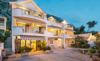
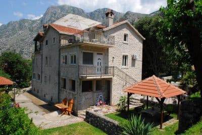
Übernachten nahe Bajova Kula
Alle Unterkünfte in Kotor →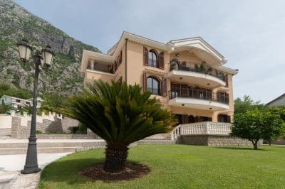

Fragen
- Is this a wild beach or a managed one?
- Managed. The JP Morsko dobro board at the entrance registers it as an organised public beach of 118 metres with a beach manager, HP Fjord, and the shore carries a cut-stone swimming platform, a buoyed swimming area and a landscaped deck behind it. An earlier version of this page called it wild, from the map alone.
- Is Bajova Kula the swimming platform beside Kotor’s Old Town walls?
- No. Bajova kula — Bajo’s tower — is the 17th-century tower of Bajo Pivljanin at Dražin Vrt, between Orahovac and Perast, and the beach named for it lies on the shore below the tower. OpenStreetMap and the Kotor municipal plan both place it there, about 11 km from the Old Town by the shore road.
- How do I get to Bajova Kula without a car?
- The Kotor local buses run along the shore road towards Perast and Risan; the stops on this stretch have shelters but no names on the map, so ask the driver for Dražin Vrt or the Bajova Kula restaurant.
- Is the water tested here?
- Yes, at its own station. Morsko dobro samples a point called "Bajova kula" nine or ten times a season and has done since 2020, so the result on this page is this beach’s own and not a neighbour’s. This page used to say the opposite; it was wrong.
Quellen
- OpenStreetMap — beach way 755698669 "Bajova kula", tower way 755698670, car park way 755698668, restaurant node 4376879119; Nominatim place lookup
- montenegro.com — Orahovac hub source notes (Kotor municipal plan: Bajo Pivljanin’s tower at Dražin Vrt; no long beach on this shore)
- Our "25 Best Beaches in Montenegro" list, entry 22 (length and surface; the location given there is wrong)
- OpenStreetMap — bus stop "Ljuta" tagged Blue line and unnamed sheltered stops on the M-1 within 600 m
- The JP Morsko dobro information board at the beach, photographed 2026-09-30: "JAVNO UREĐENO KUPALIŠTE / ORGANISED PUBLIC BEACH — 118 m", "KORISNIK / BEACH MANAGER: HP FJORD"
- Our own photographs of the beach, 2026-09-30 and 2026-10-01 — shore, shingle, stone platform, buoyed swimming area, landscaped deck, tower and shore-road parking