
Bajova Kula
Bajova kula
An organised 118-metre shingle beach at Dražin Vrt on the Kotor–Risan road, named for Bajo Pivljanin’s tower above it, with a stone swimming platform and the Boka wall across the water.
Our verdict
Bajova Kula is a shingle beach below the shore road between Orahovac and Perast, at Dražin Vrt beside the 17th-century tower that gives it its name. The board at the entrance calls it an organised public beach of 118 metres with a named manager, and it looks it: fine grey-blue pebbles, a cut-stone swimming platform with deep water straight off it, a buoyed swimming area, and behind the shore a landscaped timber deck with olive trees and festoon lighting. The seed list places it under Kotor’s walls; the map, the monument register and the board all put it here, 11 km up the coast.
- swimming
- quiet
- photography
Bajova Kula, in facts
The shore
Facilities
Access
Facts verified October 1, 2026 · Length: The JP Morsko dobro board at the beach: "organised public beach — 118 m". Our 25 Best list said 100 m and the OpenStreetMap polygon runs about 120 m; the official figure supersedes both · Facilities from The JP Morsko dobro board at the beach for the length, status and manager; OpenStreetMap contributors, ODbL, for the rest · 12 more still to check on the ground
Bajova Kula in pictures
Photographs and footage by Montenegro.com, free to reuse under CC BY 4.0. Ours were shot on October 1, 2026.
Map
The shaded water is the official bathing zone for station Bajova kula — the stretch JP Morsko dobro actually samples, not an outline of the beach.
Getting there
7.2 km
Kotor
8.8 km
Tivat airport
17 km
Herceg Novi
Straight-line distances — Montenegro's roads are mountain roads, so the drive is longer.
- By busKotor local buses (Blue Line) on the Kotor–Perast–Risan shore road; the nearest stops are unnamed on the map — ask for Dražin Vrt
- By carSome 11 km from Kotor by the shore road through Dobrota, Ljuta and Orahovac (Orahovac is 8.6 km; Dražin Vrt is 2.5 km further); the car park by the beach is private
- 1 min on footflat — Straight down from the shore road beside the Bajova Kula restaurant
Today at Bajova Kula
Which way the beach faces is computed from the OpenStreetMap coastline, so onshore and offshore mean this shore and not the region. Forecast by Open-Meteo
Water and awards
Excellent
Latest official sample September 28, 2026: Excellent
Sea 20.5 °C when the sample was taken
10 of 10 samples Excellent across the 2026 season
Official result from JP Morsko dobro, station Bajova kula
Clear over pale pebble in the shallows and deep straight off the stone platform; sampled by Morsko dobro at its own station here, "Bajova kula"
No award we can cite for this beach. Absence is information too.
Know before you swim
- The M-1 shore road runs directly behind the beach with no pavement on this stretch — walk and cross with care
- Mussel-farm float lines lie offshore all along this coast: do not swim through them
- The shore drops quickly: the water is deep straight off the stone platform, and the swimming area is buoyed but not large
- Parking is the gravel apron by the tower on the shore road and the restaurant’s own private car park — neither is large, and this is a narrow stretch of the M-1
When the water is warm
Bajova Kula was at its warmest, 27.6 °C, on August 31, 2026, and at its coldest, 20.1 °C, on May 25, 2026. Every point is a real sampling visit with the temperature read on the spot, not a monthly average copied from somewhere else.
See all 10 samplings
| Sampled | Sea | Result |
|---|---|---|
| September 28, 2026 | 20.5 °C | Excellent |
| September 14, 2026 | 25.2 °C | Excellent |
| August 31, 2026 | 27.6 °C | Excellent |
| August 17, 2026 | 25.3 °C | Excellent |
| August 3, 2026 | 25.4 °C | Excellent |
| July 20, 2026 | 26.9 °C | Excellent |
| July 6, 2026 | 22.5 °C | Excellent |
| June 22, 2026 | 25.8 °C | Excellent |
| June 8, 2026 | 23.6 °C | Excellent |
| May 25, 2026 | 20.1 °C | Excellent |
Season by season
Bajova Kula has been sampled 69 times since 2020: 64 of those readings Excellent, 5 below it.
How warm the water got, season by season. The average is of the July and August samplings only — a fixed window, so a year the inspectors happened to come early does not read as a cold one.
A handful of seasons is a record, not a trend: the spread here is what a few dated readings look like, not evidence of a sea warming or cooling. A hollow point marks a season that recorded a sampling below Excellent.
| Season | Samplings | Excellent | Below | Jul–Aug mean | Warmest |
|---|---|---|---|---|---|
| 2020 | 9 | 9 | — | 26.1 °C | 28.8 °C |
| 2021 | 10 | 10 | — | 25.5 °C | 27.1 °C |
| 2022 | 10 | 10 | — | 25.8 °C | 27.5 °C |
| 2023 | 10 | 9 | 1 | 25.5 °C | 27.6 °C |
| 2024 | 10 | 8 | 2 | 26.1 °C | 28.2 °C |
| 2025 | 10 | 8 | 2 | 25.2 °C | 26.5 °C |
| 2026in progress | 10 | 10 | — | 25.5 °C | 27.6 °C |
Nearby beaches



Bajova Kula and its neighbours
The same nine measures for the beaches you could reach the same day. Bold means it differs from this one.
| Measure | Bajova Kulathis beach |  Orahovac2.0 km Orahovac2.0 km |  Risan5.0 km Risan5.0 km |  Lipci6.4 km Lipci6.4 km |
|---|---|---|---|---|
| Surface | pebble | pebble | pebble | pebble |
| Entry | moderate | moderate | moderate | rocky — differs |
| Depth | deepens quickly | deepens quickly | deepens quickly | deepens quickly |
| Shade | natural | natural | none — differs | none — differs |
| Character | organised | wild — differs | wild — differs | wild — differs |
| Length | 118 m | 150 m | 200 m — differs | 20–50 m — differs |
| Latest water | Excellent | Excellent | Excellent | —no official sampling point — differs |
| Crowd | quiet | quiet | quiet | quiet |
| Getting there | by road | by road | on foot — differs | by road |
Stay near Bajova Kula
All stays in Kotor →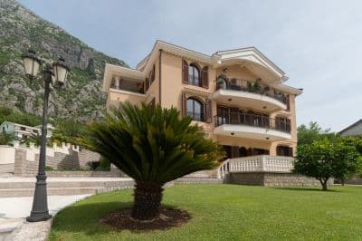
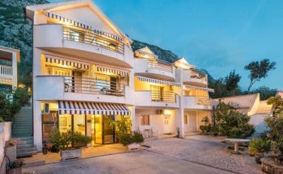
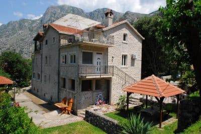

Questions
- Is this a wild beach or a managed one?
- Managed. The JP Morsko dobro board at the entrance registers it as an organised public beach of 118 metres with a beach manager, HP Fjord, and the shore carries a cut-stone swimming platform, a buoyed swimming area and a landscaped deck behind it. An earlier version of this page called it wild, from the map alone.
- Is Bajova Kula the swimming platform beside Kotor’s Old Town walls?
- No. Bajova kula — Bajo’s tower — is the 17th-century tower of Bajo Pivljanin at Dražin Vrt, between Orahovac and Perast, and the beach named for it lies on the shore below the tower. OpenStreetMap and the Kotor municipal plan both place it there, about 11 km from the Old Town by the shore road.
- How do I get to Bajova Kula without a car?
- The Kotor local buses run along the shore road towards Perast and Risan; the stops on this stretch have shelters but no names on the map, so ask the driver for Dražin Vrt or the Bajova Kula restaurant.
- Is the water tested here?
- Yes, at its own station. Morsko dobro samples a point called "Bajova kula" nine or ten times a season and has done since 2020, so the result on this page is this beach’s own and not a neighbour’s. This page used to say the opposite; it was wrong.
Sources
- OpenStreetMap — beach way 755698669 "Bajova kula", tower way 755698670, car park way 755698668, restaurant node 4376879119; Nominatim place lookup
- montenegro.com — Orahovac hub source notes (Kotor municipal plan: Bajo Pivljanin’s tower at Dražin Vrt; no long beach on this shore)
- Our "25 Best Beaches in Montenegro" list, entry 22 (length and surface; the location given there is wrong)
- OpenStreetMap — bus stop "Ljuta" tagged Blue line and unnamed sheltered stops on the M-1 within 600 m
- The JP Morsko dobro information board at the beach, photographed 2026-09-30: "JAVNO UREĐENO KUPALIŠTE / ORGANISED PUBLIC BEACH — 118 m", "KORISNIK / BEACH MANAGER: HP FJORD"
- Our own photographs of the beach, 2026-09-30 and 2026-10-01 — shore, shingle, stone platform, buoyed swimming area, landscaped deck, tower and shore-road parking