
Bajova Kula
Bajova kula
Una orilla de guijarros de 100 metros en Dražin Vrt, en la carretera de Kotor a Risan, que toma su nombre de la torre de Bajo Pivljanin que la domina, con Perast al otro lado del agua.
Nuestro veredicto
Bajova Kula es una playa de guijarros bajo la carretera de la costa entre Orahovac y Perast, situada por OpenStreetMap en Dražin Vrt, junto al restaurante del mismo nombre y a la torre que le da su nombre. Es un lugar para un baño de paso mientras se rodea la bahía, más que una salida de todo el día: sin concesión, con una caída rápida a aguas profundas de la bahía, y con vistas al oeste hacia Perast y el estrecho de Verige. La lista original la sitúa "cerca de Kotor"; tanto el mapa como el registro de monumentos la sitúan aquí, 11 km costa arriba.
- nadar
- tranquilidad
- fotografía
Bajova Kula, en datos
La orilla
Servicios
Acceso
Datos verificados el 1 de octubre de 2026 · Longitud: The JP Morsko dobro board at the beach: "organised public beach — 118 m". Our 25 Best list said 100 m and the OpenStreetMap polygon runs about 120 m; the official figure supersedes both · Servicios según The JP Morsko dobro board at the beach for the length, status and manager; OpenStreetMap contributors, ODbL, for the rest · Quedan 12 datos por comprobar sobre el terreno
Bajova Kula en imágenes
Fotografías y vídeos de Montenegro.com, libres de reutilizar bajo CC BY 4.0. Las nuestras se tomaron el 1 de octubre de 2026.
Mapa
El agua sombreada es la zona de baño oficial de la estación Bajova kula: el tramo que JP Morsko dobro muestrea realmente, no el contorno de la playa.
Cómo llegar
7.2 km
Kotor
8.8 km
Tivat airport
17 km
Herceg Novi
Distancias en línea recta — las carreteras de Montenegro son de montaña, así que el trayecto es más largo.
- En autobúsKotor local buses (Blue Line) on the Kotor–Perast–Risan shore road; the nearest stops are unnamed on the map — ask for Dražin Vrt
- En cocheSome 11 km from Kotor by the shore road through Dobrota, Ljuta and Orahovac (Orahovac is 8.6 km; Dražin Vrt is 2.5 km further); the car park by the beach is private
- 1 min a piellano — Straight down from the shore road beside the Bajova Kula restaurant
Hoy en Bajova Kula
La orientación se calcula a partir de la costa de OpenStreetMap, así que «hacia la playa» y «desde tierra» se refieren a esta orilla y no a la región. Previsión de Open-Meteo
Agua y galardones
Excelente
Última muestra oficial 28 de septiembre de 2026: Excelente
Mar a 20.5 °C en el momento de la muestra
10 de 10 muestras excelentes en la temporada 2026
Resultado oficial de JP Morsko dobro, estación Bajova kula
No hay estación de muestreo de Morsko Dobro en Dražin Vrt; el punto controlado más cercano es Orahovac 01, 2.5 km al sur
Ningún galardón que podamos citar para esta playa. La ausencia también es información.
Antes de bañarte
- La carretera M-1 pasa justo detrás de la playa sin acera en este tramo — camine y cruce con cuidado
- En toda esta costa hay líneas de boyas de los criaderos de mejillones mar adentro: no nade a través de ellas
- Una orilla de guijarros que cae rápido, sin socorrista y sin zona de baño señalizada en el mapa
- El aparcamiento junto a la playa es el privado del restaurante — no cuente con él en julio y agosto
Cuándo está templada el agua
Bajova Kula alcanzó su máximo, 27.6 °C, el 31 de agosto de 2026, y su mínimo, 20.1 °C, el 25 de mayo de 2026. Cada punto es una toma de muestra real con la temperatura medida en el sitio, no un promedio mensual copiado de otra parte.
Ver los 10 muestreos
| Muestreo | Mar | Resultado |
|---|---|---|
| 28 de septiembre de 2026 | 20.5 °C | Excelente |
| 14 de septiembre de 2026 | 25.2 °C | Excelente |
| 31 de agosto de 2026 | 27.6 °C | Excelente |
| 17 de agosto de 2026 | 25.3 °C | Excelente |
| 3 de agosto de 2026 | 25.4 °C | Excelente |
| 20 de julio de 2026 | 26.9 °C | Excelente |
| 6 de julio de 2026 | 22.5 °C | Excelente |
| 22 de junio de 2026 | 25.8 °C | Excelente |
| 8 de junio de 2026 | 23.6 °C | Excelente |
| 25 de mayo de 2026 | 20.1 °C | Excelente |
Temporada a temporada
Bajova Kula se ha muestreado 69 veces desde 2020: 64 de esas lecturas excelentes, 5 por debajo.
Lo caliente que llegó a estar el agua, temporada a temporada. La media es solo de los muestreos de julio y agosto: una ventana fija, para que un año en que los inspectores vinieron temprano no parezca frío.
Un puñado de temporadas es un registro, no una tendencia: lo que se ve aquí es la dispersión propia de unas pocas lecturas fechadas, no la prueba de un mar que se calienta o se enfría. Un punto hueco marca una temporada en la que algún muestreo quedó por debajo de excelente.
| Temporada | Muestreos | Excelente | Por debajo | Media jul.-ago. | Máxima |
|---|---|---|---|---|---|
| 2020 | 9 | 9 | — | 26.1 °C | 28.8 °C |
| 2021 | 10 | 10 | — | 25.5 °C | 27.1 °C |
| 2022 | 10 | 10 | — | 25.8 °C | 27.5 °C |
| 2023 | 10 | 9 | 1 | 25.5 °C | 27.6 °C |
| 2024 | 10 | 8 | 2 | 26.1 °C | 28.2 °C |
| 2025 | 10 | 8 | 2 | 25.2 °C | 26.5 °C |
| 2026en curso | 10 | 10 | — | 25.5 °C | 27.6 °C |
Playas cercanas



Bajova Kula y sus vecinas
Las mismas nueve medidas para las playas que puede alcanzar el mismo día. La negrita indica que difiere de esta.
| Medida | Bajova Kulaesta playa |  Orahovac2.0 km Orahovac2.0 km |  Risan5.0 km Risan5.0 km |  Lipci6.4 km Lipci6.4 km |
|---|---|---|---|---|
| Superficie | guijarros | guijarros | guijarros | guijarros |
| Entrada | moderada | moderada | moderada | rocosa — difiere |
| Profundidad | gana fondo rápido | gana fondo rápido | gana fondo rápido | gana fondo rápido |
| Sombra | natural | natural | ninguna — difiere | ninguna — difiere |
| Carácter | organizada | salvaje — difiere | salvaje — difiere | salvaje — difiere |
| Longitud | 118 m | 150 m | 200 m — difiere | 20–50 m — difiere |
| Última muestra | Excelente | Excelente | Excelente | —sin punto de muestreo oficial — difiere |
| Afluencia | tranquilidad | tranquilidad | tranquilidad | tranquilidad |
| Cómo llegar | en coche | en coche | a pie — difiere | en coche |
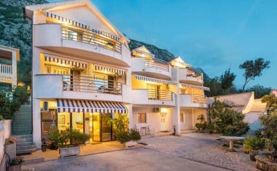
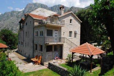
Alojarse cerca de Bajova Kula
Todos los alojamientos en Kotor →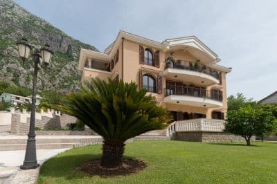

Preguntas
- Is this a wild beach or a managed one?
- Managed. The JP Morsko dobro board at the entrance registers it as an organised public beach of 118 metres with a beach manager, HP Fjord, and the shore carries a cut-stone swimming platform, a buoyed swimming area and a landscaped deck behind it. An earlier version of this page called it wild, from the map alone.
- Is Bajova Kula the swimming platform beside Kotor’s Old Town walls?
- No. Bajova kula — Bajo’s tower — is the 17th-century tower of Bajo Pivljanin at Dražin Vrt, between Orahovac and Perast, and the beach named for it lies on the shore below the tower. OpenStreetMap and the Kotor municipal plan both place it there, about 11 km from the Old Town by the shore road.
- How do I get to Bajova Kula without a car?
- The Kotor local buses run along the shore road towards Perast and Risan; the stops on this stretch have shelters but no names on the map, so ask the driver for Dražin Vrt or the Bajova Kula restaurant.
- Is the water tested here?
- Yes, at its own station. Morsko dobro samples a point called "Bajova kula" nine or ten times a season and has done since 2020, so the result on this page is this beach’s own and not a neighbour’s. This page used to say the opposite; it was wrong.
Fuentes
- OpenStreetMap — beach way 755698669 "Bajova kula", tower way 755698670, car park way 755698668, restaurant node 4376879119; Nominatim place lookup
- montenegro.com — Orahovac hub source notes (Kotor municipal plan: Bajo Pivljanin’s tower at Dražin Vrt; no long beach on this shore)
- Our "25 Best Beaches in Montenegro" list, entry 22 (length and surface; the location given there is wrong)
- OpenStreetMap — bus stop "Ljuta" tagged Blue line and unnamed sheltered stops on the M-1 within 600 m
- The JP Morsko dobro information board at the beach, photographed 2026-09-30: "JAVNO UREĐENO KUPALIŠTE / ORGANISED PUBLIC BEACH — 118 m", "KORISNIK / BEACH MANAGER: HP FJORD"
- Our own photographs of the beach, 2026-09-30 and 2026-10-01 — shore, shingle, stone platform, buoyed swimming area, landscaped deck, tower and shore-road parking