
Morinj
Una franja de 165 metros de arena y guijarro gris en la esquina de la bahía donde un arroyo frío sale del karst, con dos cámpings detrás y el restaurante de los molinos sobre la carretera.
Nuestro veredicto
Morinj es el único lugar en la cuenca de Risan con algo parecido a una playa: OpenStreetMap la etiqueta como arena, el resumen general la llama guijarro gris en una curva boscosa y sombreada, y ambos coinciden en que es tranquila y poco profunda —el baño familiar de este extremo de la bahía. Los manantiales bajo la superficie mantienen fría el agua en las desembocaduras del arroyo durante todo el verano, que es justo lo que se busca en agosto. La entrada es gratuita, las hamacas cuestan unos pocos euros en temporada, Kamp Naluka está en la desembocadura del río, y Ćatovića Mlini está en los jardines de los molinos, sobre la carretera.
- familias
- nadar
- tranquilidad
Morinj, en datos
La orilla
Servicios
Acceso
Normas y carácter
Datos verificados el 28 de septiembre de 2026 · Longitud: OpenStreetMap way 1278875855 "Plaža Morinj (3A)", about 165 m along the shore; no official length published · Quedan 11 datos por comprobar sobre el terreno
Morinj en imágenes
Algunas son nuestras y pueden reutilizarse bajo CC BY 4.0; las demás tienen licencia y no. Las nuestras se tomaron en septiembre de 2026.
Mapa
El agua sombreada es la zona de baño oficial de la estación Morinj 01: el tramo que JP Morsko dobro muestrea realmente, no el contorno de la playa.
Cómo llegar
10 km
Herceg Novi
11 km
Tivat airport
12 km
Kotor
Distancias en línea recta — las carreteras de Montenegro son de montaña, así que el trayecto es más largo.
- En autobúsStops with shelters on the M-1 shore road through the village (OpenStreetMap); route names not verified
- En cocheOn the M-1 at the north-west corner of the bay: Risan 5.9 km, the Kamenari ferry 5.5 km, Herceg Novi 20 km; paid parking about €4 a day by the beach, free spaces 200–500 m away
- 2 min a piellano — From the shore-road parking across to the pebbles where the stream comes in
Hoy en Morinj
La orientación se calcula a partir de la costa de OpenStreetMap, así que «hacia la playa» y «desde tierra» se refieren a esta orilla y no a la región. Previsión de Open-Meteo
Agua y galardones
Excelente
Última muestra oficial 28 de septiembre de 2026: Excelente
Mar a 20.2 °C en el momento de la muestra
6 de 10 muestras excelentes en la temporada 2026
Resultado oficial de JP Morsko dobro, estación Morinj 01
Agua verde y clara en el embarcadero; fría por los manantiales en las desembocaduras del arroyo durante todo el verano. No hay resultado de Morsko Dobro registrado para este sector
Ningún galardón que podamos citar para esta playa. La ausencia también es información.
Antes de bañarte
- El agua en las desembocaduras del arroyo se mantiene fría todo el verano —los manantiales suben bajo la superficie— así que entre despacio, sobre todo los niños
- Una línea de boyas marca la zona de baño en temporada; fuera de ella, los barcos usan el embarcadero y los amarres del cámping
- La carretera M-1 pasa entre los cámpings y la orilla — cruce con cuidado
- El aparcamiento de pago (unos €4 al día) se llena en julio y agosto; las plazas gratuitas están a 200–500 m
Cuándo está templada el agua
Morinj alcanzó su máximo, 25.8 °C, el 31 de agosto de 2026, y su mínimo, 16.8 °C, el 25 de mayo de 2026. Cada punto es una toma de muestra real con la temperatura medida en el sitio, no un promedio mensual copiado de otra parte.
Los puntos huecos son los 4 muestreos que no alcanzaron «Excelente».
Ver los 10 muestreos
| Muestreo | Mar | Resultado |
|---|---|---|
| 28 de septiembre de 2026 | 20.2 °C | Excelente |
| 14 de septiembre de 2026 | 22.4 °C | Suficiente |
| 31 de agosto de 2026 | 25.8 °C | Excelente |
| 17 de agosto de 2026 | 24.8 °C | Buena |
| 3 de agosto de 2026 | 23.1 °C | Excelente |
| 23 de julio de 2026 | 22.0 °C | Suficiente |
| 8 de julio de 2026 | 19.2 °C | Excelente |
| 22 de junio de 2026 | 24.0 °C | Buena |
| 8 de junio de 2026 | 17.0 °C | Excelente |
| 25 de mayo de 2026 | 16.8 °C | Excelente |
Temporada a temporada
Morinj se ha muestreado 69 veces desde 2020: 40 de esas lecturas excelentes, 29 por debajo.
Lo caliente que llegó a estar el agua, temporada a temporada. La media es solo de los muestreos de julio y agosto: una ventana fija, para que un año en que los inspectores vinieron temprano no parezca frío.
Un puñado de temporadas es un registro, no una tendencia: lo que se ve aquí es la dispersión propia de unas pocas lecturas fechadas, no la prueba de un mar que se calienta o se enfría. Un punto hueco marca una temporada en la que algún muestreo quedó por debajo de excelente.
| Temporada | Muestreos | Excelente | Por debajo | Media jul.-ago. | Máxima |
|---|---|---|---|---|---|
| 2020 | 9 | 8 | 1 | 24.6 °C | 26.6 °C |
| 2021 | 10 | 7 | 3 | 22.2 °C | 25.2 °C |
| 2022 | 10 | 7 | 3 | 23.8 °C | 25 °C |
| 2023 | 10 | 2 | 8 | 20.4 °C | 22.9 °C |
| 2024 | 10 | 4 | 6 | 23.4 °C | 26 °C |
| 2025 | 10 | 6 | 4 | 21.2 °C | 23.2 °C |
| 2026en curso | 10 | 6 | 4 | 23 °C | 25.8 °C |
Concesionada como
El Estado arrienda esta costa lote a lote. Morinj sale a concurso como 2 lotes que suman unos 135 m de orilla, cada uno con una categoría oficial.
| Categoría | Lotes | Orilla |
|---|---|---|
| Baño familiar | 2 | 135 m |
Unos 1,803 m² en total. Esto es lo concesionado, no lo observado: el número de hamacas, aseos y duchas por lote se fija en el contrato firmado, que no se publica. Licitaciones de JP Morsko dobro
Playas cercanas



Morinj y sus vecinas
Las mismas nueve medidas para las playas que puede alcanzar el mismo día. La negrita indica que difiere de esta.
| Medida | Morinjesta playa |  Lipci1.3 km Lipci1.3 km |  Risan4.5 km Risan4.5 km |  Stoliv5.1 km Stoliv5.1 km |
|---|---|---|---|---|
| Superficie | arena y guijarro fino | guijarros — difiere | guijarros — difiere | plataformas de hormigón — difiere |
| Entrada | suave | rocosa — difiere | moderada — difiere | pronunciada — difiere |
| Profundidad | poco profunda | gana fondo rápido — difiere | gana fondo rápido — difiere | profunda desde la orilla — difiere |
| Sombra | árboles y sombrillas | ninguna — difiere | ninguna — difiere | ninguna — difiere |
| Carácter | zonas organizadas y libres | salvaje — difiere | salvaje — difiere | salvaje — difiere |
| Longitud | 165 m | 20–50 m — difiere | 200 m | 100 m — difiere |
| Última muestra | Excelente | —sin punto de muestreo oficial — difiere | Excelente | Excelente |
| Afluencia | tranquilidad | tranquilidad | tranquilidad | tranquilidad |
| Cómo llegar | en coche | en coche | a pie — difiere | en coche |
Alojarse cerca de Morinj
Todos los alojamientos en Morinj →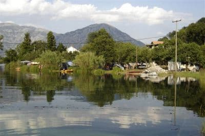
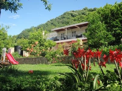
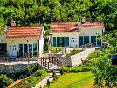
Preguntas
- ¿Es la playa de Morinj de arena o de guijarro?
- Ambas cosas, según a quién pregunte: OpenStreetMap etiqueta el sector como arena, nuestro resumen general y el directorio de playas describen guijarro gris. La imagen aérea muestra una orilla pálida y fina —espere grava fina y arena más que una franja arenosa.
- ¿Por qué está tan fría el agua?
- Manantiales de agua dulce suben bajo la superficie donde el arroyo de los molinos llega a la bahía, y mantienen fría el agua allí durante todo el verano. La bahía en sí alcanza unos 25 °C en agosto; las desembocaduras del arroyo, no.
- ¿Puedo acampar en Morinj?
- Sí: Autocamp Naluka está junto a la playa, en la desembocadura del río, con agua potable y wifi señalados en el mapa, y Autocamp Đule y Auto Kamp Lara están a un km al este, en la carretera de la costa.
- ¿Qué cuesta?
- La entrada es gratuita. Las hamacas cuestan unos €4–8 cada una de junio a septiembre, y el aparcamiento junto a la playa unos €4 al día, con plazas gratuitas a 200–500 m.
Fuentes
- montenegro.com — Morinj hub (/cities/morinj) and its source notes (traveltomontenegro.com Morinj beach page; mojaavantura.com distances)
- OpenStreetMap — beach way 1278875855 "Plaža Morinj (3A)", relation 17546484 "3B", campsite way 177389658 and nodes 4353804489, 4987897521, parking way 177389661, sheltered bus stops on the M-1
- montenegro.com — Lipci hub source notes (Morinj: Plaža Morinj, Autocamp Naluka, Autocamp Đule, a shop, Ćatovića Mlini)