
Morinj
A 165-metre strip of sand and grey pebble at the corner of the bay where a cold stream comes out of the karst, with two campsites behind it and the mills restaurant above the road.
Our verdict
Morinj is the one place in the Risan basin with something like a beach: OpenStreetMap tags it sand, the hub calls it grey pebbles in a shaded wooded bend, and both agree it is quiet and shallow — the family swim of this end of the bay. The springs under the surface keep the water cold at the stream mouths all summer, which is the point in August. Entry is free, loungers cost a few euros in season, Kamp Naluka is at the river mouth, and Ćatovića Mlini is in the mill gardens above the road.
Morinj, in facts
The shore
Facilities
Access
Rules and character
Facts verified September 28, 2026 · Length: OpenStreetMap way 1278875855 "Plaža Morinj (3A)", about 165 m along the shore; no official length published · 11 more still to check on the ground
Morinj in pictures
Some of these are ours, free to reuse under CC BY 4.0; the rest are licensed and are not. Ours were shot in September 2026.
Map
The shaded water is the official bathing zone for station Morinj 01 — the stretch JP Morsko dobro actually samples, not an outline of the beach.
Getting there
10 km
Herceg Novi
11 km
Tivat airport
12 km
Kotor
Straight-line distances — Montenegro's roads are mountain roads, so the drive is longer.
- By busStops with shelters on the M-1 shore road through the village (OpenStreetMap); route names not verified
- By carOn the M-1 at the north-west corner of the bay: Risan 5.9 km, the Kamenari ferry 5.5 km, Herceg Novi 20 km; paid parking about €4 a day by the beach, free spaces 200–500 m away
- 2 min on footflat — From the shore-road parking across to the pebbles where the stream comes in
Today at Morinj
Which way the beach faces is computed from the OpenStreetMap coastline, so onshore and offshore mean this shore and not the region. Forecast by Open-Meteo
Water and awards
Excellent
Latest official sample September 28, 2026: Excellent
Sea 20.2 °C when the sample was taken
6 of 10 samples Excellent across the 2026 season
Official result from JP Morsko dobro, station Morinj 01
Clear green water at the jetty; spring-cold at the stream mouths all summer. No Morsko Dobro result held for this sector
No award we can cite for this beach. Absence is information too.
Know before you swim
- The water at the stream mouths stays cold all summer — the springs come up under the surface — so enter slowly, especially children
- A buoyed line marks the swimming area in season; outside it, boats use the jetty and the campsite moorings
- The M-1 road runs between the campsites and the shore — cross with care
- The paid car park (about €4 a day) fills in July and August; the free spaces are 200–500 m away
When the water is warm
Morinj was at its warmest, 25.8 °C, on August 31, 2026, and at its coldest, 16.8 °C, on May 25, 2026. Every point is a real sampling visit with the temperature read on the spot, not a monthly average copied from somewhere else.
Hollow points are the 4 samplings that came back below Excellent.
See all 10 samplings
| Sampled | Sea | Result |
|---|---|---|
| September 28, 2026 | 20.2 °C | Excellent |
| September 14, 2026 | 22.4 °C | Sufficient |
| August 31, 2026 | 25.8 °C | Excellent |
| August 17, 2026 | 24.8 °C | Good |
| August 3, 2026 | 23.1 °C | Excellent |
| July 23, 2026 | 22.0 °C | Sufficient |
| July 8, 2026 | 19.2 °C | Excellent |
| June 22, 2026 | 24.0 °C | Good |
| June 8, 2026 | 17.0 °C | Excellent |
| May 25, 2026 | 16.8 °C | Excellent |
Season by season
Morinj has been sampled 69 times since 2020: 40 of those readings Excellent, 29 below it.
How warm the water got, season by season. The average is of the July and August samplings only — a fixed window, so a year the inspectors happened to come early does not read as a cold one.
A handful of seasons is a record, not a trend: the spread here is what a few dated readings look like, not evidence of a sea warming or cooling. A hollow point marks a season that recorded a sampling below Excellent.
| Season | Samplings | Excellent | Below | Jul–Aug mean | Warmest |
|---|---|---|---|---|---|
| 2020 | 9 | 8 | 1 | 24.6 °C | 26.6 °C |
| 2021 | 10 | 7 | 3 | 22.2 °C | 25.2 °C |
| 2022 | 10 | 7 | 3 | 23.8 °C | 25 °C |
| 2023 | 10 | 2 | 8 | 20.4 °C | 22.9 °C |
| 2024 | 10 | 4 | 6 | 23.4 °C | 26 °C |
| 2025 | 10 | 6 | 4 | 21.2 °C | 23.2 °C |
| 2026in progress | 10 | 6 | 4 | 23 °C | 25.8 °C |
Licensed as
The state leases this coast lot by lot. Morinj is tendered as 2 lots covering about 135 m of shore, each with an official category.
| Category | Lots | Shore |
|---|---|---|
| Family bathing | 2 | 135 m |
About 1,803 m² in total. This is what has been licensed, not what we saw: the number of sunbeds, toilets and showers on a lot is fixed in the signed lease, which is not published. JP Morsko dobro tenders
Nearby beaches



Morinj and its neighbours
The same nine measures for the beaches you could reach the same day. Bold means it differs from this one.
| Measure | Morinjthis beach |  Lipci1.3 km Lipci1.3 km |  Risan4.5 km Risan4.5 km |  Stoliv5.1 km Stoliv5.1 km |
|---|---|---|---|---|
| Surface | sand and fine pebble | pebble — differs | pebble — differs | concrete platforms — differs |
| Entry | gentle | rocky — differs | moderate — differs | steep — differs |
| Depth | shallow | deepens quickly — differs | deepens quickly — differs | deep at the edge — differs |
| Shade | trees and umbrellas | none — differs | none — differs | none — differs |
| Character | organised and free sections | wild — differs | wild — differs | wild — differs |
| Length | 165 m | 20–50 m — differs | 200 m | 100 m — differs |
| Latest water | Excellent | —no official sampling point — differs | Excellent | Excellent |
| Crowd | quiet | quiet | quiet | quiet |
| Getting there | by road | by road | on foot — differs | by road |
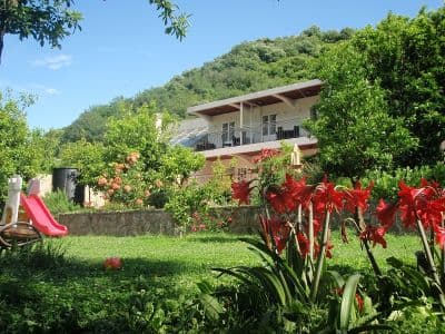
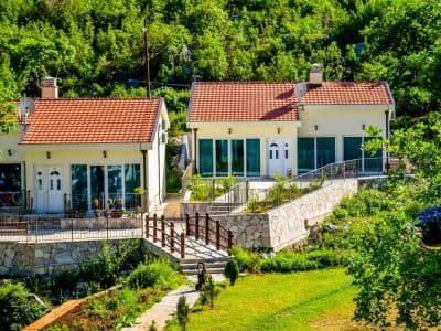
Stay near Morinj
All stays in Morinj →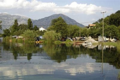
Questions
- Is Morinj beach sand or pebble?
- Both, depending on whom you ask: OpenStreetMap tags the sector sand, our hub and the beach directory describe grey pebbles. The aerial frame shows a pale, fine shore — expect fine gravel and sand rather than a sandy strand.
- Why is the water so cold?
- Freshwater springs come up under the surface where the stream from the mills reaches the bay, and they keep the water there cold all summer. The bay itself reaches about 25 °C in August; the stream mouths do not.
- Can I camp at Morinj?
- Yes: Autocamp Naluka is beside the beach at the river mouth, with drinking water and wifi mapped, and Autocamp Đule and Auto Kamp Lara are about 1 km east on the shore road.
- What does it cost?
- Entry is free. Loungers are about €4–8 each from June to September, and the car park by the beach about €4 a day, with free spaces 200–500 m away.
Sources
- montenegro.com — Morinj hub (/cities/morinj) and its source notes (traveltomontenegro.com Morinj beach page; mojaavantura.com distances)
- OpenStreetMap — beach way 1278875855 "Plaža Morinj (3A)", relation 17546484 "3B", campsite way 177389658 and nodes 4353804489, 4987897521, parking way 177389661, sheltered bus stops on the M-1
- montenegro.com — Lipci hub source notes (Morinj: Plaža Morinj, Autocamp Naluka, Autocamp Đule, a shop, Ćatovića Mlini)