
Morinj
Una striscia di 165 metri di sabbia e ciottoli grigi all'angolo della baia dove un ruscello freddo esce dal carso, con due campeggi alle spalle e il ristorante dei mulini sopra la strada.
Il nostro verdetto
Morinj è l'unico posto nel bacino di Risan con qualcosa che assomiglia a una spiaggia: OpenStreetMap la etichetta come sabbia, la nostra pagina generale la descrive come ciottoli grigi in un'ansa boscosa e ombreggiata, ed entrambe concordano che sia tranquilla e bassa — il bagno di famiglia di questa parte della baia. Le sorgenti sotto la superficie mantengono l'acqua fredda alle foci dei ruscelli per tutta l'estate, ed è proprio questo il punto di forza ad agosto. L'ingresso è gratuito, i lettini costano pochi euro in stagione, il Kamp Naluka si trova alla foce del fiume, e Ćatovića Mlini si trova nei giardini dei mulini sopra la strada.
- famiglie
- nuotare
- tranquillità
Morinj, in dati
La riva
Servizi
Accesso
Regole e carattere
Dati verificati il 28 settembre 2026 · Lunghezza: OpenStreetMap way 1278875855 "Plaža Morinj (3A)", about 165 m along the shore; no official length published · Altri 11 dati da verificare sul posto
Morinj in immagini
Alcune sono nostre e riutilizzabili con licenza CC BY 4.0; le altre sono su licenza e non lo sono. Le nostre sono di settembre 2026.
Mappa
L’area ombreggiata è la zona di balneazione ufficiale della stazione Morinj 01: il tratto che JP Morsko dobro campiona davvero, non il contorno della spiaggia.
Come arrivare
10 km
Herceg Novi
11 km
Tivat airport
12 km
Kotor
Distanze in linea d'aria — le strade del Montenegro sono strade di montagna, quindi il viaggio è più lungo.
- In autobusStops with shelters on the M-1 shore road through the village (OpenStreetMap); route names not verified
- In autoOn the M-1 at the north-west corner of the bay: Risan 5.9 km, the Kamenari ferry 5.5 km, Herceg Novi 20 km; paid parking about €4 a day by the beach, free spaces 200–500 m away
- 2 min a piedipianeggiante — From the shore-road parking across to the pebbles where the stream comes in
Oggi a Morinj
L’orientamento è calcolato dalla linea di costa di OpenStreetMap, quindi «verso la spiaggia» e «da terra» riguardano questa riva, non la regione. Previsioni di Open-Meteo
Acqua e riconoscimenti
Eccellente
Ultimo campione ufficiale 28 settembre 2026: Eccellente
Mare a 20.2 °C al momento del prelievo
6 campioni eccellenti su 10 nella stagione 2026
Risultato ufficiale di JP Morsko dobro, stazione Morinj 01
Acqua verde limpida presso il pontile; fredda come una sorgente alle foci dei ruscelli per tutta l'estate. Nessun risultato Morsko Dobro disponibile per questo settore
Nessun riconoscimento che possiamo citare per questa spiaggia. Anche l'assenza è un'informazione.
Da sapere prima di fare il bagno
- L'acqua alle foci dei ruscelli resta fredda tutta l'estate — le sorgenti risalgono sotto la superficie — quindi entra lentamente, soprattutto i bambini
- Una linea di boe segna l'area di balneazione in stagione; al di fuori di essa, le barche usano il pontile e gli ormeggi del campeggio
- La strada M-1 corre tra i campeggi e l'arenile — attraversa con prudenza
- Il parcheggio a pagamento (circa 4 € al giorno) si riempie a luglio e agosto; i posti gratuiti sono a 200–500 m di distanza
Quando l'acqua è calda
Morinj ha toccato il massimo, 25.8 °C, il 31 agosto 2026, e il minimo, 16.8 °C, il 25 maggio 2026. Ogni punto è un campionamento reale con la temperatura rilevata sul posto, non una media mensile copiata altrove.
I punti vuoti sono i 4 campionamenti risultati sotto «Eccellente».
Vedi tutti i 10 campionamenti
| Campionato | Mare | Esito |
|---|---|---|
| 28 settembre 2026 | 20.2 °C | Eccellente |
| 14 settembre 2026 | 22.4 °C | Sufficiente |
| 31 agosto 2026 | 25.8 °C | Eccellente |
| 17 agosto 2026 | 24.8 °C | Buona |
| 3 agosto 2026 | 23.1 °C | Eccellente |
| 23 luglio 2026 | 22.0 °C | Sufficiente |
| 8 luglio 2026 | 19.2 °C | Eccellente |
| 22 giugno 2026 | 24.0 °C | Buona |
| 8 giugno 2026 | 17.0 °C | Eccellente |
| 25 maggio 2026 | 16.8 °C | Eccellente |
Stagione per stagione
Morinj è stata campionata 69 volte dal 2020: 40 di quelle letture eccellenti, 29 sotto.
Quanto si è scaldata l'acqua, stagione per stagione. La media riguarda solo i campionamenti di luglio e agosto: una finestra fissa, così un anno in cui gli ispettori sono passati presto non risulta freddo.
Una manciata di stagioni è un archivio, non una tendenza: quella che si vede qui è la dispersione normale di poche misure datate, non la prova di un mare che si scalda o si raffredda. Un punto vuoto segna una stagione in cui un campionamento è finito sotto «eccellente».
| Stagione | Campionamenti | Eccellente | Sotto | Media lug.-ago. | Massima |
|---|---|---|---|---|---|
| 2020 | 9 | 8 | 1 | 24.6 °C | 26.6 °C |
| 2021 | 10 | 7 | 3 | 22.2 °C | 25.2 °C |
| 2022 | 10 | 7 | 3 | 23.8 °C | 25 °C |
| 2023 | 10 | 2 | 8 | 20.4 °C | 22.9 °C |
| 2024 | 10 | 4 | 6 | 23.4 °C | 26 °C |
| 2025 | 10 | 6 | 4 | 21.2 °C | 23.2 °C |
| 2026in corso | 10 | 6 | 4 | 23 °C | 25.8 °C |
In concessione come
Lo Stato affitta questa costa lotto per lotto. Morinj è messa a gara in 2 lotti per circa 135 m di riva, ognuno con una categoria ufficiale.
| Categoria | Lotti | Riva |
|---|---|---|
| Balneazione per famiglie | 2 | 135 m |
Circa 1,803 m² in tutto. Questo è ciò che è in concessione, non ciò che abbiamo visto: il numero di lettini, servizi e docce per lotto è fissato nel contratto firmato, che non viene pubblicato. Bandi di JP Morsko dobro
Spiagge vicine



Morinj e le spiagge vicine
Le stesse nove misure per le spiagge raggiungibili in giornata. Il grassetto indica una differenza rispetto a questa.
| Misura | Morinjquesta spiaggia |  Lipci1.3 km Lipci1.3 km |  Risan4.5 km Risan4.5 km |  Stoliv5.1 km Stoliv5.1 km |
|---|---|---|---|---|
| Fondo | sabbia e ciottoli fini | ciottoli — differisce | ciottoli — differisce | piattaforme di cemento — differisce |
| Ingresso | dolce | roccioso — differisce | moderato — differisce | ripido — differisce |
| Profondità | bassa | si fa presto profonda — differisce | si fa presto profonda — differisce | profonda dalla riva — differisce |
| Ombra | alberi e ombrelloni | nessuna — differisce | nessuna — differisce | nessuna — differisce |
| Carattere | tratti attrezzati e liberi | selvaggia — differisce | selvaggia — differisce | selvaggia — differisce |
| Lunghezza | 165 m | 20–50 m — differisce | 200 m | 100 m — differisce |
| Ultimo campione | Eccellente | —nessun punto di campionamento ufficiale — differisce | Eccellente | Eccellente |
| Affollamento | tranquillità | tranquillità | tranquillità | tranquillità |
| Come arrivare | in auto | in auto | a piedi — differisce | in auto |
Dormire vicino a Morinj
Tutti gli alloggi a Morinj →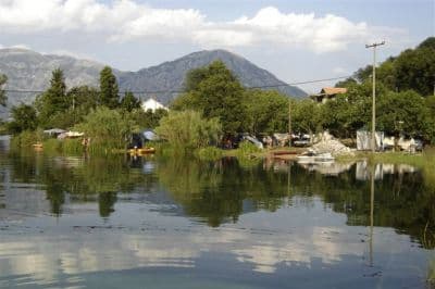
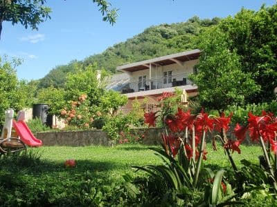
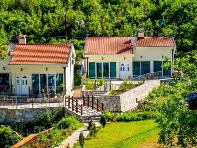
Domande
- La spiaggia di Morinj è sabbia o ciottoli?
- Entrambe le cose, a seconda di chi lo chiedi: OpenStreetMap etichetta il settore come sabbia, la nostra pagina generale e l'elenco delle spiagge descrivono ciottoli grigi. L'immagine aerea mostra un arenile chiaro e fine — aspettati ghiaia fine e sabbia più che un vero arenile sabbioso.
- Perché l'acqua è così fredda?
- Sorgenti di acqua dolce risalgono sotto la superficie dove il ruscello dei mulini raggiunge la baia, e mantengono l'acqua lì fredda per tutta l'estate. La baia stessa raggiunge circa 25 °C ad agosto; le foci dei ruscelli no.
- Si può fare campeggio a Morinj?
- Sì: l'Autocamp Naluka si trova accanto alla spiaggia alla foce del fiume, con acqua potabile e wifi segnalati in mappa, e l'Autocamp Đule e l'Auto Kamp Lara sono a circa 1 km a est sulla strada costiera.
- Quanto costa?
- L'ingresso è gratuito. I lettini costano circa 4–8 € ciascuno da giugno a settembre, e il parcheggio accanto alla spiaggia circa 4 € al giorno, con posti gratuiti a 200–500 m di distanza.
Fonti
- montenegro.com — Morinj hub (/cities/morinj) and its source notes (traveltomontenegro.com Morinj beach page; mojaavantura.com distances)
- OpenStreetMap — beach way 1278875855 "Plaža Morinj (3A)", relation 17546484 "3B", campsite way 177389658 and nodes 4353804489, 4987897521, parking way 177389661, sheltered bus stops on the M-1
- montenegro.com — Lipci hub source notes (Morinj: Plaža Morinj, Autocamp Naluka, Autocamp Đule, a shop, Ćatovića Mlini)