
Bajova Kula
Bajova kula
100-metarska šljunkovita obala u Dražinom Vrtu na putu Kotor–Risan, nazvana po kuli Baja Pivljanina iznad nje, sa Perastom na drugoj strani vode.
Naša ocjena
Bajova Kula je šljunkovita plaža ispod obalskog puta između Orahovca i Perasta, koju OpenStreetMap smješta u Dražin Vrt, pored istoimenog restorana i kule po kojoj je dobila ime. Ovo je mjesto za kupanje usput, dok obilazite zaliv, a ne za cio dan: nema koncesiju, brzo se ulazi u duboku vodu zaliva, a pogled puca na zapad ka Perastu i tjesnacu Verige. Polazna lista je smješta pod zidine Kotora; i karta i registar spomenika je, međutim, smještaju ovdje, 11 km uz obalu.
- plivanje
- mir
- fotografisanje
Bajova Kula u činjenicama
Obala
Sadržaji
Pristup
Činjenice provjerene 1. oktobar 2026. · Dužina: The JP Morsko dobro board at the beach: "organised public beach — 118 m". Our 25 Best list said 100 m and the OpenStreetMap polygon runs about 120 m; the official figure supersedes both · Sadržaji prema izvoru The JP Morsko dobro board at the beach for the length, status and manager; OpenStreetMap contributors, ODbL, for the rest · Još 12 podataka treba provjeriti na licu mjesta
Bajova Kula u slikama
Fotografije i snimci: Montenegro.com, slobodni za korišćenje pod licencom CC BY 4.0. Naši snimci su od 1. oktobar 2026.
Mapa
Osjenčena površina je zvanična kupališna zona mjerne stanice Bajova kula — dionica koju JP Morsko dobro zaista uzorkuje, a ne obris plaže.
Kako doći
7.2 km
Kotor
8.8 km
Tivat airport
17 km
Herceg Novi
Rastojanja vazdušnom linijom — crnogorski putevi su planinski, pa je vožnja duža.
- AutobusomKotor local buses (Blue Line) on the Kotor–Perast–Risan shore road; the nearest stops are unnamed on the map — ask for Dražin Vrt
- AutomSome 11 km from Kotor by the shore road through Dobrota, Ljuta and Orahovac (Orahovac is 8.6 km; Dražin Vrt is 2.5 km further); the car park by the beach is private
- 1 min pješkeravno — Straight down from the shore road beside the Bajova Kula restaurant
Danas na plaži Bajova Kula
Orijentacija je izračunata iz OpenStreetMap linije obale, pa se „prema obali“ i „s kopna“ odnose na ovu obalu, a ne na region. Prognoza: Open-Meteo
Voda i priznanja
Odlična
Posljednji zvanični uzorak 28. septembar 2026.: Odlična
More 20.5 °C u trenutku uzorkovanja
10 od 10 uzoraka ocijenjeno odlično u sezoni 2026
Zvanični rezultat JP Morsko dobro, mjerna stanica Bajova kula
Nema mjerne stanice Morskog Dobra u Dražinom Vrtu; najbliža nadzirana lokacija je Orahovac 01, 2,5 km južnije
Nema priznanja koje možemo navesti za ovu plažu. I to je informacija.
Znajte prije kupanja
- Put M-1 prolazi neposredno iza plaže bez trotoara na ovoj dionici — hodajte i prelazite pažljivo
- Plutajuće linije uzgajališta dagnji nalaze se duž cijele ove obale: ne plivajte kroz njih
- Šljunkovita obala koja naglo tone, bez spasioca i bez obilježene zone za kupanje na karti
- Parking pored plaže je privatni parking restorana — ne računajte na njega u julu i avgustu
Kad je more toplo
Najtoplije je bilo 27.6 °C, 31. avgust 2026., a najhladnije 20.1 °C, 25. maj 2026.. Svaka tačka je stvarni izlazak na teren, sa temperaturom izmjerenom na licu mjesta, a ne mjesečni prosjek prepisan sa strane.
Prikaži svih 10 uzorkovanja
| Uzorkovano | More | Ocjena |
|---|---|---|
| 28. septembar 2026. | 20.5 °C | Odlična |
| 14. septembar 2026. | 25.2 °C | Odlična |
| 31. avgust 2026. | 27.6 °C | Odlična |
| 17. avgust 2026. | 25.3 °C | Odlična |
| 3. avgust 2026. | 25.4 °C | Odlična |
| 20. jul 2026. | 26.9 °C | Odlična |
| 6. jul 2026. | 22.5 °C | Odlična |
| 22. jun 2026. | 25.8 °C | Odlična |
| 8. jun 2026. | 23.6 °C | Odlična |
| 25. maj 2026. | 20.1 °C | Odlična |
Zvanični rezultat JP Morsko dobro, mjerna stanica Bajova kula
Sezona po sezonu
Voda na plaži Bajova Kula uzorkovana je 69 puta od 2020. godine: 64 puta ocijenjena je kao odlična, 5 puta niže od toga.
Koliko se voda ugrijala, sezona po sezonu. Prosjek obuhvata samo uzorkovanja u julu i avgustu — stalni prozor, da godina u kojoj su inspektori dolazili rano ne ispadne hladna.
Nekoliko sezona je zapis, a ne trend: ovo rasipanje pokazuje kako izgleda mali broj datiranih mjerenja, a ne dokaz da se more grije ili hladi. Šuplja tačka označava sezonu u kojoj je jedno uzorkovanje bilo ispod ocjene odlična.
| Sezona | Uzorkovanja | Odlična | Ispod | Prosjek jul–avg. | Najtoplije |
|---|---|---|---|---|---|
| 2020 | 9 | 9 | — | 26.1 °C | 28.8 °C |
| 2021 | 10 | 10 | — | 25.5 °C | 27.1 °C |
| 2022 | 10 | 10 | — | 25.8 °C | 27.5 °C |
| 2023 | 10 | 9 | 1 | 25.5 °C | 27.6 °C |
| 2024 | 10 | 8 | 2 | 26.1 °C | 28.2 °C |
| 2025 | 10 | 8 | 2 | 25.2 °C | 26.5 °C |
| 2026u toku | 10 | 10 | — | 25.5 °C | 27.6 °C |
Zvanični rezultat JP Morsko dobro, mjerna stanica Bajova kula
Plaže u blizini



Bajova Kula i susjedne plaže
Istih devet podataka za plaže do kojih možete stići istog dana. Podebljano znači da se razlikuje od ove.
| Podatak | Bajova Kulaova plaža |  Orahovac2.0 km Orahovac2.0 km |  Risan5.0 km Risan5.0 km |  Lipci6.4 km Lipci6.4 km |
|---|---|---|---|---|
| Podloga | šljunak | šljunak | šljunak | šljunak |
| Ulazak u more | umjeren | umjeren | umjeren | kamenit — razlikuje se |
| Dubina | brzo postaje duboko | brzo postaje duboko | brzo postaje duboko | brzo postaje duboko |
| Hlad | prirodni | prirodni | nema — razlikuje se | nema — razlikuje se |
| Karakter | uređena | divlja — razlikuje se | divlja — razlikuje se | divlja — razlikuje se |
| Dužina | 118 m | 150 m | 200 m — razlikuje se | 20–50 m — razlikuje se |
| Posljednji uzorak | Odlična | Odlična | Odlična | —nema zvaničnog mjernog mjesta — razlikuje se |
| Gužva | mir | mir | mir | mir |
| Kako doći | automobilom | automobilom | pješke — razlikuje se | automobilom |
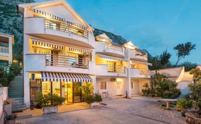
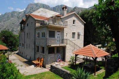
Smještaj blizu plaže Bajova Kula
Sav smještaj u mjestu Kotor →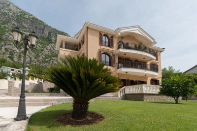

Pitanja
- Is this a wild beach or a managed one?
- Managed. The JP Morsko dobro board at the entrance registers it as an organised public beach of 118 metres with a beach manager, HP Fjord, and the shore carries a cut-stone swimming platform, a buoyed swimming area and a landscaped deck behind it. An earlier version of this page called it wild, from the map alone.
- Is Bajova Kula the swimming platform beside Kotor’s Old Town walls?
- No. Bajova kula — Bajo’s tower — is the 17th-century tower of Bajo Pivljanin at Dražin Vrt, between Orahovac and Perast, and the beach named for it lies on the shore below the tower. OpenStreetMap and the Kotor municipal plan both place it there, about 11 km from the Old Town by the shore road.
- How do I get to Bajova Kula without a car?
- The Kotor local buses run along the shore road towards Perast and Risan; the stops on this stretch have shelters but no names on the map, so ask the driver for Dražin Vrt or the Bajova Kula restaurant.
- Is the water tested here?
- Yes, at its own station. Morsko dobro samples a point called "Bajova kula" nine or ten times a season and has done since 2020, so the result on this page is this beach’s own and not a neighbour’s. This page used to say the opposite; it was wrong.
Izvori
- OpenStreetMap — beach way 755698669 "Bajova kula", tower way 755698670, car park way 755698668, restaurant node 4376879119; Nominatim place lookup
- montenegro.com — Orahovac hub source notes (Kotor municipal plan: Bajo Pivljanin’s tower at Dražin Vrt; no long beach on this shore)
- Our "25 Best Beaches in Montenegro" list, entry 22 (length and surface; the location given there is wrong)
- OpenStreetMap — bus stop "Ljuta" tagged Blue line and unnamed sheltered stops on the M-1 within 600 m
- The JP Morsko dobro information board at the beach, photographed 2026-09-30: "JAVNO UREĐENO KUPALIŠTE / ORGANISED PUBLIC BEACH — 118 m", "KORISNIK / BEACH MANAGER: HP FJORD"
- Our own photographs of the beach, 2026-09-30 and 2026-10-01 — shore, shingle, stone platform, buoyed swimming area, landscaped deck, tower and shore-road parking