
Bajova Kula
Bajova kula
Une rive de galets de 100 mètres à Dražin Vrt, sur la route Kotor–Risan, qui doit son nom à la tour de Bajo Pivljanin qui la domine, avec Perast de l’autre côté de l’eau.
Notre verdict
Bajova Kula est une plage de galets en contrebas de la route littorale entre Orahovac et Perast, localisée par OpenStreetMap à Dražin Vrt, à côté du restaurant du même nom et de la tour qui lui donne son nom. C’est un endroit pour une baignade en faisant le tour de la baie plutôt qu’une sortie à la journée : aucune concession, une entrée rapide dans une eau profonde, et la vue vers l’ouest sur Perast et le détroit de Verige. La liste d’origine la situe sous les murs de Kotor ; la carte comme le registre des monuments la placent tous deux ici, à 11 km le long de la côte.
- nage
- calme
- photographie
Bajova Kula, en quelques repères
Le rivage
Équipements
Accès
Données vérifiées le 1 octobre 2026 · Longueur: The JP Morsko dobro board at the beach: "organised public beach — 118 m". Our 25 Best list said 100 m and the OpenStreetMap polygon runs about 120 m; the official figure supersedes both · Équipements d'après The JP Morsko dobro board at the beach for the length, status and manager; OpenStreetMap contributors, ODbL, for the rest · 12 points restent à vérifier sur place
Bajova Kula en images
Photographies et images de Montenegro.com, réutilisables sous licence CC BY 4.0. Les nôtres datent du 1 octobre 2026.
Carte
La zone ombrée est la zone de baignade officielle de la station Bajova kula : la portion que JP Morsko dobro prélève réellement, et non le contour de la plage.
Y aller
7.2 km
Kotor
8.8 km
Tivat airport
17 km
Herceg Novi
Distances à vol d'oiseau — les routes du Monténégro sont des routes de montagne, le trajet est donc plus long.
- En busKotor local buses (Blue Line) on the Kotor–Perast–Risan shore road; the nearest stops are unnamed on the map — ask for Dražin Vrt
- En voitureSome 11 km from Kotor by the shore road through Dobrota, Ljuta and Orahovac (Orahovac is 8.6 km; Dražin Vrt is 2.5 km further); the car park by the beach is private
- 1 min à piedplat — Straight down from the shore road beside the Bajova Kula restaurant
Aujourd'hui à Bajova Kula
L’orientation est calculée depuis le trait de côte OpenStreetMap : « vers la plage » et « de la terre » désignent ce rivage, pas la région. Prévisions par Open-Meteo
Eau et labels
Excellente
Dernier prélèvement officiel 28 septembre 2026 : Excellente
Mer à 20.5 °C lors du prélèvement
10 prélèvements excellents sur 10 durant la saison 2026
Résultat officiel de JP Morsko dobro, station Bajova kula
Aucune station de prélèvement Morsko Dobro à Dražin Vrt ; le site surveillé le plus proche est Orahovac 01, à 2,5 km au sud
Aucun label que nous puissions citer pour cette plage. L'absence est aussi une information.
À savoir avant de se baigner
- La route littorale M-1 longe directement l’arrière de la plage sans trottoir sur ce tronçon — marchez et traversez avec prudence
- Des lignes de flotteurs de moules s’étirent au large tout le long de cette côte : ne nagez pas au travers
- Une rive de galets qui plonge rapidement, sans maître-nageur ni zone de baignade balisée sur la carte
- Le parking à côté de la plage est celui, privé, du restaurant — ne comptez pas dessus en juillet et août
Quand l'eau est chaude
Bajova Kula a atteint son maximum, 27.6 °C, le 31 août 2026, et son minimum, 20.1 °C, le 25 mai 2026. Chaque point est un prélèvement réel avec la température relevée sur place, et non une moyenne mensuelle recopiée ailleurs.
Voir les 10 prélèvements
| Prélevé | Mer | Résultat |
|---|---|---|
| 28 septembre 2026 | 20.5 °C | Excellente |
| 14 septembre 2026 | 25.2 °C | Excellente |
| 31 août 2026 | 27.6 °C | Excellente |
| 17 août 2026 | 25.3 °C | Excellente |
| 3 août 2026 | 25.4 °C | Excellente |
| 20 juillet 2026 | 26.9 °C | Excellente |
| 6 juillet 2026 | 22.5 °C | Excellente |
| 22 juin 2026 | 25.8 °C | Excellente |
| 8 juin 2026 | 23.6 °C | Excellente |
| 25 mai 2026 | 20.1 °C | Excellente |
Saison par saison
Bajova Kula a fait l'objet de 69 prélèvements depuis 2020 : 64 relevés excellents, 5 en dessous.
La chaleur qu'a atteinte l'eau, saison par saison. La moyenne ne porte que sur les prélèvements de juillet et août : une fenêtre fixe, pour qu'une année où les inspecteurs sont passés tôt ne paraisse pas froide.
Une poignée de saisons est un relevé, pas une tendance : ce que l'on voit ici est la dispersion normale de quelques mesures datées, non la preuve d'une mer qui se réchauffe ou se refroidit. Un point creux signale une saison où un prélèvement est passé sous « excellente ».
| Saison | Prélèvements | Excellente | En dessous | Moyenne juil.-août | Maximum |
|---|---|---|---|---|---|
| 2020 | 9 | 9 | — | 26.1 °C | 28.8 °C |
| 2021 | 10 | 10 | — | 25.5 °C | 27.1 °C |
| 2022 | 10 | 10 | — | 25.8 °C | 27.5 °C |
| 2023 | 10 | 9 | 1 | 25.5 °C | 27.6 °C |
| 2024 | 10 | 8 | 2 | 26.1 °C | 28.2 °C |
| 2025 | 10 | 8 | 2 | 25.2 °C | 26.5 °C |
| 2026en cours | 10 | 10 | — | 25.5 °C | 27.6 °C |
Plages à proximité



Bajova Kula et ses voisines
Les mêmes neuf mesures pour les plages accessibles dans la journée. Le gras signale une différence avec celle-ci.
| Mesure | Bajova Kulacette plage |  Orahovac2.0 km Orahovac2.0 km |  Risan5.0 km Risan5.0 km |  Lipci6.4 km Lipci6.4 km |
|---|---|---|---|---|
| Sol | galets | galets | galets | galets |
| Entrée | modérée | modérée | modérée | rocheuse — diffère |
| Profondeur | profond rapidement | profond rapidement | profond rapidement | profond rapidement |
| Ombre | naturelle | naturelle | aucune — diffère | aucune — diffère |
| Caractère | aménagée | sauvage — diffère | sauvage — diffère | sauvage — diffère |
| Longueur | 118 m | 150 m | 200 m — diffère | 20–50 m — diffère |
| Dernier prélèvement | Excellente | Excellente | Excellente | —pas de point de prélèvement officiel — diffère |
| Affluence | calme | calme | calme | calme |
| Accès | en voiture | en voiture | à pied — diffère | en voiture |
Dormir près de Bajova Kula
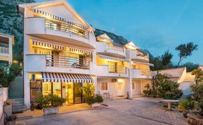
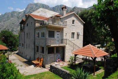
Tous les hébergements à Kotor →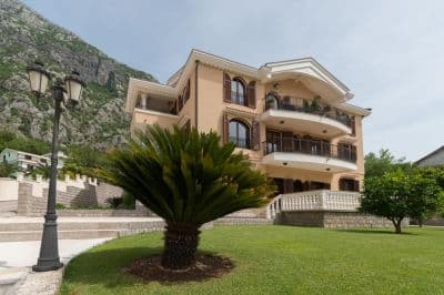

Questions
- Is this a wild beach or a managed one?
- Managed. The JP Morsko dobro board at the entrance registers it as an organised public beach of 118 metres with a beach manager, HP Fjord, and the shore carries a cut-stone swimming platform, a buoyed swimming area and a landscaped deck behind it. An earlier version of this page called it wild, from the map alone.
- Is Bajova Kula the swimming platform beside Kotor’s Old Town walls?
- No. Bajova kula — Bajo’s tower — is the 17th-century tower of Bajo Pivljanin at Dražin Vrt, between Orahovac and Perast, and the beach named for it lies on the shore below the tower. OpenStreetMap and the Kotor municipal plan both place it there, about 11 km from the Old Town by the shore road.
- How do I get to Bajova Kula without a car?
- The Kotor local buses run along the shore road towards Perast and Risan; the stops on this stretch have shelters but no names on the map, so ask the driver for Dražin Vrt or the Bajova Kula restaurant.
- Is the water tested here?
- Yes, at its own station. Morsko dobro samples a point called "Bajova kula" nine or ten times a season and has done since 2020, so the result on this page is this beach’s own and not a neighbour’s. This page used to say the opposite; it was wrong.
Sources
- OpenStreetMap — beach way 755698669 "Bajova kula", tower way 755698670, car park way 755698668, restaurant node 4376879119; Nominatim place lookup
- montenegro.com — Orahovac hub source notes (Kotor municipal plan: Bajo Pivljanin’s tower at Dražin Vrt; no long beach on this shore)
- Our "25 Best Beaches in Montenegro" list, entry 22 (length and surface; the location given there is wrong)
- OpenStreetMap — bus stop "Ljuta" tagged Blue line and unnamed sheltered stops on the M-1 within 600 m
- The JP Morsko dobro information board at the beach, photographed 2026-09-30: "JAVNO UREĐENO KUPALIŠTE / ORGANISED PUBLIC BEACH — 118 m", "KORISNIK / BEACH MANAGER: HP FJORD"
- Our own photographs of the beach, 2026-09-30 and 2026-10-01 — shore, shingle, stone platform, buoyed swimming area, landscaped deck, tower and shore-road parking