
Bajova Kula
Bajova kula
En 100 meter lang steinstrand ved Dražin Vrt langs veien Kotor–Risan, oppkalt etter Bajo Pivljanins tårn ovenfor, med Perast på den andre siden av vannet.
Vår dom
Bajova Kula er en steinstrand nedenfor kystveien mellom Orahovac og Perast, kartlagt av OpenStreetMap ved Dražin Vrt, ved siden av restauranten med samme navn og tårnet stranden har fått navnet sitt fra. Det er et sted for en dukkert på vei rundt bukten, snarere enn en heldagsutflukt: ingen strandkonsesjon, en rask nedgang i dypt buktvann, og utsikt vestover mot Perast og Verige-sundet. Utgangslisten vår plasserer den under murene i Kotor; både kartet og monumentregisteret plasserer den her, 11 km oppover kysten.
- svømming
- ro
- fotografering
Bajova Kula i fakta
Stranden
Fasiliteter
Adkomst
Fakta verifisert 1. oktober 2026 · Lengde: The JP Morsko dobro board at the beach: "organised public beach — 118 m". Our 25 Best list said 100 m and the OpenStreetMap polygon runs about 120 m; the official figure supersedes both · Fasiliteter fra The JP Morsko dobro board at the beach for the length, status and manager; OpenStreetMap contributors, ODbL, for the rest · 12 opplysninger gjenstår å sjekke på stedet
Bajova Kula i bilder
Foto og film av Montenegro.com, fritt gjenbrukbart under CC BY 4.0. Våre er tatt 1. oktober 2026.
Kart
Det skraverte vannet er den offisielle badesonen for målestasjon Bajova kula — strekningen JP Morsko dobro faktisk tar prøver av, ikke omrisset av stranden.
Slik kommer du dit
7.2 km
Kotor
8.8 km
Tivat airport
17 km
Herceg Novi
Avstander i luftlinje — veiene i Montenegro er fjellveier, så kjøreturen er lengre.
- Med bussKotor local buses (Blue Line) on the Kotor–Perast–Risan shore road; the nearest stops are unnamed on the map — ask for Dražin Vrt
- Med bilSome 11 km from Kotor by the shore road through Dobrota, Ljuta and Orahovac (Orahovac is 8.6 km; Dražin Vrt is 2.5 km further); the car park by the beach is private
- 1 min til fotsflatt — Straight down from the shore road beside the Bajova Kula restaurant
I dag på Bajova Kula
Retningen er regnet ut fra OpenStreetMap-kystlinjen, så pålands- og fralandsvind gjelder denne stranden og ikke regionen. Værvarsel fra Open-Meteo
Vann og utmerkelser
Utmerket
Siste offisielle prøve 28. september 2026: Utmerket
Sjøen 20.5 °C da prøven ble tatt
10 av 10 prøver utmerket i sesongen 2026
Offisielt resultat fra JP Morsko dobro, målestasjon Bajova kula
Ingen prøvetakingsstasjon fra Morsko Dobro ved Dražin Vrt; nærmeste overvåkede sted er Orahovac 01, 2,5 km sør
Ingen utmerkelse vi kan dokumentere for denne stranden. Det er også informasjon.
Godt å vite før du bader
- M-1-kystveien går rett bak stranden uten fortau på denne strekningen — gå og kryss med forsiktighet
- Flytelinjer fra muslingoppdrett ligger ute i vannet langs hele denne kysten: ikke svøm gjennom dem
- En steinstrand som skråner brått, ingen livredder og ingen merket badesone på kartet
- Parkeringsplassen ved siden av stranden er restaurantens private — ikke regn med den i juli og august
Når vannet er varmt
Bajova Kula var varmest, 27.6 °C, den 31. august 2026, og kaldest, 20.1 °C, den 25. mai 2026. Hvert punkt er en faktisk prøvetaking med temperaturen målt på stedet, ikke et månedsgjennomsnitt hentet et annet sted fra.
Se alle 10 prøvetakingene
| Prøvetatt | Sjø | Resultat |
|---|---|---|
| 28. september 2026 | 20.5 °C | Utmerket |
| 14. september 2026 | 25.2 °C | Utmerket |
| 31. august 2026 | 27.6 °C | Utmerket |
| 17. august 2026 | 25.3 °C | Utmerket |
| 3. august 2026 | 25.4 °C | Utmerket |
| 20. juli 2026 | 26.9 °C | Utmerket |
| 6. juli 2026 | 22.5 °C | Utmerket |
| 22. juni 2026 | 25.8 °C | Utmerket |
| 8. juni 2026 | 23.6 °C | Utmerket |
| 25. mai 2026 | 20.1 °C | Utmerket |
Offisielt resultat fra JP Morsko dobro, målestasjon Bajova kula
Sesong for sesong
Bajova Kula er prøvetatt 69 ganger siden 2020: 64 av målingene utmerket, 5 under det.
Hvor varmt vannet ble, sesong for sesong. Snittet gjelder bare prøvene i juli og august — et fast vindu, slik at et år inspektørene kom tidlig ikke framstår som kaldt.
En håndfull sesonger er en oversikt, ikke en trend: spredningen her er slik få daterte målinger ser ut, ikke bevis for et hav som blir varmere eller kaldere. Et hult punkt markerer en sesong der en prøve havnet under utmerket.
| Sesong | Prøver | Utmerket | Under | Snitt juli–aug. | Varmest |
|---|---|---|---|---|---|
| 2020 | 9 | 9 | — | 26.1 °C | 28.8 °C |
| 2021 | 10 | 10 | — | 25.5 °C | 27.1 °C |
| 2022 | 10 | 10 | — | 25.8 °C | 27.5 °C |
| 2023 | 10 | 9 | 1 | 25.5 °C | 27.6 °C |
| 2024 | 10 | 8 | 2 | 26.1 °C | 28.2 °C |
| 2025 | 10 | 8 | 2 | 25.2 °C | 26.5 °C |
| 2026pågår | 10 | 10 | — | 25.5 °C | 27.6 °C |
Offisielt resultat fra JP Morsko dobro, målestasjon Bajova kula
Strender i nærheten



Bajova Kula og nabostrendene
De samme ni målene for strendene du rekker samme dag. Fet skrift betyr at det skiller seg fra denne.
| Mål | Bajova Kuladenne stranden |  Orahovac2.0 km Orahovac2.0 km |  Risan5.0 km Risan5.0 km |  Lipci6.4 km Lipci6.4 km |
|---|---|---|---|---|
| Underlag | rullestein | rullestein | rullestein | rullestein |
| Nedgang i vannet | moderat | moderat | moderat | steinete — skiller seg |
| Dybde | blir raskt dypt | blir raskt dypt | blir raskt dypt | blir raskt dypt |
| Skygge | naturlig | naturlig | ingen — skiller seg | ingen — skiller seg |
| Karakter | tilrettelagt | vill — skiller seg | vill — skiller seg | vill — skiller seg |
| Lengde | 118 m | 150 m | 200 m — skiller seg | 20–50 m — skiller seg |
| Siste prøve | Utmerket | Utmerket | Utmerket | —ingen offisiell målestasjon — skiller seg |
| Folkemengde | ro | ro | ro | ro |
| Slik kommer du dit | med bil | med bil | til fots — skiller seg | med bil |
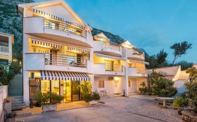
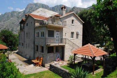
Bo nær Bajova Kula
All overnatting i Kotor →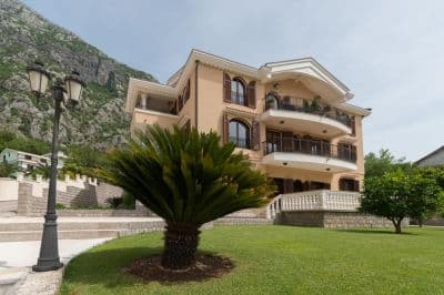

Spørsmål
- Is this a wild beach or a managed one?
- Managed. The JP Morsko dobro board at the entrance registers it as an organised public beach of 118 metres with a beach manager, HP Fjord, and the shore carries a cut-stone swimming platform, a buoyed swimming area and a landscaped deck behind it. An earlier version of this page called it wild, from the map alone.
- Is Bajova Kula the swimming platform beside Kotor’s Old Town walls?
- No. Bajova kula — Bajo’s tower — is the 17th-century tower of Bajo Pivljanin at Dražin Vrt, between Orahovac and Perast, and the beach named for it lies on the shore below the tower. OpenStreetMap and the Kotor municipal plan both place it there, about 11 km from the Old Town by the shore road.
- How do I get to Bajova Kula without a car?
- The Kotor local buses run along the shore road towards Perast and Risan; the stops on this stretch have shelters but no names on the map, so ask the driver for Dražin Vrt or the Bajova Kula restaurant.
- Is the water tested here?
- Yes, at its own station. Morsko dobro samples a point called "Bajova kula" nine or ten times a season and has done since 2020, so the result on this page is this beach’s own and not a neighbour’s. This page used to say the opposite; it was wrong.
Kilder
- OpenStreetMap — beach way 755698669 "Bajova kula", tower way 755698670, car park way 755698668, restaurant node 4376879119; Nominatim place lookup
- montenegro.com — Orahovac hub source notes (Kotor municipal plan: Bajo Pivljanin’s tower at Dražin Vrt; no long beach on this shore)
- Our "25 Best Beaches in Montenegro" list, entry 22 (length and surface; the location given there is wrong)
- OpenStreetMap — bus stop "Ljuta" tagged Blue line and unnamed sheltered stops on the M-1 within 600 m
- The JP Morsko dobro information board at the beach, photographed 2026-09-30: "JAVNO UREĐENO KUPALIŠTE / ORGANISED PUBLIC BEACH — 118 m", "KORISNIK / BEACH MANAGER: HP FJORD"
- Our own photographs of the beach, 2026-09-30 and 2026-10-01 — shore, shingle, stone platform, buoyed swimming area, landscaped deck, tower and shore-road parking