
Bajova Kula
Bajova kula
En 100 meter lång stenstrand vid Dražin Vrt på vägen Kotor–Risan, uppkallad efter Bajo Pivljanins torn ovanför den, med Perast på andra sidan vattnet.
Vårt omdöme
Bajova Kula är en stenstrand nedanför kustvägen mellan Orahovac och Perast, kartlagd av OpenStreetMap vid Dražin Vrt bredvid restaurangen med samma namn och tornet som gett platsen dess namn. Det är ett ställe för ett dopp på vägen runt bukten snarare än en heldag: ingen strandkoncession, snabbt djupt vatten i bukten, och utsikt västerut mot Perast och Verige-sundet. Ursprungslistan placerar den under Kotors murar; både kartan och kulturminnesregistret placerar den istället här, 11 km upp längs kusten.
- simning
- lugn
- fotografering
Bajova Kula i fakta
Stranden
Faciliteter
Tillgänglighet
Fakta verifierade 1 oktober 2026 · Längd: The JP Morsko dobro board at the beach: "organised public beach — 118 m". Our 25 Best list said 100 m and the OpenStreetMap polygon runs about 120 m; the official figure supersedes both · Faciliteter enligt The JP Morsko dobro board at the beach for the length, status and manager; OpenStreetMap contributors, ODbL, for the rest · 12 uppgifter återstår att kontrollera på plats
Bajova Kula i bilder
Foto och film av Montenegro.com, fria att återanvända under CC BY 4.0. Våra är tagna den 1 oktober 2026.
Karta
Det skuggade vattnet är den officiella badzonen för mätstation Bajova kula — den sträcka JP Morsko dobro faktiskt provtar, inte strandens kontur.
Hitta hit
7.2 km
Kotor
8.8 km
Tivat airport
17 km
Herceg Novi
Avstånd fågelvägen — Montenegros vägar är bergsvägar, så bilresan är längre.
- Med bussKotor local buses (Blue Line) on the Kotor–Perast–Risan shore road; the nearest stops are unnamed on the map — ask for Dražin Vrt
- Med bilSome 11 km from Kotor by the shore road through Dobrota, Ljuta and Orahovac (Orahovac is 8.6 km; Dražin Vrt is 2.5 km further); the car park by the beach is private
- 1 min till fotsplant — Straight down from the shore road beside the Bajova Kula restaurant
I dag på Bajova Kula
Riktningen är beräknad från OpenStreetMaps kustlinje, så pålands- och frånlandsvind gäller just den här stranden och inte regionen. Prognos från Open-Meteo
Vatten och utmärkelser
Utmärkt
Senaste officiella prov 28 september 2026: Utmärkt
Havet 20.5 °C när provet togs
10 av 10 prover utmärkta under säsongen 2026
Officiellt resultat från JP Morsko dobro, mätstation Bajova kula
Ingen Morsko Dobro-mätstation vid Dražin Vrt; närmaste övervakade plats är Orahovac 01, 2,5 km söderut
Ingen utmärkelse vi kan belägga för den här stranden. Även frånvaron är information.
Bra att veta innan du badar
- M-1-kustvägen går direkt bakom stranden utan trottoar på den här sträckan — gå och korsa med försiktighet
- Flottörlinor från musselodlingar ligger utanför kusten längs hela sträckan: simma inte genom dem
- En stenstrand som sluttar brant, ingen livräddare och ingen markerad badzon på kartan
- Parkeringen bredvid stranden är restaurangens privata — räkna inte med den i juli och augusti
När vattnet är varmt
Bajova Kula var varmast, 27.6 °C, den 31 augusti 2026, och kallast, 20.1 °C, den 25 maj 2026. Varje punkt är ett verkligt provtagningsbesök med temperaturen mätt på plats, inte ett månadsmedelvärde hämtat någon annanstans ifrån.
Visa alla 10 provtagningar
| Provtaget | Hav | Resultat |
|---|---|---|
| 28 september 2026 | 20.5 °C | Utmärkt |
| 14 september 2026 | 25.2 °C | Utmärkt |
| 31 augusti 2026 | 27.6 °C | Utmärkt |
| 17 augusti 2026 | 25.3 °C | Utmärkt |
| 3 augusti 2026 | 25.4 °C | Utmärkt |
| 20 juli 2026 | 26.9 °C | Utmärkt |
| 6 juli 2026 | 22.5 °C | Utmärkt |
| 22 juni 2026 | 25.8 °C | Utmärkt |
| 8 juni 2026 | 23.6 °C | Utmärkt |
| 25 maj 2026 | 20.1 °C | Utmärkt |
Officiellt resultat från JP Morsko dobro, mätstation Bajova kula
Säsong för säsong
Bajova Kula har provtagits 69 gånger sedan 2020: 64 av mätningarna utmärkta, 5 under det.
Hur varmt vattnet blev, säsong för säsong. Medelvärdet gäller bara proverna i juli och augusti — ett fast fönster, så att ett år då inspektörerna kom tidigt inte framstår som kallt.
En handfull säsonger är en sammanställning, inte en trend: spridningen här är hur få daterade mätningar ser ut, inte belägg för ett hav som blir varmare eller kallare. En ihålig punkt markerar en säsong där ett prov hamnade under utmärkt.
| Säsong | Prover | Utmärkt | Under | Medel juli–aug. | Varmast |
|---|---|---|---|---|---|
| 2020 | 9 | 9 | — | 26.1 °C | 28.8 °C |
| 2021 | 10 | 10 | — | 25.5 °C | 27.1 °C |
| 2022 | 10 | 10 | — | 25.8 °C | 27.5 °C |
| 2023 | 10 | 9 | 1 | 25.5 °C | 27.6 °C |
| 2024 | 10 | 8 | 2 | 26.1 °C | 28.2 °C |
| 2025 | 10 | 8 | 2 | 25.2 °C | 26.5 °C |
| 2026pågår | 10 | 10 | — | 25.5 °C | 27.6 °C |
Officiellt resultat från JP Morsko dobro, mätstation Bajova kula
Stränder i närheten



Bajova Kula och grannstränderna
Samma nio mått för stränderna du hinner samma dag. Fet stil betyder att det skiljer sig från den här.
| Mått | Bajova Kuladen här stranden |  Orahovac2.0 km Orahovac2.0 km |  Risan5.0 km Risan5.0 km |  Lipci6.4 km Lipci6.4 km |
|---|---|---|---|---|
| Underlag | klappersten | klappersten | klappersten | klappersten |
| Nedgång i vattnet | måttlig | måttlig | måttlig | stenig — skiljer sig |
| Djup | blir snabbt djupt | blir snabbt djupt | blir snabbt djupt | blir snabbt djupt |
| Skugga | naturlig | naturlig | ingen — skiljer sig | ingen — skiljer sig |
| Karaktär | organiserad | vild — skiljer sig | vild — skiljer sig | vild — skiljer sig |
| Längd | 118 m | 150 m | 200 m — skiljer sig | 20–50 m — skiljer sig |
| Senaste provet | Utmärkt | Utmärkt | Utmärkt | —ingen officiell mätpunkt — skiljer sig |
| Trängsel | lugn | lugn | lugn | lugn |
| Ta dig dit | med bil | med bil | till fots — skiljer sig | med bil |
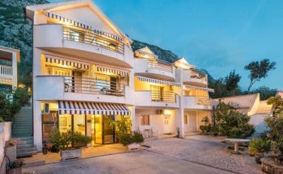
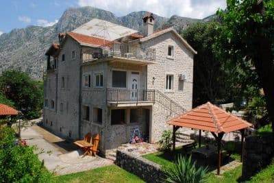
Bo nära Bajova Kula
Alla boenden i Kotor →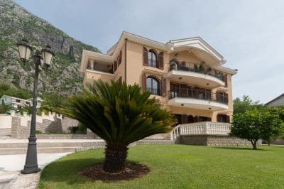

Frågor
- Is this a wild beach or a managed one?
- Managed. The JP Morsko dobro board at the entrance registers it as an organised public beach of 118 metres with a beach manager, HP Fjord, and the shore carries a cut-stone swimming platform, a buoyed swimming area and a landscaped deck behind it. An earlier version of this page called it wild, from the map alone.
- Is Bajova Kula the swimming platform beside Kotor’s Old Town walls?
- No. Bajova kula — Bajo’s tower — is the 17th-century tower of Bajo Pivljanin at Dražin Vrt, between Orahovac and Perast, and the beach named for it lies on the shore below the tower. OpenStreetMap and the Kotor municipal plan both place it there, about 11 km from the Old Town by the shore road.
- How do I get to Bajova Kula without a car?
- The Kotor local buses run along the shore road towards Perast and Risan; the stops on this stretch have shelters but no names on the map, so ask the driver for Dražin Vrt or the Bajova Kula restaurant.
- Is the water tested here?
- Yes, at its own station. Morsko dobro samples a point called "Bajova kula" nine or ten times a season and has done since 2020, so the result on this page is this beach’s own and not a neighbour’s. This page used to say the opposite; it was wrong.
Källor
- OpenStreetMap — beach way 755698669 "Bajova kula", tower way 755698670, car park way 755698668, restaurant node 4376879119; Nominatim place lookup
- montenegro.com — Orahovac hub source notes (Kotor municipal plan: Bajo Pivljanin’s tower at Dražin Vrt; no long beach on this shore)
- Our "25 Best Beaches in Montenegro" list, entry 22 (length and surface; the location given there is wrong)
- OpenStreetMap — bus stop "Ljuta" tagged Blue line and unnamed sheltered stops on the M-1 within 600 m
- The JP Morsko dobro information board at the beach, photographed 2026-09-30: "JAVNO UREĐENO KUPALIŠTE / ORGANISED PUBLIC BEACH — 118 m", "KORISNIK / BEACH MANAGER: HP FJORD"
- Our own photographs of the beach, 2026-09-30 and 2026-10-01 — shore, shingle, stone platform, buoyed swimming area, landscaped deck, tower and shore-road parking