
Risan
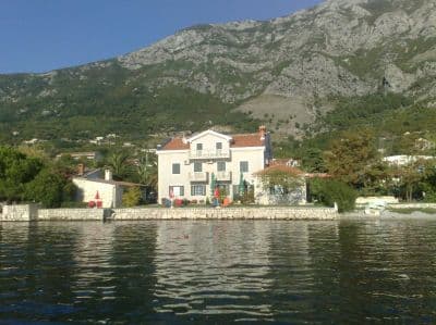
Grusvikar på båda sidor om hamnen i buktens äldsta stad, med Orjens toppar speglade i det spegelblanka vattnet och en romersk mosaik av sömnens gud 300 m från stranden.
Vårt omdöme
Risan är ett bad mellan två andra saker: den romerska villans golv med sin Hypnos-mosaik, och en kaffe på kustvägen. Badandet är blygsamt — grus- och betongfläckar på båda sidor om hamnen snarare än en strand — men vattnet vid buktens innersta del är lugnt, bergen reser sig rakt upp ur det, och nästan ingen annan är i vattnet. Kom i maj, juni eller september, när mosaikerna är dina alldeles ensam.
- simning
- lugn
- fotografering
Risan i fakta
Stranden
Faciliteter
Tillgänglighet
Fakta verifierade 28 september 2026 · Längd: Our 25 Best Beaches list; the OpenStreetMap beach polygon west of the harbour (way 240080159) also runs about 200 m · Faciliteter enligt OpenStreetMap contributors, ODbL · 13 uppgifter återstår att kontrollera på plats
Risan i bilder
Några av dem är våra och får återanvändas fritt under CC BY 4.0; övriga är licensierade och får inte.
Karta
Det skuggade vattnet är den officiella badzonen för mätstation RISAN — den sträcka JP Morsko dobro faktiskt provtar, inte strandens kontur.
Hitta hit
12 km
Kotor
13 km
Tivat airport
14 km
Herceg Novi
Avstånd fågelvägen — Montenegros vägar är bergsvägar, så bilresan är längre.
- Med bussStops with shelters on the M-1 shore road through the town (OpenStreetMap); Kotor local buses run Kotor–Perast–Risan — route names not verified
- Med bilOn the M-1 shore road at the head of the bay, 17.5 km from Kotor (about 20 minutes) and 3 km beyond Perast; park in the town
- 3 min till fotsplant — Along the waterfront from the centre of Risan; the coves lie either side of the harbour
I dag på Risan
Riktningen är beräknad från OpenStreetMaps kustlinje, så pålands- och frånlandsvind gäller just den här stranden och inte regionen. Prognos från Open-Meteo
Vatten och utmärkelser
Utmärkt
Senaste officiella prov 28 september 2026: Utmärkt
Havet 20.5 °C när provet togs
10 av 10 prover utmärkta under säsongen 2026
Officiellt resultat från JP Morsko dobro, mätstation RISAN
Buktens innersta del: spegelblankt, skyddat vatten med Orjens toppar speglade i det; inget Morsko Dobro-resultat finns för Risan
Ingen utmärkelse vi kan belägga för den här stranden. Även frånvaron är information.
Bra att veta innan du badar
- Betongkanter och trappsteg snarare än en sluttande strand: se upp med barn vid vattenlinjen
- Båtar som använder hamnen och bryggkonobornas gäster delar vattnet med badare
- M-1-kustvägen går längs strandkanten; vikarna nås genom att korsa den
När vattnet är varmt
Risan var varmast, 27.5 °C, den 31 augusti 2026, och kallast, 20.0 °C, den 25 maj 2026. Varje punkt är ett verkligt provtagningsbesök med temperaturen mätt på plats, inte ett månadsmedelvärde hämtat någon annanstans ifrån.
Visa alla 10 provtagningar
| Provtaget | Hav | Resultat |
|---|---|---|
| 28 september 2026 | 20.5 °C | Utmärkt |
| 14 september 2026 | 24.7 °C | Utmärkt |
| 31 augusti 2026 | 27.5 °C | Utmärkt |
| 17 augusti 2026 | 25.4 °C | Utmärkt |
| 3 augusti 2026 | 25.2 °C | Utmärkt |
| 20 juli 2026 | 26.7 °C | Utmärkt |
| 6 juli 2026 | 21.9 °C | Utmärkt |
| 22 juni 2026 | 24.1 °C | Utmärkt |
| 8 juni 2026 | 22.6 °C | Utmärkt |
| 25 maj 2026 | 20.0 °C | Utmärkt |
Säsong för säsong
Risan har provtagits 30 gånger sedan 2024: 22 av mätningarna utmärkta, 8 under det.
| Säsong | Prover | Utmärkt | Under | Medel juli–aug. | Varmast |
|---|---|---|---|---|---|
| 2024 | 10 | 6 | 4 | 25.1 °C | 27.7 °C |
| 2025 | 10 | 6 | 4 | 24.3 °C | 25.6 °C |
| 2026pågår | 10 | 10 | — | 25.3 °C | 27.5 °C |
Upplåten som
Staten arrenderar ut kusten lott för lott. Risan är utlyst som 3 lotter på omkring 254 m strandlinje, var och en med en officiell kategori.
| Kategori | Lotter | Strandlinje |
|---|---|---|
| Familjebad | 3 | 254 m |
Sammanlagt omkring 3,010 m². Det här är vad som upplåtits, inte vad vi sett: antalet solsängar, toaletter och duschar per lott fastställs i det tecknade avtalet, som inte offentliggörs. Upphandlingar från JP Morsko dobro
Stränder i närheten



Risan och grannstränderna
Samma nio mått för stränderna du hinner samma dag. Fet stil betyder att det skiljer sig från den här.
| Mått | Risanden här stranden |  Lipci3.3 km Lipci3.3 km |  Bajova Kula5.0 km Bajova Kula5.0 km |  Orahovac6.1 km Orahovac6.1 km |
|---|---|---|---|---|
| Underlag | klappersten | klappersten | klappersten | klappersten |
| Nedgång i vattnet | måttlig | stenig — skiljer sig | måttlig | måttlig |
| Djup | blir snabbt djupt | blir snabbt djupt | blir snabbt djupt | blir snabbt djupt |
| Skugga | ingen | ingen | naturlig — skiljer sig | naturlig — skiljer sig |
| Karaktär | vild | vild | organiserad — skiljer sig | vild |
| Längd | 200 m | 20–50 m — skiljer sig | 118 m — skiljer sig | 150 m |
| Senaste provet | Utmärkt | —ingen officiell mätpunkt — skiljer sig | Utmärkt | Utmärkt |
| Trängsel | lugn | lugn | lugn | lugn |
| Ta dig dit | till fots | med bil — skiljer sig | med bil — skiljer sig | med bil — skiljer sig |

Frågor
- Var exakt badar man i Risan?
- Från grusvikarna på båda sidor om hamnen vid strandkanten, nås genom att korsa kustvägen. OpenStreetMap kartlägger en 200 m lång remsa strax väster om hamnen och en mindre "Pomodna plaža" 600 m söderut mot Perast.
- Kan jag kombinera badet med mosaikerna?
- Lätt: den romerska villaplatsen ligger i staden, några minuter till fots från stranden. Gå innan turistbussarna anländer; översiktssidan rekommenderar maj och juni för att ha golven för dig själv.
- Ligger Risan på en busslinje?
- M-1-kustvägen går genom staden och har hållplatser med väderskydd; Kotors lokalbussar når Risan via Perast (omkring 20 minuter från Kotor längs vägen). Linjenamn har inte verifierats för den här sidan.
Källor
- montenegro.com — Risan hub (/cities/risan)
- Our "25 Best Beaches in Montenegro" list, entry 25
- OpenStreetMap — beach ways 240080159, 240248810, 240248980, 240248981, 239301386 "Pomodna plaža"; café node 4353492290; town node 425487395 (Nominatim); sheltered bus stops on the M-1