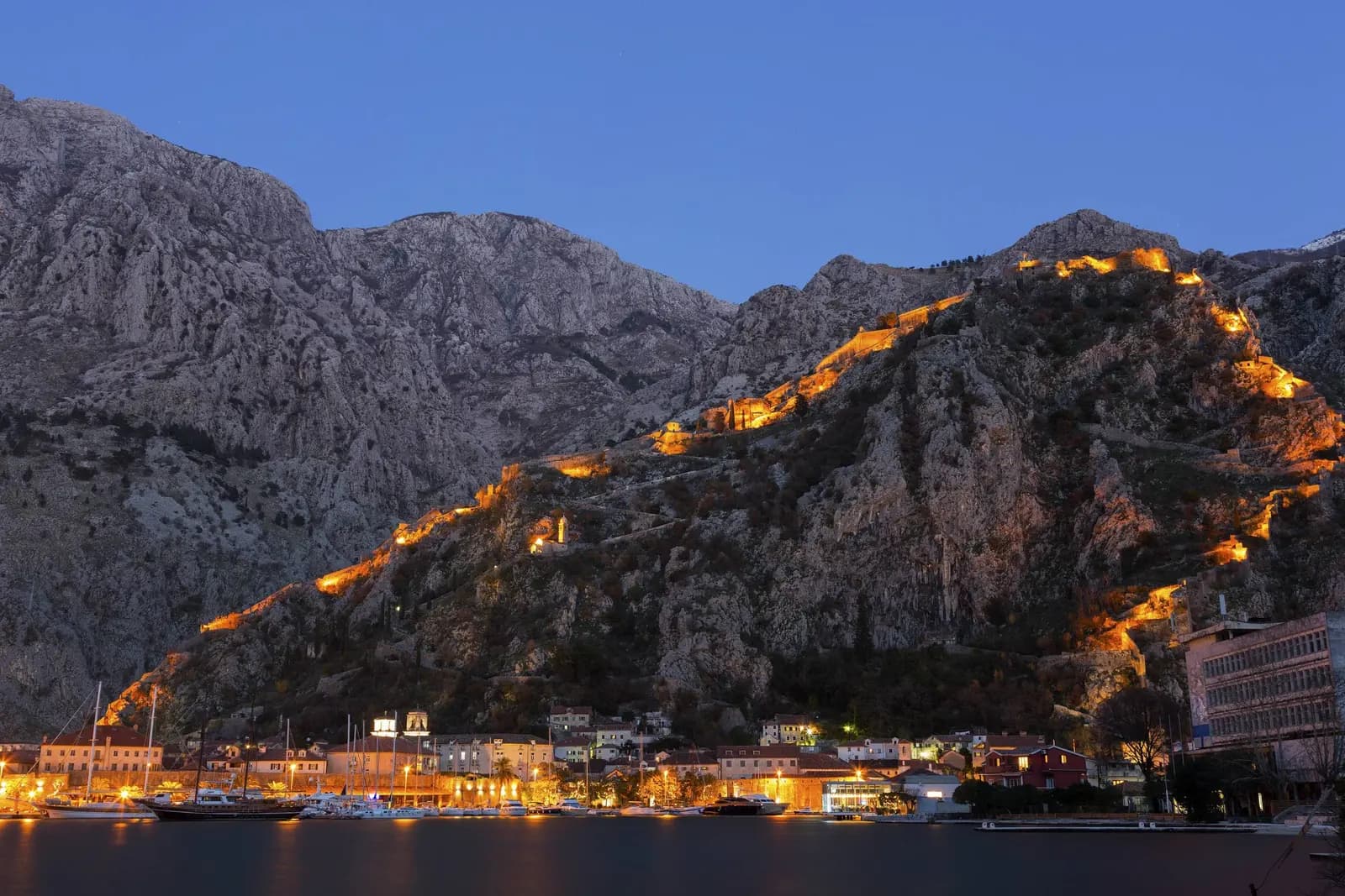
Kotor’s walls occupy an unusual position in World Heritage: the same fortification helps express two different protected ideas. In the 1979 Natural and Culturo-Historical Region of Kotor, the walls belong to a bay-wide relationship between settlements, architecture, water and steep mountain terrain. In the 2017 Venetian Works of Defence, the City of Kotor is one of six transnational components illustrating the Republic of Venice’s gunpowder-era defensive network.
That double context changes conservation. Managers cannot preserve only the most recognisably Venetian bastions, nor can they treat the mountain circuit as a viewpoint detached from the living bay. Medieval faces, later military changes, earthquake reconstruction, vegetation, visitor movement and the setting all carry evidence. Kotor’s 2026 work makes those choices visible: a municipal statement defended reversible closures at unsafe informal openings, while a separate maintenance contract used test cleaning and a stated principle of cleaning without over-cleaning.
This is a conservation case study, not another summit itinerary. The separate Kotor fortress climb guide holds current entrances, seasons, fee evidence and ascent planning.
The wall is larger than the famous staircase
Kotor Municipality describes a system built progressively from the 9th to the 18th century, approximately 4.5 kilometres long, 2–15 metres wide and up to 20 metres high in places. A more detailed municipal heritage guide uses “more than 4 kilometres” and a 2–16-metre width range. These are compatible approximations for an irregular complex, not an invitation to choose the more dramatic number.
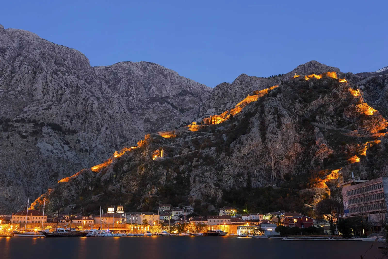
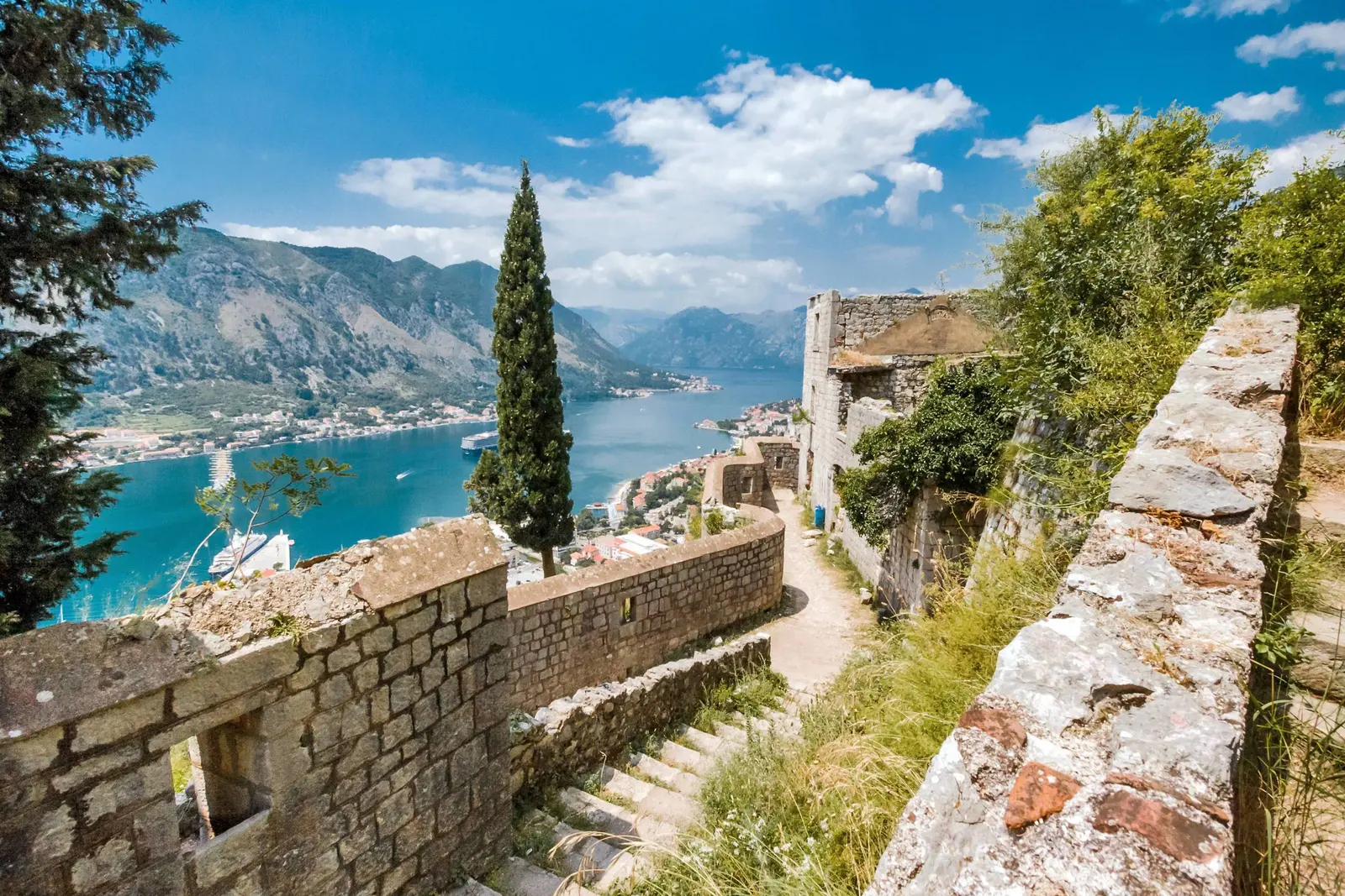
The old town occupies a narrow triangle between the bay, the Škurda River and the karst spring at Gurdić. Saint John hill rises immediately behind. Lower walls protect the harbour and water edges; gates compress entry; long arms climb the rock to a high castle. The visitor staircase is one circulation line inside that system. The monument also includes sea walls, river walls, towers, bastions, gate complexes, outworks and mountain fabric that no single climb reveals.
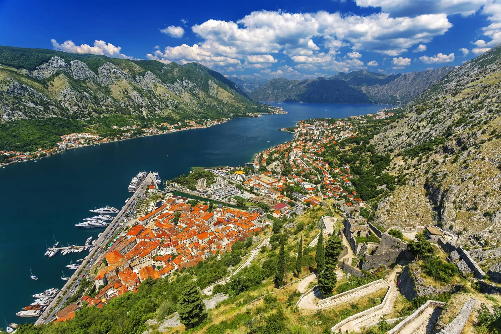
This full-system view also distinguishes Kotor from superficially similar fortified destinations. The Kotor and Dubrovnik comparison is useful precisely because wall length or ticket price cannot explain how each city’s fortifications respond to a different terrain and political geography.
Layer one: evidence before Venice
Popular accounts often begin with surviving Illyrian foundations and Roman bastions. The municipality’s heritage guide is more rigorous. It says remains of a presumed Illyrian hillfort or possible Roman fort at the Saint John summit were destroyed by later rebuilding. Ancient occupation may be historically plausible, but no visitor should label exposed summit masonry “Illyrian” merely because it occupies an old strategic position.
The firmer starting point is documentary. By the 9th century, Byzantine sources distinguished a lower town from a fortress above. By the 14th century, the wall belt enclosed the urban core and Saint John hill with its castle. The guide identifies surviving external faces from intensive 13th- and 14th-century work on parts of the northern and western walls. Early in the 15th century, builders strengthened older fabric with new scarped walls.
That sequence matters for authenticity. A fortification is designed to be changed when weapons, threats and routes change. Rebuilding is not automatically loss; it can be the historical process the monument exists to document. The conservation task is to retain enough physical and documentary evidence for those changes to remain readable.
| Period | What survives / was built |
|---|---|
| ANCIENT? | Presumed position; fabric lost |
| 9th c. | Lower town and fortress documented |
| By 14th c. | Town and hill inside circuit |
| 15th–17th c. | Venetian bastioned adaptations |
| 18th c. | Continued military rebuilding |
| 19th c. | Austro-Hungarian modifications |
| Conservation note | Truthful conservation keeps the sequence legible instead of selecting one ideal century |
Source: kotor.me
Layer two: the Venetian gunpowder system
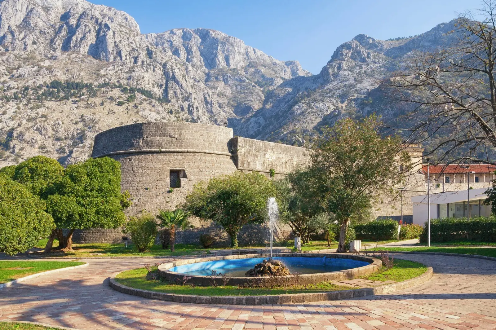
Venetian rule supplied the layer most relevant to Kotor’s 2017 inscription. As artillery transformed warfare, walls designed mainly for height had to absorb impact, cover approaches and create overlapping fields of fire. Kotor’s terrain prevented a textbook geometric fortress, so bastioned ideas were adapted to river, harbour and near-vertical rock.
The municipal guide identifies the large rounded Gurdić bastion protecting the southern gate, Valier and Corner on the western sector, Riva and Bembo around the northern approach, and the Citadel with Kampana tower at the north-west corner. On the mountain, the Mala tvrđava complex and Kontarini tower guarded the small gate toward Špiljari and the historic route inland. Each element belongs to a tactical relationship, not a checklist of isolated attractions.
The World Heritage Committee’s 2017 decision calls the serial property an exceptional testimony to Venetian alla moderna military culture. Its six components span more than 1,000 kilometres across Italy, Croatia and Montenegro. Their shared value lies in a network—technical knowledge, logistics, state organisation and defensive strategy—rather than visual uniformity.
Crucially, UNESCO says earlier medieval and later modifications strongly contribute to truthful presentation and recognition of each site’s final tactical coherence. This prevents a destructive interpretation of “Venetian purity.” Removing later Austro-Hungarian evidence simply because it falls outside the 16th–17th-century headline could make the fortification easier to market and less truthful to read.
UNESCO system one: the 1979 Kotor region
The Natural and Culturo-Historical Region of Kotor covers 14,600 hectares, with a much larger buffer zone. It protects the inner bay as a cultural landscape where fortified and open towns, settlements, palaces, churches, monasteries, cultivated slopes, water and mountains create one historical entity. Kotor’s walls are important because they make the relationship between urban form and setting exceptionally clear.
The property was inscribed in 1979, the year a destructive earthquake seriously damaged the walls and many other monuments. UNESCO says principal monuments and historic urban areas were carefully restored and reconstructed under its auspices while retaining architectural, urban and historical authenticity. That statement rejects the simplistic idea that reconstruction automatically creates a fake.
Authenticity at this scale is relational. A repaired bastion can remain authentic if its form, materials, evidence and connection to town and landscape are conserved. Conversely, an untouched fragment can lose meaning if uncontrolled development destroys the view, settlement pattern or spatial relationship it was built to command.
The nearby village of Muo helps make that landscape scale visible, while the planning history around Morinj shows why protection decisions cannot stop at Old Town’s gates.
UNESCO system two: the 2017 serial property
The Venetian Works of Defence property asks a more specialised comparative question: how did Venice develop and transmit bastioned military architecture across its land and maritime territories? Kotor represents the western Stato da Mar alongside Zadar and Saint Nicholas Fort, while three Italian cities represent other applications of the system.
This property is serial, meaning no one component expresses the whole value alone. Conservation therefore has a cross-border dimension. Altering a bastion, obscuring a tactical relationship or replacing evidence without documentation affects not only local appearance but the ability to compare Kotor with five partner components.
| Inscription | Scope | What it values |
|---|---|---|
| 1979 REGION | Bay-wide landscape | Settlements + water; architecture + mountains; integrity at regional scale |
| 2017 SERIAL WORKS | 6 components, 3 countries | Venetian military network; comparative fortification value |
| City of Kotor | One component, two duties | Belongs to both inscriptions |
Source: whc.unesco.org
The 2025 regional warning is not a wall-condition report
In 2025 the World Heritage Committee requested that Montenegro halt further approvals of new construction and development projects within the Kotor property and buffer zone until legal, administrative and planning frameworks were harmonised to protect Outstanding Universal Value. It referred to urgent conservation needs and possible consideration of the List of World Heritage in Danger.
This was a governance and cumulative-development warning across a large cultural landscape. It was not a structural inspection declaring the Saint John staircase unsafe. The distinction matters in both directions: an open ticketed route does not mean the regional management problem is solved, and a severe regional UNESCO decision does not automatically close every monument.
A joint UNESCO-ICOMOS mission in February 2025 examined legislation, management planning and development pressures. Montenegro’s Government said in May 2026 that its talks with UNESCO continued to focus on Kotor’s state of conservation and technical recommendations. That is evidence of an active process, not a final clearance.
| Question | Controlling evidence and scale |
|---|---|
| Why do the walls matter in the bay? | 1979 Kotor-region property: landscape, settlements, architecture and setting across 14,600 hectares. |
| Why are Venetian bastions internationally comparable? | 2017 serial property: six components of a transnational 16th–17th-century defence network. |
| Is a particular visitor route open? | Current municipality-backed operating site, barriers and day-of local control—not a UNESCO property decision. |
| How should stone be cleaned? | A conservation method based on testing, supervision, compatible materials and retained authenticity. |
| Can a modern safety closure be acceptable? | Yes when need, material compatibility, reversibility and effects on original fabric are documented. |
2026 case study one: reversible closure
On 8 May 2026 Kotor Municipality reported that it had temporarily sealed two gunport openings at Renijer and Batalja. The statement does not date the masonry work itself; it says the intervention occurred in the previous period. The openings had been used as informal entries with ladders, ropes and other improvised aids. They stand five metres or more above difficult ground, and the municipality reported multiple visitor injuries.
The response used stone and lime mortar and was explicitly described as reversible. The openings can be returned to their earlier state without permanent effects on original fabric. That makes the work a useful conservation example. Reversibility does not mean visually invisible or ideologically neutral. It means a present safety response does not have to pretend to be historic, destroy the evidence it protects or prevent a better future solution.
The municipality tied any reopening to conditions for safe, controlled use and a clearly defined management system. This frames access as a design and governance question rather than a binary conflict between “free heritage” and “closed heritage.” A historic aperture can be culturally meaningful and operationally dangerous at the same time.
2026 case study two: clean, but do not over-clean
On 6 August 2026 the municipality described a €199,710.50 maintenance contract including VAT. Work begun on 27 July covered stone washing, vegetation removal and repointing. The announced scope included about 4,500 square metres of sea walls and planned washing of about 4,000 square metres beside Škurda. These figures define treated surfaces, not the total monument.
Before wider work, conservators conducted test cleaning at the Citadel and Gurdić bastion under professional supervision. The stated principle was to clean without over-cleaning so the stone’s characteristics and authenticity remained. This is more consequential than it sounds. Weathering layers can contain salts, biological growth, soot, previous mortars and evidence of water movement. An aggressive method may make a wall photogenic while weakening its surface or erasing information needed for future diagnosis.
Vegetation also demands judgement. Roots can displace masonry and retain moisture, but indiscriminate removal can destabilise joints or disturb habitat. Repointing must manage water while remaining compatible with historic masonry. The choice of lime mortar in the reversible closure is therefore not a rustic styling decision; material behaviour and removability matter.
| Risk | Evidence | Intervention |
|---|---|---|
| Access management | Elevated informal openings; improvised aids and injuries | Stone + lime mortar closure; reported as reversible |
| Material maintenance | Deposits, vegetation and joints needing care | Test + supervise; wash, remove, repoint |
| Principle | Minimum necessary change | Compatible material and documentation protect future choices |
Source: kotor.me
Why patina and later layers need advocates
Visitors often reward legibility: clean stone, a single date, one ruler, one heroic story. Conservation must protect messier truths. A darker surface may be stable patina or damaging deposit; a patch may be documented earthquake repair or incompatible cement; vegetation may threaten joints or contribute to a valued landscape. Diagnosis comes before treatment.
The same applies to historical layers. Nineteenth-century modifications can interrupt an idealised Venetian outline while documenting how the fort remained useful after Venice. Post-1979 reconstruction can look newer while recording an internationally significant recovery programme. Removing these layers to stage a cleaner Renaissance object would undermine both evidence and the 1979 property’s history.
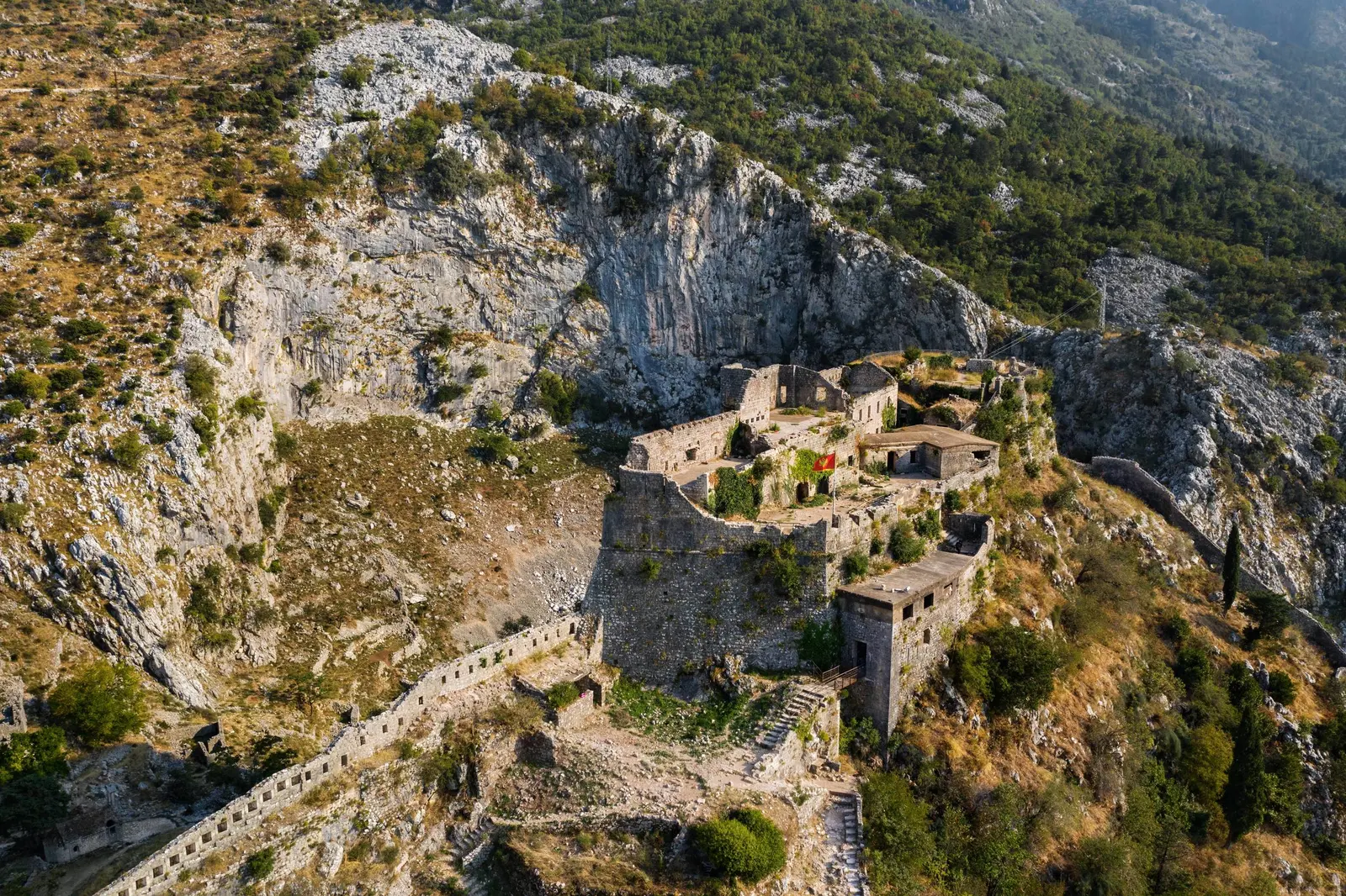
ICOMOS’s fortification guidelines treat protection, conservation, interpretation and safeguarding as connected. Interpretation is not an optional plaque added after building work. If a repair makes chronology unintelligible or a visitor route rewards damaging behaviour, management has changed how the monument is understood.
Practical field-reading plan
Use the walls as an outdoor evidence exercise rather than a summit checklist. Start at the lower circuit, where Kampana, the Citadel, Škurda and Gurdić reveal how water and masonry control movement. Compare curved towers, angled projections, curtain walls, gate passages, mortar joints and surface weathering. Then look upward to see how the mountain arms turn terrain into defence.
Before entering the managed climb, check the municipality-backed Kotor City Walls site. It currently identifies Parilo and Škaljarska pjaca as official entrances, publishes seasonal gate hours, says winter toll booths are closed with climbing at the visitor’s own risk, and prohibits staying on or climbing the walls after 22:00 year-round. Follow current barriers and work controls; they are part of the monument’s management record.
Take three photographs with different purposes: one of the town-water-mountain relationship, one of a defensive junction, and one close view of a repair or mortar change. Do not assign a date from appearance alone. Instead, write what is observable, what is inferred and what would require a conservation drawing or archaeological report. That method produces better memories and fewer myths.
What a transparent annual wall report could show
Kotor’s notices provide valuable snapshots, but long-term stewardship would be easier to evaluate through one annual public record. It could distinguish routine maintenance from structural conservation, identify reviewed project documentation, map closed sectors, publish materials and methods, and report monitoring results after intervention.
Visitor management could be similarly transparent: entries and exemptions, revenue directed to conservation, incidents, rescue callouts, erosion at high-traffic points and winter conditions. These metrics would not reduce heritage to a dashboard. They would make trade-offs visible and help separate evidence-based restrictions from assumptions.
This is also where Kotor’s international context helps. A serial World Heritage property creates opportunities to compare how six components document repair, visitor pressure, climate exposure and later layers. The goal is not identical treatment but shared learning across related defensive systems.
FAQ
Are Kotor’s walls listed by UNESCO twice?
The City of Kotor contributes to two different World Heritage properties. The 1979 property protects a bay-wide natural and cultural landscape; the 2017 serial property protects a transnational system of Venetian gunpowder-era defences. “Twice” is geographically true but conceptually incomplete.
Does the Venetian inscription cover every historical layer equally?
Its central value concerns 16th–17th-century Venetian defence. However, UNESCO’s inscription decision says earlier and later structures strongly contribute to truthful presentation and the tactical coherence of each component.
Are visible summit stones Illyrian or Roman?
The municipal heritage guide says remains of a presumed Illyrian hillfort or possible Roman fort were destroyed by later rebuilding. Individual visible stones should not receive an ancient label without archaeological documentation.
Why were openings in the wall sealed?
On 8 May 2026 the municipality reported earlier temporary sealing of two elevated gunport openings used for uncontrolled access with improvised aids. It cited injuries and described the stone-and-lime intervention as reversible.
When did that sealing occur?
The municipal statement is dated 8 May 2026 but says the work occurred “in the previous period.” The reviewed source does not provide a more precise intervention date.
Why leave some colour or weathering on old stone?
Because cleaning can remove or damage material as well as dirt. Kotor’s 2026 maintenance used test cleaning and professional supervision, with an explicit principle of avoiding over-cleaning.
Did the 2026 contract restore all of Kotor’s walls?
No. The municipality announced defined lower-wall surfaces and tasks. Its approximately 4,500-square-metre sea-wall scope and planned 4,000-square-metre Škurda scope should not be confused with the complete four-plus-kilometre system.
Does UNESCO’s 2025 warning close the walls?
No. The decision addresses urgent management and development pressures across the whole property and buffer zone. Operational access comes from the municipality’s current site, physical barriers and day-of conditions.
Methodology and sources
The municipal heritage guide controls construction phases and explicitly limits the ancient claim. UNESCO’s 1979 property record and 2017 inscription decision control the two Outstanding Universal Value frameworks. Kotor’s 8 May and 6 August 2026 statements control the reversible-closure and maintenance case studies. The publication date of a statement is not used as the date of an earlier intervention.
This conservation lens deliberately avoids duplicating climb logistics. Readers planning a full visit can connect it to the Kotor base guide, the seven-day itinerary, the evidence-led Grand Tour, and the foreign-press narrative audit. Those pages answer trip-design questions; this one stays with conservation evidence.