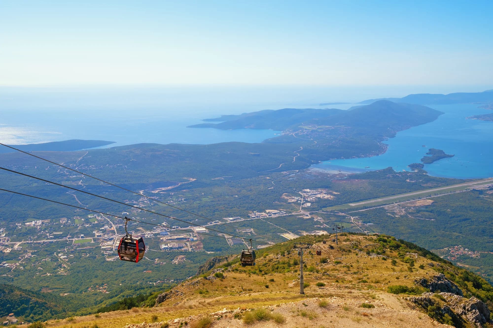
Nei dintorni, non Plavi Horizonti stessa — La penisola di Luštica e il lato di Tivat delle Bocche di Kotor vista dalla funivia sopra Kotor — la bassa penisola boscosa la cui costa meridionale ospita la baia di Pržno di Plavi Horizonti
Plavi Horizonti
Pržno (Plavi horizonti)
Blue Horizons: 350 metri di sabbia chiara e fine nella riparata baia di Pržno sulla costa meridionale di Luštica, bassa per un lungo tratto e con i pini alle spalle — la spiaggia sabbiosa più grande del comune di Tivat.
Il nostro verdetto
Plavi Horizonti è l'eccezione sabbiosa su una costa di ciottoli: una baia a ferro di cavallo di sabbia chiara e fine che degrada così dolcemente che i bambini piccoli possono stare in piedi per un lungo tratto, con boschi di pini alle spalle, lettini a 12–15 €, un bar e un ristorante, docce e un parcheggio a pagamento. L'Organizzazione Turistica di Tivat chiama la baia Pržna e la nostra pagina su Tivat definisce la spiaggia "la scelta migliore" entro mezz'ora dalla città. È prima di tutto una spiaggia di famiglia, e in un weekend di luglio è la spiaggia di famiglia di Tivat — il parcheggio e la stretta strada attraverso la penisola, non la sabbia, ne segnano il limite.
- famiglie
- nuotare
- sport acquatici
Plavi Horizonti, in dati
La riva
Servizi
Accesso
Dati verificati il 28 settembre 2026 · Lunghezza: Our Tivat city hub (350 m of fine pale sand) and our 25 Best Beaches list · Altri 11 dati da verificare sul posto
Plavi Horizonti in immagini
Mappa
L’area ombreggiata è la zona di balneazione ufficiale della stazione Uvala Pržno: il tratto che JP Morsko dobro campiona davvero, non il contorno della spiaggia.
Come arrivare
3.9 km
Tivat airport
8.4 km
Kotor
14 km
Herceg Novi
Distanze in linea d'aria — le strade del Montenegro sono strade di montagna, quindi il viaggio è più lungo.
- In autoAcross the Luštica peninsula, about 30 minutes from Tivat centre and signposted from the main road; parking €3–5
Oggi a Plavi Horizonti
L’orientamento è calcolato dalla linea di costa di OpenStreetMap, quindi «verso la spiaggia» e «da terra» riguardano questa riva, non la regione. Previsioni di Open-Meteo
Acqua e riconoscimenti
Eccellente
Ultimo campione ufficiale 29 settembre 2026: Eccellente
Mare a 21.8 °C al momento del prelievo
10 campioni eccellenti su 10 nella stagione 2026
Risultato ufficiale di JP Morsko dobro, stazione Uvala Pržno
Poco profonda, con fondale sabbioso e acqua turchese nella baia riparata.
Nessun riconoscimento che possiamo citare per questa spiaggia. Anche l'assenza è un'informazione.
Da sapere prima di fare il bagno
- La strada attraverso Luštica è stretta e tortuosa e il parcheggio (3–5 €) si riempie nei weekend estivi — la nostra guida di Krašići consiglia di verificare le attuali modalità di accesso prima di partire
- Gli sport acquatici operano dalla spiaggia in estate — tieni i bambini all'interno della zona di balneazione
- La baia si apre a sud-ovest verso l'Adriatico aperto: una brezza marina pomeridiana solleva un moto ondoso anche quando la mattina era piatta
- I pini fanno ombra sul retro della spiaggia, non sul bagnasciuga — la sabbia è calda entro mezzogiorno
Quando l'acqua è calda
Plavi Horizonti ha toccato il massimo, 27.3 °C, il 1 settembre 2026, e il minimo, 21.8 °C, il 29 settembre 2026. Ogni punto è un campionamento reale con la temperatura rilevata sul posto, non una media mensile copiata altrove.
Vedi tutti i 10 campionamenti
| Campionato | Mare | Esito |
|---|---|---|
| 29 settembre 2026 | 21.8 °C | Eccellente |
| 15 settembre 2026 | 25.1 °C | Eccellente |
| 1 settembre 2026 | 27.3 °C | Eccellente |
| 18 agosto 2026 | 26.0 °C | Eccellente |
| 4 agosto 2026 | 25.9 °C | Eccellente |
| 21 luglio 2026 | 25.7 °C | Eccellente |
| 7 luglio 2026 | 22.3 °C | Eccellente |
| 23 giugno 2026 | 24.2 °C | Eccellente |
| 9 giugno 2026 | 23.2 °C | Eccellente |
| 26 maggio 2026 | 22.1 °C | Eccellente |
Risultato ufficiale di JP Morsko dobro, stazione Uvala Pržno
Stagione per stagione
Plavi Horizonti è stata campionata 69 volte dal 2020: 65 di quelle letture eccellenti, 4 sotto.
Quanto si è scaldata l'acqua, stagione per stagione. La media riguarda solo i campionamenti di luglio e agosto: una finestra fissa, così un anno in cui gli ispettori sono passati presto non risulta freddo.
Una manciata di stagioni è un archivio, non una tendenza: quella che si vede qui è la dispersione normale di poche misure datate, non la prova di un mare che si scalda o si raffredda. Un punto vuoto segna una stagione in cui un campionamento è finito sotto «eccellente».
| Stagione | Campionamenti | Eccellente | Sotto | Media lug.-ago. | Massima |
|---|---|---|---|---|---|
| 2020 | 9 | 8 | 1 | 25.7 °C | 27.2 °C |
| 2021 | 10 | 10 | — | 26.3 °C | 27.7 °C |
| 2022 | 10 | 10 | — | 25.2 °C | 27 °C |
| 2023 | 10 | 9 | 1 | 24.8 °C | 26.8 °C |
| 2024 | 10 | 8 | 2 | 24.6 °C | 27.4 °C |
| 2025 | 10 | 10 | — | 24.5 °C | 26.7 °C |
| 2026in corso | 10 | 10 | — | 25 °C | 27.3 °C |
Risultato ufficiale di JP Morsko dobro, stazione Uvala Pržno
Spiagge vicine



Plavi Horizonti e le spiagge vicine
Le stesse nove misure per le spiagge raggiungibili in giornata. Il grassetto indica una differenza rispetto a questa.
| Misura | Plavi Horizontiquesta spiaggia |  Mirišta8.6 km Mirišta8.6 km |  Žanjice8.6 km Žanjice8.6 km |  Stoliv9.9 km Stoliv9.9 km |
|---|---|---|---|---|
| Fondo | sabbia fine | ciottoli — differisce | ciottoli — differisce | piattaforme di cemento — differisce |
| Ingresso | dolce | moderato — differisce | moderato — differisce | ripido — differisce |
| Profondità | bassa a lungo | si fa presto profonda — differisce | si fa presto profonda — differisce | profonda dalla riva — differisce |
| Ombra | alberi e ombrelloni | alberi e ombrelloni | ombrelloni a noleggio — differisce | nessuna — differisce |
| Carattere | attrezzata | tratti attrezzati e liberi — differisce | attrezzata | selvaggia — differisce |
| Lunghezza | 350 m | 200 m — differisce | 300 m | 100 m — differisce |
| Ultimo campione | Eccellente | Eccellente | Eccellente | Eccellente |
| Affollamento | affollata in stagione | tranquillità — differisce | affollata in stagione | tranquillità — differisce |
| Come arrivare | in auto | a piedi — differisce | in auto | in auto |
Dormire vicino a Plavi Horizonti
Tutti gli alloggi a Luštica →

Domande
- Plavi Horizonti è davvero sabbiosa?
- Sì — sabbia chiara e fine, rara su questa costa, e un fondale che resta basso per un lungo tratto. Sia la nostra pagina su Tivat sia OpenStreetMap la registrano come sabbia.
- Plavi Horizonti si trova a Tivat o a Herceg Novi?
- Nel comune di Tivat — l'Organizzazione Turistica di Tivat elenca la baia di Pržna come la spiaggia sabbiosa più grande del comune — ma fisicamente sulla penisola di Luštica vicino a Radovići, a circa 30 minuti in auto dal centro di Tivat.
- Come si chiama la baia?
- Pržno (Pržna) è il nome della baia; Plavi Horizonti, "Blue Horizons", è quello della spiaggia ed è il nome sui cartelli. Non è la Pržno vicino a Budva.
Fonti
- montenegro.com — Tivat city hub (350 m of fine pale sand, 30 minutes from Tivat; the Tivat FAQ)
- montenegro.com — Radovići guide (/blog/radovici): Pržna bay, the largest sandy beach in the municipality
- montenegro.com — Krašići guide (/blog/krasici-la-dolce-vita-rest): the Tivat Tourism Organisation’s description, road and parking notes
- montenegro.com — Luštica city hub (sheltered sandy bay backed by pines)
- Our 25 Best Beaches in Montenegro list (entry 17)
- OpenStreetMap — beach way 128450964 (surface sand, supervised yes)