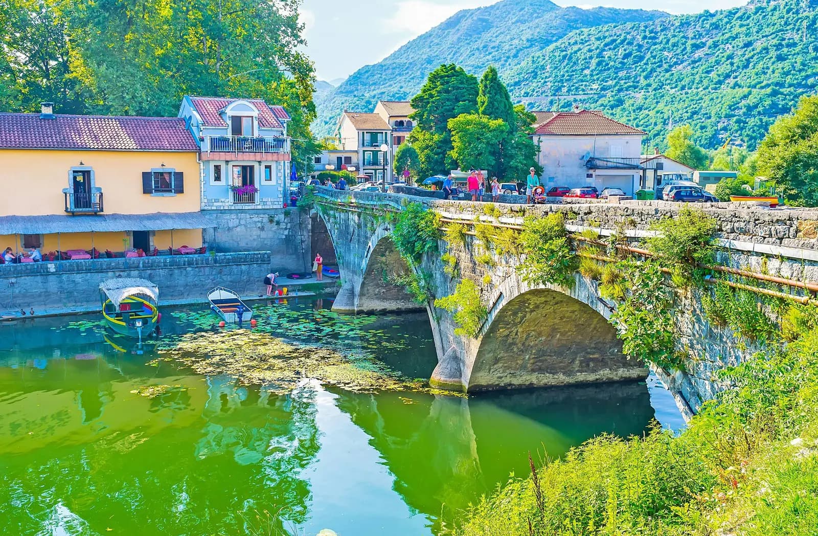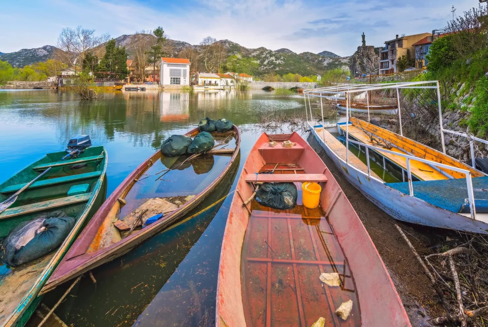
Three stone bridges, a reed channel out to the largest lake in southern Europe, and a fort on the hill — Crmnica’s market town, and the garrison the 1941 uprising took on its opening day.
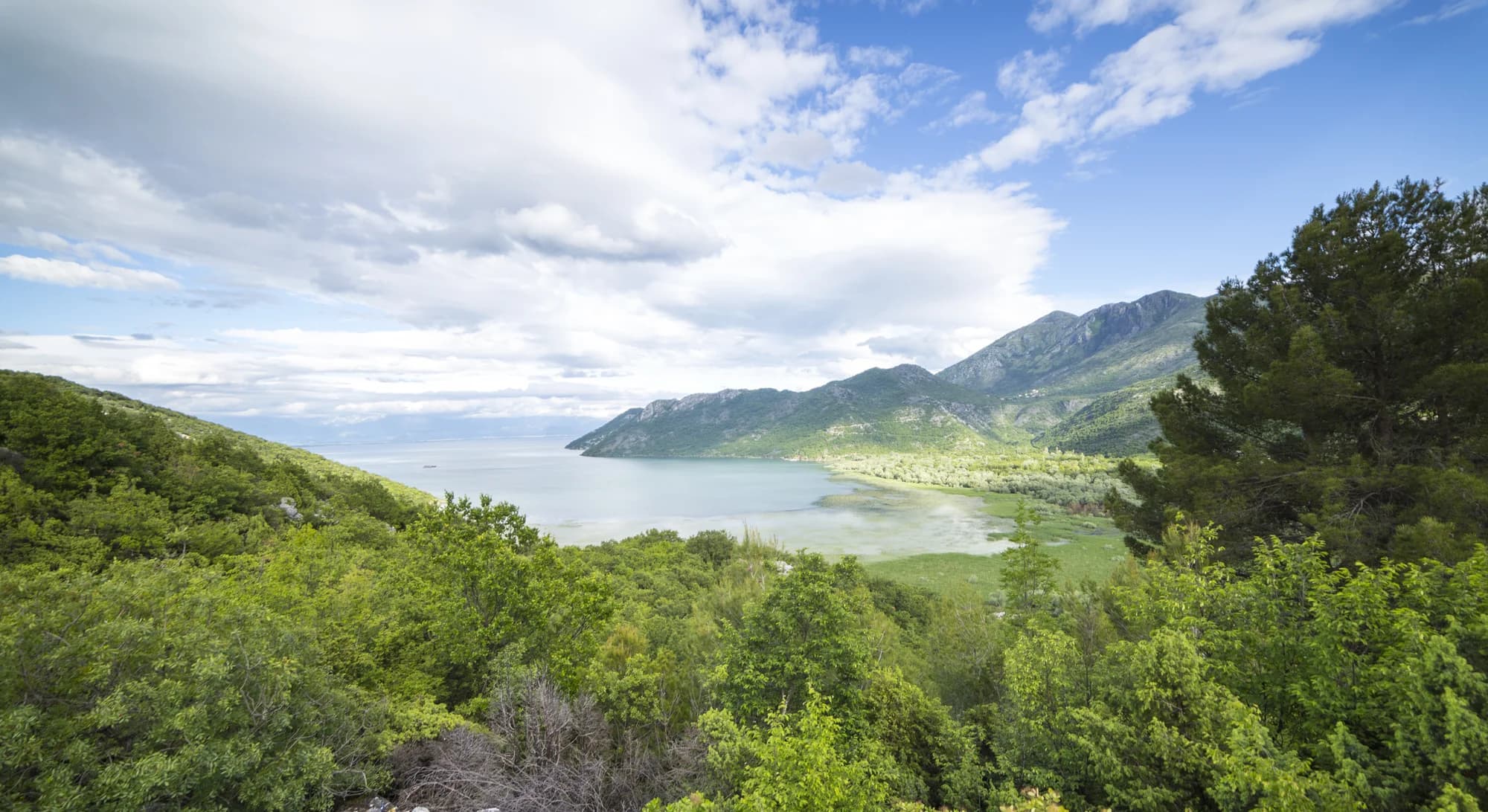
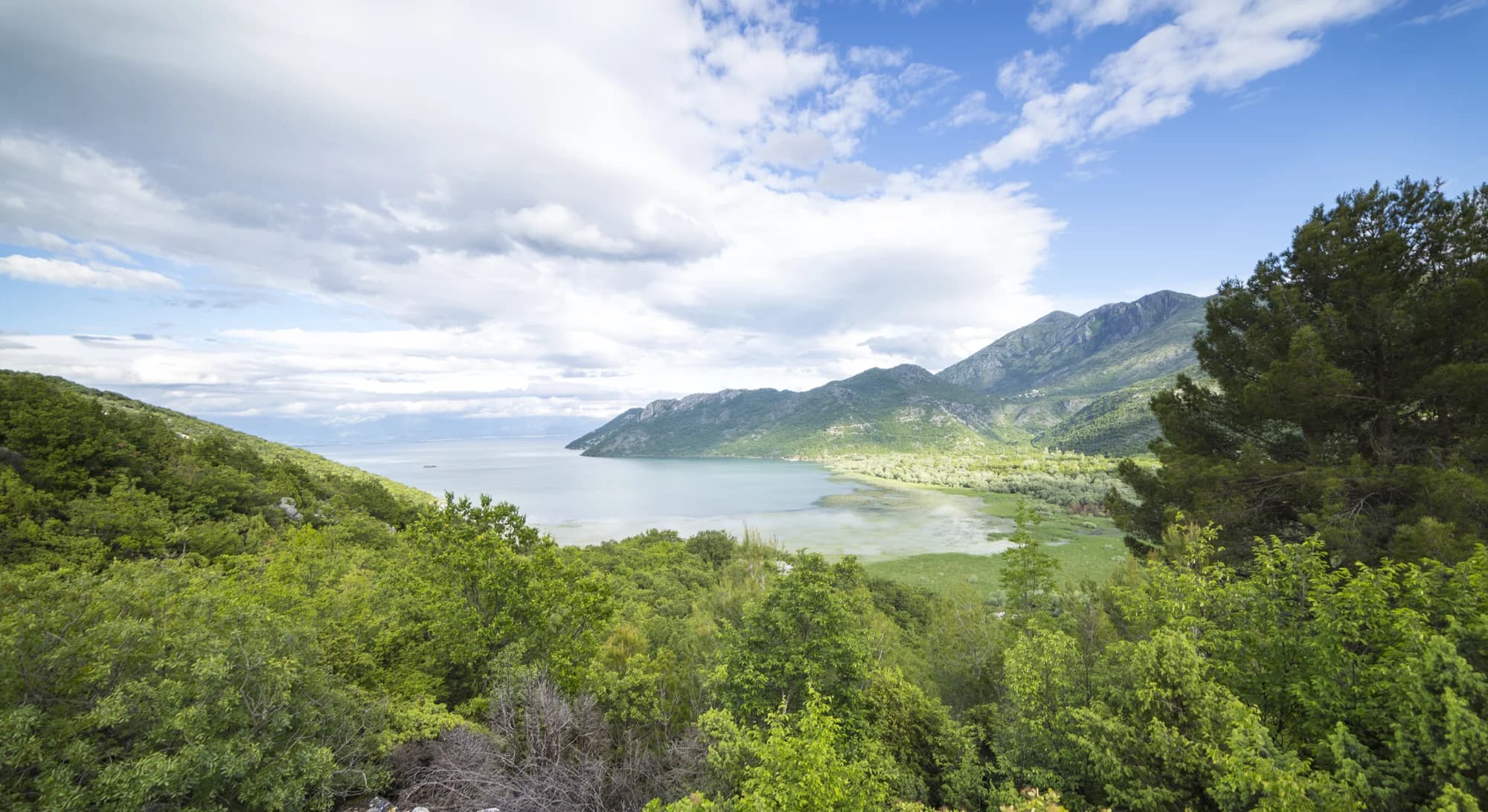
Virpazar är en charmant sjöby som fungerar som huvudvägen in till Skadar Lake National Park, den största sjön på Balkans. Från dess små hamn slingrar sig båtturer genom vattenlilja-kanaler fulla av fågelliv, inklusive sällsynta Dalmatian pelicans. Byn ligger mitt i Crmnica vinregion, där lokala vingårdar producerar den karakteristiska Vranac red.
Ottoman after the fall of Lower Zeta, Montenegrin from the fighting of the early 1700s, and a frontier the whole time — Crmnica was one of the four nahije of Old Montenegro while the lake islands in front of it stayed Ottoman until 1878. Widths are to scale.
A day at the lake gate
Virpazar runs on boat departures and the Bar road
Sök bland tusentals hotell och lägenheter med aktuella priser.
Vi kan tjäna provision från partnerlänkar. Detta hjälper oss att hålla Montenegro.com gratis för resenärer.
Sök hotell, lägenheter och gästhus med aktuell tillgänglighet.
Vi kan tjäna provision från partnerlänkar. Detta hjälper oss att hålla Montenegro.com gratis för resenärer.
The 1242 charter to the Vranjina monastery and the 1908 railway: Serbian Wikipedia on Virpazar and Crmnica, citing the Republic Statistical Office and standard chronologies. Besac in 1478 and the fighting of Christmas Eve 1702: Istorijski leksikon Crne Gore and Đuro Popović’s 1899 geography of the Principality. Crmnička nahija as one of the four nahije of Old Montenegro. 1878: the Congress of Berlin, and the year Lesendro was freed. 1941: Hronologija oslobodilačke borbe (1964).
Virpazar är en liten by vid Skadarsjöns ände och den viktigaste porten till nationalparken. Den ligger där floden Crmnica når sjön, omkring 35 km från Podgorica, och härifrån utgår de flesta båtturerna ut på vattnet.
Ta båt ut på Skadarsjön, gå upp till Besac-fästningen ovanför byn för utsikten över våtmarkerna, äta insjöfisk på byns matställen, och använda orten som bas för vinbyarna i Crmnica innanför.
Två timmar är standard, med näckrosfälten, fågelkolonierna och oftast ett av öklostren eller Grmožur-fästningen. Längre halvdagsturer går längre ut. Våren ger det bästa fågellivet och blomningen; på sensommaren kan lågt vatten begränsa rutterna.
Omkring 30 minuter med bil från Podgorica, eller 40 från Bar. Järnvägen Podgorica–Bar stannar här, vilket gör sjön till en enkel dagsutflykt utan bil — men kontrollera returtiderna, eftersom avgångarna glesnar på kvällen.
Sen vår är bäst: näckrosorna blommar, flyttfåglarna är på plats och hettan har ännu inte kommit. Hösten passar för vin och lugn. Högsommaren är varm och disig över vattnet, och vintern ger högt vatten och få öppna ställen.
För en natt eller två, ja, om du vill ha sjön utanför dörren och en tidig båt. Det är en by och ingen semesterort, med gästhus snarare än hotell, och de flesta kommer på dagsutflykt från Podgorica eller kusten.
Nej — den närmaste är Podgorica flygplats (TGD), 23 km bort via väg.
15,2 km längs väg, ungefär 17 min med bil.
Storbritanniens utrikesdepartement (FCDO) avråder inte från resor till Montenegro; råden sågs senast över 13 augusti 2026. Det är deras bedömning av landet som helhet, inte vår och ingen dom över Virpazar — läs den själv innan du reser. Nödnumret i Montenegro är 112.
Virpazar i siffror
first named in King Vladislav’s charter to the Vranjina monastery, already a trading centre
many sources give Besac to the Ottomans, straight after the fall of Lower Zeta
2023 census — the central settlement of the Crmnica region
the Montenegrin side of Lake Skadar becomes a national park
bird species recorded on the lake, which holds some of the last pelicans in Europe
43.3 km of 750 mm gauge from the port of Bar to Virpazar’s lake port; closed 1959 for the standard-gauge line Virpazar still sits on
MONSTAT, settlement tables of the 1948–2023 censuses · Istorijski leksikon Crne Gore · Lake Skadar National Park
De närmaste orterna kring Virpazar, på sina verkliga platser – Tuzi ligger ungefär 24 km bort fågelvägen.
Schematisk. Positioner och avstånd är fågelvägen, utifrån de koordinater vi har för varje plats; bergsvägarna gör bilresan längre. Den tjocka linjen är kusten där den passerar genom den här vyn. Kustlinje och Skadarsjön © OpenStreetMap contributors.
Några timmar
Most people stop here only for the boat. The fort has its own road — a spur off the Virpazar–Bar road via Sutorman — and the best view in Crmnica.
En hel dag
A full day here is a boat, a fort and a wine village. The lake does the work; Virpazar sells the tickets.
Virpazar
Bäst för the bridges and the quay — hotels and guesthouses within walking distance of every boat
Godinje
Bäst för five kilometres up the plain: a compact stone village with five centuries of vines
The Crmnica villages
Bäst för Boljevići, Limljani, Dupilo — the old tribal villages of the most fertile region in Montenegro, and its Vranac
Bar and Sutomore
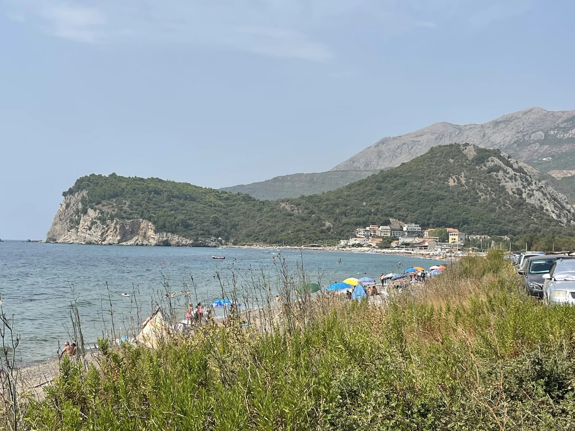
Bäst för the coast, 18 to 23 km away through the Sozina tunnel, if you want a beach with your lake
Vad saker kostar i Virpazar
Boat prices are a Virpazar operator’s published rates; the €5 is the national park’s own price list and is charged on top of a shared boat seat. The park also hires kayaks at €3–5 an hour and guides at €40 for four hours.
Folkräkningar, Virpazar kommun
Virpazar peaked at 412 residents in 1981. It counted 337 in 2003, 277 in 2011 and 235 in 2023 — 120 men and 115 women, and barely more than the 223 the first postwar census found in 1948. The village that sells the tickets into a national park has lost two out of every five residents since 1981.
Under tiden, år 1941
Virpazar, 13 July 1941: guerrilla detachments from Godinje, Seoca, Boljevići, Krnjice and Virpazar attacked the Italian garrison in the village and took it after a short fight — six Italian soldiers killed, 15 wounded, 50 captured. A town command was set up the same day.
The coast — by the end of that first day the shore from Miločer to Sutomore was in insurgent hands. The uprising took the Cetinje and Bar districts first and spread the next day to Podgorica, Danilovgrad, Nikšić and Kolašin.
The lake, 16 July: insurgents had seized several small boats at Virpazar. They sent one down to Scutari carrying 46 captured Italian soldiers, and traded them for medical supplies and food.
After — the July uprising was suppressed within six weeks and cost some 5,000 Montenegrin lives. 13 July is now Statehood Day, marking both this and the Congress of Berlin of 1878; in Virpazar it is marked by Mirko Ostoja’s Monument to the Revolution.
“Through Crmnica we cut the Turks down, and levelled the town of Besac with the ground.”
Njegoš, Gorski vijenac
The verses report the fighting on Christmas Eve 1702, when a great many Crmnica men died at Besac. Quoted in Đuro Popović’s geography of the Principality of Montenegro, Cetinje, 1899.
“Besac comes from the Albanian besa — faith, the given word, safety.”
Borislav Stojković, on the toponyms of Bar municipality
Published in Matica crnogorska 45, 2011. The fort above Virpazar is protected as a monument of fortification architecture, third category, by a decision of 27 November 1957.
juliStatehood Day, 13 July — the date carries both the 1878 recognition and the uprising that opened in this village
dec.Festival of wine and ukljeva — Crmnica’s autochthonous wines and the lake fish, in Virpazar
Den lokala tallriken
Ukljeva is the small bleak of Lake Skadar, and Virpazar names a whole December festival after it and the wine. The wine is Vranac — Montenegro’s own red grape and its most planted one, which until the Second World War grew almost nowhere but Crmnica before it spread across the country.
Var The konobas at the Virpazar bridges, where the boats tie up; the festival is in December
Bästa restid: april · maj · oktober
| Plats | Längs väg | Körtid |
|---|---|---|
| Sutomore | 15,2 km | ca 17 min |
| Bar | 24,5 km | ca 32 min |
| Petrovac | 26,1 km | ca 34 min |
| Suturman | 27,2 km | ca 46 min |
| Podgorica | 29,4 km | ca 35 min |
| Budva | 43,3 km | ca 1 tim |
| Kotor | 64,1 km | ca 1 tim 26 min |
Vägavstånd beräknade på OpenStreetMap-data, © OpenStreetMap contributors. Restiderna är utan köer och tar ingen hänsyn till sommartrafik eller väntan vid färjeläget.