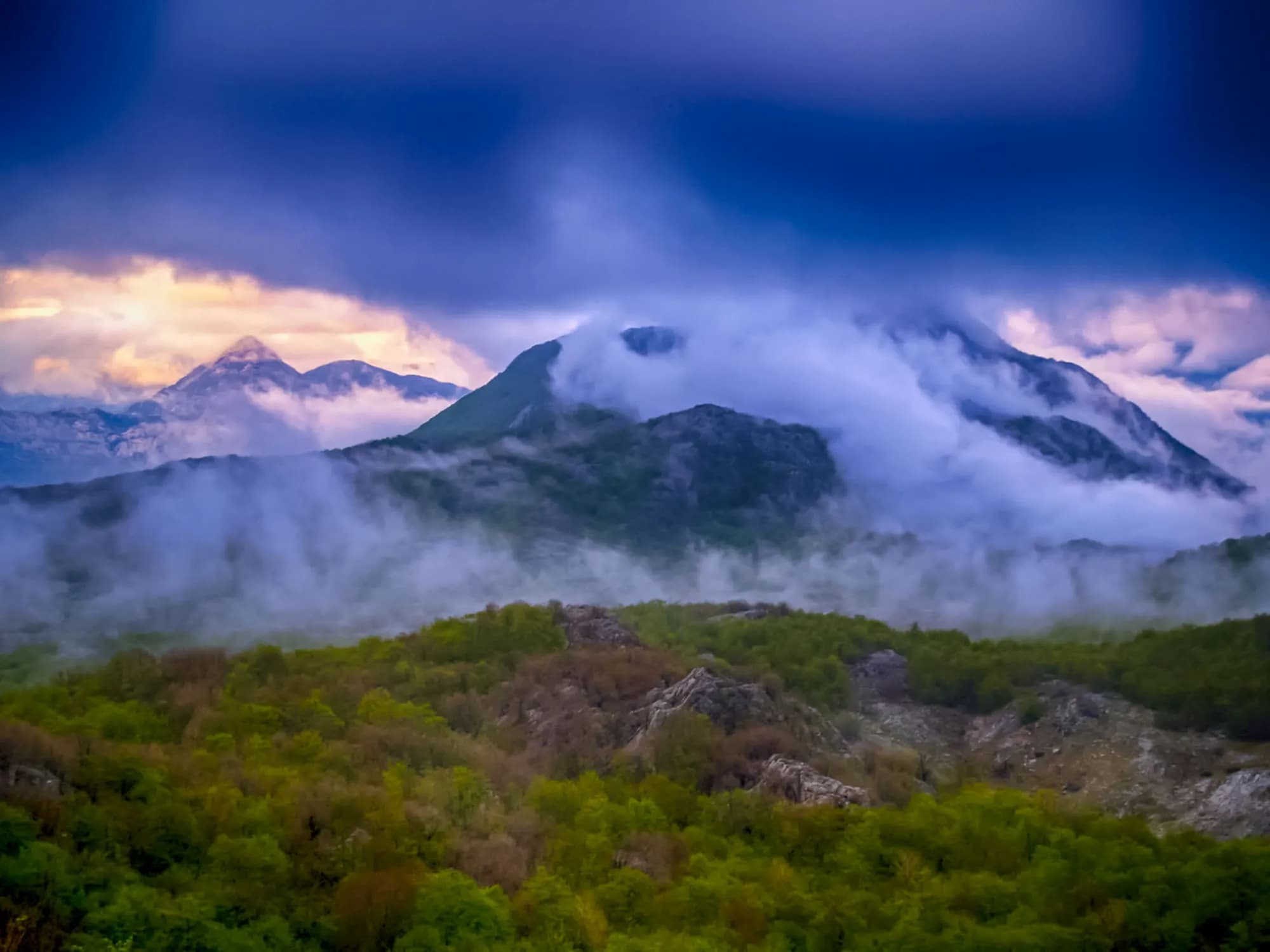
Four and a half metres of rain a year on a mountain with no springs — and the roofless town Austria-Hungary built here for seven thousand soldiers. The plateau around it is down to about a hundred people.
Crkvice su gotovi napušteni grad visoko na planini Orjen iznad Bokokotorskog zaliva. Drže evropski rekord po godišnjoj količini padavina, sa preko 4.900 mm kiše godišnje. Nekada napredno naselje, danas je uglavnom grad duhova, koji privlači avanturističke planinare privučene njegovom sjetnom atmosferom i ekstremnom mikroklimom.

Potpuni vodič
Crkvice su uglavnom napušteno naselje na padinama Orjena iznad Risna, koje drži evropski rekord svih vremena u padavinama od 8.069 mm (1937). Austrougarska meteorološka stanica, dramatičan kraški pejzaž i potpuna zabačenost čine ih jednom od najneobičnijih destinacija Crne Gore.
Pročitajte cjeloviti vodič kroz CrkviceCrkvice u brojkama
the 1931–1960 average at the Crkvice gauge, and 4,631 mm for 1961–1990 — the wettest inhabited place in Europe
the village; the Dinarsko gorje gazetteer gives 940 m for the rain gauge, and the two forts above it stand at 1,154 m and 1,225 m
Kom and Stražnik, two of some 70 forts in the Primorska tvrđava Boka system
under snow in an average year at the Crkvice station; Risan, a thousand metres below, averages two
the camp made its own power and drew water from twelve cisterns — Orjen has no springs
Tivat, 59 minutes, including the Kamenari–Lepetane ferry
Crkvice gauge series 1931–1990 and the two fort elevations (Dinarsko gorje) · en.wikipedia (Crkvice; Orjen; Fort Kom) · RTCG on the FORT-NET panels · road distance measured on the OSM network
Najbliža mjesta mjestu Crkvice, na svojim stvarnim položajima — Rudine je udaljeno oko 20 km vazdušnom linijom.
Najbolje vrijeme: jun · jul · septembar
| Mjesto | Putem | Vožnja |
|---|---|---|
| Dragalj | 7,4 km | oko 14 min |
| Morinj | 25,5 km | oko 35 min |
| Lipci | 26,5 km | oko 37 min |
| Kostanjica | 27,3 km | oko 38 min |
| Kotor | 48,1 km | oko 1 h 10 min |
| Budva | 59,5 km | oko 1 h 22 min |
| Podgorica | 111,4 km | oko 2 h 16 min |
Rute označene sa ⛴ prelaze trajektom Kamenari–Lepetane. Udaljenosti putem izračunate na osnovu OpenStreetMap podataka, © OpenStreetMap contributors. Vremena vožnje su bez gužve i ne računaju ljetnji saobraćaj ni čekanje na trajektnoj rampi.
Nekoliko sati
Two hours on the FORT-NET trail. Of more than 150 buildings only a few big shells are still standing, and nothing up here is staffed or for sale: carry your own water.
Cio dan
Rain, station by station
Mean annual precipitation around Orjen and down the coast
Crkvice takes more than three and a half times Dubrovnik’s rain, and half again what falls on Risan — eight kilometres away in a straight line and a thousand metres lower. In 1937 the gauge here read 8,036 mm.
The plateau emptying out
People living in Krivošije, seven villages on 114 km²
Venice, Vienna and the Sultan all drew Krivošije inside their borders. From about 1710 until 1882 none of them collected a tax or a conscript here. Widths are to scale.
Sea level to the wettest village in Europe
Five kilometres along the water, then twenty-six up
SRTM 30 m elevations read at seventeen equal points along the 31.5 km drive, measured on the OSM road network. The road leaves the sea at the Lipci roundabout, 4.9 km west of Risan, climbs 18.3 km on the M-8, dips to about 630 m across the karst, then covers the last 8.2 km on a local road. The village node reads 1,120 m here; en.wikipedia gives 1,092 m for the village and the Dinarsko gorje gazetteer 940 m for the site of the rain gauge. Above Crkvice the regional road to Orjensko sedlo, at 1,594 m, is not asphalted.
Pretražite hiljade hotela i apartmana sa aktuelnim cijenama.
Možemo zaraditi proviziju putem partnerskih linkova. To nam pomaže da zadržimo Montenegro.com besplatnim za putnike.

Pretražite hotele, apartmane i pansione sa trenutnom dostupnošću.
Možemo zaraditi proviziju putem partnerskih linkova. To nam pomaže da zadržimo Montenegro.com besplatnim za putnike.

Crkvice itself has no line in the census. Kotor’s settlement register counts Dragalj (46 people in 2023) and Ledenice (13), and nobody at all in Han, Knežlaz, Malov Do, Unijerina or Zvečava — but in 2011 and again in 2023 it lists no Crkvice, and en.wikipedia calls the village “nowadays virtually uninhabited”.
Dinarsko gorje, Krivošije; en.wikipedia (Krivošije; Krivošije uprising; Fort Vrmac). Sovereignty on paper changed hands more often than the band shows — Venice fell in 1797, France held the plateau from 1807, Montenegro from 1813, Austria again after the Congress of Vienna in 1814 — but the free territory these sources call Kneževina Krivošije outlasted all of them on the ground.
Crkvice su visoko na obronku Orjena, oko 940 m iznad Bokokotorskog zaliva. Prilaz je spor uspon uskim putevima kroz krečnjački predio iza Risna, a promjena u odnosu na primorje je nagla.
Po vremenu. Drže evropski rekord po godišnjoj količini padavina, u prosjeku preko 4.900 mm godišnje, a u izuzetnim godinama i mnogo više — jedno od najkišovitijih naseljenih mjesta na kontinentu.
Topao i vlažan vazduh koji s Jadrana ide u unutrašnjost udara u orjenski zid i istovari sve što nosi. Zima donosi snijeg koji se mjeri u metrima, a nanosi su nekad sedmicama odsijecali naselje od obale.
Tek nekoliko sezonskih stanovnika. Austrougarski inženjeri su krajem 19. vijeka probili vojni put preko ovih visova i sagradili kasarne, a uz njih je narasla i civilna zajednica. Ostale su kamene kuće bez krova, čatrnje i zarđali kosturi vojnih objekata.
Dolazi se pješke. Crkvice su usputna tačka planinarima koji prelaze Orjen između grada iznad Kotora i viših vrhova, a ruševine su pamtljiva pauza u dugom danu — tihe, vlažne i nalik ničemu drugom u Crnoj Gori.
Vodu, hranu i toplu odjeću bez obzira na prognozu, jer sadržaja nema nikakvih. Od kasnog proljeća do rane jeseni je upotrebljiv period; van njega magla, kiša i snijeg mogu potpuno zatvoriti zaravan.
Ne — najbliži je aerodrom Tivat (TIV), 41 km putem.
7,4 km putem, oko 14 min vožnje.
Britansko Ministarstvo inostranih poslova (FCDO) nema upozorenje protiv putovanja u Crnu Goru; svoje smjernice je posljednji put revidiralo 13. avgusta 2026. To je njihova procjena države u cjelini, ne naša i ne ocjena o ovom gradu, pa je pročitajte sami prije puta. Broj za hitne slučajeve u Crnoj Gori je 112.
Šematski prikaz. Položaji i udaljenosti mjereni su vazdušnom linijom, prema koordinatama koje imamo za svako mjesto; zbog planinskih puteva vožnja je duža. Podebljana linija označava obalu na dijelu koji prolazi kroz ovaj prikaz. Obala i Skadarsko jezero © OpenStreetMap contributors.
A full day outdoors and most of it uphill. Take the forecast seriously: this is the wettest inhabited place on the continent.
Risan
Najbolje za the base everyone actually uses — 1,899 residents, hotels and apartments on the bay, 31.5 km and 42 minutes below the village
Dragalj
Najbolje za the nearest village the census still counts anyone in: 46 people in 14 households, 12.6 km along the karst
Herceg Novi
Najbolje za the nearest town with a real choice of rooms: 30 km, but 66 minutes of it, most of that on the unpaved old Austrian road over the plateau
Ko posjećuje Crnu Goru
Udio noćenja stranih gostiju, 2025.
MONSTAT · 2025
Crkvice reaches the Montenegrin press every few years, usually as the same story told again: the wettest place in Europe, with a dead town inside it.
Vijesti “Tvrđava Boka odolijeva vremenu” — Siniša Luković on the fortress system built between 1838 and 1914, whose third phase concentrated on Krivošije. The Crkvice camp, he writes, held six to seven thousand men, with a bowling alley, a ski slope and its own generator. 31 August.
Boka News Don Anton Belan on the camp’s Catholic church of the Assumption, built in 1895 and pulled down from about 1955, with the 1956 letters about its missing altar slab. 26 November.
RTCG “Putovanje u prošlost: Vojni grad Crkvice” — Ozren Zogović walks the FORT-NET thematic trail panel by panel: the cisterns, the bakery, the two forts, the military cemetery. 30 October.
Vijesti The fifth “Svi na Crkvice” day, run by Kotor’s tourist organisation and the municipality, with guided walks up to Stražnik and Kom. 11 August.
All four items were opened at the outlet. The RTCG piece is the fullest account of the camp in circulation; a fifth, the road-repair notice Vijesti ran on 10 September 2024, is the reason the Crkvice–Orjen Sedlo road is passable at all.
U međuvremenu — 1882
Krivošije, 1882: Austrian control is reimposed after a second rising against conscription. The plateau had recognised nobody’s authority, paid nobody’s tax and served in nobody’s army for some 170 years.
Crkvice — Vienna answers with a town rather than an argument. Feldmarschalleutnant Stjepan baron Jovanović directs a fortification programme across Boka, and more than 150 buildings go up on waterless karst above Risan: hotel, hospital, bakery, cinema, tennis courts, a bowling alley, a rifle range and a football ground with stands for a thousand.
Fort Kom, 1882 and 1883: a three-level barracks under an artillery platform, to Colonel Karl Wahlberg’s standard design, held by three officers and fifty-nine men. Its job was the roads onto the plateau from the north and east.
Vienna and Berlin, 20 May 1882: Germany, Austria-Hungary and Italy sign the Triple Alliance. In March, Serbia had been proclaimed a kingdom and Robert Koch had named the tuberculosis bacterium; in September Edison lit a square mile of lower Manhattan from Pearl Street.
“They bent their necks looking at the sky — in summer waiting for rain to save them from the drought, in winter waiting for it to stop.”
Lokalna legenda
Why the plateau is called Krivošije
“Although it is a mountain with a great deal of rainfall, Orjen is a mountain without springs.”
The FORT-NET panel on water, via RTCG
Hence twelve cisterns for the garrison, two of them large, and drinking water carried up or melted from snow kept in pits.
janSveti Jovan — 20 January — the krsna slava of the Krivošije brotherhoods, kept in the house rather than the square, in the middle of the rain season
avgSvi na Crkvice — Kotor’s tourist organisation brings a day of guided walks to Kom and Stražnik, archery and music up to the plateau; the fifth edition ran in August 2024. August here is often rainless end to end, and the fire risk peaks with it
novThe wettest month — November averages 714 mm at the Crkvice gauge — more than three times Dubrovnik’s November — and the Orjen literature reports late-autumn storms dropping 2,000 mm in a few days






