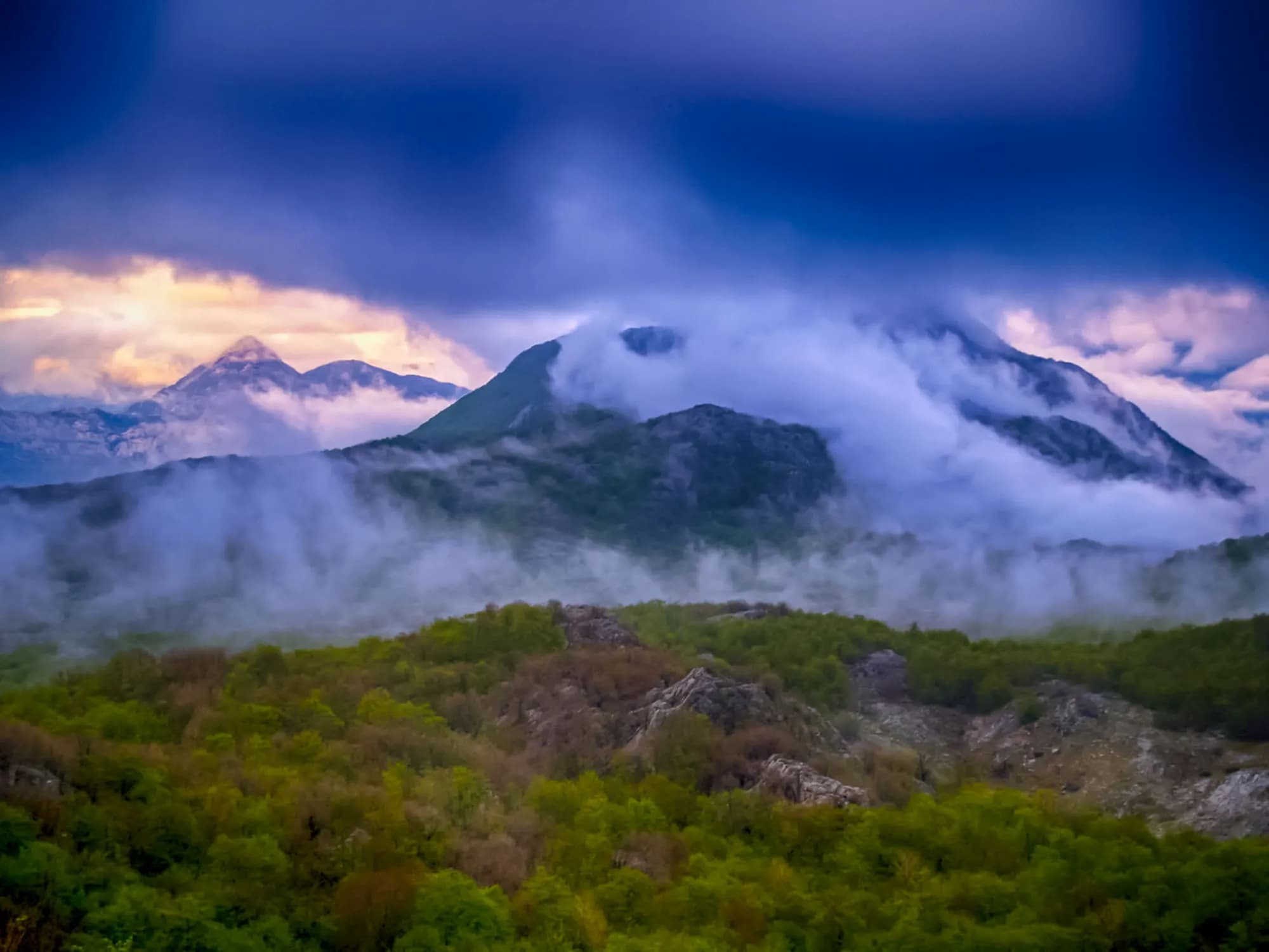
Four and a half metres of rain a year on a mountain with no springs — and the roofless town Austria-Hungary built here for seven thousand soldiers. The plateau around it is down to about a hundred people.
Crkvice sits high on the flank of Mount Orjen, roughly 940 metres above the Bay of Kotor and a world away from the water. The approach is a slow climb on narrow roads through limestone country behind Risan, and the change is abrupt: the coast's palms and oleander give way to beech woods, sinkholes and bare grey rock. On clear days the bay glitters far below; on many days the cloud simply sits on the plateau and stays there. The village is best known for its weather. Crkvice holds the European record for annual rainfall, receiving an average of over 4,900 millimetres a year and, in exceptional years, far more than that. It is one of the wettest inhabited places on the continent. Warm, moist air pushed inland off the Adriatic hits the Orjen wall and unloads everything it carries. Winter brings snow measured in metres rather than centimetres, and drifts once cut the settlement off from the coast for weeks at a time. People did live here, and not so long ago. Austro-Hungarian engineers drove a military road across these uplands in the late nineteenth century and built barracks to garrison them, and a small civilian community grew alongside. What remains now is a scatter of roofless stone houses, cisterns, cracked walls and the rusting bones of the military buildings, with only a handful of seasonal residents. Grass, moss and beech saplings are taking the rest back. Visitors come on foot. Crkvice is a waypoint for walkers crossing Orjen between the villages above Kotor and the higher summits, and the ruins make a memorable break in a long day out - quiet, damp and unlike anywhere else in Montenegro. There is nothing here in the way of services, so carry water, food and warm layers whatever the forecast says. Late spring through early autumn is the practical window; outside it, fog, rain and snow can close the plateau entirely. It suits hikers, photographers and anyone curious about how quickly a place can empty out.
Rain, station by station
Mean annual precipitation around Orjen and down the coast
Crkvice takes more than three and a half times Dubrovnik’s rain, and half again what falls on Risan — eight kilometres away in a straight line and a thousand metres lower. In 1937 the gauge here read 8,036 mm.
The plateau emptying out
People living in Krivošije, seven villages on 114 km²
Crkvice itself has no line in the census. Kotor’s settlement register counts Dragalj (46 people in 2023) and Ledenice (13), and nobody at all in Han, Knežlaz, Malov Do, Unijerina or Zvečava — but in 2011 and again in 2023 it lists no Crkvice, and en.wikipedia calls the village “nowadays virtually uninhabited”.
Who visits Montenegro
Share of foreign overnight stays, 2025
MONSTAT · 2025
Venice, Vienna and the Sultan all drew Krivošije inside their borders. From about 1710 until 1882 none of them collected a tax or a conscript here. Widths are to scale.
Dinarsko gorje, Krivošije; en.wikipedia (Krivošije; Krivošije uprising; Fort Vrmac). Sovereignty on paper changed hands more often than the band shows — Venice fell in 1797, France held the plateau from 1807, Montenegro from 1813, Austria again after the Congress of Vienna in 1814 — but the free territory these sources call Kneževina Krivošije outlasted all of them on the ground.
Sea level to the wettest village in Europe
Five kilometres along the water, then twenty-six up
SRTM 30 m elevations read at seventeen equal points along the 31.5 km drive, measured on the OSM road network. The road leaves the sea at the Lipci roundabout, 4.9 km west of Risan, climbs 18.3 km on the M-8, dips to about 630 m across the karst, then covers the last 8.2 km on a local road. The village node reads 1,120 m here; en.wikipedia gives 1,092 m for the village and the Dinarsko gorje gazetteer 940 m for the site of the rain gauge. Above Crkvice the regional road to Orjensko sedlo, at 1,594 m, is not asphalted.
Crkvice reaches the Montenegrin press every few years, usually as the same story told again: the wettest place in Europe, with a dead town inside it.
Vijesti “Tvrđava Boka odolijeva vremenu” — Siniša Luković on the fortress system built between 1838 and 1914, whose third phase concentrated on Krivošije. The Crkvice camp, he writes, held six to seven thousand men, with a bowling alley, a ski slope and its own generator. 31 August.
Boka News Don Anton Belan on the camp’s Catholic church of the Assumption, built in 1895 and pulled down from about 1955, with the 1956 letters about its missing altar slab. 26 November.
RTCG “Putovanje u prošlost: Vojni grad Crkvice” — Ozren Zogović walks the FORT-NET thematic trail panel by panel: the cisterns, the bakery, the two forts, the military cemetery. 30 October.
Vijesti The fifth “Svi na Crkvice” day, run by Kotor’s tourist organisation and the municipality, with guided walks up to Stražnik and Kom. 11 August.
All four items were opened at the outlet. The RTCG piece is the fullest account of the camp in circulation; a fifth, the road-repair notice Vijesti ran on 10 September 2024, is the reason the Crkvice–Orjen Sedlo road is passable at all.
Meanwhile, in 1882
Krivošije, 1882: Austrian control is reimposed after a second rising against conscription. The plateau had recognised nobody’s authority, paid nobody’s tax and served in nobody’s army for some 170 years.
Crkvice — Vienna answers with a town rather than an argument. Feldmarschalleutnant Stjepan baron Jovanović directs a fortification programme across Boka, and more than 150 buildings go up on waterless karst above Risan: hotel, hospital, bakery, cinema, tennis courts, a bowling alley, a rifle range and a football ground with stands for a thousand.
Fort Kom, 1882 and 1883: a three-level barracks under an artillery platform, to Colonel Karl Wahlberg’s standard design, held by three officers and fifty-nine men. Its job was the roads onto the plateau from the north and east.
Vienna and Berlin, 20 May 1882: Germany, Austria-Hungary and Italy sign the Triple Alliance. In March, Serbia had been proclaimed a kingdom and Robert Koch had named the tuberculosis bacterium; in September Edison lit a square mile of lower Manhattan from Pearl Street.
“They bent their necks looking at the sky — in summer waiting for rain to save them from the drought, in winter waiting for it to stop.”
Local legend
Why the plateau is called Krivošije
“Although it is a mountain with a great deal of rainfall, Orjen is a mountain without springs.”
The FORT-NET panel on water, via RTCG
Hence twelve cisterns for the garrison, two of them large, and drinking water carried up or melted from snow kept in pits.
Search thousands of hotels and apartments with live prices.
We may earn a commission from partner links. This helps us keep Montenegro.com free for travelers.
Search hotels, apartments and guest houses with live availability.
We may earn a commission from partner links. This helps us keep Montenegro.com free for travelers.
Crkvice sits high on the flank of Mount Orjen, roughly 940 m above the Bay of Kotor. The approach is a slow climb on narrow roads through limestone country behind Risan, and the change from the coast is abrupt.
For its weather. It holds the European record for annual rainfall, averaging over 4,900 mm a year and far more in exceptional years, which makes it one of the wettest inhabited places on the continent.
Warm, moist air pushed inland off the Adriatic hits the wall of Orjen and unloads everything it carries. Winter brings snow measured in metres rather than centimetres, and drifts once cut the settlement off from the coast for weeks at a time.
Only a handful of seasonal residents. Austro-Hungarian engineers drove a military road across these uplands in the late 19th century and built barracks to garrison them, and a civilian community grew alongside; what remains is roofless stone houses, cisterns and the rusting bones of the military buildings.
Visitors come on foot. Crkvice is a waypoint for walkers crossing Orjen between the villages above Kotor and the higher summits, and the ruins make a memorable break in a long day out — quiet, damp and unlike anywhere else in Montenegro.
Water, food and warm layers whatever the forecast says, because there are no services at all. Late spring through early autumn is the practical window; outside it, fog, rain and snow can close the plateau entirely.
No — the nearest is Tivat Airport (TIV), 41 km away by road.
7.4 km by road, about 14 min by car.
The UK Foreign, Commonwealth & Development Office (FCDO) has no advisory against travel to Montenegro; it last reviewed its guidance on 13 August 2026. That is their assessment of the country as a whole, not ours and not a judgement about Crkvice, so read it yourself before you travel. The emergency number in Montenegro is 112.
JanSveti Jovan — 20 January — the krsna slava of the Krivošije brotherhoods, kept in the house rather than the square, in the middle of the rain season
AugSvi na Crkvice — Kotor’s tourist organisation brings a day of guided walks to Kom and Stražnik, archery and music up to the plateau; the fifth edition ran in August 2024. August here is often rainless end to end, and the fire risk peaks with it
NovThe wettest month — November averages 714 mm at the Crkvice gauge — more than three times Dubrovnik’s November — and the Orjen literature reports late-autumn storms dropping 2,000 mm in a few days
The nearest places to Crkvice, at their true positions — Rudine is about 20 km away in a straight line.
Schematic. Positions and straight-line distances from the coordinates we hold for each place; mountain roads make the drive longer. Coastline and Lake Skadar © OpenStreetMap contributors.
Crkvice in numbers
the 1931–1960 average at the Crkvice gauge, and 4,631 mm for 1961–1990 — the wettest inhabited place in Europe
the village; the Dinarsko gorje gazetteer gives 940 m for the rain gauge, and the two forts above it stand at 1,154 m and 1,225 m
Kom and Stražnik, two of some 70 forts in the Primorska tvrđava Boka system
under snow in an average year at the Crkvice station; Risan, a thousand metres below, averages two
the camp made its own power and drew water from twelve cisterns — Orjen has no springs
Tivat, 59 minutes, including the Kamenari–Lepetane ferry
Crkvice gauge series 1931–1990 and the two fort elevations (Dinarsko gorje) · en.wikipedia (Crkvice; Orjen; Fort Kom) · RTCG on the FORT-NET panels · road distance measured on the OSM network
A few hours
Two hours on the FORT-NET trail. Of more than 150 buildings only a few big shells are still standing, and nothing up here is staffed or for sale: carry your own water.
One full day
A full day outdoors and most of it uphill. Take the forecast seriously: this is the wettest inhabited place on the continent.
Risan
Best for the base everyone actually uses — 1,899 residents, hotels and apartments on the bay, 31.5 km and 42 minutes below the village
Dragalj
Best for the nearest village the census still counts anyone in: 46 people in 14 households, 12.6 km along the karst
Herceg Novi
Best for the nearest town with a real choice of rooms: 30 km, but 66 minutes of it, most of that on the unpaved old Austrian road over the plateau
Best time: June · July · September
| Place | By road | Driving |
|---|---|---|
| Dragalj | 7.4 km | about 14 min |
| Morinj | 25.5 km | about 35 min |
| Lipci | 26.5 km | about 37 min |
| Kostanjica | 27.3 km | about 38 min |
| Kotor | 48.1 km | about 1 h 10 min |
| Budva | 59.5 km | about 1 h 22 min |
| Podgorica | 111.4 km | about 2 h 16 min |
Routes marked ⛴ cross on the Kamenari–Lepetane ferry. Road distances routed over OpenStreetMap data, © OpenStreetMap contributors. Driving times are free-flow and take no account of summer traffic or a queue at the ferry ramp.








