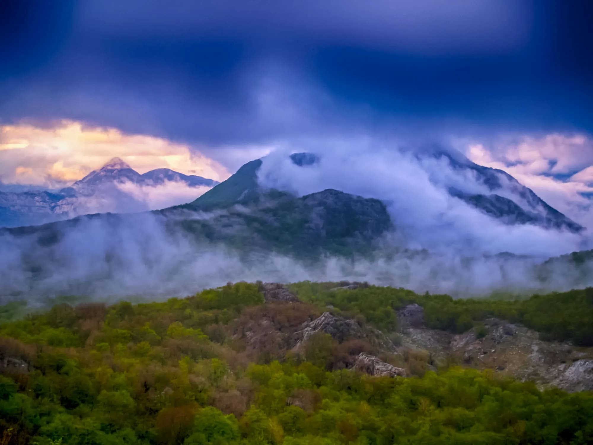
Four and a half metres of rain a year on a mountain with no springs — and the roofless town Austria-Hungary built here for seven thousand soldiers. The plateau around it is down to about a hundred people.
Crkvice er et nesten forlatt landsby høyt oppe på Mount Orjen over Bay of Kotor. Det holder europeisk rekord for årlig nedbør, og mottar over 4 900 mm per år. Tidligere en blomstrende bosetting, er det nå stort sett en spøkelsesby som tiltrekker eventyrlyste fjellvandrere tiltrukket av dens foruroligende atmosfære og ekstrem mikroklima.

Den komplette guiden
Crkvice er en stort sett forlatt bosetting på skråningene av Mount Orjen over Risan, og holder Europas alle tiders nedbørrekord på 8,069mm (1937). Dens østerriksk-ungarsk værstasjonen, dramatisk karstlandskap og total isolasjon gjør det til et av Montenegros mest uvanlige reisemål.
Les hele guiden til CrkviceCrkvice i tall
the 1931–1960 average at the Crkvice gauge, and 4,631 mm for 1961–1990 — the wettest inhabited place in Europe
the village; the Dinarsko gorje gazetteer gives 940 m for the rain gauge, and the two forts above it stand at 1,154 m and 1,225 m
Kom and Stražnik, two of some 70 forts in the Primorska tvrđava Boka system
under snow in an average year at the Crkvice station; Risan, a thousand metres below, averages two
the camp made its own power and drew water from twelve cisterns — Orjen has no springs
Tivat, 59 minutes, including the Kamenari–Lepetane ferry
Crkvice gauge series 1931–1990 and the two fort elevations (Dinarsko gorje) · en.wikipedia (Crkvice; Orjen; Fort Kom) · RTCG on the FORT-NET panels · road distance measured on the OSM network
De nærmeste stedene rundt Crkvice, plassert der de faktisk ligger – Rudine ligger omtrent 20 km unna i luftlinje.
Beste reisetid: juni · juli · september
| Sted | Langs vei | Kjøretid |
|---|---|---|
| Dragalj | 7,4 km | ca. 14 min |
| Morinj | 25,5 km | ca. 35 min |
| Lipci | 26,5 km | ca. 37 min |
| Kostanjica | 27,3 km | ca. 38 min |
| Kotor | 48,1 km | ca. 1 t 10 min |
| Budva | 59,5 km | ca. 1 t 22 min |
| Podgorica | 111,4 km | ca. 2 t 16 min |
Ruter merket ⛴ krysser med ferja Kamenari–Lepetane. Veiavstander beregnet på OpenStreetMap-data, © OpenStreetMap contributors. Kjøretidene er uten kø og tar ikke hensyn til sommertrafikk eller venting på fergeleiet.
Noen timer
Two hours on the FORT-NET trail. Of more than 150 buildings only a few big shells are still standing, and nothing up here is staffed or for sale: carry your own water.
En hel dag
Rain, station by station
Mean annual precipitation around Orjen and down the coast
Crkvice takes more than three and a half times Dubrovnik’s rain, and half again what falls on Risan — eight kilometres away in a straight line and a thousand metres lower. In 1937 the gauge here read 8,036 mm.
The plateau emptying out
People living in Krivošije, seven villages on 114 km²
Venice, Vienna and the Sultan all drew Krivošije inside their borders. From about 1710 until 1882 none of them collected a tax or a conscript here. Widths are to scale.
Sea level to the wettest village in Europe
Five kilometres along the water, then twenty-six up
SRTM 30 m elevations read at seventeen equal points along the 31.5 km drive, measured on the OSM road network. The road leaves the sea at the Lipci roundabout, 4.9 km west of Risan, climbs 18.3 km on the M-8, dips to about 630 m across the karst, then covers the last 8.2 km on a local road. The village node reads 1,120 m here; en.wikipedia gives 1,092 m for the village and the Dinarsko gorje gazetteer 940 m for the site of the rain gauge. Above Crkvice the regional road to Orjensko sedlo, at 1,594 m, is not asphalted.
Søk blant tusenvis av hoteller og leiligheter med oppdaterte priser.
Vi kan tjene provisjon fra partnerlenker. Dette hjelper oss med å holde Montenegro.com gratis for reisende.

Søk blant hoteller, leiligheter og gjestehus med oppdatert tilgjengelighet.
Vi kan tjene provisjon fra partnerlenker. Dette hjelper oss med å holde Montenegro.com gratis for reisende.

Crkvice itself has no line in the census. Kotor’s settlement register counts Dragalj (46 people in 2023) and Ledenice (13), and nobody at all in Han, Knežlaz, Malov Do, Unijerina or Zvečava — but in 2011 and again in 2023 it lists no Crkvice, and en.wikipedia calls the village “nowadays virtually uninhabited”.
Dinarsko gorje, Krivošije; en.wikipedia (Krivošije; Krivošije uprising; Fort Vrmac). Sovereignty on paper changed hands more often than the band shows — Venice fell in 1797, France held the plateau from 1807, Montenegro from 1813, Austria again after the Congress of Vienna in 1814 — but the free territory these sources call Kneževina Krivošije outlasted all of them on the ground.
Crkvice ligger høyt i lia av fjellet Orjen, rundt 940 moh. over Kotorbukta. Adkomsten er en langsom stigning på smale veier gjennom kalksteinlandskapet bak Risan, og overgangen fra kysten er brå.
For været. Stedet holder den europeiske rekorden for årsnedbør, med et snitt på over 4 900 mm i året og langt mer i ekstreme år — et av de våteste bebodde stedene på kontinentet.
Varm, fuktig luft som presses innover fra Adriaterhavet treffer Orjen-veggen og tømmer alt den bærer. Vinteren gir snø målt i meter framfor centimeter, og fonner skar en gang stedet av fra kysten i ukevis.
Bare en håndfull sesongboere. Østerriksk-ungarske ingeniører la en militærvei over disse høydene sent på 1800-tallet og bygde brakker; ved siden av vokste et sivilt samfunn fram. Igjen står steinhus uten tak, sisterner og de rustne skjelettene av militærbygningene.
Man kommer til fots. Crkvice er et veipunkt for turgåere som krysser Orjen mellom bygdene over Kotor og de høyere toppene, og ruinene gir en minneverdig pause på en lang dag — stille, fuktige og ulikt alt annet i Montenegro.
Vann, mat og varme lag uansett hva meldingen sier, for det finnes ingen tjenester i det hele tatt. Fra sen vår til tidlig høst er det praktiske vinduet; utenom det kan tåke, regn og snø stenge platået helt.
Nei — den nærmeste er Tivat lufthavn (TIV), 41 km unna langs vei.
7,4 km langs vei, omtrent 14 min med bil.
Det britiske utenriksdepartementet (FCDO) fraråder ikke reiser til Montenegro; rådene ble sist gjennomgått 13. august 2026. Det er deres vurdering av landet som helhet, ikke vår og ingen dom over Crkvice — les den selv før du reiser. Nødnummeret i Montenegro er 112.
Skjematisk. Plasseringer og avstander er i luftlinje, basert på koordinatene vi har for hvert sted; fjellveier gjør kjøreturen lengre. Den tykke linjen er kysten der den går gjennom dette utsnittet. Kystlinje og Skadarsjøen © OpenStreetMap contributors.
A full day outdoors and most of it uphill. Take the forecast seriously: this is the wettest inhabited place on the continent.
Risan
Best for the base everyone actually uses — 1,899 residents, hotels and apartments on the bay, 31.5 km and 42 minutes below the village
Dragalj
Best for the nearest village the census still counts anyone in: 46 people in 14 households, 12.6 km along the karst
Herceg Novi
Best for the nearest town with a real choice of rooms: 30 km, but 66 minutes of it, most of that on the unpaved old Austrian road over the plateau
Hvem besøker Montenegro
Andel av utenlandske gjesters overnattinger, 2025
MONSTAT · 2025
Crkvice reaches the Montenegrin press every few years, usually as the same story told again: the wettest place in Europe, with a dead town inside it.
Vijesti “Tvrđava Boka odolijeva vremenu” — Siniša Luković on the fortress system built between 1838 and 1914, whose third phase concentrated on Krivošije. The Crkvice camp, he writes, held six to seven thousand men, with a bowling alley, a ski slope and its own generator. 31 August.
Boka News Don Anton Belan on the camp’s Catholic church of the Assumption, built in 1895 and pulled down from about 1955, with the 1956 letters about its missing altar slab. 26 November.
RTCG “Putovanje u prošlost: Vojni grad Crkvice” — Ozren Zogović walks the FORT-NET thematic trail panel by panel: the cisterns, the bakery, the two forts, the military cemetery. 30 October.
Vijesti The fifth “Svi na Crkvice” day, run by Kotor’s tourist organisation and the municipality, with guided walks up to Stražnik and Kom. 11 August.
All four items were opened at the outlet. The RTCG piece is the fullest account of the camp in circulation; a fifth, the road-repair notice Vijesti ran on 10 September 2024, is the reason the Crkvice–Orjen Sedlo road is passable at all.
I mellomtiden, i 1882
Krivošije, 1882: Austrian control is reimposed after a second rising against conscription. The plateau had recognised nobody’s authority, paid nobody’s tax and served in nobody’s army for some 170 years.
Crkvice — Vienna answers with a town rather than an argument. Feldmarschalleutnant Stjepan baron Jovanović directs a fortification programme across Boka, and more than 150 buildings go up on waterless karst above Risan: hotel, hospital, bakery, cinema, tennis courts, a bowling alley, a rifle range and a football ground with stands for a thousand.
Fort Kom, 1882 and 1883: a three-level barracks under an artillery platform, to Colonel Karl Wahlberg’s standard design, held by three officers and fifty-nine men. Its job was the roads onto the plateau from the north and east.
Vienna and Berlin, 20 May 1882: Germany, Austria-Hungary and Italy sign the Triple Alliance. In March, Serbia had been proclaimed a kingdom and Robert Koch had named the tuberculosis bacterium; in September Edison lit a square mile of lower Manhattan from Pearl Street.
“They bent their necks looking at the sky — in summer waiting for rain to save them from the drought, in winter waiting for it to stop.”
Lokal legende
Why the plateau is called Krivošije
“Although it is a mountain with a great deal of rainfall, Orjen is a mountain without springs.”
The FORT-NET panel on water, via RTCG
Hence twelve cisterns for the garrison, two of them large, and drinking water carried up or melted from snow kept in pits.
janSveti Jovan — 20 January — the krsna slava of the Krivošije brotherhoods, kept in the house rather than the square, in the middle of the rain season
augSvi na Crkvice — Kotor’s tourist organisation brings a day of guided walks to Kom and Stražnik, archery and music up to the plateau; the fifth edition ran in August 2024. August here is often rainless end to end, and the fire risk peaks with it
novThe wettest month — November averages 714 mm at the Crkvice gauge — more than three times Dubrovnik’s November — and the Orjen literature reports late-autumn storms dropping 2,000 mm in a few days






