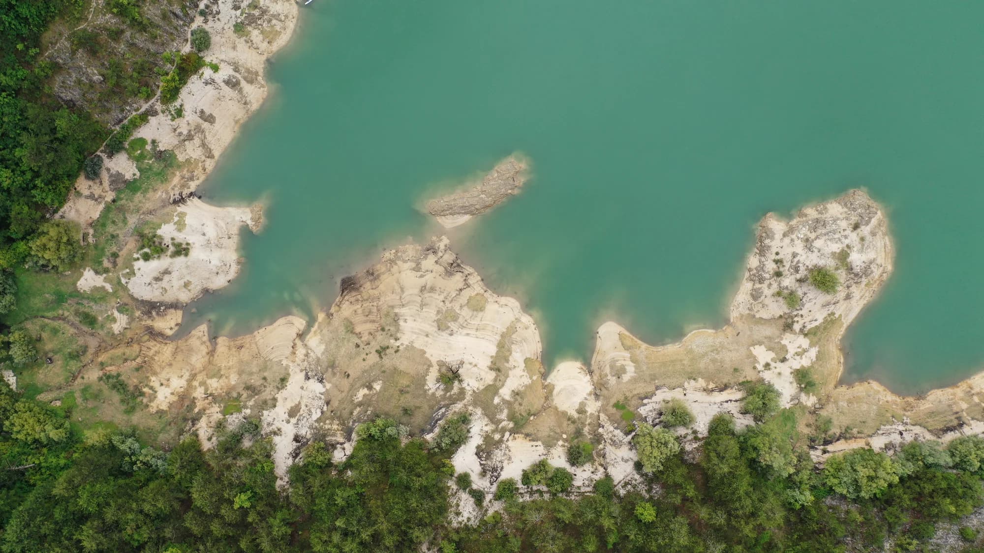
A hundred and two people on a karst field seven kilometres long, and the ground where in 1858 Montenegro won the battle that made Europe draw its border.
Grahovo er en landsby som ligger i et bredt karstfelt mellom Nikšić og Adriaterhavskysten. Det har dypt historisk betydning som stedet for Grahovo-slaget i 1858, en avgjørende montenegrinsk seier over Det osmanske riket som sikret landets uavhengighet og territoriell ekspansjon mot havet.
Den komplette guiden
Grahovo er et historisk bosettelse på et karsthøydeland i vestlig Montenegro, stedet for den avgjørende kampen i 1858 som sikret Montenegros uavhengighet.
Les hele guiden til GrahovoGrahovo i tall
2023 census — 185 at the 1961 peak, 120 in 2011
the floor of the polje runs 695–780 m, under Orjen’s 1,894 m
a year on the field, against 1,990 mm at Nikšić — Crkvice, 11 km south on the same massif, is the wettest inhabited place in Europe
the Church of the Holy Saviour at Grahovac, built on the ground where Husein-paša’s tent had stood
rises on the northern rim of the field and is dammed there for an irrigation reservoir
MONSTAT censuses by settlement (Republički zavod za statistiku 1948–2011; Popis 2023 settlement tables) · the field: Prof. Branko Radojičić in Enciklopedija Jugoslavije vol. 4 (1986), p. 545 · Nikšić rainfall: Hydrological and Meteorological Service of Montenegro, 1991–2020
De nærmeste stedene rundt Grahovo, plassert der de faktisk ligger – Bogetići ligger omtrent 25 km unna i luftlinje.
Beste reisetid: juni · juli · september
The district emptied; Grahovo did not
Population change by settlement, 1953 to 2003
Six of these seven villages lost more than half their people in fifty years, and Dolovi and Zagora lost more than four in five. Grahovo, the old municipal seat, finished the half-century three people up.
What is left of the old municipality
Residents by settlement, 2003 census
Whoever held Grahovo held the way into Herzegovina, which is why two battles were fought over a field of 6.4 square kilometres. Widths are to scale.
A day on the field
No rush hour: thirty-nine households and a road that goes two ways
Søk blant tusenvis av hoteller og leiligheter med oppdaterte priser.
Vi kan tjene provisjon fra partnerlenker. Dette hjelper oss med å holde Montenegro.com gratis for reisende.

Søk blant hoteller, leiligheter og gjestehus med oppdatert tilgjengelighet.
Vi kan tjene provisjon fra partnerlenker. Dette hjelper oss med å holde Montenegro.com gratis for reisende.

Seven villages, 574 people between them in 2003 — down from 1,525 in 1953.
Bolizza’s survey of 1614; knez Jakov Daković’s decision of 1834 to attach the field to Montenegro; the battles of 1836 and 1858; the church of 1864; the Grahovo municipality abolished in 1960.
Grahovo ligger i et karstfelt vest i Nikšić kommune, nær grensen til Bosnia og om lag 40 km fra Nikšić selv. Veien fra Risan ved bukta klatrer hit, og stedet binder dermed kysten til innlandet.
En montenegrinsk seier over en osmansk hær i mai 1858, utkjempet på sletta nedenfor bygda. Den tvang stormaktene til for første gang å megle fram en grense for Montenegro, og huskes som et vendepunkt mot anerkjent statsdannelse.
Ja, med et monument på sletta og et lite minnesmerke i bygda. Selve stedet er hovedsaken: en åpen karstslette omkranset av nakne åser, noe som forklarer mye om hvordan kampene forløp.
Høyt, steinete og nesten uten trær — et klassisk montenegrinsk karstpolje, grønt om våren og svidd på sensommeren, med tørrmurer og dolinar. Vintrene er harde, og sletta holder på snøen når kysten alt er varm.
Bare tynt. Utvandringen har tømt mye av det, og mange hus står stengt mesteparten av året og fylles kort om sommeren når familier vender hjem. Det er et av stedene der fraflyttingen fra innlandet er tydeligst.
For slagmarken, for karstlandskapet og som en uvanlig rute mellom Risan og Nikšić som nesten ingen besøkende tar. Det finnes så godt som ingen fasiliteter, så fyll tanken og ta med vann.
Nei — den nærmeste er Tivat lufthavn (TIV), 41 km unna langs vei.
5,1 km langs vei, omtrent 8 min med bil.
Det britiske utenriksdepartementet (FCDO) fraråder ikke reiser til Montenegro; rådene ble sist gjennomgått 13. august 2026. Det er deres vurdering av landet som helhet, ikke vår og ingen dom over Grahovo — les den selv før du reiser. Nødnummeret i Montenegro er 112.
Skjematisk. Plasseringer og avstander er i luftlinje, basert på koordinatene vi har for hvert sted; fjellveier gjør kjøreturen lengre. Den tykke linjen er kysten der den går gjennom dette utsnittet. Kystlinje og Skadarsjøen © OpenStreetMap contributors.
Noen timer
Two hours is the right length: a church, a monument and a field, none of it dressed up for visitors.
En hel dag
The Risan road is the way in: you climb out of the Bay of Kotor and arrive on the field the border was fought over.
Grahovo
Best for the field at the door and both battle sites within a few kilometres — thirty-nine households at the 2023 census, and a restaurant with rooms on the through road
Vilusi
Best for the biggest village of the old Grahovo municipality, 132 people in 2023, 13 km north
Risan
Best for 32 km down the mountain: Roman mosaics, the Bay of Kotor and as many rooms as you like
Nikšić
Best for 47 km east — hotels, a planned town centre, and the municipality Grahovo belongs to
Hvem besøker Montenegro
Andel av utenlandske gjesters overnattinger, 2025
MONSTAT · 2025
Folketellinger, Grahovo kommune
A hundred and eighty-five people in 1961, eighty-two by 1991, a hundred and thirty-three in 2003, a hundred and two across thirty-nine households in 2023. Grahovo held on better than its neighbours: it was the seat of its own municipality until 1960, and the main road still runs through it. Zagora, in that same municipality, went from 179 to 20 over the same fifty years.
I mellomtiden, i 1858
Grahovac, 28 April 1858: Husein-paša marches in from Trebinje and Bileća with about 4,000 regulars and some 6,000 bashi-bozouks, takes Vilusi and Grahovo, digs trenches above the field and sets out eight cannons. He leaves his own line of retreat open.
Three days later — 1 May by the old calendar, 13 May by the new, and Ascension Day. About 400 Montenegrins under vojvoda Vujović hold the heights; some 5,000 more come up under Mirko Petrović Njegoš, the prince’s elder brother. When the Montenegrins take the guns the Ottoman line breaks, and the rout is chased as far as Klobuk. Austrian reports of the spoils: six thousand rifles, two thousand horses, a hundred and fifty tents.
Cetinje — Knjaz Danilo strikes the Grahovac Medal, the first military medal Montenegro made, and gives Mirko a gold one, a sabre engraved “Danilo I” on one side and “Grahovac 1858” on the other, and the title of Grand Duke of Grahovo. The first medals are handed out in August 1859. The captured arsenal arms the wars of 1862 and 1875–78.
Europe — the victory forces the Great Powers to fix the frontier. A demarcation commission sits at Istanbul later in 1858 and finishes the next year; the protocol is signed in April 1860. Grahovo, Rudine, the Nikšić Župa and Upper Vasojevići pass to Montenegro.
“As Kosovo was dewed with the blood of the nine Jugovići, so Grahovo was soaked with blood — ten Petrovići.”
King Nikola I, “Grahovsko kolo”, 1913
The Petrovići of the song fell in the summer of 1836, when a detachment of 300 men under Joko Tomov was beaten at the Čelinski potok. The histories count nine Petrovići among the dead, the song ten; Joko, brother of Petar II Petrović Njegoš, and Stevan, brother of the future Knjaz Danilo, were two of them.
“The monument to your valour is Montenegro and her freedom.”
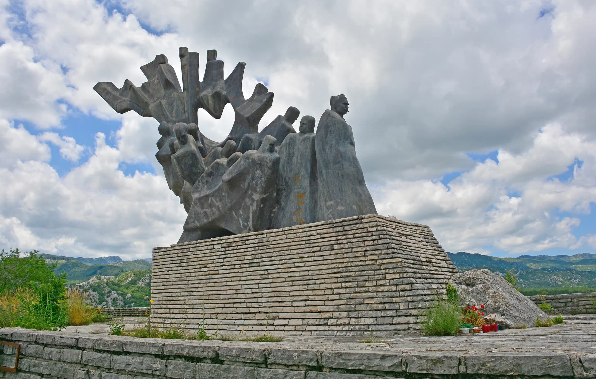
Cut on the church at Grahovac and on the 2008 monument
Spomenik je vašeg junaštva, Crna Gora i njena sloboda — put on the 1864 church as a plaque at the battle’s centenary, and repeated when the Government of Montenegro raised the monument to the fallen in 2008.
| Sted | Langs vei | Kjøretid |
|---|---|---|
| Dragalj | 5,1 km | ca. 8 min |
| Crkvice | 15,4 km | ca. 21 min |
| Vilusi | 19 km | ca. 29 min |
| Rudine | 24,4 km | ca. 31 min |
| Kotor | 48,8 km | ca. 1 t 6 min |
| Budva | 60,2 km | ca. 1 t 18 min |
| Podgorica | 96,5 km | ca. 1 t 56 min |
Ruter merket ⛴ krysser med ferja Kamenari–Lepetane. Veiavstander beregnet på OpenStreetMap-data, © OpenStreetMap contributors. Kjøretidene er uten kø og tar ikke hensyn til sommertrafikk eller venting på fergeleiet.






