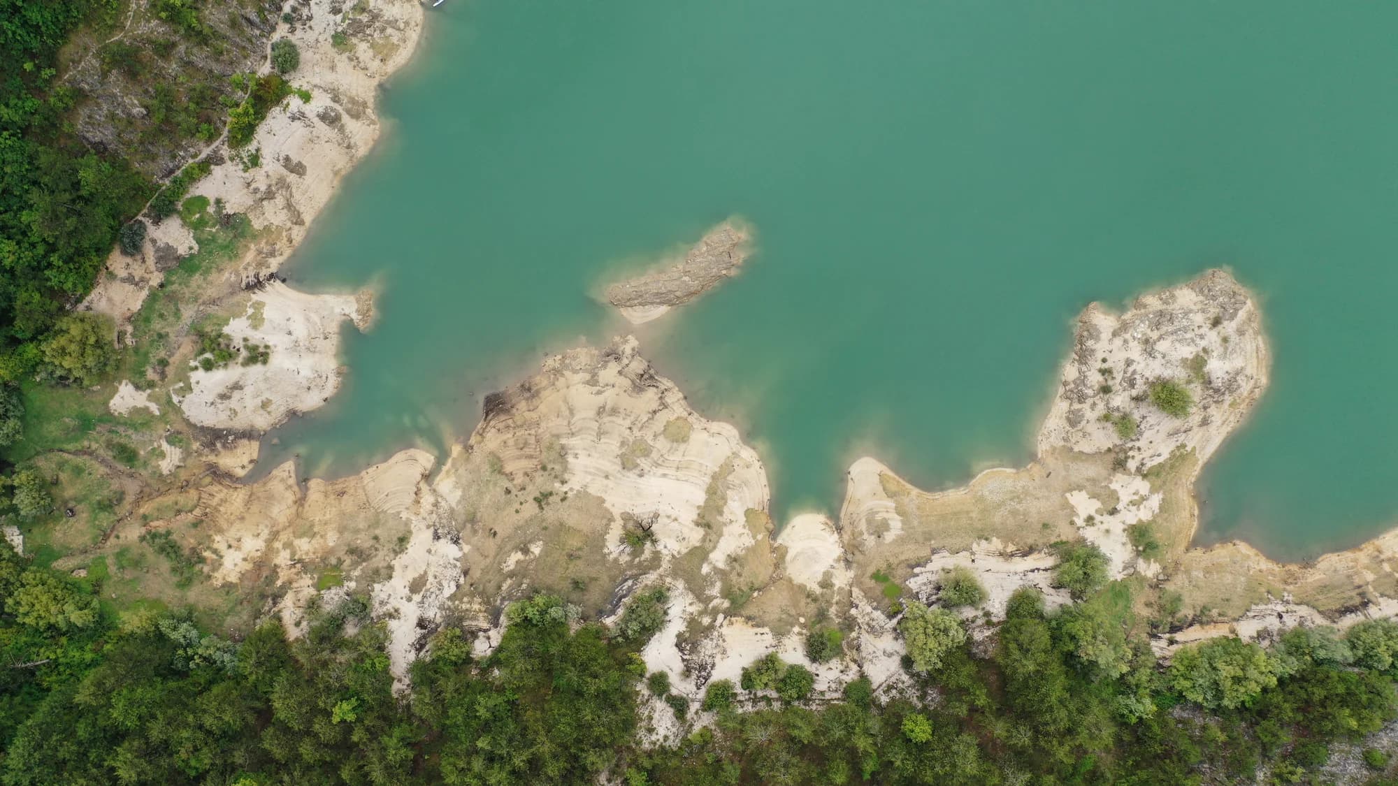
A hundred and two people on a karst field seven kilometres long, and the ground where in 1858 Montenegro won the battle that made Europe draw its border.
Grahovo is a village set in a broad karst field between Nikšić and the Adriatic coast, on the old road that ran from the mountains down to Risan and the Bay of Kotor. The polje is wide and flat, ringed by grey limestone ridges, green with hay meadows in early summer and pale by August. It is ground built for grazing rather than crops, and for most of its history that is what it did: sheep, cattle, hay, and a scattering of stone hamlets around the rim. Its significance is historical and considerable. In May 1858 Montenegrin forces under Grand Duke Mirko Petrović, father of the future King Nikola, met a far larger Ottoman army on this field and destroyed it. The Battle of Grahovac was the most complete Montenegrin victory of the century. It forced the Great Powers to intervene, produced the first internationally recognised demarcation of Montenegro's borders the following year, and pushed the country's territory toward the sea. Montenegrins had fought the Ottomans for generations, but Grahovac is the point at which the principality began to be treated as a state. A memorial on the field marks the battle, and the village keeps a place in the national story out of all proportion to its size. Otherwise Grahovo is small and quiet: a scatter of houses, a church, and the same emptying-out common across the interior, with many buildings opened only in summer when families come back from Nikšić and the coast. Travellers usually pass through rather than stop, which is a shame on a clear day. The drive over from Risan is one of the good ones in Montenegro, climbing out of the bay in switchbacks into open upland, and the road on toward Nikšić crosses country few visitors ever see. There is little in the way of services, so arrive fuelled and fed. Late spring through autumn is the season; the polje traps snow and cold air in winter. Grahovo suits drivers, cyclists and anyone interested in how Montenegro became Montenegro.
The district emptied; Grahovo did not
Population change by settlement, 1953 to 2003
Six of these seven villages lost more than half their people in fifty years, and Dolovi and Zagora lost more than four in five. Grahovo, the old municipal seat, finished the half-century three people up.
What is left of the old municipality
Residents by settlement, 2003 census
Seven villages, 574 people between them in 2003 — down from 1,525 in 1953.
Who visits Montenegro
Share of foreign overnight stays, 2025
MONSTAT · 2025
Census population, Grahovo municipality
A hundred and eighty-five people in 1961, eighty-two by 1991, a hundred and thirty-three in 2003, a hundred and two across thirty-nine households in 2023. Grahovo held on better than its neighbours: it was the seat of its own municipality until 1960, and the main road still runs through it. Zagora, in that same municipality, went from 179 to 20 over the same fifty years.
Whoever held Grahovo held the way into Herzegovina, which is why two battles were fought over a field of 6.4 square kilometres. Widths are to scale.
Bolizza’s survey of 1614; knez Jakov Daković’s decision of 1834 to attach the field to Montenegro; the battles of 1836 and 1858; the church of 1864; the Grahovo municipality abolished in 1960.
A day on the field
No rush hour: thirty-nine households and a road that goes two ways
Meanwhile, in 1858
Grahovac, 28 April 1858: Husein-paša marches in from Trebinje and Bileća with about 4,000 regulars and some 6,000 bashi-bozouks, takes Vilusi and Grahovo, digs trenches above the field and sets out eight cannons. He leaves his own line of retreat open.
Three days later — 1 May by the old calendar, 13 May by the new, and Ascension Day. About 400 Montenegrins under vojvoda Vujović hold the heights; some 5,000 more come up under Mirko Petrović Njegoš, the prince’s elder brother. When the Montenegrins take the guns the Ottoman line breaks, and the rout is chased as far as Klobuk. Austrian reports of the spoils: six thousand rifles, two thousand horses, a hundred and fifty tents.
Cetinje — Knjaz Danilo strikes the Grahovac Medal, the first military medal Montenegro made, and gives Mirko a gold one, a sabre engraved “Danilo I” on one side and “Grahovac 1858” on the other, and the title of Grand Duke of Grahovo. The first medals are handed out in August 1859. The captured arsenal arms the wars of 1862 and 1875–78.
Europe — the victory forces the Great Powers to fix the frontier. A demarcation commission sits at Istanbul later in 1858 and finishes the next year; the protocol is signed in April 1860. Grahovo, Rudine, the Nikšić Župa and Upper Vasojevići pass to Montenegro.
“As Kosovo was dewed with the blood of the nine Jugovići, so Grahovo was soaked with blood — ten Petrovići.”
King Nikola I, “Grahovsko kolo”, 1913
The Petrovići of the song fell in the summer of 1836, when a detachment of 300 men under Joko Tomov was beaten at the Čelinski potok. The histories count nine Petrovići among the dead, the song ten; Joko, brother of Petar II Petrović Njegoš, and Stevan, brother of the future Knjaz Danilo, were two of them.
“The monument to your valour is Montenegro and her freedom.”
Cut on the church at Grahovac and on the 2008 monument
Spomenik je vašeg junaštva, Crna Gora i njena sloboda — put on the 1864 church as a plaque at the battle’s centenary, and repeated when the Government of Montenegro raised the monument to the fallen in 2008.
Search thousands of hotels and apartments with live prices.
We may earn a commission from partner links. This helps us keep Montenegro.com free for travelers.
Search hotels, apartments and guest houses with live availability.
We may earn a commission from partner links. This helps us keep Montenegro.com free for travelers.
Grahovo lies in a karst field in the west of Niksic municipality, close to the Bosnian border and about 40 km from Niksic itself. The road from Risan on the bay climbs to it, making it a link between the coast and the interior.
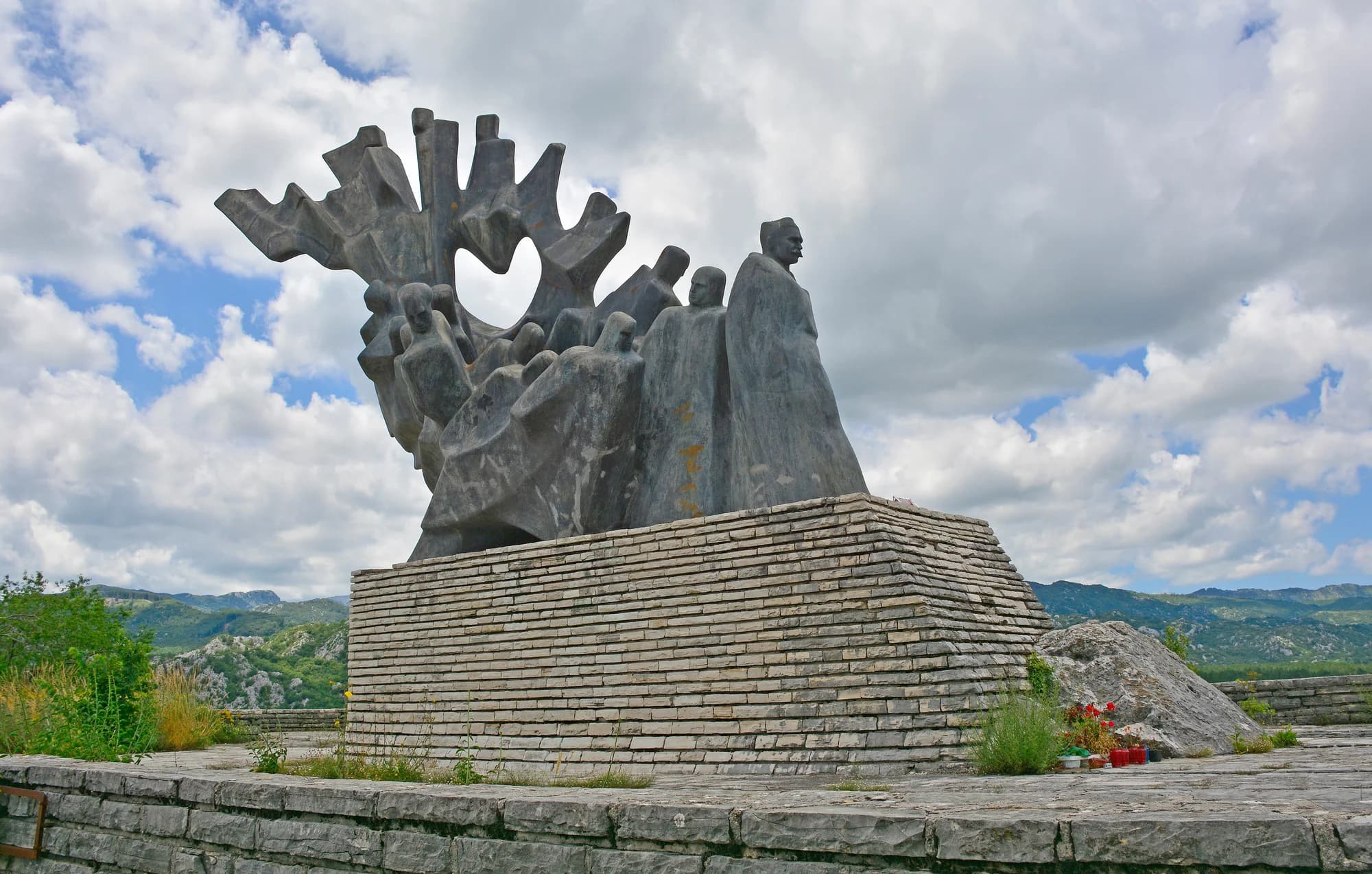
A Montenegrin victory over an Ottoman army in May 1858, fought in the field below the village. It forced the powers to arbitrate a border for Montenegro for the first time, and it is remembered as a turning point towards recognised statehood.
Yes, a monument on the field and a small memorial in the village. The site itself is the main thing to see: an open karst plain ringed by bare hills, which explains a good deal about how the fighting went.
High, stony and largely treeless — a classic Montenegrin karst polje, green in spring and burnt by late summer, with drystone walls and sinkholes. Winters are hard and the field holds snow after the coast is already warm.
Only sparsely. Emigration has emptied much of it, and many houses stand shut for most of the year, filling briefly in summer when families return. It is one of the clearest places to see what depopulation has done to the Montenegrin interior.
For the battlefield, for the karst scenery and as an unusual route between Risan and Niksic that almost no visitor takes. There are no facilities to speak of, so fill up and carry water before you go.
No — the nearest is Tivat Airport (TIV), 41 km away by road.
5.1 km by road, about 8 min by car.
The UK Foreign, Commonwealth & Development Office (FCDO) has no advisory against travel to Montenegro; it last reviewed its guidance on 13 August 2026. That is their assessment of the country as a whole, not ours and not a judgement about Grahovo, so read it yourself before you travel. The emergency number in Montenegro is 112.
The nearest places to Grahovo, at their true positions — Bogetići is about 25 km away in a straight line.
Schematic. Positions and straight-line distances from the coordinates we hold for each place; mountain roads make the drive longer. Coastline and Lake Skadar © OpenStreetMap contributors.
Grahovo in numbers
2023 census — 185 at the 1961 peak, 120 in 2011
the floor of the polje runs 695–780 m, under Orjen’s 1,894 m
a year on the field, against 1,990 mm at Nikšić — Crkvice, 11 km south on the same massif, is the wettest inhabited place in Europe
the Church of the Holy Saviour at Grahovac, built on the ground where Husein-paša’s tent had stood
rises on the northern rim of the field and is dammed there for an irrigation reservoir
MONSTAT censuses by settlement (Republički zavod za statistiku 1948–2011; Popis 2023 settlement tables) · the field: Prof. Branko Radojičić in Enciklopedija Jugoslavije vol. 4 (1986), p. 545 · Nikšić rainfall: Hydrological and Meteorological Service of Montenegro, 1991–2020
A few hours
Two hours is the right length: a church, a monument and a field, none of it dressed up for visitors.
One full day
The Risan road is the way in: you climb out of the Bay of Kotor and arrive on the field the border was fought over.
Grahovo
Best for the field at the door and both battle sites within a few kilometres — thirty-nine households at the 2023 census, and a restaurant with rooms on the through road
Vilusi
Best for the biggest village of the old Grahovo municipality, 132 people in 2023, 13 km north
Risan
Best for 32 km down the mountain: Roman mosaics, the Bay of Kotor and as many rooms as you like
Nikšić
Best for 47 km east — hotels, a planned town centre, and the municipality Grahovo belongs to
Best time: June · July · September
| Place | By road | Driving |
|---|---|---|
| Dragalj | 5.1 km | about 8 min |
| Crkvice | 15.4 km | about 21 min |
| Vilusi | 19 km | about 29 min |
| Rudine | 24.4 km | about 31 min |
| Kotor | 48.8 km | about 1 h 6 min |
| Budva | 60.2 km | about 1 h 18 min |
| Podgorica | 96.5 km | about 1 h 56 min |
Routes marked ⛴ cross on the Kamenari–Lepetane ferry. Road distances routed over OpenStreetMap data, © OpenStreetMap contributors. Driving times are free-flow and take no account of summer traffic or a queue at the ferry ramp.








