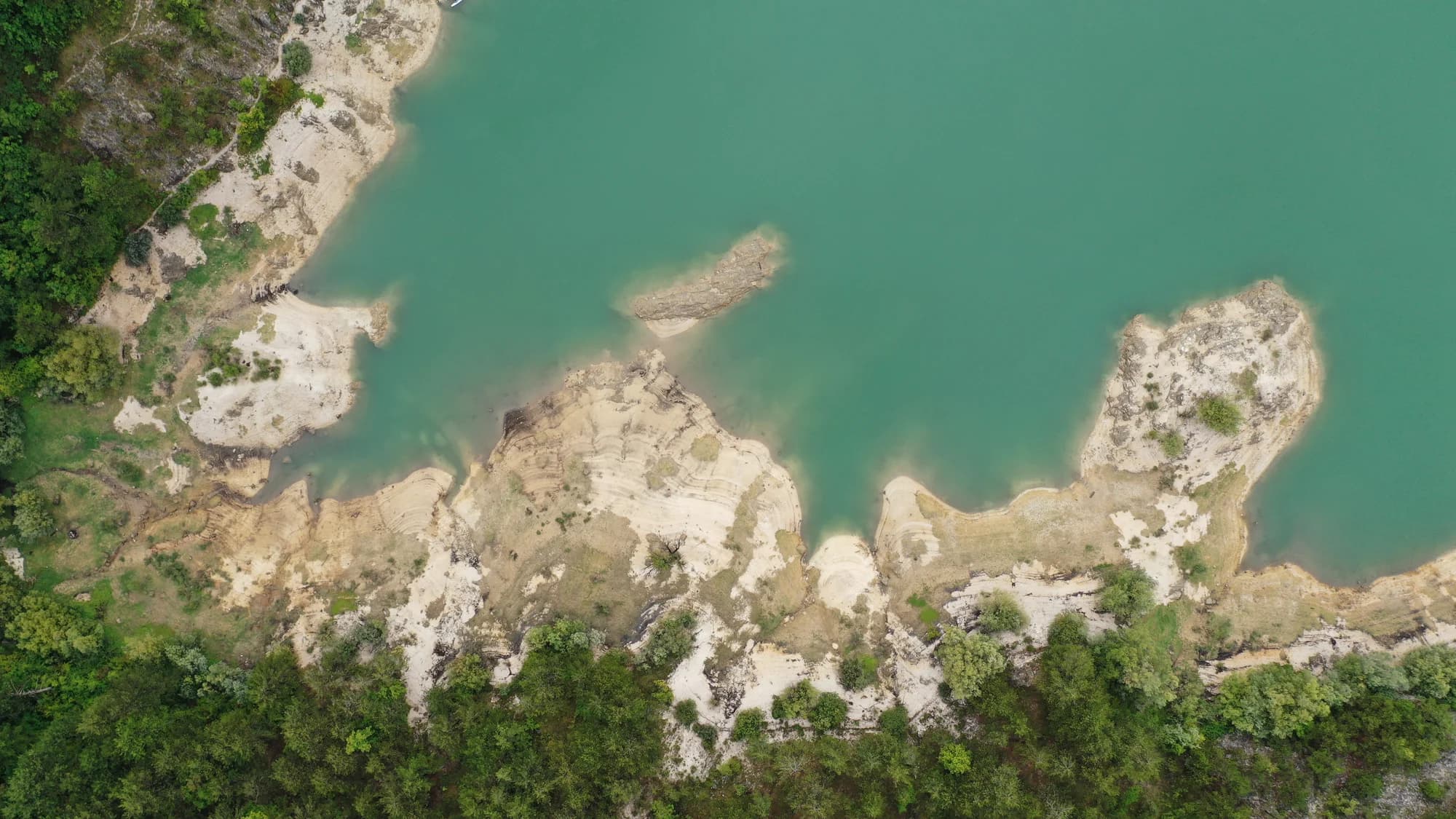
A hundred and two people on a karst field seven kilometres long, and the ground where in 1858 Montenegro won the battle that made Europe draw its border.
Grahovi je grad smješten u prostranom kraškom polju između Nikšića i Jadranske obale. Ima dubok istorijski značaj kao mjesto Grahovske bitke iz 1858. godine, presudne crnogorske pobjede nad Osmanskim carstvom kojom je osigurana nezavisnost zemlje i njeno teritorijalno širenje prema moru.
Potpuni vodič
Grahovo je istorijsko naselje na kraškoj zaravni u zapadnoj Crnoj Gori, mjesto presudne bitke iz 1858. koja je osigurala crnogorsku nezavisnost.
Pročitajte cjeloviti vodič kroz GrahovoGrahovo u brojkama
2023 census — 185 at the 1961 peak, 120 in 2011
the floor of the polje runs 695–780 m, under Orjen’s 1,894 m
a year on the field, against 1,990 mm at Nikšić — Crkvice, 11 km south on the same massif, is the wettest inhabited place in Europe
the Church of the Holy Saviour at Grahovac, built on the ground where Husein-paša’s tent had stood
rises on the northern rim of the field and is dammed there for an irrigation reservoir
MONSTAT censuses by settlement (Republički zavod za statistiku 1948–2011; Popis 2023 settlement tables) · the field: Prof. Branko Radojičić in Enciklopedija Jugoslavije vol. 4 (1986), p. 545 · Nikšić rainfall: Hydrological and Meteorological Service of Montenegro, 1991–2020
Najbliža mjesta mjestu Grahovo, na svojim stvarnim položajima — Bogetići je udaljeno oko 25 km vazdušnom linijom.
The district emptied; Grahovo did not
Population change by settlement, 1953 to 2003
Six of these seven villages lost more than half their people in fifty years, and Dolovi and Zagora lost more than four in five. Grahovo, the old municipal seat, finished the half-century three people up.
What is left of the old municipality
Residents by settlement, 2003 census
Whoever held Grahovo held the way into Herzegovina, which is why two battles were fought over a field of 6.4 square kilometres. Widths are to scale.
A day on the field
No rush hour: thirty-nine households and a road that goes two ways
Pretražite hiljade hotela i apartmana sa aktuelnim cijenama.
Možemo zaraditi proviziju putem partnerskih linkova. To nam pomaže da zadržimo Montenegro.com besplatnim za putnike.

Pretražite hotele, apartmane i pansione sa trenutnom dostupnošću.
Možemo zaraditi proviziju putem partnerskih linkova. To nam pomaže da zadržimo Montenegro.com besplatnim za putnike.

Seven villages, 574 people between them in 2003 — down from 1,525 in 1953.
Bolizza’s survey of 1614; knez Jakov Daković’s decision of 1834 to attach the field to Montenegro; the battles of 1836 and 1858; the church of 1864; the Grahovo municipality abolished in 1960.
Grahovo leži u kraškom polju na zapadu nikšićke opštine, blizu granice s Bosnom i oko 40 km od samog Nikšića. Put iz Risna s primorja penje se ovamo, pa mjesto povezuje obalu i unutrašnjost.
Crnogorska pobjeda nad osmanskom vojskom u maju 1858, vođena u polju ispod grada. Natjerala je sile da po prvi put arbitriraju granicu Crne Gore, i pamti se kao prekretnica prema priznatoj državnosti.
Postoji — spomenik u polju i mali memorijal u gradu. Sam prostor je glavna stvar: otvoreno kraško polje okruženo golim brdima, što dosta objašnjava o toku borbe.
Visok, kamenit i uglavnom bez drveća — klasično crnogorsko kraško polje, zeleno u proljeće i spaljeno u kasno ljeto, sa suhozidima i vrtačama. Zime su oštre, a polje drži snijeg i kad je primorje već toplo.
Vrlo rijetko. Iseljavanje ga je umnogome ispraznilo, mnoge kuće stoje zatvorene veći dio godine i nakratko se napune ljeti kad se porodice vrate. To je jedno od mjesta gdje se najjasnije vidi šta je depopulacija učinila unutrašnjosti.
Zbog poprišta, zbog kraškog pejzaža i kao neobična ruta između Risna i Nikšića kojom gotovo nijedan posjetilac ne ide. Sadržaja praktično nema, pa natočite gorivo i ponesite vodu.
Ne — najbliži je aerodrom Tivat (TIV), 41 km putem.
5,1 km putem, oko 8 min vožnje.
Britansko Ministarstvo inostranih poslova (FCDO) nema upozorenje protiv putovanja u Crnu Goru; svoje smjernice je posljednji put revidiralo 13. avgusta 2026. To je njihova procjena države u cjelini, ne naša i ne ocjena o ovom gradu, pa je pročitajte sami prije puta. Broj za hitne slučajeve u Crnoj Gori je 112.
Šematski prikaz. Položaji i udaljenosti mjereni su vazdušnom linijom, prema koordinatama koje imamo za svako mjesto; zbog planinskih puteva vožnja je duža. Podebljana linija označava obalu na dijelu koji prolazi kroz ovaj prikaz. Obala i Skadarsko jezero © OpenStreetMap contributors.
Nekoliko sati
Two hours is the right length: a church, a monument and a field, none of it dressed up for visitors.
Cio dan
The Risan road is the way in: you climb out of the Bay of Kotor and arrive on the field the border was fought over.
Grahovo
Najbolje za the field at the door and both battle sites within a few kilometres — thirty-nine households at the 2023 census, and a restaurant with rooms on the through road
Vilusi
Najbolje za the biggest village of the old Grahovo municipality, 132 people in 2023, 13 km north
Risan
Najbolje za 32 km down the mountain: Roman mosaics, the Bay of Kotor and as many rooms as you like
Nikšić
Najbolje za 47 km east — hotels, a planned town centre, and the municipality Grahovo belongs to
Ko posjećuje Crnu Goru
Udio noćenja stranih gostiju, 2025.
MONSTAT · 2025
Popis stanovništva, opština Grahovo
A hundred and eighty-five people in 1961, eighty-two by 1991, a hundred and thirty-three in 2003, a hundred and two across thirty-nine households in 2023. Grahovo held on better than its neighbours: it was the seat of its own municipality until 1960, and the main road still runs through it. Zagora, in that same municipality, went from 179 to 20 over the same fifty years.
U međuvremenu — 1858
Grahovac, 28 April 1858: Husein-paša marches in from Trebinje and Bileća with about 4,000 regulars and some 6,000 bashi-bozouks, takes Vilusi and Grahovo, digs trenches above the field and sets out eight cannons. He leaves his own line of retreat open.
Three days later — 1 May by the old calendar, 13 May by the new, and Ascension Day. About 400 Montenegrins under vojvoda Vujović hold the heights; some 5,000 more come up under Mirko Petrović Njegoš, the prince’s elder brother. When the Montenegrins take the guns the Ottoman line breaks, and the rout is chased as far as Klobuk. Austrian reports of the spoils: six thousand rifles, two thousand horses, a hundred and fifty tents.
Cetinje — Knjaz Danilo strikes the Grahovac Medal, the first military medal Montenegro made, and gives Mirko a gold one, a sabre engraved “Danilo I” on one side and “Grahovac 1858” on the other, and the title of Grand Duke of Grahovo. The first medals are handed out in August 1859. The captured arsenal arms the wars of 1862 and 1875–78.
Europe — the victory forces the Great Powers to fix the frontier. A demarcation commission sits at Istanbul later in 1858 and finishes the next year; the protocol is signed in April 1860. Grahovo, Rudine, the Nikšić Župa and Upper Vasojevići pass to Montenegro.
“As Kosovo was dewed with the blood of the nine Jugovići, so Grahovo was soaked with blood — ten Petrovići.”
King Nikola I, “Grahovsko kolo”, 1913
The Petrovići of the song fell in the summer of 1836, when a detachment of 300 men under Joko Tomov was beaten at the Čelinski potok. The histories count nine Petrovići among the dead, the song ten; Joko, brother of Petar II Petrović Njegoš, and Stevan, brother of the future Knjaz Danilo, were two of them.
“The monument to your valour is Montenegro and her freedom.”
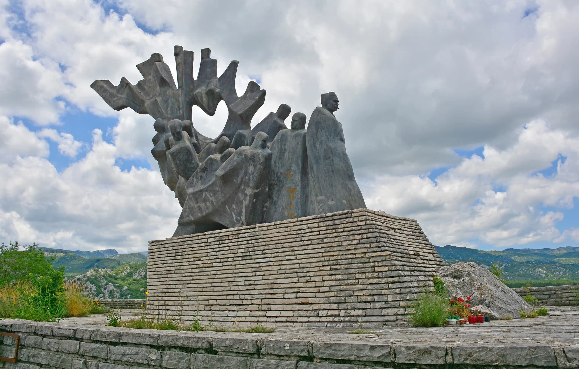
Cut on the church at Grahovac and on the 2008 monument
Spomenik je vašeg junaštva, Crna Gora i njena sloboda — put on the 1864 church as a plaque at the battle’s centenary, and repeated when the Government of Montenegro raised the monument to the fallen in 2008.
Najbolje vrijeme: jun · jul · septembar
| Mjesto | Putem | Vožnja |
|---|---|---|
| Dragalj | 5,1 km | oko 8 min |
| Crkvice | 15,4 km | oko 21 min |
| Vilusi | 19 km | oko 29 min |
| Rudine | 24,4 km | oko 31 min |
| Kotor | 48,8 km | oko 1 h 6 min |
| Budva | 60,2 km | oko 1 h 18 min |
| Podgorica | 96,5 km | oko 1 h 56 min |
Rute označene sa ⛴ prelaze trajektom Kamenari–Lepetane. Udaljenosti putem izračunate na osnovu OpenStreetMap podataka, © OpenStreetMap contributors. Vremena vožnje su bez gužve i ne računaju ljetnji saobraćaj ni čekanje na trajektnoj rampi.






