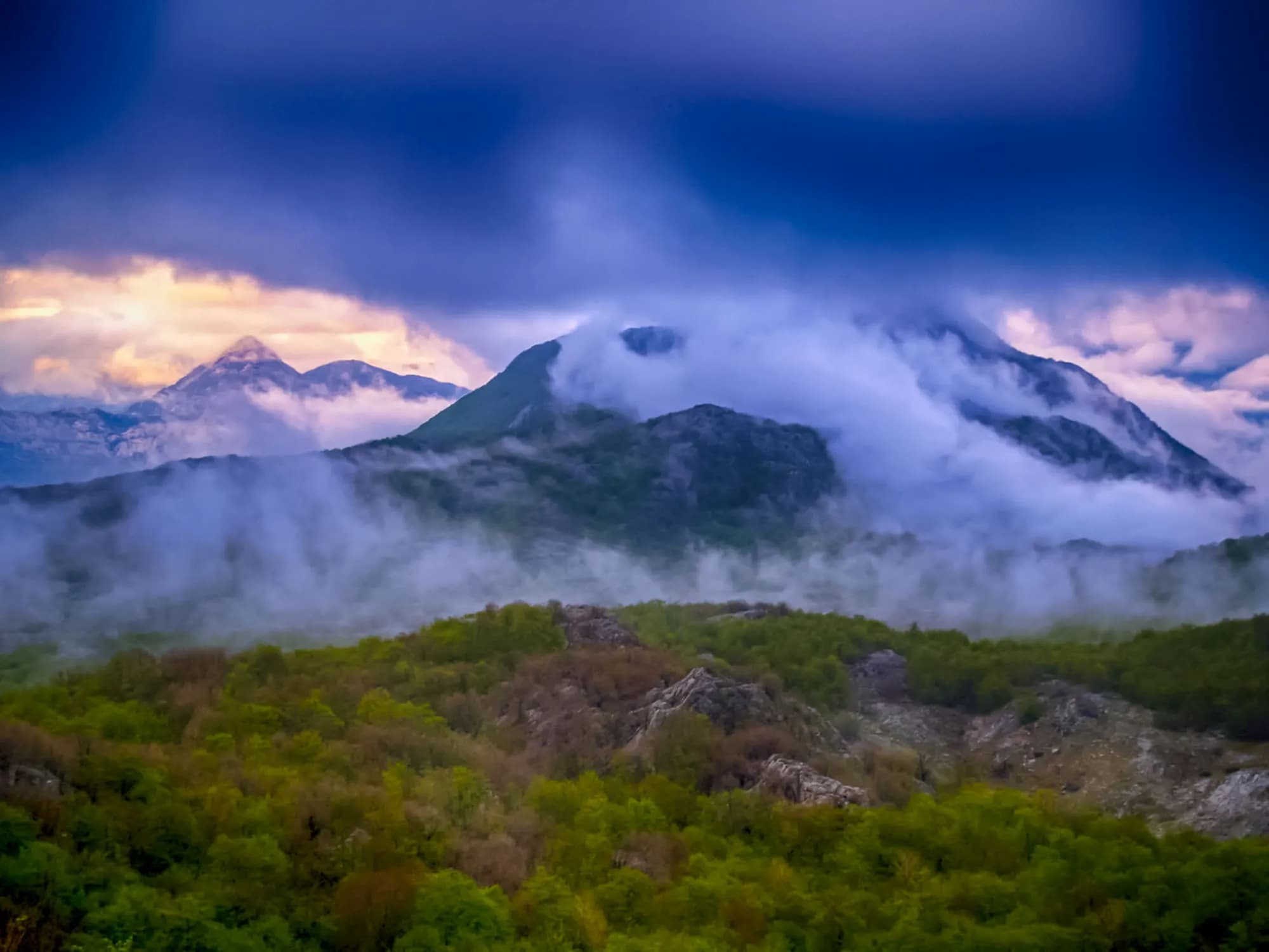
A karst plain at 640 m behind the mountain from Risan, with 46 people and 14 households left on it — and the winter it made Vienna drop conscription.
Dragalj is a small village in the dramatic karst landscape of western central Montenegro, set in a shallow limestone field that holds the only flat, farmable ground for miles. This is the high country between Nikšić and the Bay of Kotor, behind Risan: dry grey rock, sinkholes, scattered beech and juniper, grassland that greens fast in spring and burns brown by August. Rain disappears underground almost as soon as it falls, which is why settlements here cluster on the floors of these fields and why every old house is built around a cistern. The landscape is harsher than it looks from the coast road, and it has a history to match. These uplands sat on a strategic frontier under Austro-Hungarian rule, and the empire drove military roads across them and built stone forts to hold the passes. The local population rose against Vienna twice in the second half of the nineteenth century, in insurrections still remembered here. Ruined barracks and fortifications stand along the roads, slowly being taken apart by weather and vegetation. Today Dragalj is remote and peaceful, with a small permanent population and more houses than households. Some are used seasonally by families who come up from the coast in summer, when the plateau is markedly cooler than Kotor. Sheep still graze the field. There are no services to speak of - no shop or fuel to rely on - and mobile signal comes and goes. Visitors come for the drive and the emptiness. The road up from Risan climbs in tight switchbacks with the bay opening behind you, then levels into a landscape that feels like another country entirely before running on toward Grahovo and Nikšić. The high ground of Orjen lies to the west for walkers. Late spring through October is the season; winter brings snow and the roads can be difficult. Dragalj suits drivers, cyclists and anyone wanting an authentic look at life in Montenegro's rugged interior rather than a destination with things laid on.
The Congress of Vienna handed the plateau to Austria in 1814. Twice, in 1869 and again in 1881, Krivošije refused to give Vienna its conscripts. Widths are to scale.
en.wikipedia (Krivošije; Krivošije uprising 1869; 32nd Infantry Division "Marche"); Dinarsko gorje.
Sea level to the polje
Five kilometres along the water, then twenty-three up and over the rim
Read off the SRTM and ASTER elevation models at thirteen equal points along the 27.8 km drive from Risan. The road tops out near 680 m and then drops into the basin, which is why the village is not the high point; 640 m is the figure given for the polje floor itself.
Meanwhile, in 1869
Ledenice, 7 October 1869: the first shot of the Krivošije uprising. Vienna had extended the 1868 Defence Act to a plateau whose men had never been obliged to serve in anyone’s army.
Dragalj — one of six villages the insurgents held. About a thousand fighters faced five Austro-Hungarian battalions, eighteen by November, and a force of more than thirteen thousand. Ten thousand of those had to come by sea: Ottoman Sutorina cut the Kotor district off from the rest of the empire, and the roads were no use.
Knežlaz, 11 January 1870: the peace. Conscription was abandoned, a general pardon was granted to every insurgent, and the men who surrendered to General Gavrilo Rodić walked home still carrying their rifles.
Elsewhere in 1869 — the Suez Canal opens in November, and in Saint Petersburg Mendeleev sets out the first periodic table. Vienna comes back in 1881 with conscription for its new provinces and a renewed claim on Krivošije, gets a second rising, and answers with a fortification system instead of an argument.
“Around 250 houses and 1,200 souls, all of the Orthodox faith.”
Vuk Stefanović Karadžić on Krivošije, 1834
His count is quoted in the Dinarsko gorje survey of the plateau. The 2023 census finds 46 people in Dragalj and none at all in Han, Knežlaz, Malov Do, Unijerina or Zvečava.
“Conscription was abandoned and a general pardon was granted to all insurgents.”
The terms of the peace at Knežlaz, 11 January 1870
Wikipedia’s account of the Krivošije uprising, citing Rothenberg’s history of the Austrian army: the rebels surrendered to General Gavrilo Rodić and were allowed to keep their weapons.
Search thousands of hotels and apartments with live prices.
We may earn a commission from partner links. This helps us keep Montenegro.com free for travelers.
Search hotels, apartments and guest houses with live availability.
We may earn a commission from partner links. This helps us keep Montenegro.com free for travelers.
Dragalj is a small village in the high karst country between Niksic and the Bay of Kotor, behind Risan, set in a shallow limestone field that holds the only flat, farmable ground for miles.
Dry grey rock, sinkholes, scattered beech and juniper, and grassland that greens fast in spring and burns brown by August. Rain disappears underground almost as soon as it falls, which is why settlements sit on the floors of these fields and every old house is built around a cistern.
These uplands sat on a strategic frontier under Austria-Hungary, which drove military roads across them and built stone forts to hold the passes. The local population rose against Vienna twice in the later 19th century, and ruined barracks still stand along the roads.
A small permanent population, and more houses than households. Some are used seasonally by families who come up from the coast in summer, when the plateau is markedly cooler than Kotor. Sheep still graze the field.
The road from Risan climbs in tight switchbacks with the bay opening behind you, then levels into a landscape that feels like another country entirely before running on toward Grahovo and Niksic. The high ground of Orjen lies west for walkers.
There are no services to speak of — no shop or fuel to rely on — and mobile signal comes and goes. Late spring through October is the season; winter brings snow and the roads can be difficult.
No — the nearest is Tivat Airport (TIV), 38 km away by road.
7.4 km by road, about 14 min by car.
The UK Foreign, Commonwealth & Development Office (FCDO) has no advisory against travel to Montenegro; it last reviewed its guidance on 13 August 2026. That is their assessment of the country as a whole, not ours and not a judgement about Dragalj, so read it yourself before you travel. The emergency number in Montenegro is 112.
JanSveti Jovan — 20 January — the krsna slava of the Krivošije brotherhoods, kept in the house, not the square
OctPokrov Bogorodice — the village church’s own feast: 1 October on the church calendar, 14 October on ours
The nearest places to Dragalj, at their true positions — Grahovo is about 16 km away in a straight line.
Schematic. Positions and straight-line distances from the coordinates we hold for each place; mountain roads make the drive longer. Coastline and Lake Skadar © OpenStreetMap contributors.
Dragalj in numbers
the floor of Dragaljsko polje, the largest plain on the Krivošije plateau
2023 census, in 14 households — the other five Krivošije settlements in Kotor’s register record nobody at all
a year at Crkvice, 13 km along the same plateau: the wettest inhabited place in Europe
Pokrov Bogorodice, the village church
Tivat, 51 minutes — the polje is the high end of the drive
MONSTAT, Popis 2023 (settlement tables for population, households and age) · sr.wikipedia, Драгаљско поље · en.wikipedia, Krivošije and Crkvice · Dinarsko gorje · road distances measured on the OSM network
A few hours
Half a morning and a full tank — nothing up here sells fuel or lunch.
One full day
One road, from the mosaics at sea level to the saddle under Orjen, with emptied villages on both sides of it.
Risan
Best for the base everyone actually uses: 1,899 residents, hotels and apartments on the bay, 28 km and 35 minutes below the polje
Morinj and Lipci
Best for the two shore villages at the foot of the plateau road — apartments on the water at Morinj, and the turn inland at Lipci
Grahovo
Best for the nearest inhabited crossroads, a hundred and two people 4 km north on the Nikšić road; there is nothing to book in Dragalj itself
Census population, Dragalj municipality
257 people in 1948, 32 by 2003, 46 in 2023 — and old: of the 46, eleven are over 70 and ten are in their fifties, with every other age band too small for MONSTAT to publish. Krivošije as a whole, roughly a third of Kotor municipality by area, held 1,053 people in 1953 and about 110 in 2018.
Best time: April · May · October
| Place | By road | Driving |
|---|---|---|
| Crkvice | 7.4 km | about 14 min |
| Morinj | 13.3 km | about 20 min |
| Lipci | 14.3 km | about 22 min |
| Kostanjica | 15 km | about 23 min |
| Kotor | 35.9 km | about 55 min |
| Budva | 47.3 km | about 1 h 7 min |
| Podgorica | 116.5 km | about 2 h 20 min |
Routes marked ⛴ cross on the Kamenari–Lepetane ferry. Road distances routed over OpenStreetMap data, © OpenStreetMap contributors. Driving times are free-flow and take no account of summer traffic or a queue at the ferry ramp.








