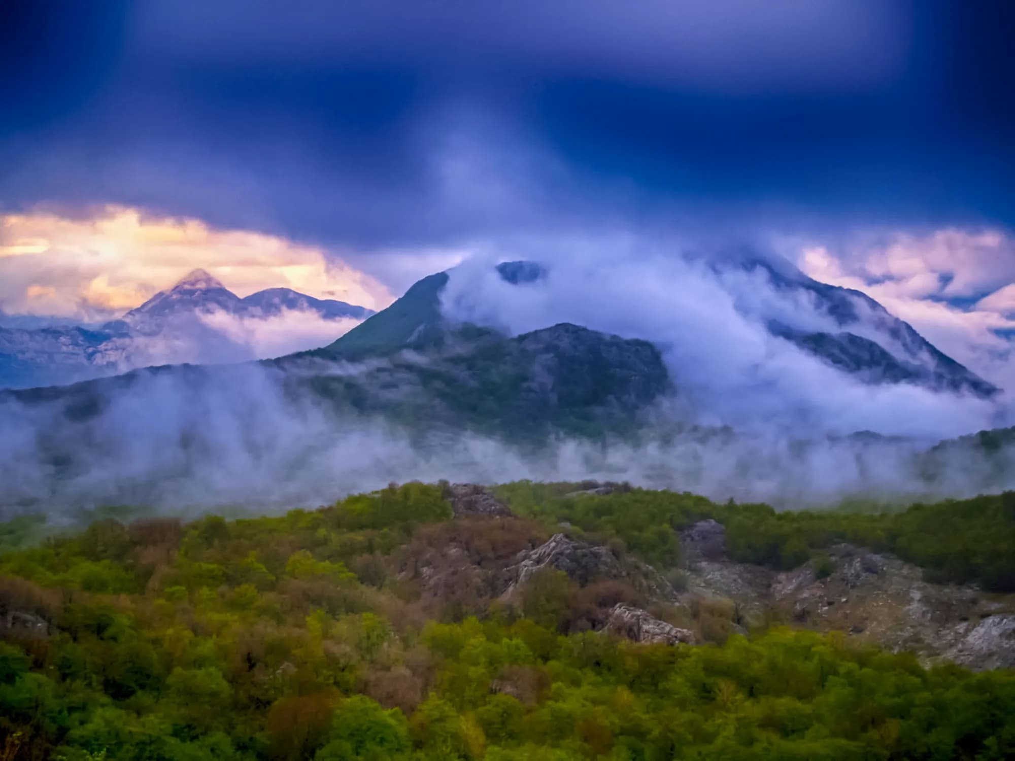
Four and a half metres of rain a year on a mountain with no springs — and the roofless town Austria-Hungary built here for seven thousand soldiers. The plateau around it is down to about a hundred people.
Crkvice är en nästan övergiven by högt upp på Mount Orjen ovanför Bay of Kotor. Det håller det europeiska rekordet för årligt regn och mottar över 4 900 mm per år. En gång en blomstrande bosättning, är det nu i stort sett en spökby som lockar äventyrliga vandrare till sin hemsökande atmosfär och extrema mikroklim.

Den kompletta guiden
Crkvice är en till stor del övergiven bosättning på sluttningarna av Mount Orjen ovan Risan, med Europas alltidens regnrekord på 8,069mm (1937). Dess austro-ungerska väderstation, dramatiska karstlandskap och fullständig avskildhet gör det till en av Montenegros mest ovanliga destinationer.
Läs hela guiden till CrkviceCrkvice i siffror
the 1931–1960 average at the Crkvice gauge, and 4,631 mm for 1961–1990 — the wettest inhabited place in Europe
the village; the Dinarsko gorje gazetteer gives 940 m for the rain gauge, and the two forts above it stand at 1,154 m and 1,225 m
Kom and Stražnik, two of some 70 forts in the Primorska tvrđava Boka system
under snow in an average year at the Crkvice station; Risan, a thousand metres below, averages two
the camp made its own power and drew water from twelve cisterns — Orjen has no springs
Tivat, 59 minutes, including the Kamenari–Lepetane ferry
Crkvice gauge series 1931–1990 and the two fort elevations (Dinarsko gorje) · en.wikipedia (Crkvice; Orjen; Fort Kom) · RTCG on the FORT-NET panels · road distance measured on the OSM network
De närmaste orterna kring Crkvice, på sina verkliga platser – Rudine ligger ungefär 20 km bort fågelvägen.
Bästa restid: juni · juli · september
| Plats | Längs väg | Körtid |
|---|---|---|
| Dragalj | 7,4 km | ca 14 min |
| Morinj | 25,5 km | ca 35 min |
| Lipci | 26,5 km | ca 37 min |
| Kostanjica | 27,3 km | ca 38 min |
| Kotor | 48,1 km | ca 1 tim 10 min |
| Budva | 59,5 km | ca 1 tim 22 min |
| Podgorica | 111,4 km | ca 2 tim 16 min |
Rutter märkta ⛴ korsar med färjan Kamenari–Lepetane. Vägavstånd beräknade på OpenStreetMap-data, © OpenStreetMap contributors. Restiderna är utan köer och tar ingen hänsyn till sommartrafik eller väntan vid färjeläget.
Några timmar
Two hours on the FORT-NET trail. Of more than 150 buildings only a few big shells are still standing, and nothing up here is staffed or for sale: carry your own water.
En hel dag
Risan
Bäst för the base everyone actually uses — 1,899 residents, hotels and apartments on the bay, 31.5 km and 42 minutes below the village
Dragalj
Bäst för the nearest village the census still counts anyone in: 46 people in 14 households, 12.6 km along the karst
Herceg Novi
Bäst för the nearest town with a real choice of rooms: 30 km, but 66 minutes of it, most of that on the unpaved old Austrian road over the plateau
Rain, station by station
Mean annual precipitation around Orjen and down the coast
Crkvice takes more than three and a half times Dubrovnik’s rain, and half again what falls on Risan — eight kilometres away in a straight line and a thousand metres lower. In 1937 the gauge here read 8,036 mm.
The plateau emptying out
People living in Krivošije, seven villages on 114 km²
Crkvice itself has no line in the census. Kotor’s settlement register counts Dragalj (46 people in 2023) and Ledenice (13), and nobody at all in Han, Knežlaz, Malov Do, Unijerina or Zvečava — but in 2011 and again in 2023 it lists no Crkvice, and en.wikipedia calls the village “nowadays virtually uninhabited”.
Venice, Vienna and the Sultan all drew Krivošije inside their borders. From about 1710 until 1882 none of them collected a tax or a conscript here. Widths are to scale.
Sea level to the wettest village in Europe
Five kilometres along the water, then twenty-six up
SRTM 30 m elevations read at seventeen equal points along the 31.5 km drive, measured on the OSM road network. The road leaves the sea at the Lipci roundabout, 4.9 km west of Risan, climbs 18.3 km on the M-8, dips to about 630 m across the karst, then covers the last 8.2 km on a local road. The village node reads 1,120 m here; en.wikipedia gives 1,092 m for the village and the Dinarsko gorje gazetteer 940 m for the site of the rain gauge. Above Crkvice the regional road to Orjensko sedlo, at 1,594 m, is not asphalted.
Sök bland tusentals hotell och lägenheter med aktuella priser.
Vi kan tjäna provision från partnerlänkar. Detta hjälper oss att hålla Montenegro.com gratis för resenärer.

Sök hotell, lägenheter och gästhus med aktuell tillgänglighet.
Vi kan tjäna provision från partnerlänkar. Detta hjälper oss att hålla Montenegro.com gratis för resenärer.

Dinarsko gorje, Krivošije; en.wikipedia (Krivošije; Krivošije uprising; Fort Vrmac). Sovereignty on paper changed hands more often than the band shows — Venice fell in 1797, France held the plateau from 1807, Montenegro from 1813, Austria again after the Congress of Vienna in 1814 — but the free territory these sources call Kneževina Krivošije outlasted all of them on the ground.
Crkvice ligger högt på berget Orjens sida, omkring 940 meter ovanför Kotorbukten. Uppfarten är en långsam stigning på smala vägar genom kalkstenslandskapet bakom Risan, och skiftet från kusten är abrupt.
För vädret. Platsen håller det europeiska rekordet för årsnederbörd, med i snitt över 4 900 mm per år och långt mer under extrema år — en av de blötaste bebodda platserna på kontinenten.
Varm, fuktig luft som pressas inåt land från Adriatiska havet slår mot Orjenväggen och lastar av allt den bär. Vintern ger snö mätt i meter snarare än centimeter, och drivorna skar en gång av orten från kusten i veckor.
Bara en handfull säsongsboende. Österrikisk-ungerska ingenjörer drog en militärväg över dessa höjder i slutet av 1800-talet och byggde kaserner; vid sidan av dem växte ett civilt samhälle fram. Kvar står stenhus utan tak, cisterner och de rostande skeletten av militärbyggnaderna.
Man kommer till fots. Crkvice är en vägpunkt för vandrare som korsar Orjen mellan byarna ovanför Kotor och de högre topparna, och ruinerna ger en minnesvärd paus under en lång dag — tysta, fuktiga och olika allt annat i Montenegro.
Vatten, mat och varma lager oavsett vad prognosen säger, för det finns ingen service alls. Från sen vår till tidig höst är det praktiska fönstret; utanför det kan dimma, regn och snö stänga platån helt.
Nej — den närmaste är Tivat flygplats (TIV), 41 km bort via väg.
7,4 km längs väg, ungefär 14 min med bil.
Storbritanniens utrikesdepartement (FCDO) avråder inte från resor till Montenegro; råden sågs senast över 13 augusti 2026. Det är deras bedömning av landet som helhet, inte vår och ingen dom över Crkvice — läs den själv innan du reser. Nödnumret i Montenegro är 112.
Schematisk. Positioner och avstånd är fågelvägen, utifrån de koordinater vi har för varje plats; bergsvägarna gör bilresan längre. Den tjocka linjen är kusten där den passerar genom den här vyn. Kustlinje och Skadarsjön © OpenStreetMap contributors.
A full day outdoors and most of it uphill. Take the forecast seriously: this is the wettest inhabited place on the continent.
Vilka besöker Montenegro
Andel av utländska gästers övernattningar, 2025
MONSTAT · 2025
Crkvice reaches the Montenegrin press every few years, usually as the same story told again: the wettest place in Europe, with a dead town inside it.
Vijesti “Tvrđava Boka odolijeva vremenu” — Siniša Luković on the fortress system built between 1838 and 1914, whose third phase concentrated on Krivošije. The Crkvice camp, he writes, held six to seven thousand men, with a bowling alley, a ski slope and its own generator. 31 August.
Boka News Don Anton Belan on the camp’s Catholic church of the Assumption, built in 1895 and pulled down from about 1955, with the 1956 letters about its missing altar slab. 26 November.
RTCG “Putovanje u prošlost: Vojni grad Crkvice” — Ozren Zogović walks the FORT-NET thematic trail panel by panel: the cisterns, the bakery, the two forts, the military cemetery. 30 October.
Vijesti The fifth “Svi na Crkvice” day, run by Kotor’s tourist organisation and the municipality, with guided walks up to Stražnik and Kom. 11 August.
All four items were opened at the outlet. The RTCG piece is the fullest account of the camp in circulation; a fifth, the road-repair notice Vijesti ran on 10 September 2024, is the reason the Crkvice–Orjen Sedlo road is passable at all.
Under tiden, år 1882
Krivošije, 1882: Austrian control is reimposed after a second rising against conscription. The plateau had recognised nobody’s authority, paid nobody’s tax and served in nobody’s army for some 170 years.
Crkvice — Vienna answers with a town rather than an argument. Feldmarschalleutnant Stjepan baron Jovanović directs a fortification programme across Boka, and more than 150 buildings go up on waterless karst above Risan: hotel, hospital, bakery, cinema, tennis courts, a bowling alley, a rifle range and a football ground with stands for a thousand.
Fort Kom, 1882 and 1883: a three-level barracks under an artillery platform, to Colonel Karl Wahlberg’s standard design, held by three officers and fifty-nine men. Its job was the roads onto the plateau from the north and east.
Vienna and Berlin, 20 May 1882: Germany, Austria-Hungary and Italy sign the Triple Alliance. In March, Serbia had been proclaimed a kingdom and Robert Koch had named the tuberculosis bacterium; in September Edison lit a square mile of lower Manhattan from Pearl Street.
“They bent their necks looking at the sky — in summer waiting for rain to save them from the drought, in winter waiting for it to stop.”
Lokal legend
Why the plateau is called Krivošije
“Although it is a mountain with a great deal of rainfall, Orjen is a mountain without springs.”
The FORT-NET panel on water, via RTCG
Hence twelve cisterns for the garrison, two of them large, and drinking water carried up or melted from snow kept in pits.
jan.Sveti Jovan — 20 January — the krsna slava of the Krivošije brotherhoods, kept in the house rather than the square, in the middle of the rain season
aug.Svi na Crkvice — Kotor’s tourist organisation brings a day of guided walks to Kom and Stražnik, archery and music up to the plateau; the fifth edition ran in August 2024. August here is often rainless end to end, and the fire risk peaks with it
nov.The wettest month — November averages 714 mm at the Crkvice gauge — more than three times Dubrovnik’s November — and the Orjen literature reports late-autumn storms dropping 2,000 mm in a few days






