Igalo
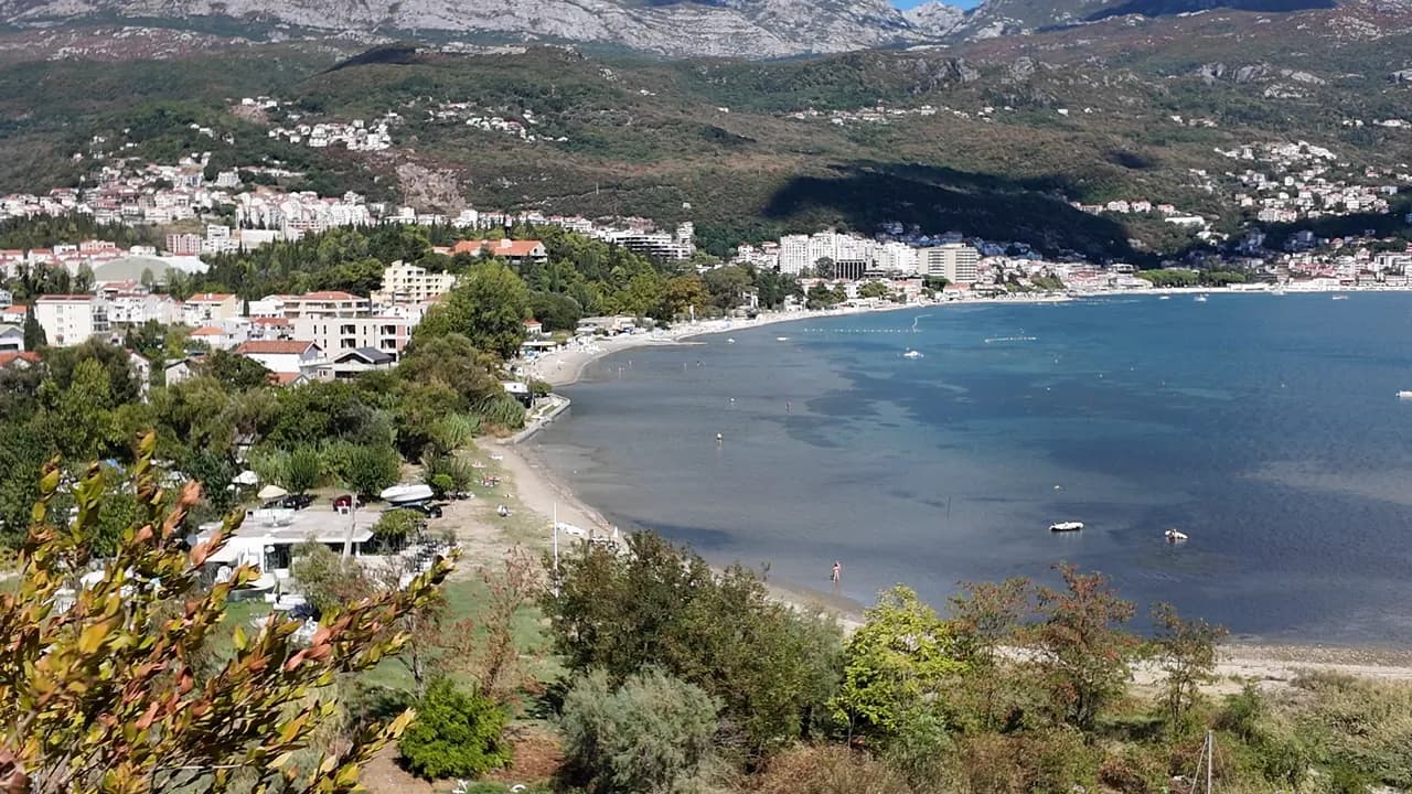
Den plattaste, mildaste stranden i bukten: upp till en kilometer sand, grus och betongplattformar i grunt, varmt vatten, med lerstranden Stara Banja vid Sutorinas mynning.
Vårt omdöme
Igalo är en kurorts strand, och den beter sig som en sådan. Huvudstranden — omkring 600 m enligt vår guide, 1 km enligt vår lista — är sand och grus med betongplattformar, ett behagligt insteg och vatten som förblir grunt och varmt, vilket är anledningen till att Institutet Dr Simo Milošević förlades hit 1949 och varför småbarn och fysioterapipatienter delar den. Väster om institutet, vid Sutorinas mynning, ligger viken Stara Banja där den svarta mineralleran grävs upp och appliceras. Solstolar kostar 8–14 €, det finns inget trappsteg någonstans mellan busshållplatsen och vattnet, och promenaden Pet Danica börjar vid institutets dörr.
Igalo i fakta
Stranden
Faciliteter
Tillgänglighet
Fakta verifierade 28 september 2026 · Längd: Our Igalo guide gives the main beach as about 600 m within 1.5 km of shore; our 25 Best Beaches list says 1 km · 12 uppgifter återstår att kontrollera på plats
Igalo i bilder
Några av dem är våra och får återanvändas fritt under CC BY 4.0; övriga är licensierade och får inte. Våra är tagna i september 2026.
Igalo i rörelse
Igalo och Orjens bergsvägg sedd från vägen ovanför Njivice
Stara Banja, den gamla kurortsviken vid Sutorinas mynning, sedd från kullen ovanför
Foto och film av Montenegro.com, fria att återanvända under CC BY 4.0. Våra är tagna i september 2026.
Karta
Det skuggade vattnet är den officiella badzonen för mätstation Igalo 02 — den sträcka JP Morsko dobro faktiskt provtar, inte strandens kontur.
Hitta hit
2.1 km
Herceg Novi
18 km
Tivat airport
22 km
Kotor
Avstånd fågelvägen — Montenegros vägar är bergsvägar, så bilresan är längre.
- På vandringen Pet Danica-promenadenAnhalt: igalo-institute
- Med bussBlue Line: Igalo–Kamenari and the Igalo–Meljine–Igalo circular
- Med bilIgalo is 2.6 km west of Herceg Novi; a barrier-controlled car park in Norveška Street, seasonal parking near the Institute and formal parking along the Igalo–Meljine corridor
- 5 min till fotsplant — From the Institute bus stop; Igalo is the one flat town on the bay, with no steps between the road and the water
I dag på Igalo
Riktningen är beräknad från OpenStreetMaps kustlinje, så pålands- och frånlandsvind gäller just den här stranden och inte regionen. Prognos från Open-Meteo
Vatten och utmärkelser
Utmärkt
Senaste officiella prov 28 september 2026: Utmärkt
Havet 20.6 °C när provet togs
5 av 10 prover utmärkta under säsongen 2026
Officiellt resultat från JP Morsko dobro, mätstation Igalo 02
Grunt, varmt inre bukvatten vid Sutorinas mynning, och den svagaste officiella statistiken på den här kusten: vid tre mätstationer 2026 sträckte sig resultaten från utmärkt ner till tillfredsställande, inklusive en tillfredsställande mätning vid Igalo 02 den 3 augusti, mitt i högsäsong
Ingen utmärkelse vi kan belägga för den här stranden. Även frånvaron är information.
Bra att veta innan du badar
- Lerstranden vid Stara Banja är hal och leran fläckar — skölj av dig innan du kliver upp på promenaden
- Sutorinas flodmynning intill Stara Banja grumlar vattnet en dag efter kraftigt regn — bada då från huvudstranden istället
- Båtar använder Sutorina-kanalen och förtöjer i viken — håll dig till det markerade badvattnet
- Botten är stenig på sina ställen under sanden — badskor för barnen
När vattnet är varmt
Igalo var varmast, 27.5 °C, den 31 augusti 2026, och kallast, 19.8 °C, den 25 maj 2026. Varje punkt är ett verkligt provtagningsbesök med temperaturen mätt på plats, inte ett månadsmedelvärde hämtat någon annanstans ifrån.
Ihåliga punkter är de 5 provtagningar som hamnade under ”Utmärkt”.
Visa alla 10 provtagningar
| Provtaget | Hav | Resultat |
|---|---|---|
| 28 september 2026 | 20.6 °C | Utmärkt |
| 16 september 2026 | 23.0 °C | Tillfredsställande |
| 31 augusti 2026 | 27.5 °C | Bra |
| 17 augusti 2026 | 24.7 °C | Utmärkt |
| 3 augusti 2026 | 25.4 °C | Tillfredsställande |
| 20 juli 2026 | 25.9 °C | Utmärkt |
| 6 juli 2026 | 21.5 °C | Utmärkt |
| 22 juni 2026 | 25.2 °C | Bra |
| 8 juni 2026 | 21.9 °C | Bra |
| 25 maj 2026 | 19.8 °C | Utmärkt |
Officiellt resultat från JP Morsko dobro, mätstation Igalo 02
Säsong för säsong
Igalo har provtagits 69 gånger sedan 2020: 37 av mätningarna utmärkta, 32 under det.
Hur varmt vattnet blev, säsong för säsong. Medelvärdet gäller bara proverna i juli och augusti — ett fast fönster, så att ett år då inspektörerna kom tidigt inte framstår som kallt.
En handfull säsonger är en sammanställning, inte en trend: spridningen här är hur få daterade mätningar ser ut, inte belägg för ett hav som blir varmare eller kallare. En ihålig punkt markerar en säsong där ett prov hamnade under utmärkt.
| Säsong | Prover | Utmärkt | Under | Medel juli–aug. | Varmast |
|---|---|---|---|---|---|
| 2020 | 9 | 7 | 2 | 24.1 °C | 26.1 °C |
| 2021 | 10 | 6 | 4 | 25.4 °C | 27.1 °C |
| 2022 | 11 | 5 | 6 | 24.4 °C | 26.3 °C |
| 2023 | 9 | 3 | 6 | 24.7 °C | 27.1 °C |
| 2024 | 10 | 6 | 4 | 24.2 °C | 26.7 °C |
| 2025 | 10 | 5 | 5 | 23.3 °C | 24.6 °C |
| 2026pågår | 10 | 5 | 5 | 25 °C | 27.5 °C |
Officiellt resultat från JP Morsko dobro, mätstation Igalo 02
Upplåten som
Staten arrenderar ut kusten lott för lott. Igalo är utlyst som 9 lotter på omkring 580 m strandlinje, var och en med en officiell kategori.
Även upplåtet här: en förtöjningsplattform i vattnet utanför stranden.
| Kategori | Lotter | Strandlinje |
|---|---|---|
| Familjebad | 8 | 405 m |
| Hotellstrand | 1 | 175 m |
Sammanlagt omkring 8,171 m². Det här är vad som upplåtits, inte vad vi sett: antalet solsängar, toaletter och duschar per lott fastställs i det tecknade avtalet, som inte offentliggörs. Upphandlingar från JP Morsko dobro
Stränder i närheten



Igalo och grannstränderna
Samma nio mått för stränderna du hinner samma dag. Fet stil betyder att det skiljer sig från den här.
| Mått | 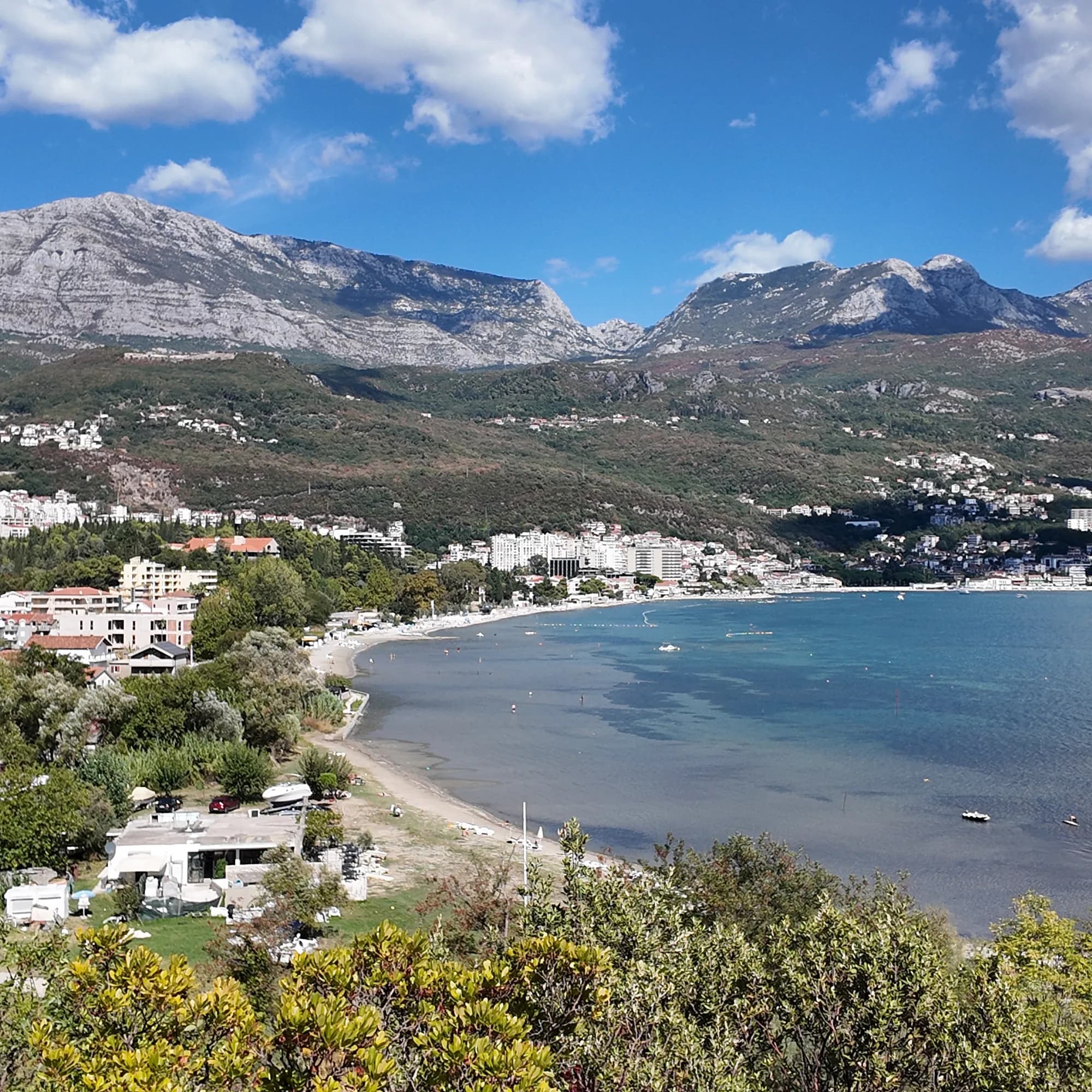 Igaloden här stranden Igaloden här stranden |  Njivice1.8 km Njivice1.8 km |  Savina3.1 km Savina3.1 km |  Meljine Beach3.8 km Meljine Beach3.8 km |
|---|---|---|---|---|
| Underlag | sand och fin klappersten | klippa — skiljer sig | klappersten — skiljer sig | klappersten — skiljer sig |
| Nedgång i vattnet | mjuk | stenig — skiljer sig | måttlig — skiljer sig | mjuk |
| Djup | grunt | blir snabbt djupt — skiljer sig | blir snabbt djupt — skiljer sig | grunt |
| Skugga | parasoller att hyra | parasoller att hyra | parasoller att hyra | parasoller att hyra |
| Karaktär | organiserad | organiserade och fria delar — skiljer sig | organiserade och fria delar — skiljer sig | organiserad |
| Längd | 600–1000 m | 200 m — skiljer sig | 200 m — skiljer sig | 30 m — skiljer sig |
| Senaste provet | Utmärkt | Utmärkt | Utmärkt | —ingen officiell mätpunkt — skiljer sig |
| Trängsel | full i säsong | lugn — skiljer sig | full i säsong | full i säsong |
| Ta dig dit | med bil | med bil | med bil | med bil |
Bo nära Igalo
Alla boenden i Igalo →

Den fullständiga guiden
Läs guiden till Igalo
Allt ovan är kortversionen. Guiden har källorna, sektorkoderna, provtagningsdatumen och det som förändras under en säsong.
Frågor
- Vad är Igalo-leran?
- Igaljsko blato — en svart, mineralrik havslera från botten av Igalo-bukten med en svag svaveldoft, som appliceras som omslag och bad på institutet mot reumatiska och ledbesvär. Viken Stara Banja vid Sutorinas mynning är lerstranden; huvudstranden är vanlig sand och grus.
- Hur tar jag mig till stranden i Igalo från Herceg Novi?
- Gå promenaden Pet Danica västerut — plant hela vägen, omkring 2,6 km — eller ta en Blue Line-buss (Igalo–Kamenari, eller ringlinjen Igalo–Meljine). Hållplatsen vid institutet är promenadens västra ände.
- Är vattnet i Igalo rent?
- Vår guide hänvisar läsare till Morsko Dobros officiella badvattenövervakning för det aktuella provet istället för att ange ett; bukten är grund och grumlas efter regn nära flodmynningen.
Källor
- montenegro.com — Igalo guide (/cities/igalo/igalo-guide): beach lengths and surfaces, Stara Banja mud, the Institute, Blue Line routes, parking
- montenegro.com — Igalo city hub (shallow warm water, sunbed prices, distances, sea temperatures)
- montenegro.com — Pet Danica walk (/walks/pet-danica): stop 1 Igalo Institute & Mud Baths
- Our 25 Best Beaches in Montenegro list (entry 20)
- OpenStreetMap — beach ways 571737992 and 1359144925 (Blatna plaža)
- Our own frames and clips, September 2026