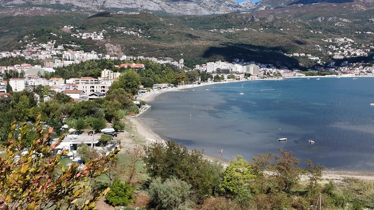
Igalo
Das flachste, sanfteste Ufer der Bucht: bis zu einem Kilometer Sand, Kies und Betonplattformen in flachem, warmem Wasser, mit dem Schlammstrand von Stara Banja an der Mündung der Sutorina.
Unser Urteil
Igalo ist der Strand einer Kurstadt, und er verhält sich auch so. Der Hauptstrand — laut unserem Guide etwa 600 m, laut unserer Liste 1 km — besteht aus Sand und Kies mit Betonplattformen, einem sanften Einstieg und Wasser, das flach und warm bleibt, weshalb 1949 das Institut Dr. Simo Milošević hier errichtet wurde und weshalb sich hier Kleinkinder und Physiotherapie-Patienten den Strand teilen. Westlich des Instituts, an der Mündung der Sutorina, liegt die Bucht Stara Banja, wo der schwarze Mineralschlamm abgebaut und aufgetragen wird. Liegen kosten €8–14, es gibt keine einzige Stufe zwischen der Bushaltestelle und dem Wasser, und die Promenade Pet Danica beginnt an der Tür des Instituts.
Igalo in Fakten
Das Ufer
Ausstattung
Anfahrt
Fakten geprüft am 28. September 2026 · Länge: Our Igalo guide gives the main beach as about 600 m within 1.5 km of shore; our 25 Best Beaches list says 1 km · 12 weitere Angaben müssen wir vor Ort prüfen
Igalo in Bildern
Einige davon stammen von uns und sind unter CC BY 4.0 frei verwendbar; die übrigen sind lizenziert und nicht frei. Unsere Aufnahmen stammen aus September 2026.
Igalo in Bewegung
Igalo und die Wand des Orjen von der Straße oberhalb von Njivice aus
Stara Banja, die alte Kurbucht an der Mündung der Sutorina, vom Hügel darüber aus
Fotos und Filmaufnahmen von Montenegro.com, frei verwendbar unter CC BY 4.0. Unsere Aufnahmen stammen aus September 2026.
Karte
Die schattierte Fläche ist die amtliche Badezone der Messstelle Igalo 02 — der Abschnitt, den JP Morsko dobro tatsächlich beprobt, nicht der Umriss des Strandes.
Anfahrt
2.1 km
Herceg Novi
18 km
Tivat airport
22 km
Kotor
Luftlinie — Montenegros Straßen sind Bergstraßen, die Fahrt ist also länger.
- Auf dem Weg Promenade Pet DanicaHalt: igalo-institute
- Mit dem BusBlue Line: Igalo–Kamenari and the Igalo–Meljine–Igalo circular
- Mit dem AutoIgalo is 2.6 km west of Herceg Novi; a barrier-controlled car park in Norveška Street, seasonal parking near the Institute and formal parking along the Igalo–Meljine corridor
- 5 Min. zu Fußeben — From the Institute bus stop; Igalo is the one flat town on the bay, with no steps between the road and the water
Heute an Igalo
Die Ausrichtung ist aus der OpenStreetMap-Küstenlinie berechnet, auflandig und ablandig meinen also dieses Ufer und nicht die Region. Vorhersage von Open-Meteo
Wasser und Auszeichnungen
Ausgezeichnet
Letzte amtliche Probe 28. September 2026: Ausgezeichnet
Wasser 20.6 °C bei der Probenahme
5 von 10 Proben ausgezeichnet in der Saison 2026
Offizielles Ergebnis von JP Morsko dobro, Messstelle Igalo 02
Flaches, warmes Wasser der inneren Bucht an der Mündung der Sutorina, und die schwächste offizielle Bilanz an dieser Küste: An drei Messstellen reichten die Ergebnisse 2026 von ausgezeichnet bis ausreichend, darunter ein Wert von ausreichend an der Station Igalo 02 am 3. August, mitten in der Hochsaison
Keine Auszeichnung, die wir für diesen Strand belegen können. Auch das ist eine Information.
Vor dem Baden wissen
- Der Schlammstrand von Stara Banja ist rutschig, und der Schlamm hinterlässt Flecken — vor dem Betreten der Promenade abspülen
- Die Mündung der Sutorina neben Stara Banja trübt das Wasser für einen Tag nach starkem Regen — in dieser Zeit lieber am Hauptstrand schwimmen
- Boote nutzen den Kanal der Sutorina und ankern in der Bucht — im markierten Badebereich bleiben
- Der Untergrund ist stellenweise unter dem Sand steinig — Badeschuhe für Kinder
Wann das Wasser warm ist
Igalo war am wärmsten mit 27.5 °C am 31. August 2026 und am kältesten mit 19.8 °C am 25. Mai 2026. Jeder Punkt ist eine echte Messfahrt mit vor Ort abgelesener Temperatur, kein anderswo abgeschriebener Monatsmittelwert.
Hohle Punkte sind die 5 Messungen, die unter „Ausgezeichnet“ lagen.
Alle 10 Messungen ansehen
| Gemessen | Wasser | Ergebnis |
|---|---|---|
| 28. September 2026 | 20.6 °C | Ausgezeichnet |
| 16. September 2026 | 23.0 °C | Ausreichend |
| 31. August 2026 | 27.5 °C | Gut |
| 17. August 2026 | 24.7 °C | Ausgezeichnet |
| 3. August 2026 | 25.4 °C | Ausreichend |
| 20. Juli 2026 | 25.9 °C | Ausgezeichnet |
| 6. Juli 2026 | 21.5 °C | Ausgezeichnet |
| 22. Juni 2026 | 25.2 °C | Gut |
| 8. Juni 2026 | 21.9 °C | Gut |
| 25. Mai 2026 | 19.8 °C | Ausgezeichnet |
Offizielles Ergebnis von JP Morsko dobro, Messstelle Igalo 02
Saison für Saison
Igalo wurde seit 2020 69 Mal beprobt: davon 37 Messungen „ausgezeichnet", 32 darunter.
Wie warm das Wasser wurde, Saison für Saison. Gemittelt werden nur die Probenahmen im Juli und August — ein festes Zeitfenster, damit ein Jahr, in dem früh gemessen wurde, nicht als kaltes erscheint.
Eine Handvoll Saisons ist eine Aufzeichnung, kein Trend: die Streuung hier zeigt, wie wenige datierte Messungen aussehen, nicht ein wärmer oder kälter werdendes Meer. Ein hohler Punkt steht für eine Saison, in der eine Probenahme unter „ausgezeichnet" lag.
| Saison | Probenahmen | Ausgezeichnet | Darunter | Mittel Jul.–Aug. | Höchstwert |
|---|---|---|---|---|---|
| 2020 | 9 | 7 | 2 | 24.1 °C | 26.1 °C |
| 2021 | 10 | 6 | 4 | 25.4 °C | 27.1 °C |
| 2022 | 11 | 5 | 6 | 24.4 °C | 26.3 °C |
| 2023 | 9 | 3 | 6 | 24.7 °C | 27.1 °C |
| 2024 | 10 | 6 | 4 | 24.2 °C | 26.7 °C |
| 2025 | 10 | 5 | 5 | 23.3 °C | 24.6 °C |
| 2026läuft | 10 | 5 | 5 | 25 °C | 27.5 °C |
Offizielles Ergebnis von JP Morsko dobro, Messstelle Igalo 02
Konzessioniert als
Der Staat verpachtet diese Küste Los für Los. Igalo ist in 9 Lose mit rund 580 m Uferlänge ausgeschrieben, jedes mit einer amtlichen Kategorie.
Ebenfalls konzessioniert: eine Anlegeplattform im Wasser vor dem Strand.
| Kategorie | Lose | Ufer |
|---|---|---|
| Familienbad | 8 | 405 m |
| Hotelstrand | 1 | 175 m |
Zusammen etwa 8,171 m². Das ist das Konzessionierte, nicht das Gesehene: Zahl der Liegen, Toiletten und Duschen je Los steht im unterzeichneten Pachtvertrag, der nicht veröffentlicht wird. Ausschreibungen von JP Morsko dobro
Strände in der Nähe



Igalo und seine Nachbarn
Dieselben neun Angaben für die Strände, die Sie am selben Tag erreichen. Fett bedeutet: anders als hier.
| Angabe | 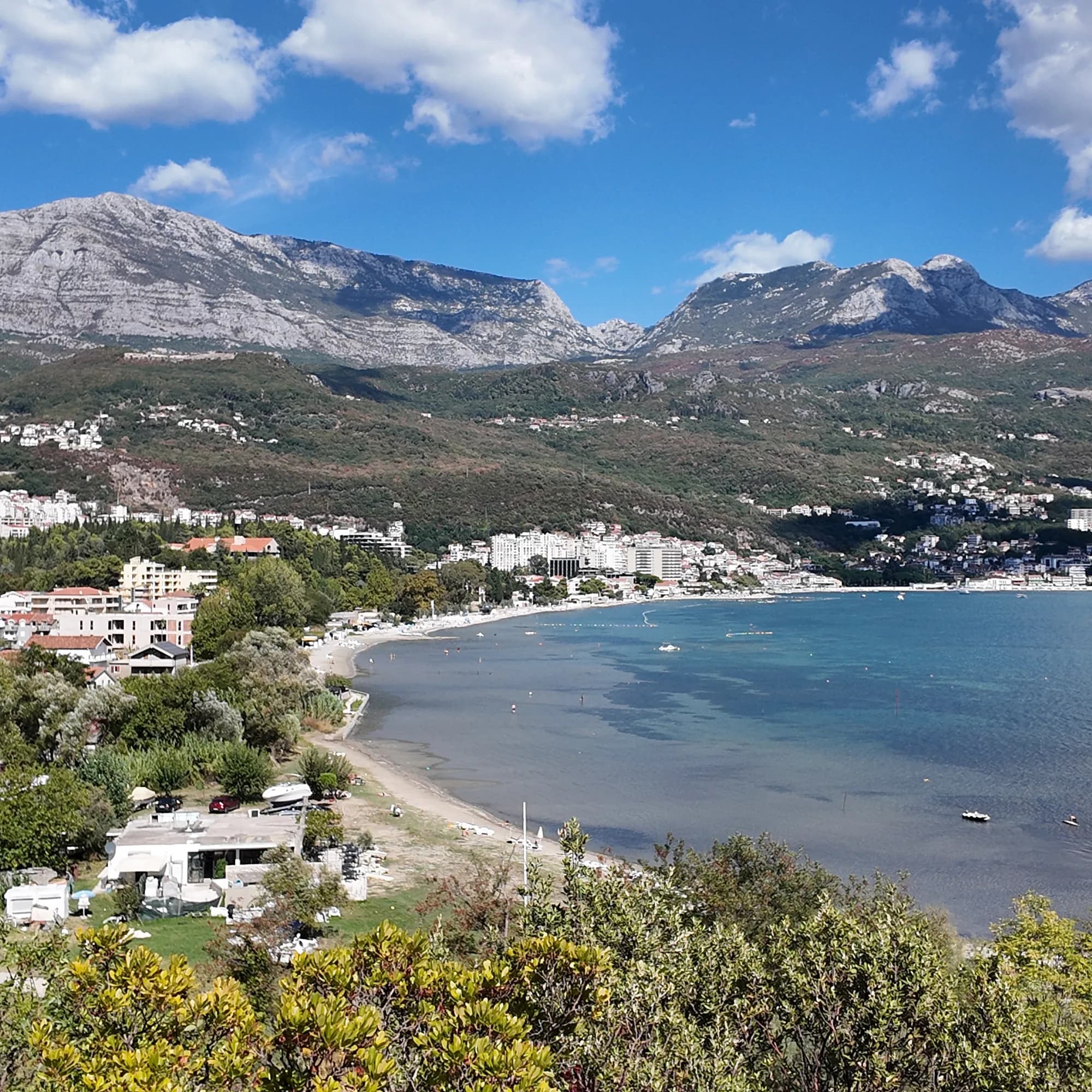 Igalodieser Strand Igalodieser Strand |  Njivice1.8 km Njivice1.8 km |  Savina3.1 km Savina3.1 km |  Meljine Beach3.8 km Meljine Beach3.8 km |
|---|---|---|---|---|
| Untergrund | Sand und feiner Kies | Fels — weicht ab | Kies — weicht ab | Kies — weicht ab |
| Einstieg | flach | felsig — weicht ab | mäßig — weicht ab | flach |
| Tiefe | flach | wird schnell tief — weicht ab | wird schnell tief — weicht ab | flach |
| Schatten | Schirme zu mieten | Schirme zu mieten | Schirme zu mieten | Schirme zu mieten |
| Charakter | bewirtschaftet | bewirtschaftete und freie Abschnitte — weicht ab | bewirtschaftete und freie Abschnitte — weicht ab | bewirtschaftet |
| Länge | 600–1000 m | 200 m — weicht ab | 200 m — weicht ab | 30 m — weicht ab |
| Letzte Messung | Ausgezeichnet | Ausgezeichnet | Ausgezeichnet | —keine amtliche Messstelle — weicht ab |
| Andrang | in der Saison voll | Ruhe — weicht ab | in der Saison voll | in der Saison voll |
| Anfahrt | mit dem Auto | mit dem Auto | mit dem Auto | mit dem Auto |
Übernachten nahe Igalo
Alle Unterkünfte in Igalo →

Der ausführliche Guide
Den Guide zu Igalo lesen
Alles oben ist die Kurzfassung. Der Guide enthält die Quellen, die Sektorcodes, die Probedaten und das, was sich innerhalb einer Saison ändert.
Fragen
- Was ist der Igalo-Schlamm?
- Igaljsko blato — ein schwarzer, mineralreicher Meeresschlamm vom Grund der Bucht von Igalo mit einem leichten Schwefelgeruch, der im Institut bei rheumatischen und Gelenkbeschwerden als Packung und Bad angewendet wird. Die Bucht Stara Banja an der Mündung der Sutorina ist der Schlammstrand; der Hauptstrand besteht aus gewöhnlichem Sand und Kies.
- Wie komme ich von Herceg Novi zum Strand von Igalo?
- Gehen Sie die Promenade Pet Danica nach Westen — durchgehend eben, etwa 2,6 km — oder nehmen Sie einen Bus der Blue Line (Igalo–Kamenari oder die Ringlinie Igalo–Meljine). Die Haltestelle am Institut liegt am westlichen Ende der Promenade.
- Ist das Wasser in Igalo sauber?
- Unser Guide verweist Leser für die aktuelle Probe auf den offiziellen Badewasser-Monitor von Morsko Dobro, statt selbst eine zu nennen; die Bucht ist flach und trübt sich nach Regen in der Nähe der Flussmündung.
Quellen
- montenegro.com — Igalo guide (/cities/igalo/igalo-guide): beach lengths and surfaces, Stara Banja mud, the Institute, Blue Line routes, parking
- montenegro.com — Igalo city hub (shallow warm water, sunbed prices, distances, sea temperatures)
- montenegro.com — Pet Danica walk (/walks/pet-danica): stop 1 Igalo Institute & Mud Baths
- Our 25 Best Beaches in Montenegro list (entry 20)
- OpenStreetMap — beach ways 571737992 and 1359144925 (Blatna plaža)
- Our own frames and clips, September 2026