Njivice
Kraljičina plaža
Montenegros letzter Strand nach Westen: Fels, Sand und Beton zum Baden unterhalb eines Weilers mit 102 Einwohnern, mit Prevlaka und Kroatien 4 km entfernt auf der anderen Seite des Wassers.
Unser Urteil
Njivice ist ein einziger langer öffentlicher Strand, Kraljičina plaža, unterhalb eines einzigen Resorts an einer Nebenstraße westlich von Igalo — Fels, Sandflecken und Betonplattformen statt Kies, ein an einem Ende abgetrennter Naturistenbereich, und Wasser, das eher vom offenen Meer als von der inneren Bucht durchspült wird. Er liegt nach Nordosten, sodass sich der Blick über die gesamte Riviera von Herceg Novi unter dem Orjen öffnet, und die Sommerboote nach Dobreč, Žanjice, Mamula und zur Blauen Grotte legen von diesem Ufer ab. Die Stammgäste sind Familien mit kleinen Kindern und ältere Besucher, die einen ruhigen Aufenthalt suchen; es gibt einen ganzjährigen Bus nach Herceg Novi und nach Einbruch der Dunkelheit gar nichts.
Njivice in Fakten
Das Ufer
Ausstattung
Anfahrt
Regeln und Charakter
Fakten geprüft am 28. September 2026 · Länge: Our 25 Best Beaches list; Morsko Dobro publishes no length for Njivice · Ausstattung laut OpenStreetMap contributors, ODbL · 9 weitere Angaben müssen wir vor Ort prüfen
Njivice in Bildern
Fotos und Filmaufnahmen von Montenegro.com, frei verwendbar unter CC BY 4.0. Unsere Aufnahmen stammen aus September 2026.
Njivice in Bewegung
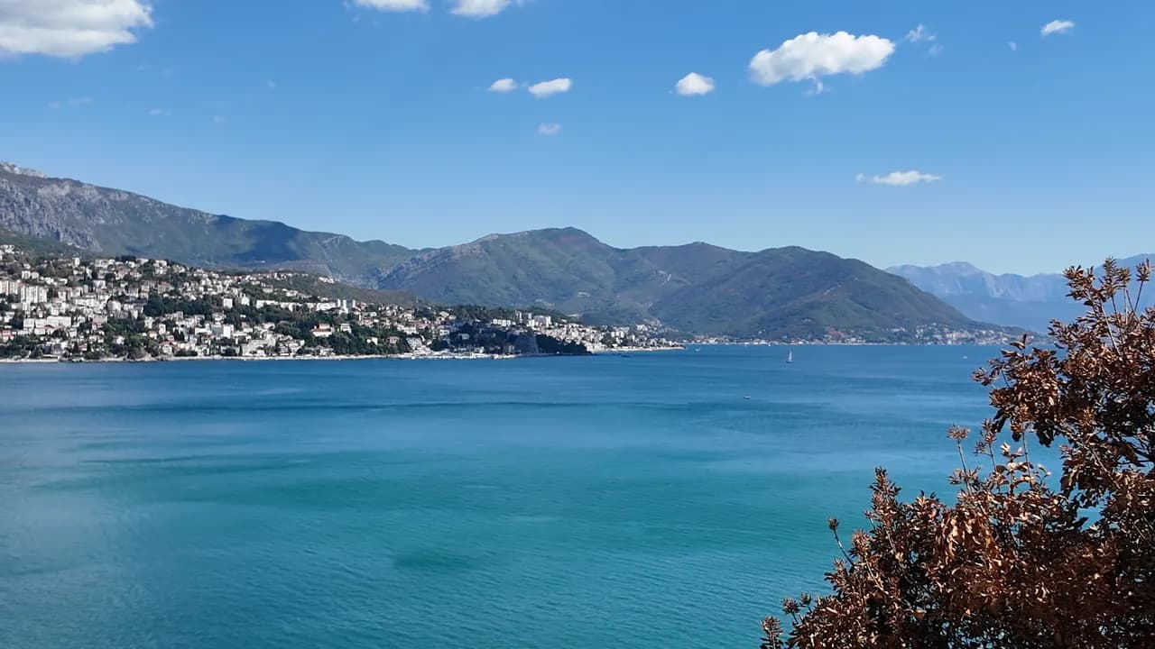
Blick vom Ufer von Njivice aus Richtung Buchtmündung und Luštica
Das Schild „I ♥ Herceg Novi“ am Aussichtspunkt von Njivice, daneben eine Palme
Fotos und Filmaufnahmen von Montenegro.com, frei verwendbar unter CC BY 4.0. Unsere Aufnahmen stammen aus September 2026.
Karte
Die schattierte Fläche ist die amtliche Badezone der Messstelle Njivice 01 — der Abschnitt, den JP Morsko dobro tatsächlich beprobt, nicht der Umriss des Strandes.
Anfahrt
2.7 km
Herceg Novi
18 km
Tivat airport
22 km
Kotor
Luftlinie — Montenegros Straßen sind Bergstraßen, die Fahrt ist also länger.
- Mit dem BusLocal bus Herceg Novi–Njivice, all year
- Mit dem BootSummer boats from the shore to Dobreč, Žanjice, Mamula, the Blue Cave and Rose
- Mit dem AutoNjivice is 3.6 km west of Igalo and 6.4 km from Herceg Novi on the side road towards the Konfin border crossing, which is 2.6 km further on
Heute an Njivice
Die Ausrichtung ist aus der OpenStreetMap-Küstenlinie berechnet, auflandig und ablandig meinen also dieses Ufer und nicht die Region. Vorhersage von Open-Meteo
Wasser und Auszeichnungen
Ausgezeichnet
Letzte amtliche Probe 28. September 2026: Ausgezeichnet
Wasser 19.9 °C bei der Probenahme
9 von 10 Proben ausgezeichnet in der Saison 2026
Offizielles Ergebnis von JP Morsko dobro, Messstelle Njivice 01
Acht von neun offiziellen Proben 2026 ausgezeichnet, eine gut am 17. August; durchspült vom offenen Meer statt von der inneren Bucht
- Blue Flag 2026, sector 1A Njivice (Hotel Iberostar, operator Montenegro Hotels d.o.o.)The only Blue Flag beach in Herceg Novi municipality, flown in 2025 and again in 2026. It certifies the hotel’s own sector, not the whole public shore.
Vor dem Baden wissen
- Einstiege über Fels und Beton mit Leitern, und Seeigel auf dem Fels — Badeschuhe
- Die Ausflugsboote nach Žanjice, Mamula und zur Blauen Grotte legen am späten Vormittag von diesem Ufer ab — innerhalb der Badezone bleiben
- Zur Buchtmündung hin offen: Südwest-Dünung bricht über den Plattformen und macht die Leitern unbenutzbar
- Der Landzugang zum Naturistenbereich wurde bereits eingeschränkt (2018: nur mit Tagespass des Resorts) — vorher prüfen, bevor man sich darauf verlässt
Wann das Wasser warm ist
Njivice war am wärmsten mit 27.6 °C am 31. August 2026 und am kältesten mit 19.9 °C am 25. Mai 2026. Jeder Punkt ist eine echte Messfahrt mit vor Ort abgelesener Temperatur, kein anderswo abgeschriebener Monatsmittelwert.
Der hohle Punkt ist die eine Messung, die unter „Ausgezeichnet“ lag.
Alle 10 Messungen ansehen
| Gemessen | Wasser | Ergebnis |
|---|---|---|
| 28. September 2026 | 19.9 °C | Ausgezeichnet |
| 14. September 2026 | 23.7 °C | Ausgezeichnet |
| 31. August 2026 | 27.6 °C | Ausgezeichnet |
| 17. August 2026 | 24.2 °C | Gut |
| 3. August 2026 | 25.4 °C | Ausgezeichnet |
| 20. Juli 2026 | 25.4 °C | Ausgezeichnet |
| 6. Juli 2026 | 21.9 °C | Ausgezeichnet |
| 22. Juni 2026 | 24.7 °C | Ausgezeichnet |
| 8. Juni 2026 | 22.5 °C | Ausgezeichnet |
| 25. Mai 2026 | 19.9 °C | Ausgezeichnet |
Offizielles Ergebnis von JP Morsko dobro, Messstelle Njivice 01
Saison für Saison
Njivice wurde seit 2020 69 Mal beprobt: davon 60 Messungen „ausgezeichnet", 9 darunter.
Wie warm das Wasser wurde, Saison für Saison. Gemittelt werden nur die Probenahmen im Juli und August — ein festes Zeitfenster, damit ein Jahr, in dem früh gemessen wurde, nicht als kaltes erscheint.
Eine Handvoll Saisons ist eine Aufzeichnung, kein Trend: die Streuung hier zeigt, wie wenige datierte Messungen aussehen, nicht ein wärmer oder kälter werdendes Meer. Ein hohler Punkt steht für eine Saison, in der eine Probenahme unter „ausgezeichnet" lag.
| Saison | Probenahmen | Ausgezeichnet | Darunter | Mittel Jul.–Aug. | Höchstwert |
|---|---|---|---|---|---|
| 2020 | 9 | 8 | 1 | 24 °C | 25.5 °C |
| 2021 | 10 | 9 | 1 | 25.2 °C | 27.6 °C |
| 2022 | 10 | 9 | 1 | 24.4 °C | 26.8 °C |
| 2023 | 10 | 6 | 4 | 25.3 °C | 27.6 °C |
| 2024 | 10 | 9 | 1 | 25.1 °C | 27 °C |
| 2025 | 10 | 10 | — | 23 °C | 25.4 °C |
| 2026läuft | 10 | 9 | 1 | 24.9 °C | 27.6 °C |
Offizielles Ergebnis von JP Morsko dobro, Messstelle Njivice 01
Konzessioniert als
Der Staat verpachtet diese Küste Los für Los. Njivice ist in 4 Lose mit rund 560 m Uferlänge ausgeschrieben, jedes mit einer amtlichen Kategorie.
| Kategorie | Lose | Ufer |
|---|---|---|
| Hotelstrand | 2 | 383 m |
| Familienbad | 2 | 177 m |
Zusammen etwa 6,453 m². Das ist das Konzessionierte, nicht das Gesehene: Zahl der Liegen, Toiletten und Duschen je Los steht im unterzeichneten Pachtvertrag, der nicht veröffentlicht wird. Ausschreibungen von JP Morsko dobro
Strände in der Nähe




Njivice und seine Nachbarn
Dieselben neun Angaben für die Strände, die Sie am selben Tag erreichen. Fett bedeutet: anders als hier.
| Angabe |  Njivicedieser Strand Njivicedieser Strand | 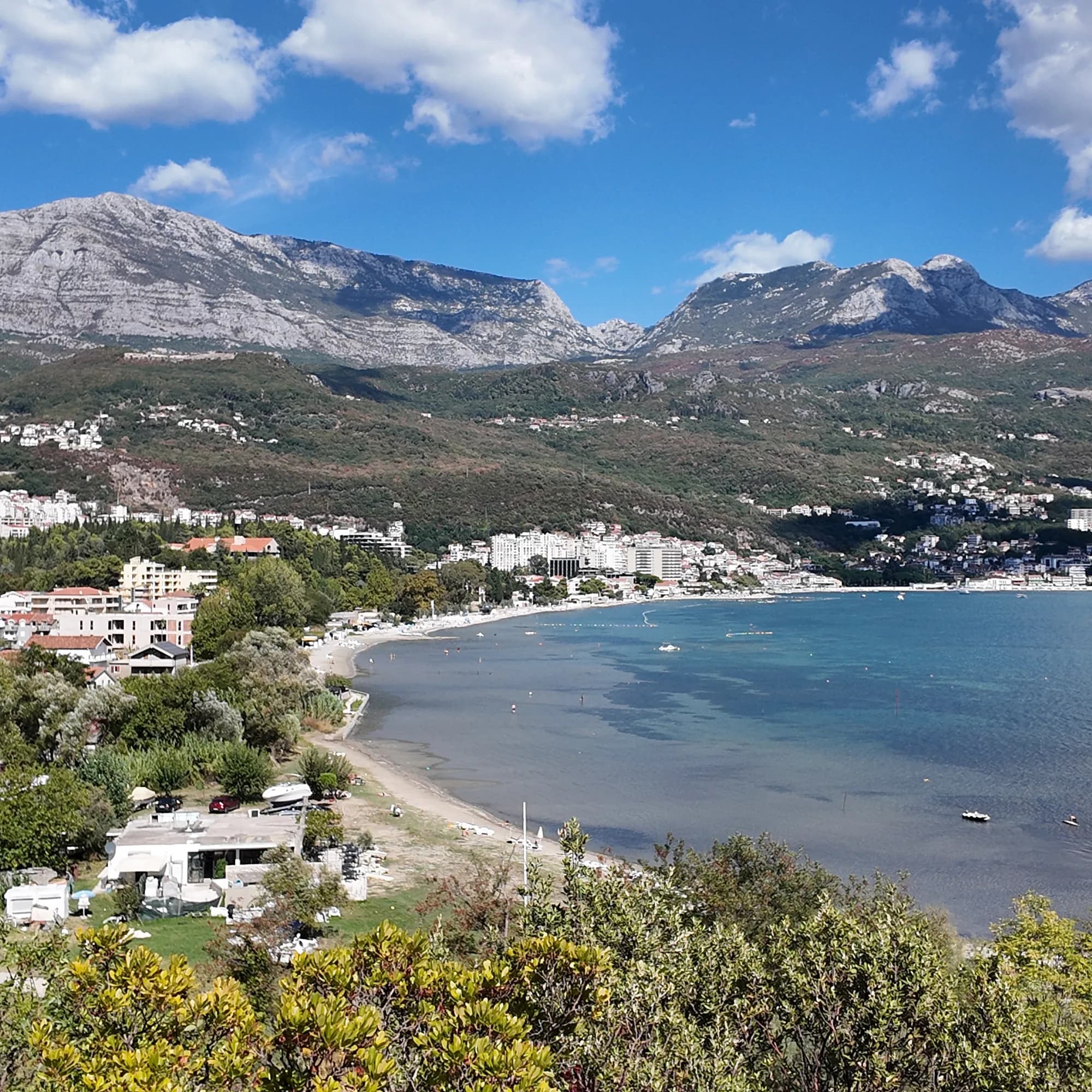 Igalo1.8 km Igalo1.8 km |  Savina3.4 km Savina3.4 km |  Mirišta7.7 km Mirišta7.7 km |
|---|---|---|---|---|
| Untergrund | Fels | Sand und feiner Kies — weicht ab | Kies — weicht ab | Kies — weicht ab |
| Einstieg | felsig | flach — weicht ab | mäßig — weicht ab | mäßig — weicht ab |
| Tiefe | wird schnell tief | flach — weicht ab | wird schnell tief | wird schnell tief |
| Schatten | Schirme zu mieten | Schirme zu mieten | Schirme zu mieten | Bäume und Schirme — weicht ab |
| Charakter | bewirtschaftete und freie Abschnitte | bewirtschaftet — weicht ab | bewirtschaftete und freie Abschnitte | bewirtschaftete und freie Abschnitte |
| Länge | 200 m | 600–1000 m — weicht ab | 200 m | 200 m |
| Letzte Messung | Ausgezeichnet | Ausgezeichnet | Ausgezeichnet | Ausgezeichnet |
| Andrang | Ruhe | in der Saison voll — weicht ab | in der Saison voll — weicht ab | Ruhe |
| Anfahrt | mit dem Auto | mit dem Auto | mit dem Auto | zu Fuß — weicht ab |
Übernachten in der Nähe von Njivice — Herceg Novi, 2.7 km entfernt
Alle Unterkünfte in Herceg Novi →


Fragen
- Wo genau liegt Njivice?
- An der Nordseite der Buchtmündung, westlich von Igalo und dem Fluss Sutorina, 6,4 km von Herceg Novi entfernt auf der Straße und 2,6 km vor dem Grenzübergang Konfin nach Kroatien. Es liegt nicht auf der Halbinsel Luštica, was ältere Guides auch behaupten mögen, und nicht an der Promenade Pet Danica, die am Institut in Igalo beginnt.
- Gibt es in Njivice einen Naturistenstrand?
- Ja — ein Ende von Kraljičina plaža ist für Naturisten abgetrennt, der älteste registrierte Naturistenstrand an dieser Küste. 2018 war der Landzugang für den Sommer geschlossen, außer durch das Resort; prüfen Sie die aktuelle Regelung, bevor Sie sich darauf verlassen.
- Hat Njivice eine Blaue Flagge?
- Einer unserer älteren Guides behauptet das, aber wir konnten kein Jahr auf der offiziellen Liste bestätigen, also drucken wir es nicht ab — lesen Sie die Flagge am Strand.
- Wie komme ich ohne Auto nach Njivice?
- Ein Lokalbus fährt das ganze Jahr über von Herceg Novi durch Igalo. Im Sommer fahren die Boote entlang der Küste in die andere Richtung, zu den Buchten Lušticas und zur Blauen Grotte.
Quellen
- montenegro.com — Njivice city hub and its source notes (visit-montenegro.com beach inventory; upoznajcrnugoru.com; Naturist Organisation of Serbia, 4 October 2018; JP Morsko dobro Boka register; Wikipedia, Njivice, Herceg Novi; OSRM road distances)
- Our 25 Best Beaches in Montenegro list (entry 21), with its geography corrected
- OpenStreetMap — beach ways 936390063 and 936390062 (naturist section)
- Our own frames and clips, 19–24 September 2026