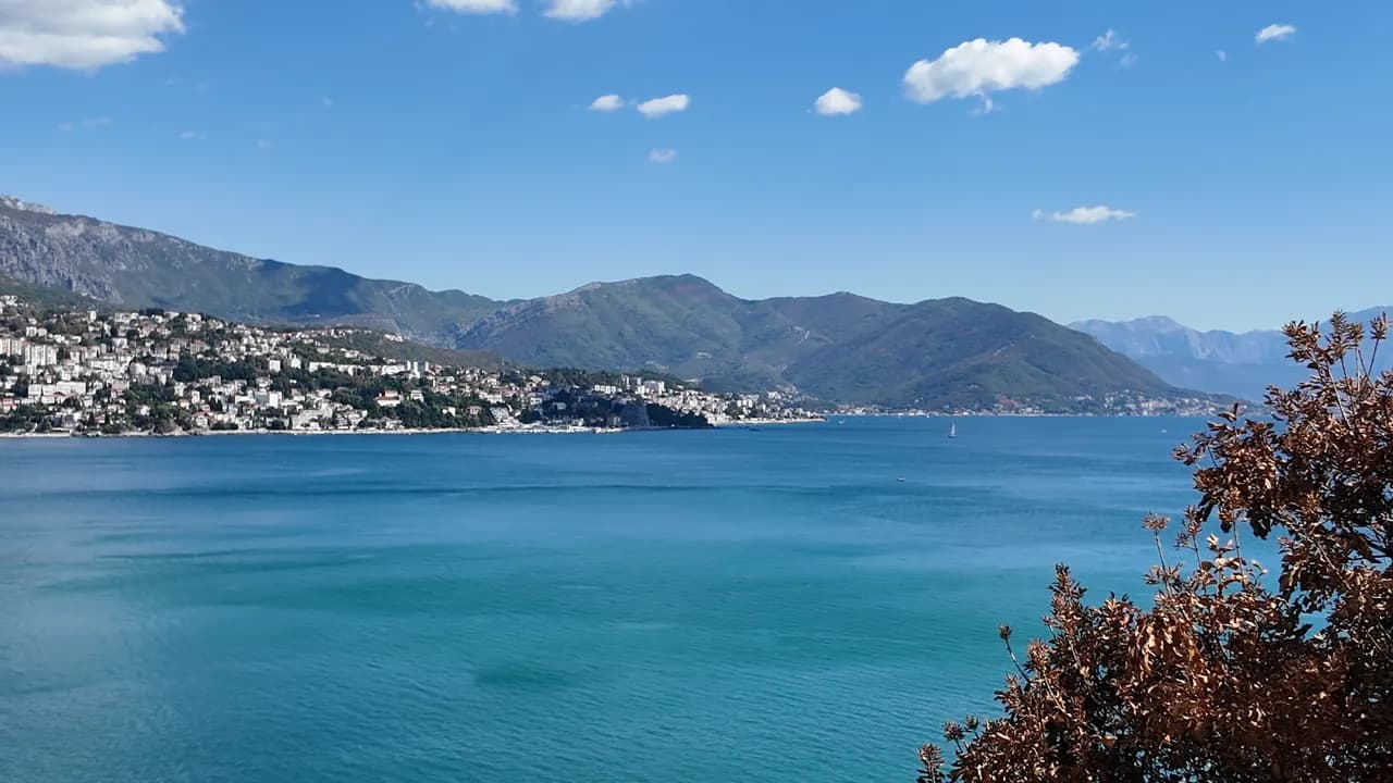
Njivice
Kraljičina plaža
La última playa de Montenegro yendo hacia el oeste: roca, arena y hormigón desde donde nadar bajo una aldea de 102 habitantes, con Prevlaka y Croacia a 4 km al otro lado del agua.
Nuestro veredicto
Njivice es una larga playa pública, Kraljičina plaža, bajo un único resort en una carretera secundaria al oeste de Igalo —roca, manchas de arena y plataformas de hormigón en lugar de guijarro, una sección naturista separada en un extremo, y un agua que renueva el mar abierto y no la bahía interior. Mira al noreste, así que la vista es toda la riviera de Herceg Novi bajo el Orjen, y los barcos de verano hacia Dobreč, Žanjice, Mamula y la Cueva Azul salen de esta orilla. Los habituales son familias con niños pequeños y visitantes mayores que buscan una estancia tranquila; hay autobús a Herceg Novi todo el año y nada de nada después del anochecer.
- tranquilidad
- nadar
- naturistas
- fotografía
Njivice, en datos
La orilla
Servicios
Acceso
Normas y carácter
Datos verificados el 28 de septiembre de 2026 · Longitud: Our 25 Best Beaches list; Morsko Dobro publishes no length for Njivice · Servicios según OpenStreetMap contributors, ODbL · Quedan 9 datos por comprobar sobre el terreno
Njivice en imágenes
Fotografías y vídeos de Montenegro.com, libres de reutilizar bajo CC BY 4.0. Las nuestras se tomaron en septiembre de 2026.
Njivice en movimiento
Mirando hacia la boca de la bahía y Luštica desde la orilla de Njivice
El cartel I ♥ Herceg Novi en el mirador de Njivice, con una palmera al lado
Fotografías y vídeos de Montenegro.com, libres de reutilizar bajo CC BY 4.0. Las nuestras se tomaron en septiembre de 2026.
Mapa
El agua sombreada es la zona de baño oficial de la estación Njivice 01: el tramo que JP Morsko dobro muestrea realmente, no el contorno de la playa.
Cómo llegar
2.7 km
Herceg Novi
18 km
Tivat airport
22 km
Kotor
Distancias en línea recta — las carreteras de Montenegro son de montaña, así que el trayecto es más largo.
- En autobúsLocal bus Herceg Novi–Njivice, all year
- En barcoSummer boats from the shore to Dobreč, Žanjice, Mamula, the Blue Cave and Rose
- En cocheNjivice is 3.6 km west of Igalo and 6.4 km from Herceg Novi on the side road towards the Konfin border crossing, which is 2.6 km further on
Hoy en Njivice
La orientación se calcula a partir de la costa de OpenStreetMap, así que «hacia la playa» y «desde tierra» se refieren a esta orilla y no a la región. Previsión de Open-Meteo
Agua y galardones
Excelente
Última muestra oficial 28 de septiembre de 2026: Excelente
Mar a 19.9 °C en el momento de la muestra
9 de 10 muestras excelentes en la temporada 2026
Resultado oficial de JP Morsko dobro, estación Njivice 01
Ocho de nueve muestras oficiales Excelente en 2026, una Buena el 17 de agosto; renovada por el mar abierto y no por la bahía interior
- Blue Flag 2026, sector 1A Njivice (Hotel Iberostar, operator Montenegro Hotels d.o.o.)The only Blue Flag beach in Herceg Novi municipality, flown in 2025 and again in 2026. It certifies the hotel’s own sector, not the whole public shore.
Antes de bañarte
- Entradas de roca y hormigón con escaleras, y erizos de mar en la roca — calzado de baño
- Los barcos de excursión a Žanjice, Mamula y la Cueva Azul salen de esta orilla a media mañana — manténgase dentro de la zona de baño
- Abierta a la boca de la bahía: un oleaje del suroeste rompe sobre las plataformas y deja las escaleras inutilizables
- El acceso terrestre al extremo naturista se ha restringido antes (2018: solo con pase de día del resort) — compruébelo antes de contar con él
Cuándo está templada el agua
Njivice alcanzó su máximo, 27.6 °C, el 31 de agosto de 2026, y su mínimo, 19.9 °C, el 25 de mayo de 2026. Cada punto es una toma de muestra real con la temperatura medida en el sitio, no un promedio mensual copiado de otra parte.
El punto hueco es el único muestreo que no alcanzó «Excelente».
Ver los 10 muestreos
| Muestreo | Mar | Resultado |
|---|---|---|
| 28 de septiembre de 2026 | 19.9 °C | Excelente |
| 14 de septiembre de 2026 | 23.7 °C | Excelente |
| 31 de agosto de 2026 | 27.6 °C | Excelente |
| 17 de agosto de 2026 | 24.2 °C | Buena |
| 3 de agosto de 2026 | 25.4 °C | Excelente |
| 20 de julio de 2026 | 25.4 °C | Excelente |
| 6 de julio de 2026 | 21.9 °C | Excelente |
| 22 de junio de 2026 | 24.7 °C | Excelente |
| 8 de junio de 2026 | 22.5 °C | Excelente |
| 25 de mayo de 2026 | 19.9 °C | Excelente |
Temporada a temporada
Njivice se ha muestreado 69 veces desde 2020: 60 de esas lecturas excelentes, 9 por debajo.
Lo caliente que llegó a estar el agua, temporada a temporada. La media es solo de los muestreos de julio y agosto: una ventana fija, para que un año en que los inspectores vinieron temprano no parezca frío.
Un puñado de temporadas es un registro, no una tendencia: lo que se ve aquí es la dispersión propia de unas pocas lecturas fechadas, no la prueba de un mar que se calienta o se enfría. Un punto hueco marca una temporada en la que algún muestreo quedó por debajo de excelente.
| Temporada | Muestreos | Excelente | Por debajo | Media jul.-ago. | Máxima |
|---|---|---|---|---|---|
| 2020 | 9 | 8 | 1 | 24 °C | 25.5 °C |
| 2021 | 10 | 9 | 1 | 25.2 °C | 27.6 °C |
| 2022 | 10 | 9 | 1 | 24.4 °C | 26.8 °C |
| 2023 | 10 | 6 | 4 | 25.3 °C | 27.6 °C |
| 2024 | 10 | 9 | 1 | 25.1 °C | 27 °C |
| 2025 | 10 | 10 | — | 23 °C | 25.4 °C |
| 2026en curso | 10 | 9 | 1 | 24.9 °C | 27.6 °C |
Concesionada como
El Estado arrienda esta costa lote a lote. Njivice sale a concurso como 4 lotes que suman unos 560 m de orilla, cada uno con una categoría oficial.
| Categoría | Lotes | Orilla |
|---|---|---|
| Playa de hotel | 2 | 383 m |
| Baño familiar | 2 | 177 m |
Unos 6,453 m² en total. Esto es lo concesionado, no lo observado: el número de hamacas, aseos y duchas por lote se fija en el contrato firmado, que no se publica. Licitaciones de JP Morsko dobro
Playas cercanas




Njivice y sus vecinas
Las mismas nueve medidas para las playas que puede alcanzar el mismo día. La negrita indica que difiere de esta.
| Medida |  Njiviceesta playa Njiviceesta playa | 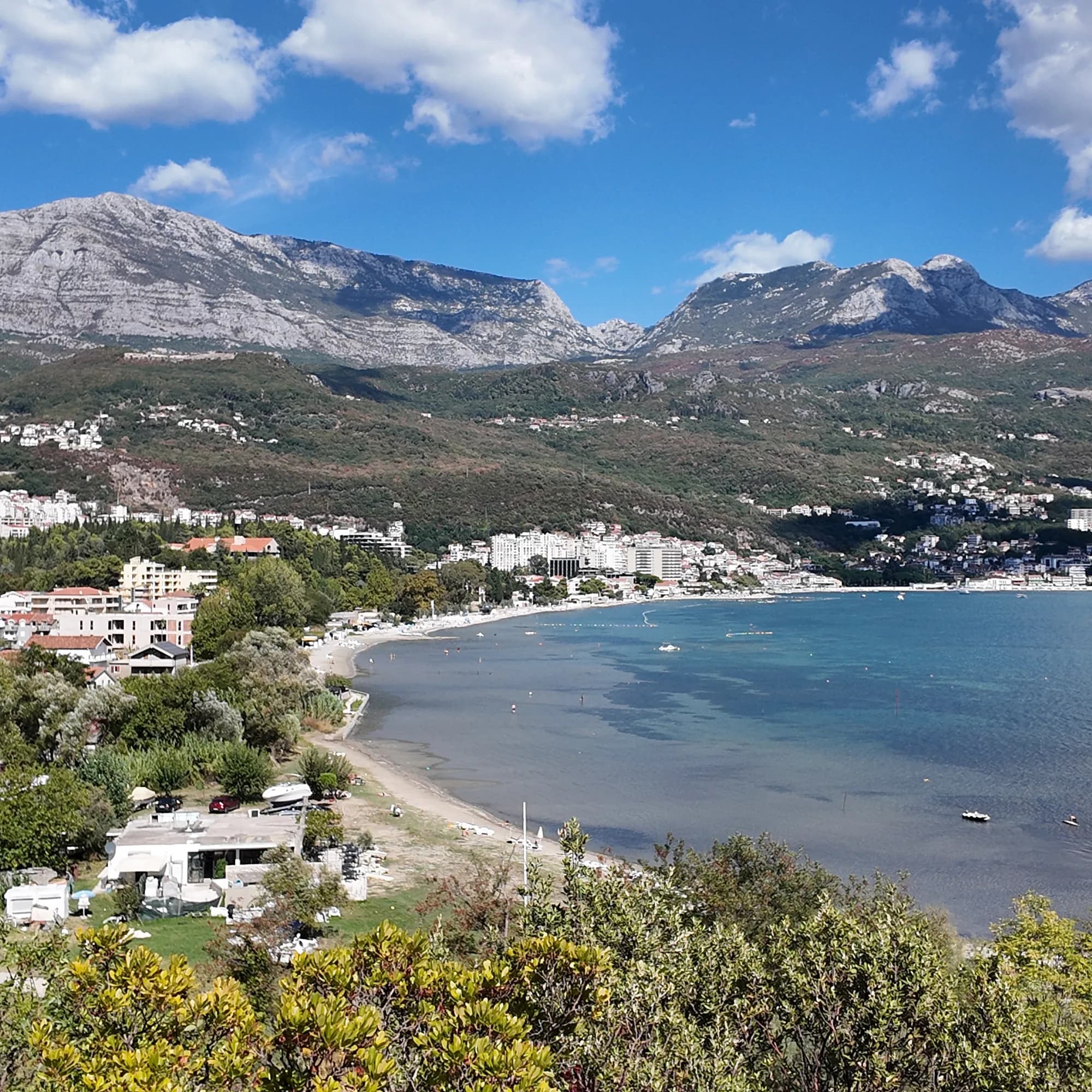 Igalo1.8 km Igalo1.8 km |  Savina3.4 km Savina3.4 km |  Mirišta7.7 km Mirišta7.7 km |
|---|---|---|---|---|
| Superficie | roca | arena y guijarro fino — difiere | guijarros — difiere | guijarros — difiere |
| Entrada | rocosa | suave — difiere | moderada — difiere | moderada — difiere |
| Profundidad | gana fondo rápido | poco profunda — difiere | gana fondo rápido | gana fondo rápido |
| Sombra | sombrillas de alquiler | sombrillas de alquiler | sombrillas de alquiler | árboles y sombrillas — difiere |
| Carácter | zonas organizadas y libres | organizada — difiere | zonas organizadas y libres | zonas organizadas y libres |
| Longitud | 200 m | 600–1000 m — difiere | 200 m | 200 m |
| Última muestra | Excelente | Excelente | Excelente | Excelente |
| Afluencia | tranquilidad | concurrida en temporada — difiere | concurrida en temporada — difiere | tranquilidad |
| Cómo llegar | en coche | en coche | en coche | a pie — difiere |
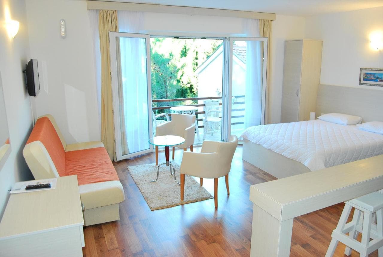
Dónde dormir cerca de Njivice — Herceg Novi, a 2.7 km
Todos los alojamientos en Herceg Novi →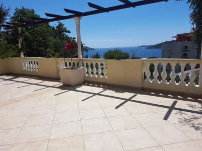


Preguntas
- ¿Dónde está exactamente Njivice?
- En el lado norte de la boca de la bahía, al oeste de Igalo y del río Sutorina, a 6.4 km de Herceg Novi por carretera y a 2.6 km del paso fronterizo de Konfin hacia Croacia. No está en la península de Luštica, diga lo que diga alguna guía antigua, ni en el paseo Pet Danica, que empieza en el Instituto de Igalo.
- ¿Hay playa naturista en Njivice?
- Sí —un extremo de Kraljičina plaža está separado para naturistas, la playa naturista registrada más antigua de esta costa. En 2018 el acceso por tierra se cerró durante el verano salvo a través del resort; compruebe el arreglo actual antes de contar con ello.
- ¿Tiene Njivice Bandera Azul?
- Una de nuestras guías más antiguas lo afirma, pero no hemos podido confirmar un año en la lista oficial, así que no lo publicamos — lea la bandera en la propia playa.
- ¿Cómo llego a Njivice sin coche?
- Un autobús local circula desde Herceg Novi pasando por Igalo todo el año. En verano los barcos por la costa van en la otra dirección, hacia las calas de Luštica y la Cueva Azul.
Fuentes
- montenegro.com — Njivice city hub and its source notes (visit-montenegro.com beach inventory; upoznajcrnugoru.com; Naturist Organisation of Serbia, 4 October 2018; JP Morsko dobro Boka register; Wikipedia, Njivice, Herceg Novi; OSRM road distances)
- Our 25 Best Beaches in Montenegro list (entry 21), with its geography corrected
- OpenStreetMap — beach ways 936390063 and 936390062 (naturist section)
- Our own frames and clips, 19–24 September 2026