Njivice
Kraljičina plaža
La dernière plage du Monténégro en allant vers l’ouest : de la roche, du sable et du béton pour se baigner, en contrebas d’un hameau de 102 habitants, avec Prevlaka et la Croatie à 4 km de l’autre côté de l’eau.
Notre verdict
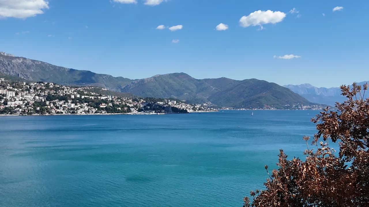
Njivice est une longue plage publique unique, Kraljičina plaža, en contrebas d’un seul complexe sur une route secondaire à l’ouest d’Igalo — de la roche, des zones de sable et des plateformes en béton plutôt que des galets, une section naturiste cloisonnée à une extrémité, et une eau brassée par la pleine mer plutôt que par la baie intérieure. Orientée au nord-est, elle offre une vue sur toute la riviera de Herceg Novi sous l’Orjen, et les bateaux d’été vers Dobreč, Žanjice, Mamula et la Grotte Bleue partent de ce rivage. Les habitués sont des familles avec de jeunes enfants et des visiteurs plus âgés en quête de calme ; il existe un bus toute l’année vers Herceg Novi, mais rien du tout après la tombée de la nuit.
- calme
- nage
- naturistes
- photographie
Njivice, en quelques repères
Le rivage
Équipements
Accès
Règles et caractère
Données vérifiées le 28 septembre 2026 · Longueur: Our 25 Best Beaches list; Morsko Dobro publishes no length for Njivice · Équipements d'après OpenStreetMap contributors, ODbL · 9 points restent à vérifier sur place
Njivice en images
Photographies et images de Montenegro.com, réutilisables sous licence CC BY 4.0. Les nôtres datent de septembre 2026.
Njivice en mouvement
Vue vers l’embouchure de la baie et Luštica depuis le rivage de Njivice
Le panneau I ♥ Herceg Novi au belvédère de Njivice, un palmier à côté
Photographies et images de Montenegro.com, réutilisables sous licence CC BY 4.0. Les nôtres datent de septembre 2026.
Carte
La zone ombrée est la zone de baignade officielle de la station Njivice 01 : la portion que JP Morsko dobro prélève réellement, et non le contour de la plage.
Y aller
2.7 km
Herceg Novi
18 km
Tivat airport
22 km
Kotor
Distances à vol d'oiseau — les routes du Monténégro sont des routes de montagne, le trajet est donc plus long.
- En busLocal bus Herceg Novi–Njivice, all year
- En bateauSummer boats from the shore to Dobreč, Žanjice, Mamula, the Blue Cave and Rose
- En voitureNjivice is 3.6 km west of Igalo and 6.4 km from Herceg Novi on the side road towards the Konfin border crossing, which is 2.6 km further on
Aujourd'hui à Njivice
L’orientation est calculée depuis le trait de côte OpenStreetMap : « vers la plage » et « de la terre » désignent ce rivage, pas la région. Prévisions par Open-Meteo
Eau et labels
Excellente
Dernier prélèvement officiel 28 septembre 2026 : Excellente
Mer à 19.9 °C lors du prélèvement
9 prélèvements excellents sur 10 durant la saison 2026
Résultat officiel de JP Morsko dobro, station Njivice 01
Huit des neuf prélèvements officiels classés excellents en 2026, un bon le 17 août ; brassée par la pleine mer plutôt que par la baie intérieure
- Blue Flag 2026, sector 1A Njivice (Hotel Iberostar, operator Montenegro Hotels d.o.o.)The only Blue Flag beach in Herceg Novi municipality, flown in 2025 and again in 2026. It certifies the hotel’s own sector, not the whole public shore.
À savoir avant de se baigner
- Des entrées sur roche et béton avec des échelles, et des oursins sur la roche — chaussures d’eau
- Les bateaux d’excursion vers Žanjice, Mamula et la Grotte Bleue partent de ce rivage en fin de matinée — restez à l’intérieur de la zone de baignade
- Ouverte à l’embouchure de la baie : une houle de sud-ouest déferle sur les plateformes et rend les échelles inutilisables
- L’accès terrestre à l’extrémité naturiste a déjà été restreint (2018 : pass journalier du complexe uniquement) — vérifiez avant de compter dessus
Quand l'eau est chaude
Njivice a atteint son maximum, 27.6 °C, le 31 août 2026, et son minimum, 19.9 °C, le 25 mai 2026. Chaque point est un prélèvement réel avec la température relevée sur place, et non une moyenne mensuelle recopiée ailleurs.
Le point évidé est le seul prélèvement repassé sous « Excellent ».
Voir les 10 prélèvements
| Prélevé | Mer | Résultat |
|---|---|---|
| 28 septembre 2026 | 19.9 °C | Excellente |
| 14 septembre 2026 | 23.7 °C | Excellente |
| 31 août 2026 | 27.6 °C | Excellente |
| 17 août 2026 | 24.2 °C | Bonne |
| 3 août 2026 | 25.4 °C | Excellente |
| 20 juillet 2026 | 25.4 °C | Excellente |
| 6 juillet 2026 | 21.9 °C | Excellente |
| 22 juin 2026 | 24.7 °C | Excellente |
| 8 juin 2026 | 22.5 °C | Excellente |
| 25 mai 2026 | 19.9 °C | Excellente |
Saison par saison
Njivice a fait l'objet de 69 prélèvements depuis 2020 : 60 relevés excellents, 9 en dessous.
La chaleur qu'a atteinte l'eau, saison par saison. La moyenne ne porte que sur les prélèvements de juillet et août : une fenêtre fixe, pour qu'une année où les inspecteurs sont passés tôt ne paraisse pas froide.
Une poignée de saisons est un relevé, pas une tendance : ce que l'on voit ici est la dispersion normale de quelques mesures datées, non la preuve d'une mer qui se réchauffe ou se refroidit. Un point creux signale une saison où un prélèvement est passé sous « excellente ».
| Saison | Prélèvements | Excellente | En dessous | Moyenne juil.-août | Maximum |
|---|---|---|---|---|---|
| 2020 | 9 | 8 | 1 | 24 °C | 25.5 °C |
| 2021 | 10 | 9 | 1 | 25.2 °C | 27.6 °C |
| 2022 | 10 | 9 | 1 | 24.4 °C | 26.8 °C |
| 2023 | 10 | 6 | 4 | 25.3 °C | 27.6 °C |
| 2024 | 10 | 9 | 1 | 25.1 °C | 27 °C |
| 2025 | 10 | 10 | — | 23 °C | 25.4 °C |
| 2026en cours | 10 | 9 | 1 | 24.9 °C | 27.6 °C |
Concédée comme
L’État loue ce littoral lot par lot. Njivice est mise en adjudication en 4 lots couvrant environ 560 m de rivage, chacun avec une catégorie officielle.
| Catégorie | Lots | Rivage |
|---|---|---|
| Plage d’hôtel | 2 | 383 m |
| Baignade familiale | 2 | 177 m |
Environ 6,453 m² au total. C’est ce qui est concédé, non ce que nous avons vu : le nombre de transats, de toilettes et de douches par lot est fixé dans le bail signé, qui n’est pas publié. Appels d’offres de JP Morsko dobro
Plages à proximité




Njivice et ses voisines
Les mêmes neuf mesures pour les plages accessibles dans la journée. Le gras signale une différence avec celle-ci.
| Mesure |  Njivicecette plage Njivicecette plage | 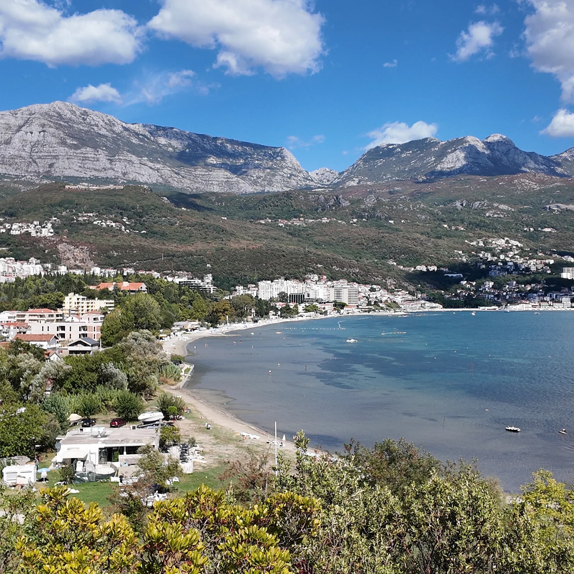 Igalo1.8 km Igalo1.8 km |  Savina3.4 km Savina3.4 km |  Mirišta7.7 km Mirišta7.7 km |
|---|---|---|---|---|
| Sol | rocher | sable et petits galets — diffère | galets — diffère | galets — diffère |
| Entrée | rocheuse | douce — diffère | modérée — diffère | modérée — diffère |
| Profondeur | profond rapidement | peu profond — diffère | profond rapidement | profond rapidement |
| Ombre | parasols à louer | parasols à louer | parasols à louer | arbres et parasols — diffère |
| Caractère | parties aménagées et libres | aménagée — diffère | parties aménagées et libres | parties aménagées et libres |
| Longueur | 200 m | 600–1000 m — diffère | 200 m | 200 m |
| Dernier prélèvement | Excellente | Excellente | Excellente | Excellente |
| Affluence | calme | fréquentée en saison — diffère | fréquentée en saison — diffère | calme |
| Accès | en voiture | en voiture | en voiture | à pied — diffère |
Où dormir près de Njivice — Herceg Novi, à 2.7 km
Tous les hébergements à Herceg Novi →


Questions
- Où se trouve exactement Njivice ?
- Sur le côté nord de l’embouchure de la baie, à l’ouest d’Igalo et de la rivière Sutorina, à 6,4 km de Herceg Novi par la route et à 2,6 km du poste-frontière de Konfin vers la Croatie. Elle n’est pas sur la péninsule de Luštica, quoi qu’en disent d’anciens guides, ni sur la promenade Pet Danica, qui commence à l’Institut d’Igalo.
- Y a-t-il une plage naturiste à Njivice ?
- Oui — une extrémité de Kraljičina plaža est cloisonnée pour les naturistes, la plus ancienne plage naturiste enregistrée sur cette côte. En 2018, l’accès terrestre a été fermé pour l’été, sauf en passant par le complexe ; vérifiez les dispositions actuelles avant d’en dépendre.
- Njivice a-t-elle un Pavillon Bleu ?
- L’un de nos anciens guides l’affirme, mais nous n’avons pas pu confirmer une année sur la liste officielle, alors nous ne le publions pas — lisez le drapeau sur la plage.
- Comment se rendre à Njivice sans voiture ?
- Un bus local circule depuis Herceg Novi à travers Igalo toute l’année. En été, les bateaux le long du rivage vont dans l’autre sens, vers les criques de Luštica et la Grotte Bleue.
Sources
- montenegro.com — Njivice city hub and its source notes (visit-montenegro.com beach inventory; upoznajcrnugoru.com; Naturist Organisation of Serbia, 4 October 2018; JP Morsko dobro Boka register; Wikipedia, Njivice, Herceg Novi; OSRM road distances)
- Our 25 Best Beaches in Montenegro list (entry 21), with its geography corrected
- OpenStreetMap — beach ways 936390063 and 936390062 (naturist section)
- Our own frames and clips, 19–24 September 2026