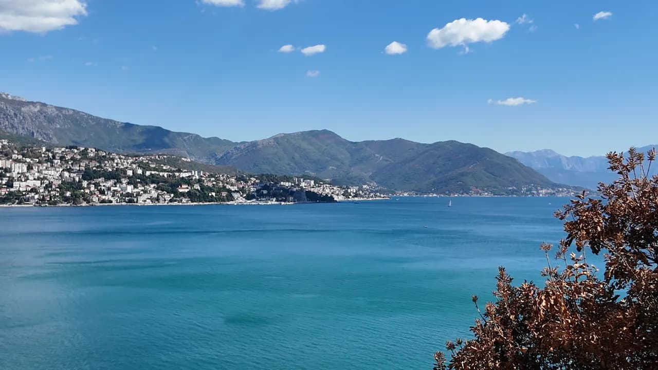
Njivice
Kraljičina plaža
L'ultima spiaggia del Montenegro andando verso ovest: roccia, sabbia e cemento da cui fare il bagno sotto una frazione di 102 abitanti, con Prevlaka e la Croazia a 4 km al di là dell'acqua.
Il nostro verdetto
Njivice è un'unica lunga spiaggia pubblica, Kraljičina plaža, sotto un unico resort su una strada laterale a ovest di Igalo — roccia, tratti di sabbia e piattaforme di cemento più che ciottoli, una sezione naturista delimitata a un'estremità, e acqua ricambiata dal mare aperto più che dalla baia interna. È rivolta a nord-est, quindi la vista abbraccia l'intera riviera di Herceg Novi sotto l'Orjen, e le barche estive per Dobreč, Žanjice, Mamula e la Grotta Azzurra partono da questo arenile. Gli habitué sono famiglie con bambini piccoli e visitatori più anziani in cerca di un soggiorno tranquillo; c'è un autobus tutto l'anno per Herceg Novi e assolutamente nulla dopo il tramonto.
- tranquillità
- nuotare
- naturisti
- fotografia
Njivice, in dati
La riva
Servizi
Accesso
Regole e carattere
Dati verificati il 28 settembre 2026 · Lunghezza: Our 25 Best Beaches list; Morsko Dobro publishes no length for Njivice · Servizi da OpenStreetMap contributors, ODbL · Altri 9 dati da verificare sul posto
Njivice in immagini
Fotografie e riprese di Montenegro.com, riutilizzabili con licenza CC BY 4.0. Le nostre sono di settembre 2026.
Njivice in movimento
Lo sguardo verso l'imboccatura della baia e Luštica dall'arenile di Njivice
Il cartello I ♥ Herceg Novi al punto panoramico di Njivice, una palma accanto
Fotografie e riprese di Montenegro.com, riutilizzabili con licenza CC BY 4.0. Le nostre sono di settembre 2026.
Mappa
L’area ombreggiata è la zona di balneazione ufficiale della stazione Njivice 01: il tratto che JP Morsko dobro campiona davvero, non il contorno della spiaggia.
Come arrivare
2.7 km
Herceg Novi
18 km
Tivat airport
22 km
Kotor
Distanze in linea d'aria — le strade del Montenegro sono strade di montagna, quindi il viaggio è più lungo.
- In autobusLocal bus Herceg Novi–Njivice, all year
- In barcaSummer boats from the shore to Dobreč, Žanjice, Mamula, the Blue Cave and Rose
- In autoNjivice is 3.6 km west of Igalo and 6.4 km from Herceg Novi on the side road towards the Konfin border crossing, which is 2.6 km further on
Oggi a Njivice
L’orientamento è calcolato dalla linea di costa di OpenStreetMap, quindi «verso la spiaggia» e «da terra» riguardano questa riva, non la regione. Previsioni di Open-Meteo
Acqua e riconoscimenti
Eccellente
Ultimo campione ufficiale 28 settembre 2026: Eccellente
Mare a 19.9 °C al momento del prelievo
9 campioni eccellenti su 10 nella stagione 2026
Risultato ufficiale di JP Morsko dobro, stazione Njivice 01
Otto campioni ufficiali su nove Eccellente nel 2026, uno Buono il 17 agosto; ricambiata dal mare aperto più che dalla baia interna
- Blue Flag 2026, sector 1A Njivice (Hotel Iberostar, operator Montenegro Hotels d.o.o.)The only Blue Flag beach in Herceg Novi municipality, flown in 2025 and again in 2026. It certifies the hotel’s own sector, not the whole public shore.
Da sapere prima di fare il bagno
- Ingressi in roccia e cemento con scalette, e ricci di mare sulla roccia — scarpette da bagno
- Le barche escursioni per Žanjice, Mamula e la Grotta Azzurra partono da questo arenile in tarda mattinata — resta all'interno della zona di balneazione
- Esposta all'imboccatura della baia: un'onda da sud-ovest si infrange sulle piattaforme e rende le scalette inutilizzabili
- L'accesso via terra all'estremità naturista è già stato limitato in passato (2018: solo con pass giornaliero del resort) — verifica prima di farci affidamento
Quando l'acqua è calda
Njivice ha toccato il massimo, 27.6 °C, il 31 agosto 2026, e il minimo, 19.9 °C, il 25 maggio 2026. Ogni punto è un campionamento reale con la temperatura rilevata sul posto, non una media mensile copiata altrove.
Il punto vuoto è l’unico campionamento risultato sotto «Eccellente».
Vedi tutti i 10 campionamenti
| Campionato | Mare | Esito |
|---|---|---|
| 28 settembre 2026 | 19.9 °C | Eccellente |
| 14 settembre 2026 | 23.7 °C | Eccellente |
| 31 agosto 2026 | 27.6 °C | Eccellente |
| 17 agosto 2026 | 24.2 °C | Buona |
| 3 agosto 2026 | 25.4 °C | Eccellente |
| 20 luglio 2026 | 25.4 °C | Eccellente |
| 6 luglio 2026 | 21.9 °C | Eccellente |
| 22 giugno 2026 | 24.7 °C | Eccellente |
| 8 giugno 2026 | 22.5 °C | Eccellente |
| 25 maggio 2026 | 19.9 °C | Eccellente |
Stagione per stagione
Njivice è stata campionata 69 volte dal 2020: 60 di quelle letture eccellenti, 9 sotto.
Quanto si è scaldata l'acqua, stagione per stagione. La media riguarda solo i campionamenti di luglio e agosto: una finestra fissa, così un anno in cui gli ispettori sono passati presto non risulta freddo.
Una manciata di stagioni è un archivio, non una tendenza: quella che si vede qui è la dispersione normale di poche misure datate, non la prova di un mare che si scalda o si raffredda. Un punto vuoto segna una stagione in cui un campionamento è finito sotto «eccellente».
| Stagione | Campionamenti | Eccellente | Sotto | Media lug.-ago. | Massima |
|---|---|---|---|---|---|
| 2020 | 9 | 8 | 1 | 24 °C | 25.5 °C |
| 2021 | 10 | 9 | 1 | 25.2 °C | 27.6 °C |
| 2022 | 10 | 9 | 1 | 24.4 °C | 26.8 °C |
| 2023 | 10 | 6 | 4 | 25.3 °C | 27.6 °C |
| 2024 | 10 | 9 | 1 | 25.1 °C | 27 °C |
| 2025 | 10 | 10 | — | 23 °C | 25.4 °C |
| 2026in corso | 10 | 9 | 1 | 24.9 °C | 27.6 °C |
In concessione come
Lo Stato affitta questa costa lotto per lotto. Njivice è messa a gara in 4 lotti per circa 560 m di riva, ognuno con una categoria ufficiale.
| Categoria | Lotti | Riva |
|---|---|---|
| Spiaggia d’albergo | 2 | 383 m |
| Balneazione per famiglie | 2 | 177 m |
Circa 6,453 m² in tutto. Questo è ciò che è in concessione, non ciò che abbiamo visto: il numero di lettini, servizi e docce per lotto è fissato nel contratto firmato, che non viene pubblicato. Bandi di JP Morsko dobro
Spiagge vicine




Njivice e le spiagge vicine
Le stesse nove misure per le spiagge raggiungibili in giornata. Il grassetto indica una differenza rispetto a questa.
| Misura |  Njivicequesta spiaggia Njivicequesta spiaggia | 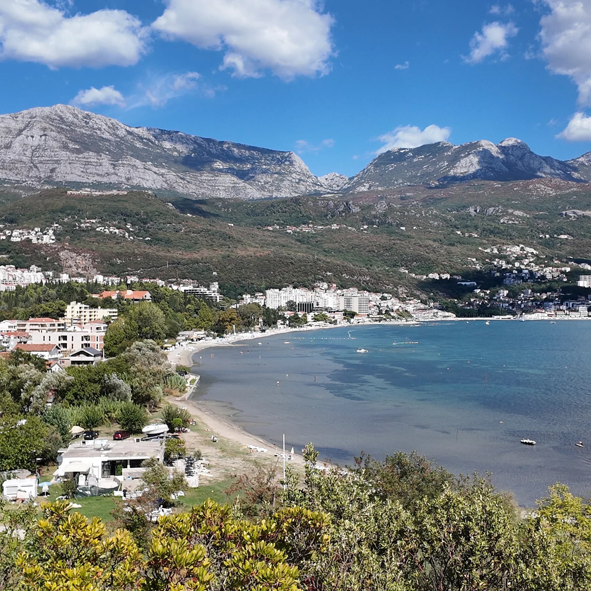 Igalo1.8 km Igalo1.8 km |  Savina3.4 km Savina3.4 km |  Mirišta7.7 km Mirišta7.7 km |
|---|---|---|---|---|
| Fondo | roccia | sabbia e ciottoli fini — differisce | ciottoli — differisce | ciottoli — differisce |
| Ingresso | roccioso | dolce — differisce | moderato — differisce | moderato — differisce |
| Profondità | si fa presto profonda | bassa — differisce | si fa presto profonda | si fa presto profonda |
| Ombra | ombrelloni a noleggio | ombrelloni a noleggio | ombrelloni a noleggio | alberi e ombrelloni — differisce |
| Carattere | tratti attrezzati e liberi | attrezzata — differisce | tratti attrezzati e liberi | tratti attrezzati e liberi |
| Lunghezza | 200 m | 600–1000 m — differisce | 200 m | 200 m |
| Ultimo campione | Eccellente | Eccellente | Eccellente | Eccellente |
| Affollamento | tranquillità | affollata in stagione — differisce | affollata in stagione — differisce | tranquillità |
| Come arrivare | in auto | in auto | in auto | a piedi — differisce |
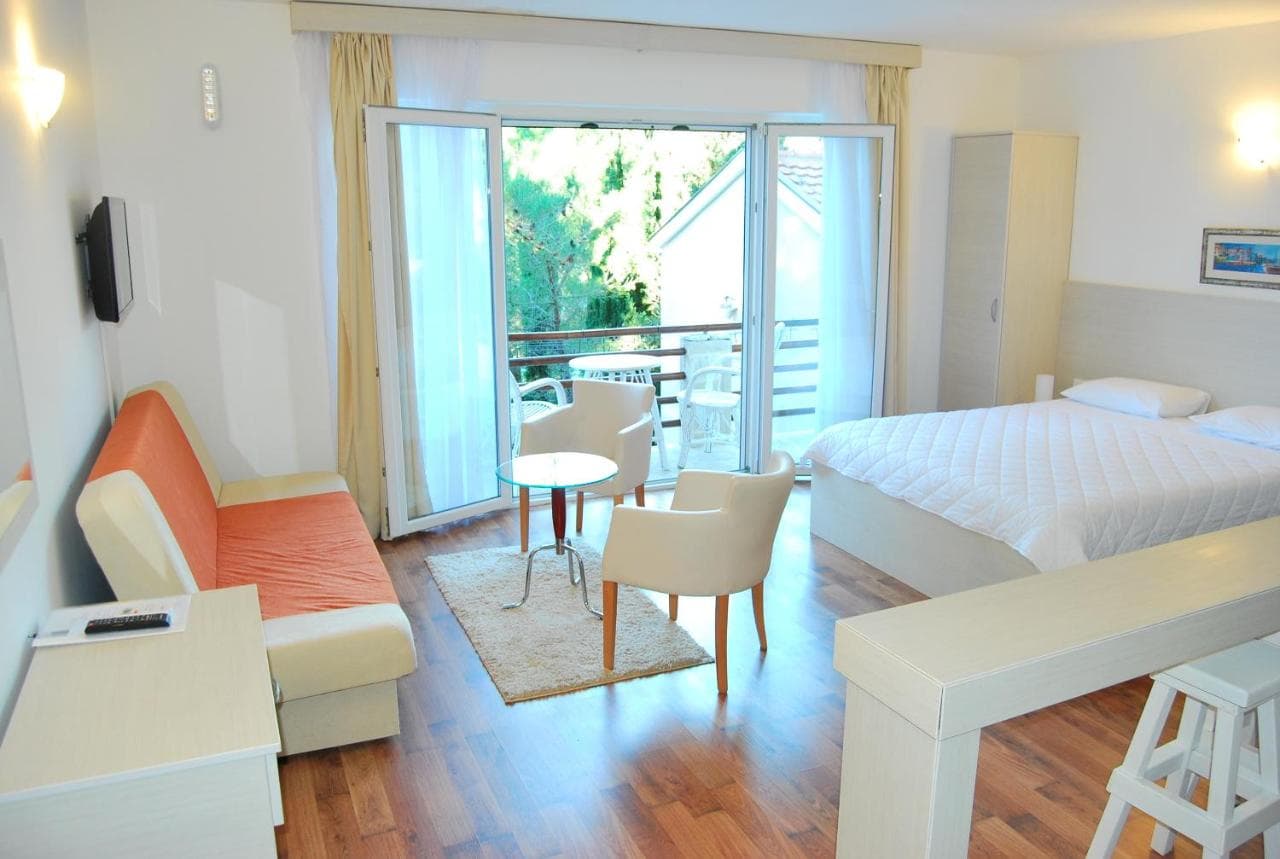
Dove dormire vicino a Njivice — Herceg Novi, a 2.7 km
Tutti gli alloggi a Herceg Novi →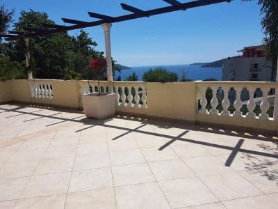


Domande
- Dove si trova esattamente Njivice?
- Sul lato nord dell'imboccatura della baia, a ovest di Igalo e del fiume Sutorina, a 6,4 km da Herceg Novi su strada e a 2,6 km dal valico di frontiera di Konfin verso la Croazia. Non si trova sulla penisola di Luštica, qualunque cosa dicano le guide più vecchie, e non sulla passeggiata Pet Danica, che inizia all'Istituto di Igalo.
- C'è una spiaggia naturista a Njivice?
- Sì — un'estremità di Kraljičina plaža è delimitata per i naturisti, la più antica spiaggia naturista registrata su questa costa. Nel 2018 l'accesso via terra fu chiuso per l'estate tranne che attraverso il resort; verifica l'assetto attuale prima di farci affidamento.
- Njivice ha la Bandiera Blu?
- Una delle nostre guide più vecchie lo afferma, ma non abbiamo potuto confermare un anno nella lista ufficiale, quindi non lo riportiamo — leggi la bandiera in spiaggia.
- Come si arriva a Njivice senza auto?
- Un autobus locale parte da Herceg Novi attraverso Igalo tutto l'anno. In estate le barche lungo la costa vanno nella direzione opposta, verso le cale di Luštica e la Grotta Azzurra.
Fonti
- montenegro.com — Njivice city hub and its source notes (visit-montenegro.com beach inventory; upoznajcrnugoru.com; Naturist Organisation of Serbia, 4 October 2018; JP Morsko dobro Boka register; Wikipedia, Njivice, Herceg Novi; OSRM road distances)
- Our 25 Best Beaches in Montenegro list (entry 21), with its geography corrected
- OpenStreetMap — beach ways 936390063 and 936390062 (naturist section)
- Our own frames and clips, 19–24 September 2026