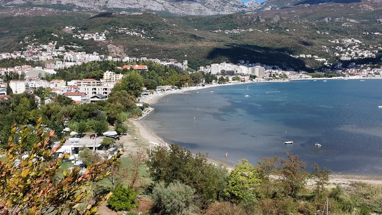
Igalo
L'arenile più piatto e dolce della baia: fino a un chilometro di sabbia, ciottoli e piattaforme di cemento in acqua bassa e tiepida, con la spiaggia di fango di Stara Banja alla foce della Sutorina.
Il nostro verdetto
Igalo è la spiaggia di una città termale, e si comporta come tale. L'arenile principale — circa 600 m secondo la nostra guida, 1 km secondo la nostra lista — è di sabbia e ciottoli con piattaforme di cemento, un ingresso dolce e acqua che resta bassa e tiepida, motivo per cui l'Istituto Dr Simo Milošević fu costruito qui nel 1949 e per cui bambini piccoli e pazienti in fisioterapia la condividono. A ovest dell'Istituto, alla foce della Sutorina, la cala di Stara Banja è dove viene estratto e applicato il fango minerale nero. I lettini costano 8–14 €, non c'è alcun gradino tra la fermata dell'autobus e l'acqua, e la passeggiata Pet Danica inizia dalla porta dell'Istituto.
- famiglie
- nuotare
- camminatori
Igalo, in dati
La riva
Servizi
Accesso
Dati verificati il 28 settembre 2026 · Lunghezza: Our Igalo guide gives the main beach as about 600 m within 1.5 km of shore; our 25 Best Beaches list says 1 km · Altri 12 dati da verificare sul posto
Igalo in immagini
Alcune sono nostre e riutilizzabili con licenza CC BY 4.0; le altre sono su licenza e non lo sono. Le nostre sono di settembre 2026.
Igalo in movimento
Igalo e la parete dell'Orjen dalla strada sopra Njivice
Stara Banja, la vecchia cala termale alla foce della Sutorina, vista dalla collina sopra di essa
Fotografie e riprese di Montenegro.com, riutilizzabili con licenza CC BY 4.0. Le nostre sono di settembre 2026.
Mappa
L’area ombreggiata è la zona di balneazione ufficiale della stazione Igalo 02: il tratto che JP Morsko dobro campiona davvero, non il contorno della spiaggia.
Come arrivare
2.1 km
Herceg Novi
18 km
Tivat airport
22 km
Kotor
Distanze in linea d'aria — le strade del Montenegro sono strade di montagna, quindi il viaggio è più lungo.
- Sulla passeggiata Lungomare Pet DanicaTappa: igalo-institute
- In autobusBlue Line: Igalo–Kamenari and the Igalo–Meljine–Igalo circular
- In autoIgalo is 2.6 km west of Herceg Novi; a barrier-controlled car park in Norveška Street, seasonal parking near the Institute and formal parking along the Igalo–Meljine corridor
- 5 min a piedipianeggiante — From the Institute bus stop; Igalo is the one flat town on the bay, with no steps between the road and the water
Oggi a Igalo
L’orientamento è calcolato dalla linea di costa di OpenStreetMap, quindi «verso la spiaggia» e «da terra» riguardano questa riva, non la regione. Previsioni di Open-Meteo
Acqua e riconoscimenti
Eccellente
Ultimo campione ufficiale 28 settembre 2026: Eccellente
Mare a 20.6 °C al momento del prelievo
5 campioni eccellenti su 10 nella stagione 2026
Risultato ufficiale di JP Morsko dobro, stazione Igalo 02
Acqua di baia interna bassa e tiepida alla foce della Sutorina, e il record ufficiale più debole di questa costa: tra le tre stazioni di monitoraggio nel 2026 i risultati sono andati da Eccellente fino a Sufficiente, compresa una lettura Sufficiente a Igalo 02 il 3 agosto, in piena stagione
Nessun riconoscimento che possiamo citare per questa spiaggia. Anche l'assenza è un'informazione.
Da sapere prima di fare il bagno
- L'arenile di fango di Stara Banja è scivoloso e il fango macchia — sciacquati prima di salire sulla passeggiata
- La foce del fiume Sutorina accanto a Stara Banja intorbidisce l'acqua per un giorno dopo una pioggia forte — in quel caso fai il bagno dall'arenile principale
- Le barche usano il canale della Sutorina e ormeggiano nella cala — resta nell'acqua di balneazione segnalata
- Il fondale è sassoso a tratti sotto la sabbia — scarpette da bagno per i bambini
Quando l'acqua è calda
Igalo ha toccato il massimo, 27.5 °C, il 31 agosto 2026, e il minimo, 19.8 °C, il 25 maggio 2026. Ogni punto è un campionamento reale con la temperatura rilevata sul posto, non una media mensile copiata altrove.
I punti vuoti sono i 5 campionamenti risultati sotto «Eccellente».
Vedi tutti i 10 campionamenti
| Campionato | Mare | Esito |
|---|---|---|
| 28 settembre 2026 | 20.6 °C | Eccellente |
| 16 settembre 2026 | 23.0 °C | Sufficiente |
| 31 agosto 2026 | 27.5 °C | Buona |
| 17 agosto 2026 | 24.7 °C | Eccellente |
| 3 agosto 2026 | 25.4 °C | Sufficiente |
| 20 luglio 2026 | 25.9 °C | Eccellente |
| 6 luglio 2026 | 21.5 °C | Eccellente |
| 22 giugno 2026 | 25.2 °C | Buona |
| 8 giugno 2026 | 21.9 °C | Buona |
| 25 maggio 2026 | 19.8 °C | Eccellente |
Stagione per stagione
Igalo è stata campionata 69 volte dal 2020: 37 di quelle letture eccellenti, 32 sotto.
Quanto si è scaldata l'acqua, stagione per stagione. La media riguarda solo i campionamenti di luglio e agosto: una finestra fissa, così un anno in cui gli ispettori sono passati presto non risulta freddo.
Una manciata di stagioni è un archivio, non una tendenza: quella che si vede qui è la dispersione normale di poche misure datate, non la prova di un mare che si scalda o si raffredda. Un punto vuoto segna una stagione in cui un campionamento è finito sotto «eccellente».
| Stagione | Campionamenti | Eccellente | Sotto | Media lug.-ago. | Massima |
|---|---|---|---|---|---|
| 2020 | 9 | 7 | 2 | 24.1 °C | 26.1 °C |
| 2021 | 10 | 6 | 4 | 25.4 °C | 27.1 °C |
| 2022 | 11 | 5 | 6 | 24.4 °C | 26.3 °C |
| 2023 | 9 | 3 | 6 | 24.7 °C | 27.1 °C |
| 2024 | 10 | 6 | 4 | 24.2 °C | 26.7 °C |
| 2025 | 10 | 5 | 5 | 23.3 °C | 24.6 °C |
| 2026in corso | 10 | 5 | 5 | 25 °C | 27.5 °C |
In concessione come
Lo Stato affitta questa costa lotto per lotto. Igalo è messa a gara in 9 lotti per circa 580 m di riva, ognuno con una categoria ufficiale.
Anche in concessione qui: una piattaforma di ormeggio nell’acqua davanti alla spiaggia.
| Categoria | Lotti | Riva |
|---|---|---|
| Balneazione per famiglie | 8 | 405 m |
| Spiaggia d’albergo | 1 | 175 m |
Circa 8,171 m² in tutto. Questo è ciò che è in concessione, non ciò che abbiamo visto: il numero di lettini, servizi e docce per lotto è fissato nel contratto firmato, che non viene pubblicato. Bandi di JP Morsko dobro
Spiagge vicine



Igalo e le spiagge vicine
Le stesse nove misure per le spiagge raggiungibili in giornata. Il grassetto indica una differenza rispetto a questa.
| Misura | 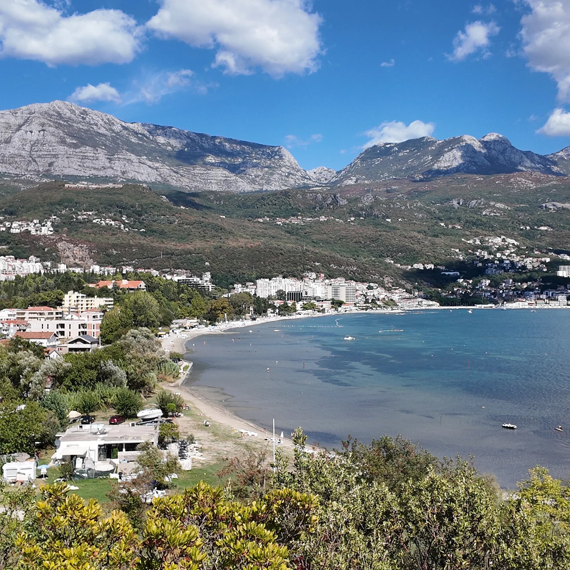 Igaloquesta spiaggia Igaloquesta spiaggia |  Njivice1.8 km Njivice1.8 km |  Savina3.1 km Savina3.1 km |  Meljine Beach3.8 km Meljine Beach3.8 km |
|---|---|---|---|---|
| Fondo | sabbia e ciottoli fini | roccia — differisce | ciottoli — differisce | ciottoli — differisce |
| Ingresso | dolce | roccioso — differisce | moderato — differisce | dolce |
| Profondità | bassa | si fa presto profonda — differisce | si fa presto profonda — differisce | bassa |
| Ombra | ombrelloni a noleggio | ombrelloni a noleggio | ombrelloni a noleggio | ombrelloni a noleggio |
| Carattere | attrezzata | tratti attrezzati e liberi — differisce | tratti attrezzati e liberi — differisce | attrezzata |
| Lunghezza | 600–1000 m | 200 m — differisce | 200 m — differisce | 30 m — differisce |
| Ultimo campione | Eccellente | Eccellente | Eccellente | —nessun punto di campionamento ufficiale — differisce |
| Affollamento | affollata in stagione | tranquillità — differisce | affollata in stagione | affollata in stagione |
| Come arrivare | in auto | in auto | in auto | in auto |
Dormire vicino a Igalo
Tutti gli alloggi a Igalo →

La guida completa
Leggi la guida di Igalo
Tutto quanto sopra è la versione breve. La guida contiene le fonti, i codici di settore, le date dei campionamenti e ciò che cambia nel corso di una stagione.
Domande
- Cos'è il fango di Igalo?
- Igaljsko blato — un fango marino nero, ricco di minerali, prelevato dal fondale della baia di Igalo con un lieve odore di zolfo, applicato come impacchi e bagni presso l'Istituto per patologie reumatiche e articolari. La cala di Stara Banja alla foce della Sutorina è la spiaggia del fango; l'arenile principale è di normale sabbia e ciottoli.
- Come si arriva alla spiaggia di Igalo da Herceg Novi?
- Percorri a piedi la passeggiata Pet Danica verso ovest — in piano per tutto il tragitto, circa 2,6 km — oppure prendi un autobus della Blue Line (Igalo–Kamenari, o la circolare Igalo–Meljine). La fermata Istituto è all'estremità occidentale della passeggiata.
- L'acqua a Igalo è pulita?
- La nostra guida indirizza i lettori al monitor ufficiale Morsko Dobro per le acque di balneazione per il campione attuale, piuttosto che citarne uno; la baia è bassa e si intorbidisce dopo la pioggia vicino alla foce del fiume.
Fonti
- montenegro.com — Igalo guide (/cities/igalo/igalo-guide): beach lengths and surfaces, Stara Banja mud, the Institute, Blue Line routes, parking
- montenegro.com — Igalo city hub (shallow warm water, sunbed prices, distances, sea temperatures)
- montenegro.com — Pet Danica walk (/walks/pet-danica): stop 1 Igalo Institute & Mud Baths
- Our 25 Best Beaches in Montenegro list (entry 20)
- OpenStreetMap — beach ways 571737992 and 1359144925 (Blatna plaža)
- Our own frames and clips, September 2026