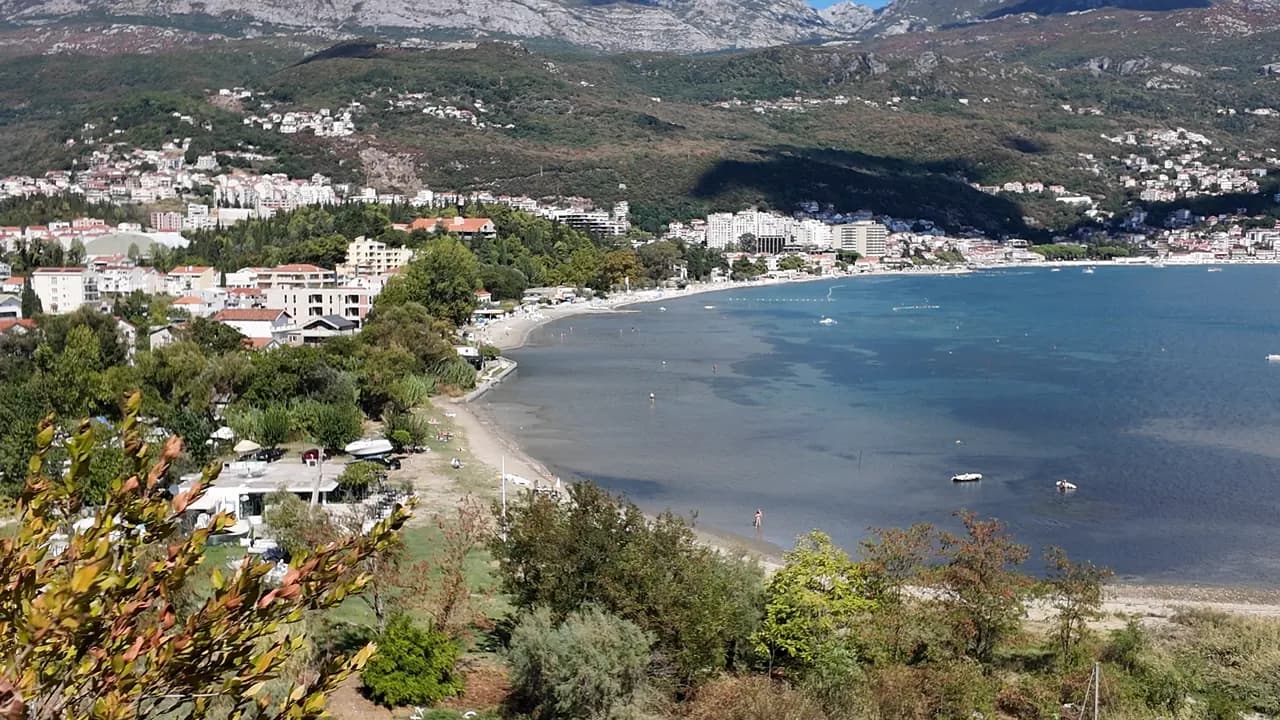
Igalo
La orilla más plana y suave de la bahía: hasta un kilómetro de arena, guijarro y plataformas de hormigón en agua cálida y poco profunda, con la playa de barro de Stara Banja en la desembocadura del Sutorina.
Nuestro veredicto
Igalo es la playa de una ciudad balneario, y se comporta como tal. La franja principal —unos 600 m según nuestra guía, 1 km según nuestra lista— es de arena y guijarro con plataformas de hormigón, entrada suave y agua que se mantiene poco profunda y cálida, motivo por el cual se instaló aquí el Instituto Dr Simo Milošević en 1949 y por el que niños pequeños y pacientes de fisioterapia comparten playa. Al oeste del Instituto, en la desembocadura del Sutorina, la cala de Stara Banja es donde se extrae y se aplica el barro mineral negro. Las hamacas cuestan €8–14, no hay ningún escalón entre la parada de autobús y el agua, y el paseo Pet Danica empieza en la puerta del Instituto.
- familias
- nadar
- senderistas
Igalo, en datos
La orilla
Servicios
Acceso
Datos verificados el 28 de septiembre de 2026 · Longitud: Our Igalo guide gives the main beach as about 600 m within 1.5 km of shore; our 25 Best Beaches list says 1 km · Quedan 12 datos por comprobar sobre el terreno
Igalo en imágenes
Algunas son nuestras y pueden reutilizarse bajo CC BY 4.0; las demás tienen licencia y no. Las nuestras se tomaron en septiembre de 2026.
Igalo en movimiento
Igalo y el muro del Orjen desde la carretera sobre Njivice
Stara Banja, la vieja cala balnearia en la desembocadura del Sutorina, desde la colina que la domina
Fotografías y vídeos de Montenegro.com, libres de reutilizar bajo CC BY 4.0. Las nuestras se tomaron en septiembre de 2026.
Mapa
El agua sombreada es la zona de baño oficial de la estación Igalo 02: el tramo que JP Morsko dobro muestrea realmente, no el contorno de la playa.
Cómo llegar
2.1 km
Herceg Novi
18 km
Tivat airport
22 km
Kotor
Distancias en línea recta — las carreteras de Montenegro son de montaña, así que el trayecto es más largo.
- En el paseo Paseo Pet DanicaParada: igalo-institute
- En autobúsBlue Line: Igalo–Kamenari and the Igalo–Meljine–Igalo circular
- En cocheIgalo is 2.6 km west of Herceg Novi; a barrier-controlled car park in Norveška Street, seasonal parking near the Institute and formal parking along the Igalo–Meljine corridor
- 5 min a piellano — From the Institute bus stop; Igalo is the one flat town on the bay, with no steps between the road and the water
Hoy en Igalo
La orientación se calcula a partir de la costa de OpenStreetMap, así que «hacia la playa» y «desde tierra» se refieren a esta orilla y no a la región. Previsión de Open-Meteo
Agua y galardones
Excelente
Última muestra oficial 28 de septiembre de 2026: Excelente
Mar a 20.6 °C en el momento de la muestra
5 de 10 muestras excelentes en la temporada 2026
Resultado oficial de JP Morsko dobro, estación Igalo 02
Agua interior de bahía, cálida y poco profunda, en la desembocadura del Sutorina, y el registro oficial más débil de esta costa: en tres estaciones de control en 2026 los resultados fueron de Excelente a Suficiente, con una lectura de Suficiente en Igalo 02 el 3 de agosto, en plena temporada
Ningún galardón que podamos citar para esta playa. La ausencia también es información.
Antes de bañarte
- La orilla de barro de Stara Banja resbala y el barro mancha — enjuáguese antes de pisar el paseo
- La desembocadura del río Sutorina, junto a Stara Banja, enturbia el agua durante un día tras lluvia fuerte — nade entonces desde la franja principal
- Los barcos usan el canal del Sutorina y fondean en la cala — manténgase en el agua de baño señalizada
- El fondo es pedregoso en algunos puntos bajo la arena — calzado de baño para los niños
Cuándo está templada el agua
Igalo alcanzó su máximo, 27.5 °C, el 31 de agosto de 2026, y su mínimo, 19.8 °C, el 25 de mayo de 2026. Cada punto es una toma de muestra real con la temperatura medida en el sitio, no un promedio mensual copiado de otra parte.
Los puntos huecos son los 5 muestreos que no alcanzaron «Excelente».
Ver los 10 muestreos
| Muestreo | Mar | Resultado |
|---|---|---|
| 28 de septiembre de 2026 | 20.6 °C | Excelente |
| 16 de septiembre de 2026 | 23.0 °C | Suficiente |
| 31 de agosto de 2026 | 27.5 °C | Buena |
| 17 de agosto de 2026 | 24.7 °C | Excelente |
| 3 de agosto de 2026 | 25.4 °C | Suficiente |
| 20 de julio de 2026 | 25.9 °C | Excelente |
| 6 de julio de 2026 | 21.5 °C | Excelente |
| 22 de junio de 2026 | 25.2 °C | Buena |
| 8 de junio de 2026 | 21.9 °C | Buena |
| 25 de mayo de 2026 | 19.8 °C | Excelente |
Temporada a temporada
Igalo se ha muestreado 69 veces desde 2020: 37 de esas lecturas excelentes, 32 por debajo.
Lo caliente que llegó a estar el agua, temporada a temporada. La media es solo de los muestreos de julio y agosto: una ventana fija, para que un año en que los inspectores vinieron temprano no parezca frío.
Un puñado de temporadas es un registro, no una tendencia: lo que se ve aquí es la dispersión propia de unas pocas lecturas fechadas, no la prueba de un mar que se calienta o se enfría. Un punto hueco marca una temporada en la que algún muestreo quedó por debajo de excelente.
| Temporada | Muestreos | Excelente | Por debajo | Media jul.-ago. | Máxima |
|---|---|---|---|---|---|
| 2020 | 9 | 7 | 2 | 24.1 °C | 26.1 °C |
| 2021 | 10 | 6 | 4 | 25.4 °C | 27.1 °C |
| 2022 | 11 | 5 | 6 | 24.4 °C | 26.3 °C |
| 2023 | 9 | 3 | 6 | 24.7 °C | 27.1 °C |
| 2024 | 10 | 6 | 4 | 24.2 °C | 26.7 °C |
| 2025 | 10 | 5 | 5 | 23.3 °C | 24.6 °C |
| 2026en curso | 10 | 5 | 5 | 25 °C | 27.5 °C |
Concesionada como
El Estado arrienda esta costa lote a lote. Igalo sale a concurso como 9 lotes que suman unos 580 m de orilla, cada uno con una categoría oficial.
También concesionado aquí: una plataforma de amarre en el agua frente a la playa.
| Categoría | Lotes | Orilla |
|---|---|---|
| Baño familiar | 8 | 405 m |
| Playa de hotel | 1 | 175 m |
Unos 8,171 m² en total. Esto es lo concesionado, no lo observado: el número de hamacas, aseos y duchas por lote se fija en el contrato firmado, que no se publica. Licitaciones de JP Morsko dobro
Playas cercanas



Igalo y sus vecinas
Las mismas nueve medidas para las playas que puede alcanzar el mismo día. La negrita indica que difiere de esta.
| Medida | 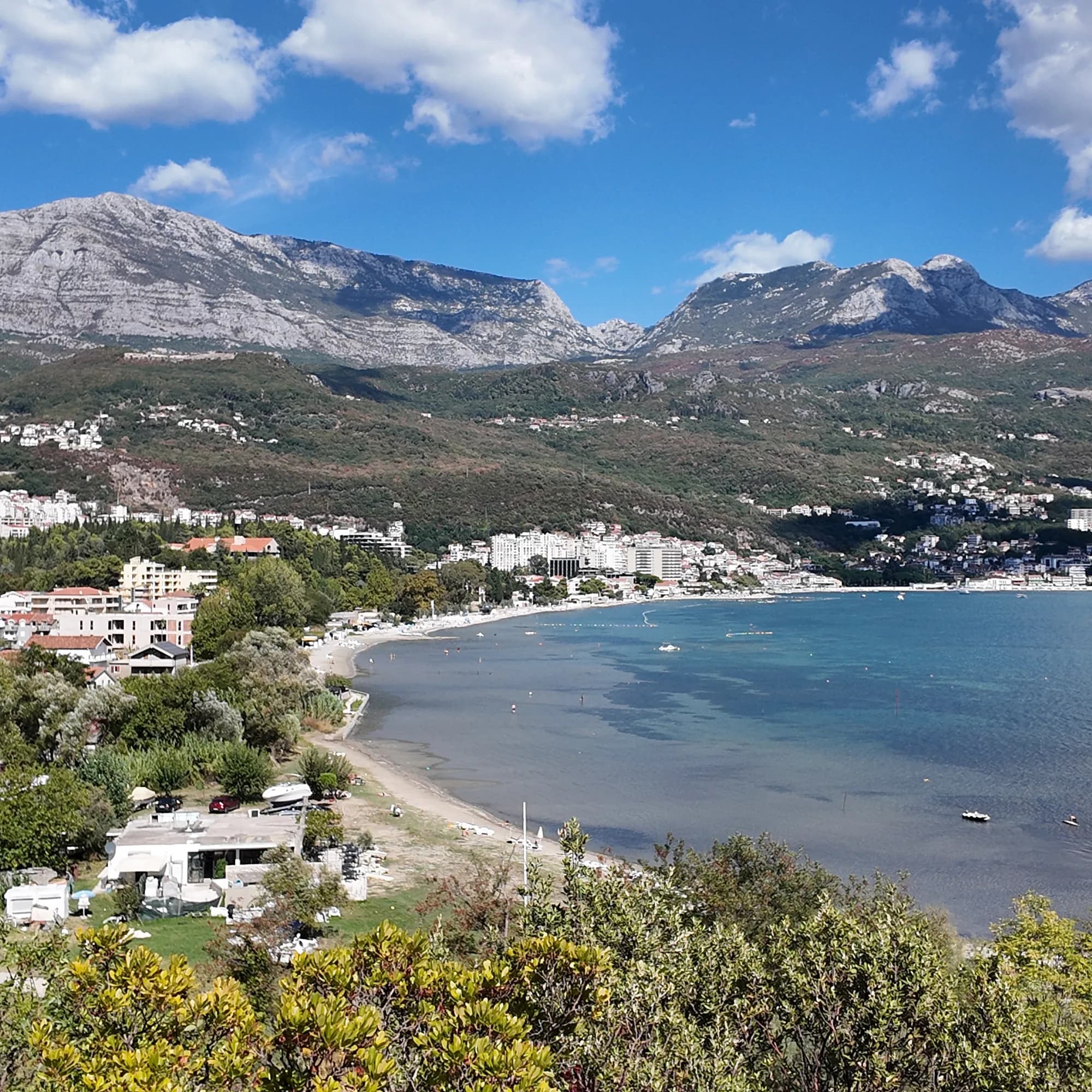 Igaloesta playa Igaloesta playa |  Njivice1.8 km Njivice1.8 km |  Savina3.1 km Savina3.1 km |  Meljine Beach3.8 km Meljine Beach3.8 km |
|---|---|---|---|---|
| Superficie | arena y guijarro fino | roca — difiere | guijarros — difiere | guijarros — difiere |
| Entrada | suave | rocosa — difiere | moderada — difiere | suave |
| Profundidad | poco profunda | gana fondo rápido — difiere | gana fondo rápido — difiere | poco profunda |
| Sombra | sombrillas de alquiler | sombrillas de alquiler | sombrillas de alquiler | sombrillas de alquiler |
| Carácter | organizada | zonas organizadas y libres — difiere | zonas organizadas y libres — difiere | organizada |
| Longitud | 600–1000 m | 200 m — difiere | 200 m — difiere | 30 m — difiere |
| Última muestra | Excelente | Excelente | Excelente | —sin punto de muestreo oficial — difiere |
| Afluencia | concurrida en temporada | tranquilidad — difiere | concurrida en temporada | concurrida en temporada |
| Cómo llegar | en coche | en coche | en coche | en coche |
Alojarse cerca de Igalo
Todos los alojamientos en Igalo →

La guía completa
Leer la guía de Igalo
Todo lo anterior es la versión corta. La guía tiene las fuentes, los códigos de sector, las fechas de muestreo y lo que cambia dentro de una temporada.
Preguntas
- ¿Qué es el barro de Igalo?
- Igaljsko blato —un barro marino negro, rico en minerales, del lecho de la bahía de Igalo, con un ligero olor a azufre, que se aplica en envolturas y baños en el Instituto para afecciones reumáticas y articulares. La cala de Stara Banja, en la desembocadura del Sutorina, es la playa de barro; la franja principal es arena y guijarro corrientes.
- ¿Cómo llego a la playa de Igalo desde Herceg Novi?
- Camine hacia el oeste por el paseo Pet Danica —llano todo el camino, unos 2.6 km— o tome un autobús Blue Line (Igalo–Kamenari, o el circular Igalo–Meljine). La parada del Instituto es el extremo occidental del paseo.
- ¿Está limpia el agua en Igalo?
- Nuestra guía remite al lector al monitor oficial de aguas de baño de Morsko Dobro para la muestra actual, en lugar de citar una; la bahía es poco profunda y se enturbia tras la lluvia cerca de la desembocadura del río.
Fuentes
- montenegro.com — Igalo guide (/cities/igalo/igalo-guide): beach lengths and surfaces, Stara Banja mud, the Institute, Blue Line routes, parking
- montenegro.com — Igalo city hub (shallow warm water, sunbed prices, distances, sea temperatures)
- montenegro.com — Pet Danica walk (/walks/pet-danica): stop 1 Igalo Institute & Mud Baths
- Our 25 Best Beaches in Montenegro list (entry 20)
- OpenStreetMap — beach ways 571737992 and 1359144925 (Blatna plaža)
- Our own frames and clips, September 2026